Facts on Borneo
Land Areas: 743,330 square kilometers (287,000 square miles, 74.33 million hectares, or 183.68 million acres)
Human Population: 17.7 million, of which 17% or 2.2 million is indigenous Dayak
Countries:
Malaysia (states of Sabah and Sarawak) (26.7%)
Brunei (Sultanate) (0.6%)
Indonesia (Kalimantan - West, Central, South, and East) (72.6%)
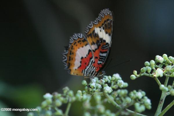
Biodiversity: 15,000 plant species, more than 1400 amphibians, birds, fish, mammals, and reptiles, unknown insects
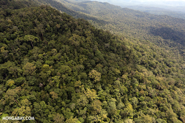
Percent Forest Cover: Around 50%
Deforestation Rate: 3.9 percent (2000-2005)
Causes of Deforestation: Logging, oil palm cultivation, other agriculture, fires
Major Conservation Initiatives: Heart of Borneo
Overview
Borneo
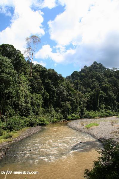
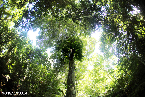
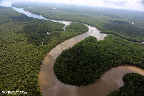
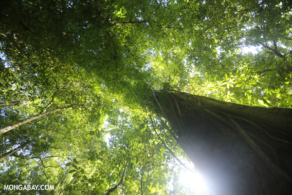
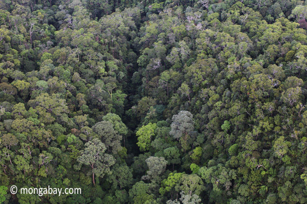
Borneo, the third largest island in the world, was once covered with dense rainforests. With swampy coastal areas fringed with mangrove forests and a mountainous interior, much of the terrain was virtually impassable and unexplored. Headhunters ruled the remote parts of the island until a century ago.
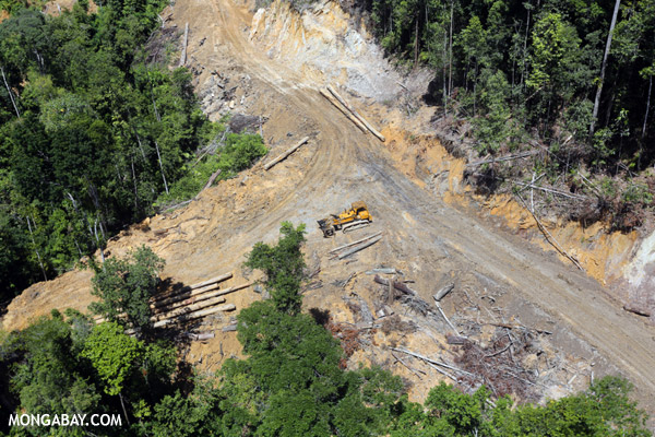
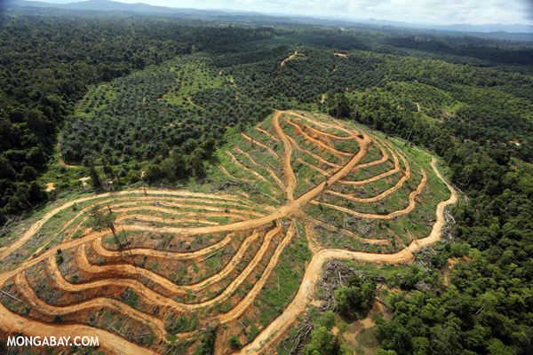
In the 1980s and 1990s Borneo underwent a remarkable transition. Its forests were leveled at a rate unparalleled in human history. Borneo's rainforests went to industrialized countries like Japan and the United States in the form of garden furniture, paper pulp and chopsticks. Initially most of the timber was taken from the Malaysian part of the island in the northern states of Sabah and Sarawak. Later forests in the southern part of Borneo, an area belonging to Indonesia and known as Kalimantan, became the primary source for tropical timber. Today the forests of Borneo are but a shadow of those of legend and those that remain are highly threatened by the emerging biofuels market, specifically, oil palm.
Oil palm is the most productive oil seed in the world. A single hectare of oil palm may yield 5,000 kilograms of crude oil, or nearly 6,000 liters of crude, making the crop remarkably profitable when grown in large plantations — one study that looked at 10,000 hectare-plantations suggests an internal rate of return of 26 percent annually. As such, vast swathes of land are being converted for oil palm plantations. Oil palm cultivation has expanded in Indonesia from 600,000 hectares in 1985 to more than 6 million hectares by early 2007, and is expected to reach 10 million hectares by 2010.
Despite this outlook, there has recently been some positive conservation news out of Borneo. In February 2007, the governments of Brunei, Malaysia, and Indonesia agreed to protect roughly 220,000 square kilometers (85,000 square miles) of tropical forest in the so-called "Heart of Borneo". Environmental group WWF was particularly active in the establishment of the protected area.
Borneo's Geography
Borneo is the third largest island in the world, covering an area of 743,330 square kilometers (287,000 square miles), or a little more than the twice the size of Germany. Politically, the island is divided between Indonesia, Malaysia and Brunei. Indonesian Borneo is known as Kalimantan, while Malaysian Borneo is known as East Malaysia. The name Borneo itself is a Western reference first used by the Dutch during their colonial rule of the island.
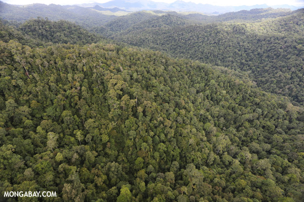
Geographically the island is divided by central highlands that run diagonally from Sabah state (Malaysia) in northeastern Borneo to southwestern Borneo, roughly forming the border between West and Central Kalimantan (Indonesia). The range is not volcanic — the whole of Borneo has only a single extinct volcano — but does feature the highest mountain in Southeast Asia: Mount Kinabalu in Sabah, which reaches 4,095 meters (13,435 feet).
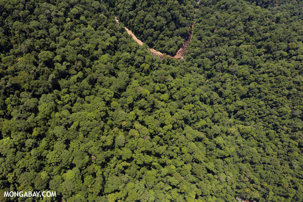
Borneo Forests
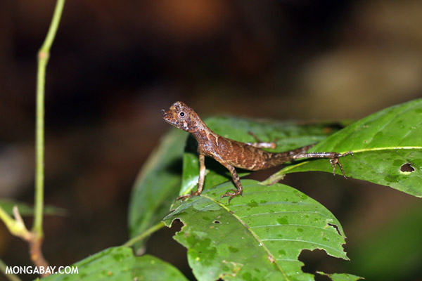
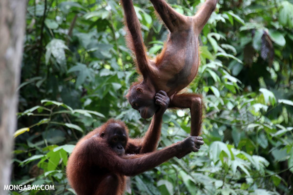
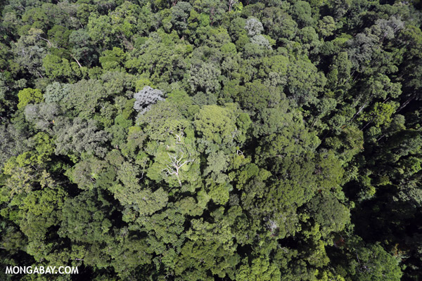
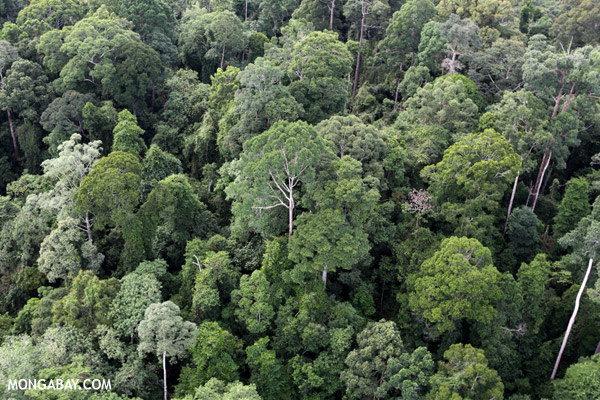
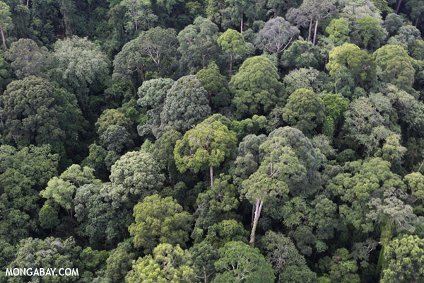
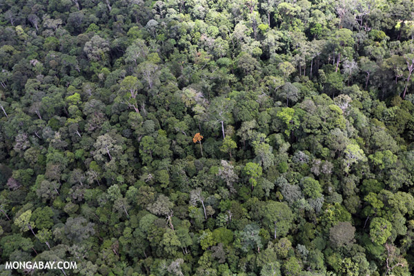
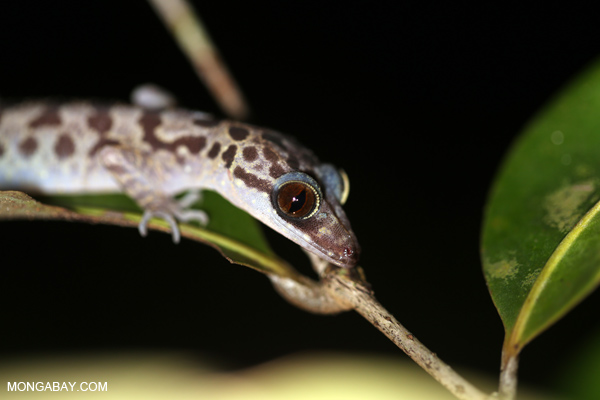
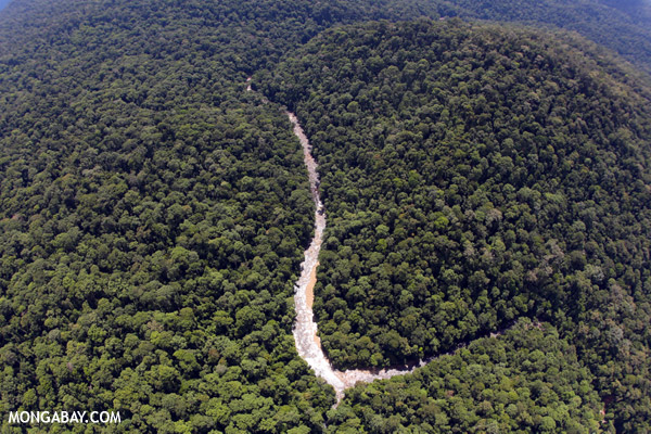
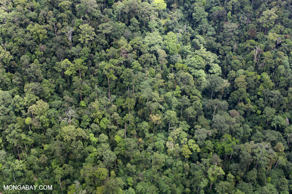
Borneo's forests are some of the most biodiverse on the planet. According to WWF, the island is estimated have at least 222 species of mammals (44 of which are endemic), 420 resident birds (37 endemic), 100 amphibians, 394 fish (19 endemic), and 15,000 plants (6,000 endemic) — more than 400 of which have been discovered since 1994. Surveys have found more than 700 species of trees in a 10 hectare plot — a number equal to the total number of trees in Canada and the United States combined.
Several distinct ecosystems are found across Borneo. These are reviewed in WWF's "Borneo: Treasure Island at Risk" report (2005).
Mangroves
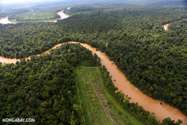
Mangroves are found in estuaries and coastal regions. WWF estimates that mangroves cover some 1.2 million hectares in Borneo, a small fraction — perhaps less than 20 percent — of their original extent. In Kalimantan large areas of mangroves were cleared by loggers and for agriculture.
Peat Swamp Forests
Peat swamp forests are the dominant form of remaining lowland forest in Borneo today. These swamp forests appear in places where dead vegetation becomes waterlogged and, too wet to decompose, accumulates as peat. These tropical peat lands, formed over hundreds of years, are giant stores of carbon. Draining and/or burning these lands, releases tremendous amounts of carbon dioxide into the atmosphere. These drained areas also become highly susceptible to combustion. Under the dry el Niño conditions of 1997-98, thousands of fires raged in the peat swamps of Indonesia. Fires in peat swamps are extraordinarily difficult to extinguish because they can burn for months virtually undetected in the deeper layers of peat. In 2002 peat forests covered about ten million hectares in Borneo according to Langner and Siegert (2005).
Montane Forests
Montane forests are generally found at an elevation from 900 meters to 3300 meters in Borneo. Trees in these forests are typically shorter than those of lowland forest, resulting in a less-developed forest canopy. Langner and Siegert (2005) estimate that in 2002 about 70 percent (1.6 million ha) of Borneo's original montane forests (2.27 million hectares) remained.
Heath Forests
Heath or kerangas forest are found on well-drained, sandy soils that are extremely nutrient-poor ("kerangas" is the indigenous Iban word for "land that will not grow rice"). These forests are characterized by certain tree species tolerant of the poor, acidic soil conditions and are considerably "stunted" in comparison with typical rainforests. Heath forests are also less biodiverse the other tropical plant communities. MacKinnon et al. (1997) estimate that Borneo was once covered with by 6,688,200 hectares of heath forests. Today this area is so diminished the World Bank estimates that almost no heath forests will remain in Borneo by 2010.
Dipterocarp Forests
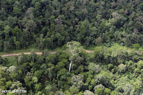
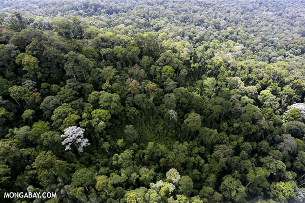
Lowland Dipterocarp forests are the most biodiverse and most threatened forests in Borneo (68% of lowlands have been cleared in Kalimantan, 56% in Malaysia). These giant trees, often exceeding 45 meters in height, are the most valuable source of timber in Borneo and have been heavily logged over the past three decades. Langner and Siegert (2005) estimated that just under 30 million hectares of lowland Dipterocarp forest remained in Borneo in 2002.
The prevalence of Dipterocarps gives Borneo's forests an unusual dynamic that is tightly linked with the ocean-atmosphere phenomenon called the El Niño-Southern Oscillation (also known as ENSO or "El Niño"). According to Lisa Curran, a biologist who has spent more than 20 years in Borneo and is now a leading expert on the natural history of the island, Dipterocarp reproduction is inextricably tied to the arrival of El Niño, with 80-93% of species synchronizing their flowering to the onset of the dry weather conditions, which traditionally occur on a roughly 4 year basis. During a "Dipterocarp year" in Kalimantan, the canopy bursts into color as countless emergent Dipterocarp trees — each of which may have 4 million flowers — bloom during a six-week period, a strategy that intermittently starves and swamps seed predators so that at least some seeds survive to germination.
The mass blooming and subsequent fruiting — which has been known to synchronize over an area of 150 million hectares (370 million acres) and involve 1870 species — is a boon to seed predators, including wild boar, the keystone seed predator in the ecosystem. Seeds and wild boar are so prevalent during these intervals that local populations have long viewed el Niño events as times of plenty, collecting Illipe nuts for export and gorging on pork. The relationship has lasted for as long as humans have inhabited Borneo and is ingrained in the cultures of people ranging from the tribes of the forested interior to coastal traders.
In recent years however, the system seems to be breaking down due to land-use change. Dr. Curran, awarded the MacAuthur genius award in 2006 for her work in this area, says that intensive logging has taken a heavy toll on this reproductive cycle. Curran found that seed production fell from 175 pounds per acre in 1991 to 16.5 pounds per acre in 1998, even though it was a one of the strongest El Niño years on record. It appears that logging has reduced the local density and biomass of mature trees below some critical threshold that limits masting.
Further, the introduction of fires in a region that had no prior fire regime, has exacerbated drought stress and caused a radical transformation in forest ecology. Today el Niño years are no longer a time of plenty. As Curran said during a visit to California, "el Niño has become the great destroyer instead of the great provider." Land use change has broken the once tightly linked ecosystem.
The impact extends well beyond Borneo with annual fires driving widespread pollution (often called "haze") that can spread as far as Australia, China, and India. The fires release massive amounts of carbon dioxide, especially when Borneo's peat forests burn. With 518 tons of carbon per hectare - one of the highest levels of biomass on the planet — these ecosystems can contribute up to 2 billion tons of carbon dioxide to the atmosphere in some years, making Indonesia the third largest greenhouse gas polluter, despite having only the world's 22nd largest economy. Some scientists worry that fires and climate change could be a positive feedback loop that only worsens conditions, producing ever drier climate, more frequent fires, and higher carbon emissions.
Deforestation: forest loss in Borneo
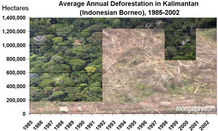
Deforestation in Borneo was historically low due to infertile soils (relative to surrounding islands), unfavorable climate, and the presence of disease. Deforestation began in earnest during the mid-twentieth century with the establishment of rubber plantations, though these had a limited impact. Industrial logging rose in the 1970s as Malaysia depleted its peninsular forests, and former Indonesian strongman President Suharto distributed large tracts of forest to cement political relationships with army generals. Logging expanded significantly in the 1980s, with logging roads providing access to remote lands for settlers and developers. At the same time, the Indonesian government's transmigration program was in full swing, sending more than 18,000 people per year during the decade to settle in Kalimantan. These transmigrants, mostly young landless poor from the crowded central islands of Java and Bali, were resettled at government expense on lands that were often inadequate for traditional farming. Unable to support themselves with subsistence agriculture, many of these people went to work for logging companies.

The state of forests in Malaysian Borneo (Sabah and Sarawak) in 2009. Note that the authors call their estimates of degraded forest "conservative". While the study didn't assess forest cover in Indonesian Borneo, the authors indicate the situation is similar.

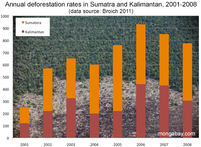
(LEFT) Land allocation zones (Ministry of Forestry Indonesia 2008) and upland areas for Kalimantan (RIGHT) Forest cover loss for Kalimantan mapped at moderate spatial resolution for the 2000–2008 interval superimposed on a Landsat image composite. (Broich 2011).
LOGGING & TRANSMIGRATION
Logging in Borneo in the 1980s and 1990s was some of the most intensive the world has ever seen, with 60-240 cubic meters of wood being harvested per hectare versus 23 cubic meters per hectare in the Amazon. According to Curran, more timber exported was from Borneo during that time than from Latin America and Africa combined. In Kalimantan, some 80% of lowlands went to timber concessions, including virtually all its mangrove forests.
By the late 1980s it became clear that Indonesia and Malaysia would soon face a timber crisis due to over-logging. Demand from timber mills was far-outstripping log production in both Malaysia and Indonesia. According to WWF, the Indonesian government responded to resource depletion by establishing a system with three types of industrial timber plantations: Hutan Tanaman Industri (HTI) pertukangan for hardwoods, HTI kayu energy for fuelwood and charcoal, and HTI kayu serat for pulp and paper. Supplying the rapidly expanding pulp and paper industry was the most profitable, so fast-growing plantations were established on previously logged areas as well as virgin forest areas. Plantation owners benefited from downstream timber subsidies including roads, saw mills, and low interest loans granted out of the national reforestation fund. Further, lack of oversight meant that logged forests were rarely replanted — a costly endeavor on heavily degraded lands — leading to additional pressure on remote forests. The State of the Forest* reports that of 3.3 million hectares allocated to HTIs, only 829,000 hectares — or 25 percent — had been replanted by 2000 (* published by Global Forest Watch, Global Forest Watch Indonesia, and World Resources Institute in 2002). The majority of land-clearing for timber plantations in Kalimantan was done by large landholders. Between 1985 and 1997 large landholders cleared nearly 1.7 million hectares of forest for tree crops, while small landholders cleared some 467,000 hectares. In total, tree plantations accounted for 2.1 million hectares (25 percent) of the 8.5 million hectares of forest that were cleared during the period.
OIL PALM
At the same time that loggable timber became increasingly scarce, interest in oil palm plantations began to spread in Borneo. Though it was first planted in Indonesia in 1848, it wasn't until the mid-1990s that oil palm cultivation really started to accelerate. In Malaysia, today the world's largest producer of palm oil, oil palm plantations grew from 60,000 hectares in 1960 to more than 3 million hectares in 2001. In 2004, 30% of these of these were located in Sabah, which has ideal growing conditions for the plant, and 13% were in Sarawak. However, because virtually all suitable land is used in Peninsular Malaysia, expansion is expected mostly to occur in Malaysian Borneo and, to a greater extent, Kalimantan. Oil palm cultivation has increased from 186,744 hectares in Sabah and Sarawak in 1984 to 1,673,721 hectares at the close of 2003.
In Kalimantan, oil palm has expanded even faster: from 13,140 hectares in 1984 to nearly one million hectares at the end of 2003. While much of this new land brought under cultivation is less than ideal for oil palm, the crop's low maintenance, combined with growing demand and lack of other viable economic options in the region, make it a low-risk investment for large estate owners. Studies underway in Western Kalimantan by Lisa Curran, suggest an annual internal rate of return of 26% over a 25 year period for oil palm plantations larger than 10,000 hectares, though small holdings are considerably less lucrative. Large plantations owners are aided by subsidies that include crude processing facilities and roads.
Today almost half of Malaysia's cultivated land consists of oil palm. In Sabah and Sarawak, most (i.e. more than 70 percent) oil palm plantations are government owned, and small landowners control only a tiny fraction of the overall crop: 6 percent in Sabah, 3 percent in Sarawak. In Indonesia, the distribution is much different. Small holders control roughly 30 percent of oil palm plantations, while state-owned estates account for 20 percent. The balance, around 50 percent, is owned by large investors, who have the highest yields. The biggest importers of Malaysian palm oil are China, Indian, Pakistan, the Netherlands, and Egypt, while the largest consumers of Indonesian palm oil are India (3 times more than the next larger user), China, Netherlands, Malaysia, and Pakistan.
Palm oil is derived from the plant's fruit, which grow in clusters that may weigh 40-50 kilograms. A hundred kilograms of oil seeds typically produce 20 kilograms of oil, while a single hectare of oil palm may yield 5,000 kilograms of crude oil, or nearly 6,000 liters of crude oil that can be used in biodiesel production. At $400 per metric ton, or about $54 per barrel, palm oil is competitive with conventional oil. In the future, palm oil prices are expected to fall further as more oil palm comes under cultivation. Indonesia aims to have 8-10 million hectares under cultivation by 2010.
FIRES
Forest fires are generally rare in Borneo, but as touched upon above, Borneo today is almost as famous for its forest fires as its tropical rainforests. Most fires in Borneo are set for land-clearing purposes. While the Indonesian government has historically blamed small-scale swidden agriculturalists for fires, WWF notes that satellite mapping has revealed that commercial development for large-scale land conversion — especially oil palm plantations — was the largest single cause of the 1997-98 fires.
The 1997-1998 fires were some of the largest ever known. These burned some 9.7 million hectares of forest and non-forest land and caused estimated economic damage of more than 9 billion dollars and released 0.8-2.5 gigatons of carbon into the atmosphere. In Kalimantan, more than 6.5 million hectares burned and the smoke over the island "covered an area measuring 2,000 by 4,000 kilometers," according to WWF.
Today fires are set annually for land clearing in agricultural areas and degraded forests. When conditions are dry, these fires can easily spread to adjacent forest land and burn out of control. As WWF explains, Borneo's forests are not well-adapted to forest fire.
As of February 2007 Indonesia has still not signed the ASEAN Agreement on Transboundary Haze Pollution, an environmental agreement signed by seven other southeast Asian nations that pledges to bring haze pollution under control in the region.
POACHING
Protected Areas
On paper, 9 percent of Kalimantan, 8 percent of Sarawak, and 14 percent of Sabah are under some form of protection according to WWF, with the caveat that some areas designated as protected aren't really safe from deforestation. For example, in Kalimantan only 82 percent of "protected forest" is actually forested. Further, between 1985 and 2001, Kalimantan's protected lowland forests declined by about 56 percent, according to Lisa Curran.
WWF reports cites Kutai National Park as a case in point. Kutai was established in 1936 as a 306,000 hectare preserve but as timber concessions and oil exploration rights have been granted over the years, the park has since been reduced to an official area of 198,629 hectares. In the 1980s and 1990s illegal logging left much of the forest in a degraded state. The fires of 1997-1998 burned 92 percent of the park area.
Gunung Palung National Park in West Kalimantan is another example. From 1998-2002 70 percent of the lowland buffer zone was deforested and today less than 9 percent of the buffer zone is lowland forest. Within the park, 38 percent of the lowland forest has been cleared by loggers.
Sabah
Of Sabah's 7.37 million hectares of land, 60 percent are forested (2005) according to the State Environmental Conservation Department. 3.6 million hectares of this forested area (known as the Permanent Forest Estate) can be broken down as follows:
These figures suggest that 586,000 hectares — or 16 percent of Sabah's total forest area — are under some form of protection. In 1997 Sabah introduced a "Sustainable Forest Management License Agreement" system that requires the use of reduced impact logging techniques, though whether this is used in practice is open to debate. Forests on the remaining 2.4 million hectares can be harvested with a timber cutting license.
Sarawak
According to the state government, about two-thirds of Sarawak's 8.22 million hectares are covered with natural forest. The government says it seeks to protect about 8 percent of the state's natural forests with the rest of the land, in equal parts, devoted to commercial forest and agriculture.
Kalimantan
Almost all forests in Kalimantan are owned by the state. In recent years centralization means that forests once controlled by the national government are now controlled at the district level. On paper, forests have been mapped and allocated for various uses, but reality bears little resemblance to the actual situation, according to WWF, which notes "the actual size and state of Indonesia's remaining forests are difficult to establish from official statistics."
Officially, Kalimantan is broken down into the following divisions (WWF):
Thus in theory, about 11 million hectares of forest are under some form of protection in Kalimantan.
In areas that have been set aside as "production forest" there are three types of industrial timber plantations: Hutan Tanaman Industri (HTI) pertukangan for hardwoods, HTI kayu energy for fuelwood and charcoal, and HTI kayu serat for pulp and paper. The system was reformed in 1999 under the Indonesian decentralization policy and licenses are now issued at the district level.
The Problems
WWF says there are four big threats to Borneo's forests: land conversion, illegal logging, poor forest management, and forest fires. It adds that large-scale industrial projects (roads, and hydroelectric projects like the Bakun dam) and hunting are also threats, but to a lesser degree. A further issue is the climate of corruption, which permeates virtually all levels of government in Kalimantan. Forestry decisions are now made at the district level, where officials are said to be sometimes easily swayed by money. A strategically gifted motorbike can often win influence at the village level.
A fundamental problem is that development in Borneo is driven by extractive industries — at present there are few economic alternatives. These industries are rarely sustainable, especially when little is invested in long-term management of resources.
The Solutions
The causes of deforestation in Borneo are not complex; the solutions are. After large-scale deforestation in the lowlands and the importation of millions of people through poorly-executed transmigration programs, there are few economic options in most of Borneo. Having lost jobs in the forestry sector, many villages are faced with having to decide whether to give up the remaining forest for oil palm or continue with subsistence living. Oil palm plantations certainly offer economic potential, especially when they are planted on already deforested and degraded lands, but it makes little sense to establish them on increasingly scare areas of natural forest. Social safeguards are also required to ensure labor abuse and sharecropping schemes are avoided. The Roundtable on Sustainable Palm Oil (RSPO) is one initiative working on equitable and sustainable palm oil production
Conservation is also an urgent priority in Borneo, especially in biologically diverse regions that have so far escaped the ravages of intensive logging and fires. The recent "Heart of Borneo" initiative is a shining example of what's possible. However, it is absolutely critical that once protected areas are established, they are maintained. The history of "protected areas" in Kalimantan — where large percentages of supposedly protected area was logged and distributed for development — is disheartening, but now is the time to move beyond this and plan for a future where conserved areas are actually protected and sustainable use of buffer zones is maximized.
Beyond setting aside areas for protection, it is crucial that forest be restored. The use of native tree species should be encouraged though financial incentives and education programs. While this effort can be costly, especially in heavily degraded areas, research into improving reforestation techniques could make it less so, especially with the help of outside governments, NGOs and private foundations. Further, there is a strong possibility that under future climate agreements, reforestation could pay direct economic dividends as well stimulating the local economy and spurring village-level entrepreneurship opportunities.
It is important to recognize that the burden of protecting and reforesting Indonesia should not be solely on Indonesia. Much of the logging that so denuded Kalimantan's landscape was the result of Western demand in an environment where a weak and corrupt government meant the vast majority if Indonesians had little control over national resources. Indonesia is now a democracy — most Indonesians had little to do with this plunder and cannot be held responsible for the actions of the past kleptocracy. Indonesia, where more than 80 million of 246 million inhabitants live on less than a $1 per day, is still wrestling with devising ways to provide basic services to the masses, including health care, education, and basic infrastructure, both financial and physical.
Malaysia, which shares most of the balance of Borneo, should be taking the lead on these efforts. With a strong economy, coupled with national wealth and a strong central government, Malaysia has few excuses not to reign in deforestation and promote sustainable use within its borders. Outside its territory, Malaysia should take initiative in prosecuting firms found guilty of igniting fires for land-clearing purposes in Kalimantan. It's time that these parties be held accountable for their actions — no more light sentences or petty fines.
Education
Efforts in two further areas are key to improving livelihoods in Borneo — especially Kalimantan: education and healthcare. Basic education can go a long way in a place where many aren't in school at the age of 13. Curriculums should include some fundamental information on the environment with emphasis on the importance of ecosystem services afforded by intact forests. Education is also important among the general population. Understanding the full cost of environmental degradation combined with learning new cultivation techniques and economic opportunities provided by certain crops could be hugely beneficial to rural populations.
Healthcare
In remote parts of Kalimantan the state of healthcare is appalling. Without adequate assurance of good health, people can't be productive, plan for the long-term, or even feed their families. One innovative organization working to address health issues in Kalimantan is Health In Harmony. Working in conjunction with the local government and communities, this program is developing medical facilities to provide high-quality, low-cost health care to poor communities; medical and environmental training programs for local people to help promote self-sufficiency and sustainability; and environmentally friendly community development programs.
The Future of Borneo
Projections of future forest cover by the World Bank and United Nations Environment Programme are discouraging. These projections do not have to become reality. The "Heart of Borneo" is a major step towards a future where Borneo retains forest cover and biological diversity, but more needs to be done to ensure the long-term ecological health of the island's forests and inhabitants.
Photo from Borneo
Borneo slide show: click image to play.
Larger version of the slide show | More Photos from Borneo
Chart : Forest Loss in Indonesia and Malaysia

Graph: Percent forest cover change in Indonesia and Malaysia between 2000 and 2010. Background satellite image courtesy of Google Earth, design by mongabay.com. Click image to enlarge.

Graph: Deforestation in Indonesia and Malaysia between 2000 and 2010. Background satellite image courtesy of Google Earth, design by mongabay.com. Click image to enlarge.
This forest cover data is from Miettinen et al 2011. Related article: Charts: deforestation in Indonesia and Malaysia, 2000-2010.
References
WWF Germany, Borneo: Treasure Island at Risk, June 2005 [pdf, 773 KB]
Curran L.M., personal communication, January 2007
Curran L.M., Trigg S.N., McDonald A.K., Astiani D., Hardiono Y.M., Siregar P., Caniago E. and Kasischke E.: Lowland Forest Loss in
Protected Areas of Indonesian Borneo; Science, 13 February 2004; VOL303: 1000-1003
Davis W., Mackenzie I., Kennedy S.: Nomads of the Dawn, Pomegranate Artbooks, 1995
Environmental Investigation Agency (EIA) and Telapak: Timber Traffickers: How Malaysia and Singapore are reaping a profit from the illegal destruction of Indonesia's tropical forests; May 2003
Environmental Investigation Agency 2004, Profiting from Plunder: How Malaysia Smuggles Endangered Wood, http://www.eia-international.org...pdf
Fuller D.O, Jessup T.C and Salim, A.: Loss of Forest Cover in Kalimantan, Indonesia, since the 1997-1998 El Niño. Conservation Biology, pp.249-254 Volume 18, No1, February 2004
Global Forest Watch, Global Forest Watch Indonesia, World Resources Institute: The State of the Forest, Indonesia, 2002
Government of Sabah: http://www.sabah.gov.mv
Government of Sarawak: http://www.sarawak.gov.mv
Holmes, D.A.: Indonesia - Where have all the forests gone? Environment and Social Development East Asia and Pacific Region. World
Bank Discussion Paper. Written 2000, published June 2002 Protected Animals Smuggling Reaches $547.5m Annually; Jakarta Post: 28/3/2003
Langner A. and Siegert F.: Assessment of Rainforest Ecosystems in Borneo using MODIS satellite imagery. Remote Sensing Solutions GmbH & GeoBio Center of Ludwig-Maximilians-University Munich, in preparation, June 2005
MacKinnon K., Hatta G., Halim H. and Mangalik A.: The Ecology of Kalimantan; Oxford University Press, 1997
Sabah Forestry Department: Forests Resource in Sabah; http://www.sabah.gov.my/htan/data_1/a_toppage_main/frames.htm accessed February 2, 2007
Sarawak Forest Department: Permanent Forests Estate http://www.forestry.sarawak.gov.my/forweb/sfm/pfe.htm accessed February 2, 2007
Stibig H.J. and Malingreau J.P.: Forest Cover of Insular Southeast Asia Mapped from Recent Satellite Images of Coarse Spatial Resolution; Ambio Vol. 32 No 7, Nov. 2003, Royal Swedish Academy of Sciences, 2003
The World Bank: Indonesia: Environment and Natural Resource Management in a Time of Transition, February 2001
UNEP World Conservation Monitoring Centre: http://www.wcmc.org accessed February 2, 2007
WWF: Borneo's Lost World: Newly Discovered Species on Borneo; written by Pio D. and D'Cruz R. (ed) for WWF, April 2005
The World Bank Group: Transmigration in Indonesia: worldbank.org 1994, accessed Jan 27, 2007
For further information log on website :
http://data.mongabay.com/borneo.html
Land Areas: 743,330 square kilometers (287,000 square miles, 74.33 million hectares, or 183.68 million acres)
Human Population: 17.7 million, of which 17% or 2.2 million is indigenous Dayak
Countries:
Biodiversity: 15,000 plant species, more than 1400 amphibians, birds, fish, mammals, and reptiles, unknown insects
Percent Forest Cover: Around 50%
Deforestation Rate: 3.9 percent (2000-2005)
Causes of Deforestation: Logging, oil palm cultivation, other agriculture, fires
Major Conservation Initiatives: Heart of Borneo
Overview
Borneo
Borneo, the third largest island in the world, was once covered with dense rainforests. With swampy coastal areas fringed with mangrove forests and a mountainous interior, much of the terrain was virtually impassable and unexplored. Headhunters ruled the remote parts of the island until a century ago.
In the 1980s and 1990s Borneo underwent a remarkable transition. Its forests were leveled at a rate unparalleled in human history. Borneo's rainforests went to industrialized countries like Japan and the United States in the form of garden furniture, paper pulp and chopsticks. Initially most of the timber was taken from the Malaysian part of the island in the northern states of Sabah and Sarawak. Later forests in the southern part of Borneo, an area belonging to Indonesia and known as Kalimantan, became the primary source for tropical timber. Today the forests of Borneo are but a shadow of those of legend and those that remain are highly threatened by the emerging biofuels market, specifically, oil palm.
Oil palm is the most productive oil seed in the world. A single hectare of oil palm may yield 5,000 kilograms of crude oil, or nearly 6,000 liters of crude, making the crop remarkably profitable when grown in large plantations — one study that looked at 10,000 hectare-plantations suggests an internal rate of return of 26 percent annually. As such, vast swathes of land are being converted for oil palm plantations. Oil palm cultivation has expanded in Indonesia from 600,000 hectares in 1985 to more than 6 million hectares by early 2007, and is expected to reach 10 million hectares by 2010.
Despite this outlook, there has recently been some positive conservation news out of Borneo. In February 2007, the governments of Brunei, Malaysia, and Indonesia agreed to protect roughly 220,000 square kilometers (85,000 square miles) of tropical forest in the so-called "Heart of Borneo". Environmental group WWF was particularly active in the establishment of the protected area.
Click to enlarge
Borneo's Geography
Borneo is the third largest island in the world, covering an area of 743,330 square kilometers (287,000 square miles), or a little more than the twice the size of Germany. Politically, the island is divided between Indonesia, Malaysia and Brunei. Indonesian Borneo is known as Kalimantan, while Malaysian Borneo is known as East Malaysia. The name Borneo itself is a Western reference first used by the Dutch during their colonial rule of the island.
Geographically the island is divided by central highlands that run diagonally from Sabah state (Malaysia) in northeastern Borneo to southwestern Borneo, roughly forming the border between West and Central Kalimantan (Indonesia). The range is not volcanic — the whole of Borneo has only a single extinct volcano — but does feature the highest mountain in Southeast Asia: Mount Kinabalu in Sabah, which reaches 4,095 meters (13,435 feet).
Borneo Forests
Borneo's forests are some of the most biodiverse on the planet. According to WWF, the island is estimated have at least 222 species of mammals (44 of which are endemic), 420 resident birds (37 endemic), 100 amphibians, 394 fish (19 endemic), and 15,000 plants (6,000 endemic) — more than 400 of which have been discovered since 1994. Surveys have found more than 700 species of trees in a 10 hectare plot — a number equal to the total number of trees in Canada and the United States combined.
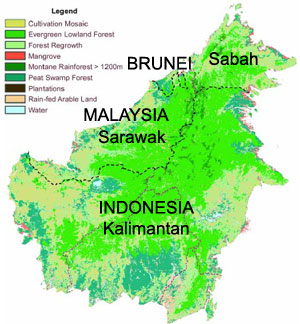 Major vegetation types of Borneo. Map modified from WWF's "Borneo: Treasure Island at Risk" report. The map is based on Langner A. and Siegert F.: Assessment of Rainforest Ecosystems in Borneo using MODIS satellite imagery. Remote Sensing Solutions GmbH & GeoBio Center of Ludwig-Maximilians-University Munich, in preparation, June 2005. Based on 57 single MODIS images dating from 11.2001 to 10.2002 with a spatial resolution of 250 m |
Several distinct ecosystems are found across Borneo. These are reviewed in WWF's "Borneo: Treasure Island at Risk" report (2005).
Mangroves
Mangroves are found in estuaries and coastal regions. WWF estimates that mangroves cover some 1.2 million hectares in Borneo, a small fraction — perhaps less than 20 percent — of their original extent. In Kalimantan large areas of mangroves were cleared by loggers and for agriculture.
Peat Swamp Forests
Peat swamp forests are the dominant form of remaining lowland forest in Borneo today. These swamp forests appear in places where dead vegetation becomes waterlogged and, too wet to decompose, accumulates as peat. These tropical peat lands, formed over hundreds of years, are giant stores of carbon. Draining and/or burning these lands, releases tremendous amounts of carbon dioxide into the atmosphere. These drained areas also become highly susceptible to combustion. Under the dry el Niño conditions of 1997-98, thousands of fires raged in the peat swamps of Indonesia. Fires in peat swamps are extraordinarily difficult to extinguish because they can burn for months virtually undetected in the deeper layers of peat. In 2002 peat forests covered about ten million hectares in Borneo according to Langner and Siegert (2005).
Montane Forests
Montane forests are generally found at an elevation from 900 meters to 3300 meters in Borneo. Trees in these forests are typically shorter than those of lowland forest, resulting in a less-developed forest canopy. Langner and Siegert (2005) estimate that in 2002 about 70 percent (1.6 million ha) of Borneo's original montane forests (2.27 million hectares) remained.
Heath Forests
Heath or kerangas forest are found on well-drained, sandy soils that are extremely nutrient-poor ("kerangas" is the indigenous Iban word for "land that will not grow rice"). These forests are characterized by certain tree species tolerant of the poor, acidic soil conditions and are considerably "stunted" in comparison with typical rainforests. Heath forests are also less biodiverse the other tropical plant communities. MacKinnon et al. (1997) estimate that Borneo was once covered with by 6,688,200 hectares of heath forests. Today this area is so diminished the World Bank estimates that almost no heath forests will remain in Borneo by 2010.
Dipterocarp Forests
Lowland Dipterocarp forests are the most biodiverse and most threatened forests in Borneo (68% of lowlands have been cleared in Kalimantan, 56% in Malaysia). These giant trees, often exceeding 45 meters in height, are the most valuable source of timber in Borneo and have been heavily logged over the past three decades. Langner and Siegert (2005) estimated that just under 30 million hectares of lowland Dipterocarp forest remained in Borneo in 2002.
The prevalence of Dipterocarps gives Borneo's forests an unusual dynamic that is tightly linked with the ocean-atmosphere phenomenon called the El Niño-Southern Oscillation (also known as ENSO or "El Niño"). According to Lisa Curran, a biologist who has spent more than 20 years in Borneo and is now a leading expert on the natural history of the island, Dipterocarp reproduction is inextricably tied to the arrival of El Niño, with 80-93% of species synchronizing their flowering to the onset of the dry weather conditions, which traditionally occur on a roughly 4 year basis. During a "Dipterocarp year" in Kalimantan, the canopy bursts into color as countless emergent Dipterocarp trees — each of which may have 4 million flowers — bloom during a six-week period, a strategy that intermittently starves and swamps seed predators so that at least some seeds survive to germination.
The mass blooming and subsequent fruiting — which has been known to synchronize over an area of 150 million hectares (370 million acres) and involve 1870 species — is a boon to seed predators, including wild boar, the keystone seed predator in the ecosystem. Seeds and wild boar are so prevalent during these intervals that local populations have long viewed el Niño events as times of plenty, collecting Illipe nuts for export and gorging on pork. The relationship has lasted for as long as humans have inhabited Borneo and is ingrained in the cultures of people ranging from the tribes of the forested interior to coastal traders.
In recent years however, the system seems to be breaking down due to land-use change. Dr. Curran, awarded the MacAuthur genius award in 2006 for her work in this area, says that intensive logging has taken a heavy toll on this reproductive cycle. Curran found that seed production fell from 175 pounds per acre in 1991 to 16.5 pounds per acre in 1998, even though it was a one of the strongest El Niño years on record. It appears that logging has reduced the local density and biomass of mature trees below some critical threshold that limits masting.
Further, the introduction of fires in a region that had no prior fire regime, has exacerbated drought stress and caused a radical transformation in forest ecology. Today el Niño years are no longer a time of plenty. As Curran said during a visit to California, "el Niño has become the great destroyer instead of the great provider." Land use change has broken the once tightly linked ecosystem.
The impact extends well beyond Borneo with annual fires driving widespread pollution (often called "haze") that can spread as far as Australia, China, and India. The fires release massive amounts of carbon dioxide, especially when Borneo's peat forests burn. With 518 tons of carbon per hectare - one of the highest levels of biomass on the planet — these ecosystems can contribute up to 2 billion tons of carbon dioxide to the atmosphere in some years, making Indonesia the third largest greenhouse gas polluter, despite having only the world's 22nd largest economy. Some scientists worry that fires and climate change could be a positive feedback loop that only worsens conditions, producing ever drier climate, more frequent fires, and higher carbon emissions.
Deforestation: forest loss in Borneo 
Deforestation in Borneo was historically low due to infertile soils (relative to surrounding islands), unfavorable climate, and the presence of disease. Deforestation began in earnest during the mid-twentieth century with the establishment of rubber plantations, though these had a limited impact. Industrial logging rose in the 1970s as Malaysia depleted its peninsular forests, and former Indonesian strongman President Suharto distributed large tracts of forest to cement political relationships with army generals. Logging expanded significantly in the 1980s, with logging roads providing access to remote lands for settlers and developers. At the same time, the Indonesian government's transmigration program was in full swing, sending more than 18,000 people per year during the decade to settle in Kalimantan. These transmigrants, mostly young landless poor from the crowded central islands of Java and Bali, were resettled at government expense on lands that were often inadequate for traditional farming. Unable to support themselves with subsistence agriculture, many of these people went to work for logging companies.
Deforestation stats for Borneo -- Indonesia and Malaysia, 2000-2010
| 2000 | 2010 | Change 2000–2010 | |||||
| 1000 ha | % | 1000 ha | % | 1000 ha | % | %/yr | |
| Sabah, Sarawak, and Brunei | 11854 | 10015 | -1839 | -15.5 | -1.6 | ||
| Kalimantan | 29834 | 26673 | -3161 | -10.6 | -1.1 | ||
The state of forests in Malaysian Borneo (Sabah and Sarawak) in 2009. Note that the authors call their estimates of degraded forest "conservative". While the study didn't assess forest cover in Indonesian Borneo, the authors indicate the situation is similar.
(LEFT) Land allocation zones (Ministry of Forestry Indonesia 2008) and upland areas for Kalimantan (RIGHT) Forest cover loss for Kalimantan mapped at moderate spatial resolution for the 2000–2008 interval superimposed on a Landsat image composite. (Broich 2011).
LOGGING & TRANSMIGRATION
Logging in Borneo in the 1980s and 1990s was some of the most intensive the world has ever seen, with 60-240 cubic meters of wood being harvested per hectare versus 23 cubic meters per hectare in the Amazon. According to Curran, more timber exported was from Borneo during that time than from Latin America and Africa combined. In Kalimantan, some 80% of lowlands went to timber concessions, including virtually all its mangrove forests.
By the late 1980s it became clear that Indonesia and Malaysia would soon face a timber crisis due to over-logging. Demand from timber mills was far-outstripping log production in both Malaysia and Indonesia. According to WWF, the Indonesian government responded to resource depletion by establishing a system with three types of industrial timber plantations: Hutan Tanaman Industri (HTI) pertukangan for hardwoods, HTI kayu energy for fuelwood and charcoal, and HTI kayu serat for pulp and paper. Supplying the rapidly expanding pulp and paper industry was the most profitable, so fast-growing plantations were established on previously logged areas as well as virgin forest areas. Plantation owners benefited from downstream timber subsidies including roads, saw mills, and low interest loans granted out of the national reforestation fund. Further, lack of oversight meant that logged forests were rarely replanted — a costly endeavor on heavily degraded lands — leading to additional pressure on remote forests. The State of the Forest* reports that of 3.3 million hectares allocated to HTIs, only 829,000 hectares — or 25 percent — had been replanted by 2000 (* published by Global Forest Watch, Global Forest Watch Indonesia, and World Resources Institute in 2002). The majority of land-clearing for timber plantations in Kalimantan was done by large landholders. Between 1985 and 1997 large landholders cleared nearly 1.7 million hectares of forest for tree crops, while small landholders cleared some 467,000 hectares. In total, tree plantations accounted for 2.1 million hectares (25 percent) of the 8.5 million hectares of forest that were cleared during the period.
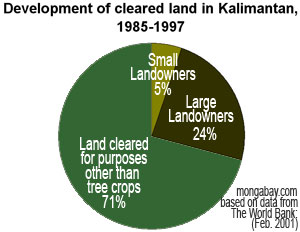 Results of Forest Conversion. Derived from figures found in WWF 2005 and based on data from The World Bank: Indonesia: Environment and Natural Resource Management in a Time of Transitio, February 2001 |
- Related articles
More on logging in Borneo | Industrial logging leaves a poor legacy in Borneo's rainforests
OIL PALM
At the same time that loggable timber became increasingly scarce, interest in oil palm plantations began to spread in Borneo. Though it was first planted in Indonesia in 1848, it wasn't until the mid-1990s that oil palm cultivation really started to accelerate. In Malaysia, today the world's largest producer of palm oil, oil palm plantations grew from 60,000 hectares in 1960 to more than 3 million hectares in 2001. In 2004, 30% of these of these were located in Sabah, which has ideal growing conditions for the plant, and 13% were in Sarawak. However, because virtually all suitable land is used in Peninsular Malaysia, expansion is expected mostly to occur in Malaysian Borneo and, to a greater extent, Kalimantan. Oil palm cultivation has increased from 186,744 hectares in Sabah and Sarawak in 1984 to 1,673,721 hectares at the close of 2003.
In Kalimantan, oil palm has expanded even faster: from 13,140 hectares in 1984 to nearly one million hectares at the end of 2003. While much of this new land brought under cultivation is less than ideal for oil palm, the crop's low maintenance, combined with growing demand and lack of other viable economic options in the region, make it a low-risk investment for large estate owners. Studies underway in Western Kalimantan by Lisa Curran, suggest an annual internal rate of return of 26% over a 25 year period for oil palm plantations larger than 10,000 hectares, though small holdings are considerably less lucrative. Large plantations owners are aided by subsidies that include crude processing facilities and roads.
Today almost half of Malaysia's cultivated land consists of oil palm. In Sabah and Sarawak, most (i.e. more than 70 percent) oil palm plantations are government owned, and small landowners control only a tiny fraction of the overall crop: 6 percent in Sabah, 3 percent in Sarawak. In Indonesia, the distribution is much different. Small holders control roughly 30 percent of oil palm plantations, while state-owned estates account for 20 percent. The balance, around 50 percent, is owned by large investors, who have the highest yields. The biggest importers of Malaysian palm oil are China, Indian, Pakistan, the Netherlands, and Egypt, while the largest consumers of Indonesian palm oil are India (3 times more than the next larger user), China, Netherlands, Malaysia, and Pakistan.
Palm oil is derived from the plant's fruit, which grow in clusters that may weigh 40-50 kilograms. A hundred kilograms of oil seeds typically produce 20 kilograms of oil, while a single hectare of oil palm may yield 5,000 kilograms of crude oil, or nearly 6,000 liters of crude oil that can be used in biodiesel production. At $400 per metric ton, or about $54 per barrel, palm oil is competitive with conventional oil. In the future, palm oil prices are expected to fall further as more oil palm comes under cultivation. Indonesia aims to have 8-10 million hectares under cultivation by 2010.
- Related articles
Why oil palm is replacing tropical rainforests | Social impact of oil palm in Borneo | Greening the world with palm oil
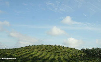 Oil palm requires high humidity (80-90%), temperature (29-30 C), 2000-2500 mm of rain, distributed roughly year round since fruit production declines during dry spells. In Malaysian Borneo, the most suitable conditions for oil palm are found in Sabah, which has the highest yields of fruit per hectare in the world. Photo by Rhett A. Butler. (click to enlarge) 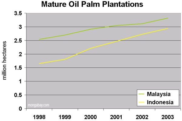 Growth of oil palm cultivation in Kalimantan and Malaysian Borneo. (click to enlarge) |
FIRES
Forest fires are generally rare in Borneo, but as touched upon above, Borneo today is almost as famous for its forest fires as its tropical rainforests. Most fires in Borneo are set for land-clearing purposes. While the Indonesian government has historically blamed small-scale swidden agriculturalists for fires, WWF notes that satellite mapping has revealed that commercial development for large-scale land conversion — especially oil palm plantations — was the largest single cause of the 1997-98 fires.
The 1997-1998 fires were some of the largest ever known. These burned some 9.7 million hectares of forest and non-forest land and caused estimated economic damage of more than 9 billion dollars and released 0.8-2.5 gigatons of carbon into the atmosphere. In Kalimantan, more than 6.5 million hectares burned and the smoke over the island "covered an area measuring 2,000 by 4,000 kilometers," according to WWF.
Today fires are set annually for land clearing in agricultural areas and degraded forests. When conditions are dry, these fires can easily spread to adjacent forest land and burn out of control. As WWF explains, Borneo's forests are not well-adapted to forest fire.
- While fires play an important role in forest ecosystems in many areas of the world, tropical rainforests have by and large been spared, prior the rise of widespread unsustainable management practices. Normally, tropical rainforests will not burn, due to dampness. The dense canopy usually keeps everything underneath it humid, even in times of drought. In addition, biological material decomposes very quickly in the damp climate. As a result, that very little flammable material covers the ground. The trees in wet tropical climate zones are not adapted to forest fires. They have a thin bark, compared to the much thicker, fire resistant, bark of trees in monsoon or more temperate climates.
As of February 2007 Indonesia has still not signed the ASEAN Agreement on Transboundary Haze Pollution, an environmental agreement signed by seven other southeast Asian nations that pledges to bring haze pollution under control in the region.
POACHING
 |
Protected Areas
On paper, 9 percent of Kalimantan, 8 percent of Sarawak, and 14 percent of Sabah are under some form of protection according to WWF, with the caveat that some areas designated as protected aren't really safe from deforestation. For example, in Kalimantan only 82 percent of "protected forest" is actually forested. Further, between 1985 and 2001, Kalimantan's protected lowland forests declined by about 56 percent, according to Lisa Curran.
WWF reports cites Kutai National Park as a case in point. Kutai was established in 1936 as a 306,000 hectare preserve but as timber concessions and oil exploration rights have been granted over the years, the park has since been reduced to an official area of 198,629 hectares. In the 1980s and 1990s illegal logging left much of the forest in a degraded state. The fires of 1997-1998 burned 92 percent of the park area.
Gunung Palung National Park in West Kalimantan is another example. From 1998-2002 70 percent of the lowland buffer zone was deforested and today less than 9 percent of the buffer zone is lowland forest. Within the park, 38 percent of the lowland forest has been cleared by loggers.
Sabah
Of Sabah's 7.37 million hectares of land, 60 percent are forested (2005) according to the State Environmental Conservation Department. 3.6 million hectares of this forested area (known as the Permanent Forest Estate) can be broken down as follows:
| Area (ha) | Classification | What it means | ||
| 342,000 | Class I: Protection | Watershed and other "functional" forests. Cannot be logged | ||
| 2,685,000 | Class II: Commercial | Forests that can be exploited | ||
| 7,000 | Class III Domestic | Forests that can be logged for local consumption | ||
| 21,000 | Class IV: Amenity | Recreational forests, often degraded | ||
| 316,000 | Class V: Mangrove | Can be harvested | ||
| 90,000 | Class VI: Virgin Jungle | Conserved for scientific purposes | ||
| 133,000 | Class VII: Wildlife | Conserved as wildlife habitat |
These figures suggest that 586,000 hectares — or 16 percent of Sabah's total forest area — are under some form of protection. In 1997 Sabah introduced a "Sustainable Forest Management License Agreement" system that requires the use of reduced impact logging techniques, though whether this is used in practice is open to debate. Forests on the remaining 2.4 million hectares can be harvested with a timber cutting license.
Sarawak
According to the state government, about two-thirds of Sarawak's 8.22 million hectares are covered with natural forest. The government says it seeks to protect about 8 percent of the state's natural forests with the rest of the land, in equal parts, devoted to commercial forest and agriculture.
Kalimantan
Almost all forests in Kalimantan are owned by the state. In recent years centralization means that forests once controlled by the national government are now controlled at the district level. On paper, forests have been mapped and allocated for various uses, but reality bears little resemblance to the actual situation, according to WWF, which notes "the actual size and state of Indonesia's remaining forests are difficult to establish from official statistics."
Officially, Kalimantan is broken down into the following divisions (WWF):
| Classification | What it means | Area (M ha) | ||
| Conservation Forest | Protected | 4.6 | ||
| Protection Forest | Forests that serve environmental functions | 6.4 | ||
| Production Forest | Timber concessions | 14.2 | ||
| Limited Production Forest | Gazetted for low-intensity logging. Often located on steep slopes. | 10.6 | ||
| Conversion Forest | Designated for permanent clearance and conversion, usually for agricultural purposes | 5.1 |
Thus in theory, about 11 million hectares of forest are under some form of protection in Kalimantan.
In areas that have been set aside as "production forest" there are three types of industrial timber plantations: Hutan Tanaman Industri (HTI) pertukangan for hardwoods, HTI kayu energy for fuelwood and charcoal, and HTI kayu serat for pulp and paper. The system was reformed in 1999 under the Indonesian decentralization policy and licenses are now issued at the district level.
The Problems
WWF says there are four big threats to Borneo's forests: land conversion, illegal logging, poor forest management, and forest fires. It adds that large-scale industrial projects (roads, and hydroelectric projects like the Bakun dam) and hunting are also threats, but to a lesser degree. A further issue is the climate of corruption, which permeates virtually all levels of government in Kalimantan. Forestry decisions are now made at the district level, where officials are said to be sometimes easily swayed by money. A strategically gifted motorbike can often win influence at the village level.
A fundamental problem is that development in Borneo is driven by extractive industries — at present there are few economic alternatives. These industries are rarely sustainable, especially when little is invested in long-term management of resources.
- Related articles
Forest fires result from government failure in Indonesia
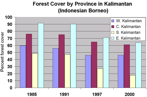 Forest cover in provinces of Kalimantan. (click to enlarge) |
The Solutions
The causes of deforestation in Borneo are not complex; the solutions are. After large-scale deforestation in the lowlands and the importation of millions of people through poorly-executed transmigration programs, there are few economic options in most of Borneo. Having lost jobs in the forestry sector, many villages are faced with having to decide whether to give up the remaining forest for oil palm or continue with subsistence living. Oil palm plantations certainly offer economic potential, especially when they are planted on already deforested and degraded lands, but it makes little sense to establish them on increasingly scare areas of natural forest. Social safeguards are also required to ensure labor abuse and sharecropping schemes are avoided. The Roundtable on Sustainable Palm Oil (RSPO) is one initiative working on equitable and sustainable palm oil production
 Click to enlarge |
Beyond setting aside areas for protection, it is crucial that forest be restored. The use of native tree species should be encouraged though financial incentives and education programs. While this effort can be costly, especially in heavily degraded areas, research into improving reforestation techniques could make it less so, especially with the help of outside governments, NGOs and private foundations. Further, there is a strong possibility that under future climate agreements, reforestation could pay direct economic dividends as well stimulating the local economy and spurring village-level entrepreneurship opportunities.
It is important to recognize that the burden of protecting and reforesting Indonesia should not be solely on Indonesia. Much of the logging that so denuded Kalimantan's landscape was the result of Western demand in an environment where a weak and corrupt government meant the vast majority if Indonesians had little control over national resources. Indonesia is now a democracy — most Indonesians had little to do with this plunder and cannot be held responsible for the actions of the past kleptocracy. Indonesia, where more than 80 million of 246 million inhabitants live on less than a $1 per day, is still wrestling with devising ways to provide basic services to the masses, including health care, education, and basic infrastructure, both financial and physical.
Malaysia, which shares most of the balance of Borneo, should be taking the lead on these efforts. With a strong economy, coupled with national wealth and a strong central government, Malaysia has few excuses not to reign in deforestation and promote sustainable use within its borders. Outside its territory, Malaysia should take initiative in prosecuting firms found guilty of igniting fires for land-clearing purposes in Kalimantan. It's time that these parties be held accountable for their actions — no more light sentences or petty fines.
Education
Efforts in two further areas are key to improving livelihoods in Borneo — especially Kalimantan: education and healthcare. Basic education can go a long way in a place where many aren't in school at the age of 13. Curriculums should include some fundamental information on the environment with emphasis on the importance of ecosystem services afforded by intact forests. Education is also important among the general population. Understanding the full cost of environmental degradation combined with learning new cultivation techniques and economic opportunities provided by certain crops could be hugely beneficial to rural populations.
Healthcare
In remote parts of Kalimantan the state of healthcare is appalling. Without adequate assurance of good health, people can't be productive, plan for the long-term, or even feed their families. One innovative organization working to address health issues in Kalimantan is Health In Harmony. Working in conjunction with the local government and communities, this program is developing medical facilities to provide high-quality, low-cost health care to poor communities; medical and environmental training programs for local people to help promote self-sufficiency and sustainability; and environmentally friendly community development programs.
The Future of Borneo
Projections of future forest cover by the World Bank and United Nations Environment Programme are discouraging. These projections do not have to become reality. The "Heart of Borneo" is a major step towards a future where Borneo retains forest cover and biological diversity, but more needs to be done to ensure the long-term ecological health of the island's forests and inhabitants.
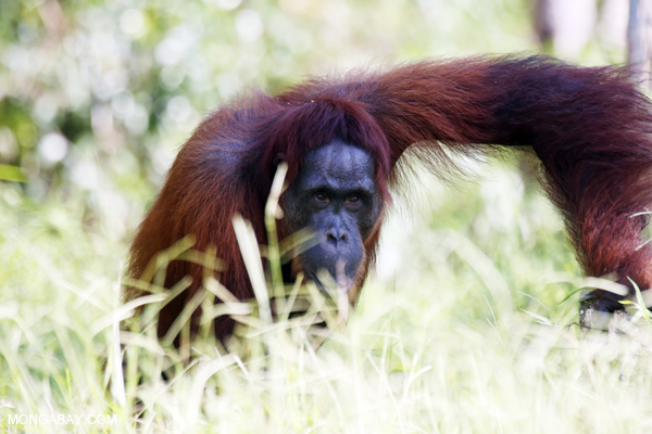
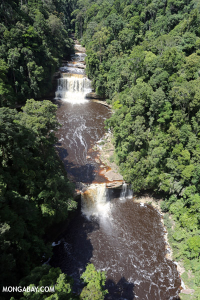
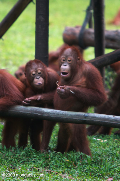
Photo from Borneo


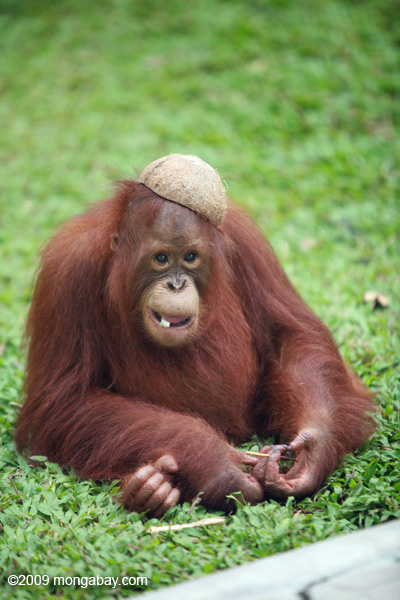
![Bornean orangutan [kalteng_0909]](http://mongabay.s3.amazonaws.com/indonesia/600/kalteng_0909.jpg)
![Bornean orangutan in Central Kalimantan [kalteng_0988]](http://mongabay.s3.amazonaws.com/indonesia/600/kalteng_0988.jpg)


![Bornean orangutan in Indonesian Borneo [kalteng_0974]](http://mongabay.s3.amazonaws.com/indonesia/600/kalteng_0974.jpg)


![Bornean orangutan [kalteng_0856]](http://mongabay.s3.amazonaws.com/indonesia/600/kalteng_0856.jpg)

![Peat forest in Borneo [kalteng_0634]](http://mongabay.s3.amazonaws.com/indonesia/600/kalteng_0634.jpg)


![Peat forest in Borneo [kalteng_0636]](http://mongabay.s3.amazonaws.com/indonesia/600/kalteng_0636.jpg)


![Bornean orangutan [kalteng_0844]](http://mongabay.s3.amazonaws.com/indonesia/600/kalteng_0844.jpg)


![Peat forest in Borneo [kalteng_0689]](http://mongabay.s3.amazonaws.com/indonesia/600/kalteng_0689.jpg)


![Bornean orangutan [kalteng_0875]](http://mongabay.s3.amazonaws.com/indonesia/600/kalteng_0875.jpg)


![Orangutan discovers the value of using tools [kalimantan_0604]](http://travel.mongabay.com/indonesia/600/kalimantan_0604.jpg)


![Bornean orangutan [kalteng_0897]](http://mongabay.s3.amazonaws.com/indonesia/600/kalteng_0897.jpg)


![Peat forest in Borneo [kalteng_0691]](http://mongabay.s3.amazonaws.com/indonesia/600/kalteng_0691.jpg)

![Bornean orangutan in Central Kalimantan [kalteng_0993]](http://mongabay.s3.amazonaws.com/indonesia/600/kalteng_0993.jpg)


![Peat forest in Borneo [kalteng_0680]](http://mongabay.s3.amazonaws.com/indonesia/600/kalteng_0680.jpg)
![Bornean orangutan [kalteng_0827]](http://mongabay.s3.amazonaws.com/indonesia/600/kalteng_0827.jpg)

![Peat forest in Borneo [kalteng_1174]](http://mongabay.s3.amazonaws.com/indonesia/600/kalteng_1174.jpg)


![Recovering peat forest after Borneo's big fires [kalteng_1051]](http://mongabay.s3.amazonaws.com/indonesia/600/kalteng_1051.jpg)


![Bornean orangutan [kalteng_0923]](http://mongabay.s3.amazonaws.com/indonesia/600/kalteng_0923.jpg)


Larger version of the slide show | More Photos from Borneo
Chart : Forest Loss in Indonesia and Malaysia

Graph: Percent forest cover change in Indonesia and Malaysia between 2000 and 2010. Background satellite image courtesy of Google Earth, design by mongabay.com. Click image to enlarge.

Graph: Deforestation in Indonesia and Malaysia between 2000 and 2010. Background satellite image courtesy of Google Earth, design by mongabay.com. Click image to enlarge.
This forest cover data is from Miettinen et al 2011. Related article: Charts: deforestation in Indonesia and Malaysia, 2000-2010.
References
For further information log on website :
http://data.mongabay.com/borneo.html


No comments:
Post a Comment