Author
For further details log on website :
http://www.mdpi.com/1999-4907/8/2/34
1
School of Computer and Information, Southwest Forestry University, Kunming, Yunnan 650224 China
2
Remote Sensing and GIS Laboratories, Quinney College of Natural Resources, Utah State University, Logan, UT 84322, USA
*
Author to whom correspondence should be addressed.
Received: 4 September 2016 / Accepted: 20 January 2017 / Published: 29 January 2017
(This article belongs to the Special Issue Optimizing Forest Inventories with Remote Sensing Techniques)
Abstract
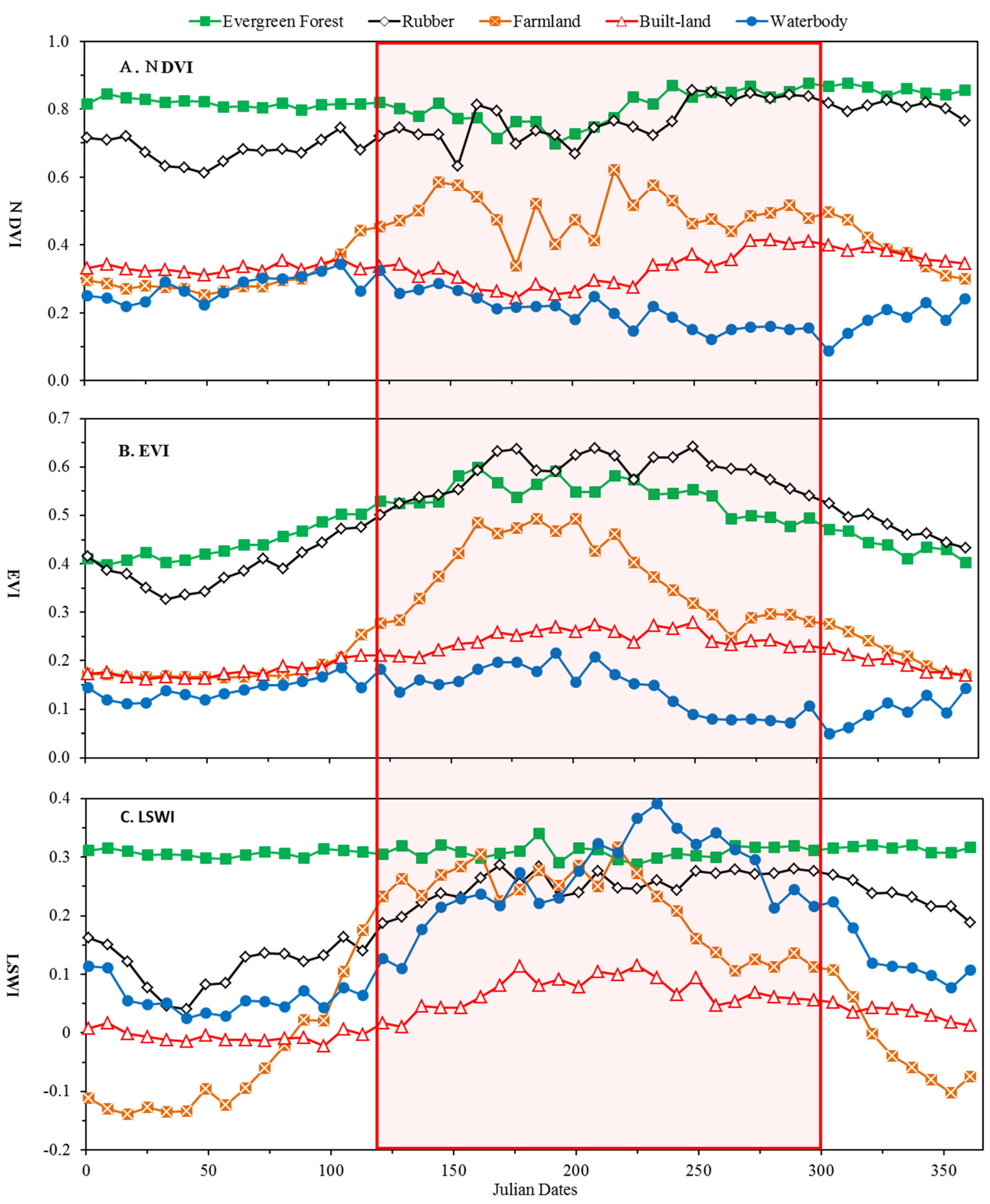
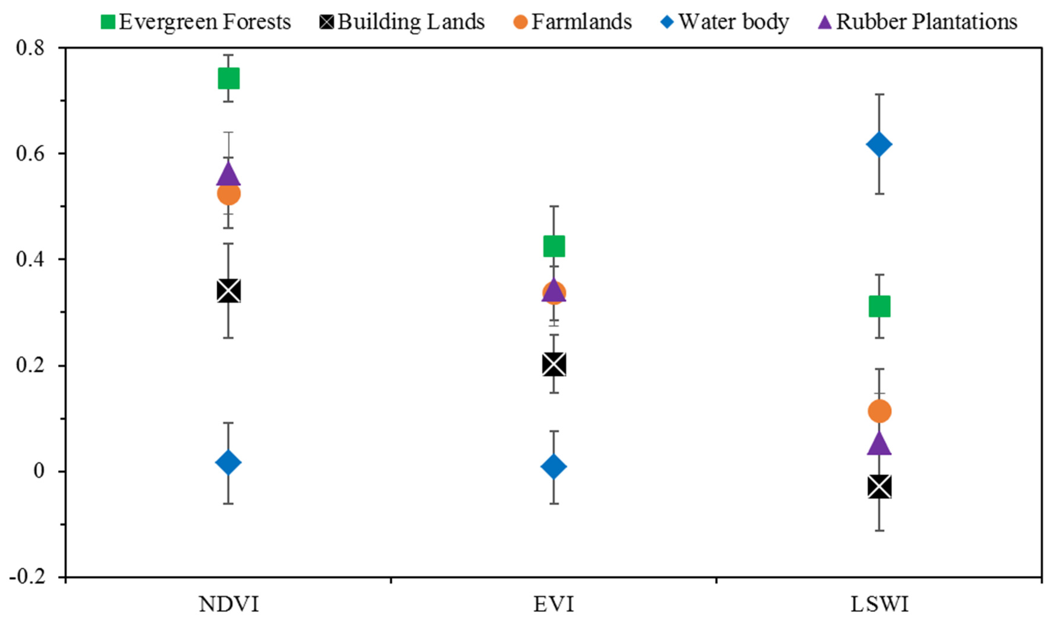
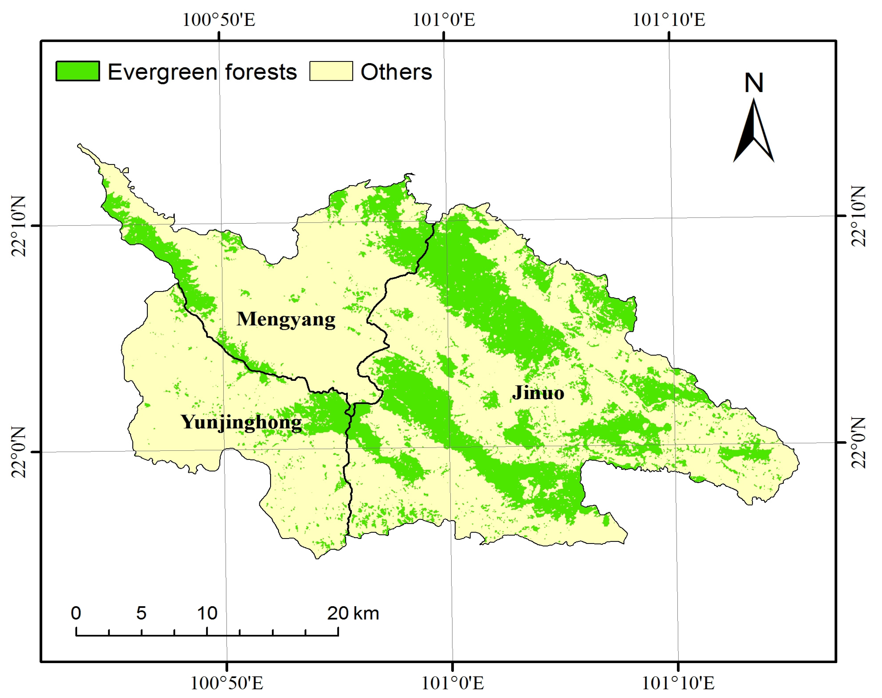
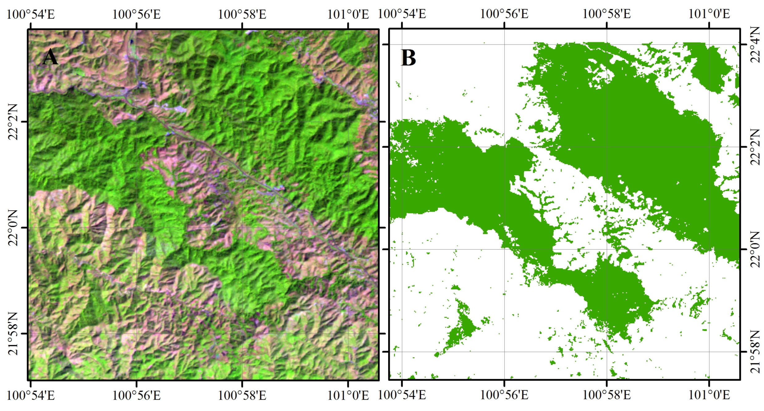
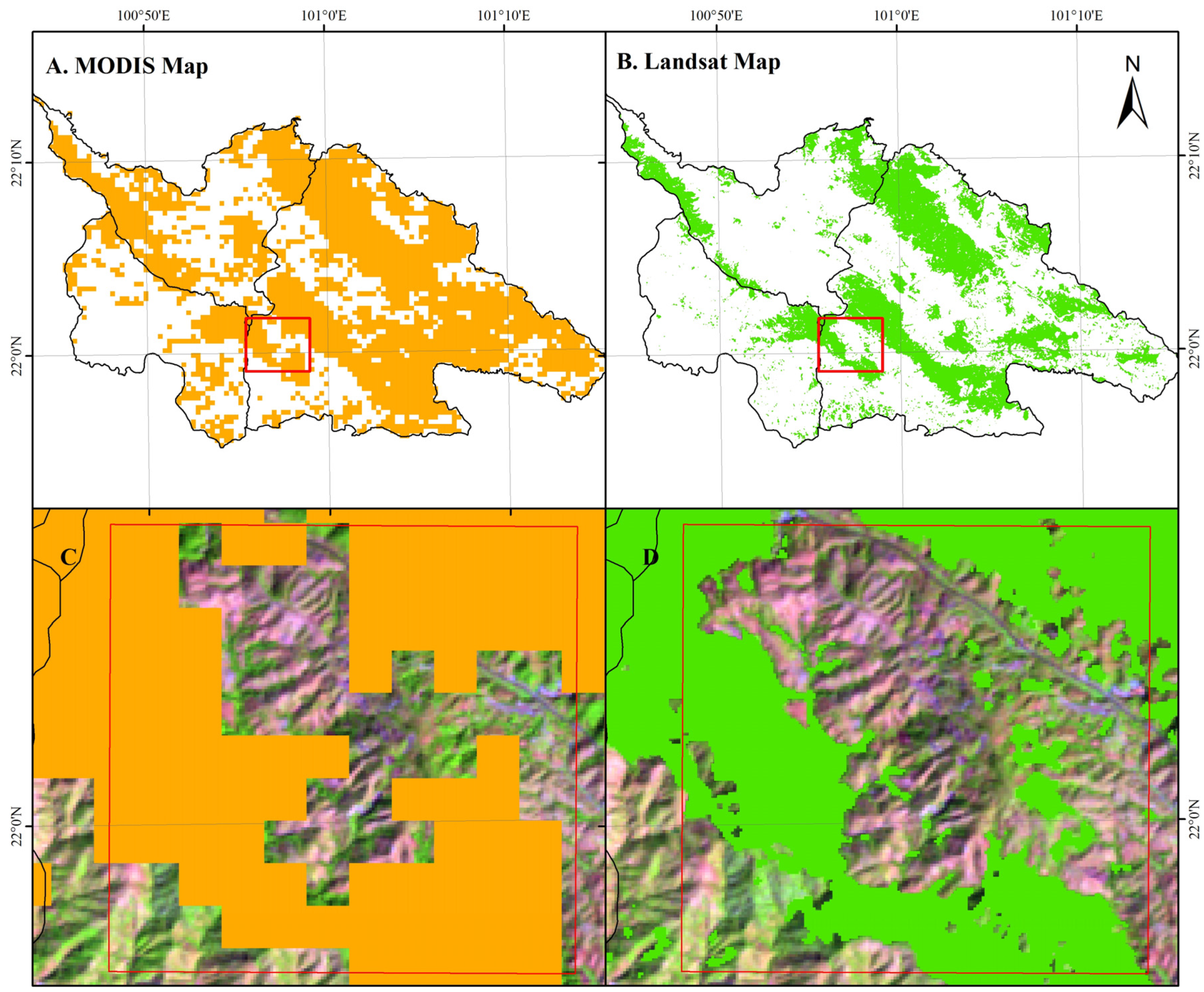
Updated extent, area, and spatial distribution of tropical evergreen forests from inventory data provides valuable knowledge for research of the carbon cycle, biodiversity, and ecosystem services in tropical regions. However, acquiring these data in mountainous regions requires labor-intensive, often cost-prohibitive field protocols. Here, we report about validated methods to rapidly identify the spatial distribution of tropical forests, and obtain accurate extent estimates using phenology-based procedures that integrate the Moderate Resolution Imaging Spectroradiometer (MODIS) and Landsat imagery. Firstly, an analysis of temporal profiles of annual time-series MODIS Normalized Difference Vegetation Index (NDVI), Enhanced Vegetation Index (EVI), and Land Surface Water Index (LSWI) was developed to identify the key phenology phase for extraction of tropical evergreen forests in five typical lands cover types. Secondly, identification signatures of tropical evergreen forests were selected and their related thresholds were calculated based on Landsat NDVI, EVI, and LSWI extracted from ground true samples of different land cover types during the key phenology phase. Finally, a map of tropical evergreen forests was created by a pixel-based thresholding. The developed methods were tested in Xishuangbanna, China, and the results show: (1) Integration of Landsat and MODIS images performs well in extracting evergreen forests in tropical complex mountainous regions. The overall accuracy of the resulting map of the case study was 92%; (2) Annual time series of high-temporal-resolution remote sensing images (MODIS) can effectively be used for identification of the key phenology phase (between Julian Date 20 and 120) to extract tropical evergreen forested areas through analysis of NDVI, EVI, and LSWI of different land cover types; (3) NDVI and LSWI are two effective metrics (NDVI ≥ 0.670 and 0.447 ≥ LSWI ≥ 0.222) to depict evergreen forests from other land cover types during the key phenology phase in tropical complex mountainous regions. This method can make full use of the Landsat and MODIS archives as well as their advantages for tropical evergreen forests geospatial inventories, and is simple and easy to use. This method is suggested for use with other similar regions. View Full-Text
Keywords: tropical evergreen forests; phenology features; remote sensing; MODIS; Landsat
▼ Figures
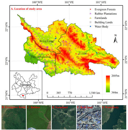
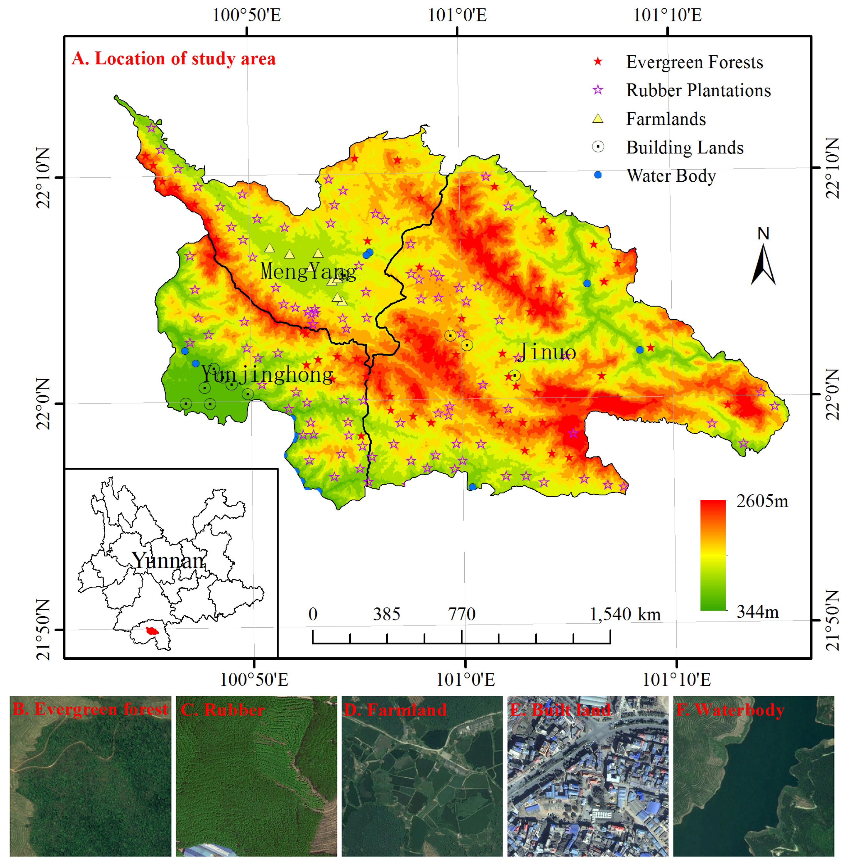
Figure 1
This is an open access article distributed under the Creative Commons Attribution License which permits unrestricted use, distribution, and reproduction in any medium, provided the original work is properly cited. (CC BY 4.0).
http://www.mdpi.com/1999-4907/8/2/34


No comments:
Post a Comment