1
Institute of Remote Sensing and Geographic Information System, Peking University, 5 Summer Palace Road, Beijing 100871, China
2
Department of International Development, Community, and Environment, Clark University, Worcester, MA 01610, USA
*
Author to whom correspondence should be addressed.
Academic Editors: Giles M. Foody, Lars T. Waser and Prasad S. Thenkabail
Received: 17 June 2016 / Revised: 7 November 2016 / Accepted: 8 November 2016 / Published: 16 November 2016
Abstract
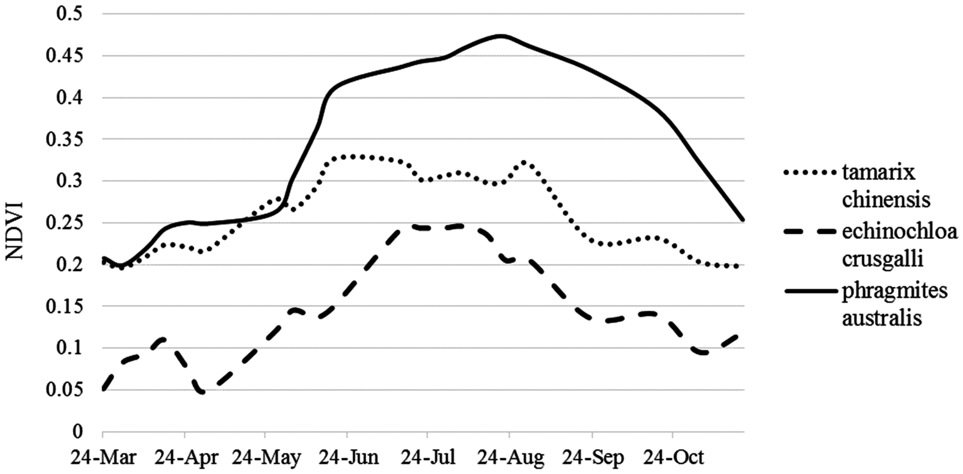
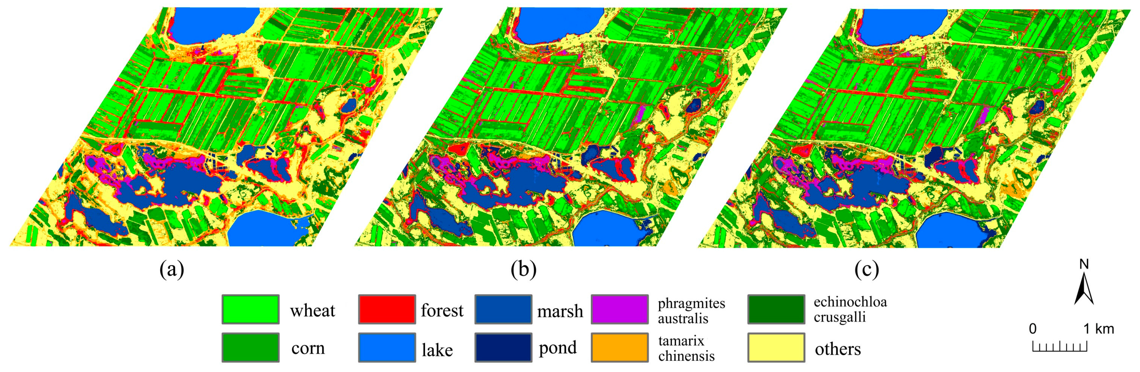
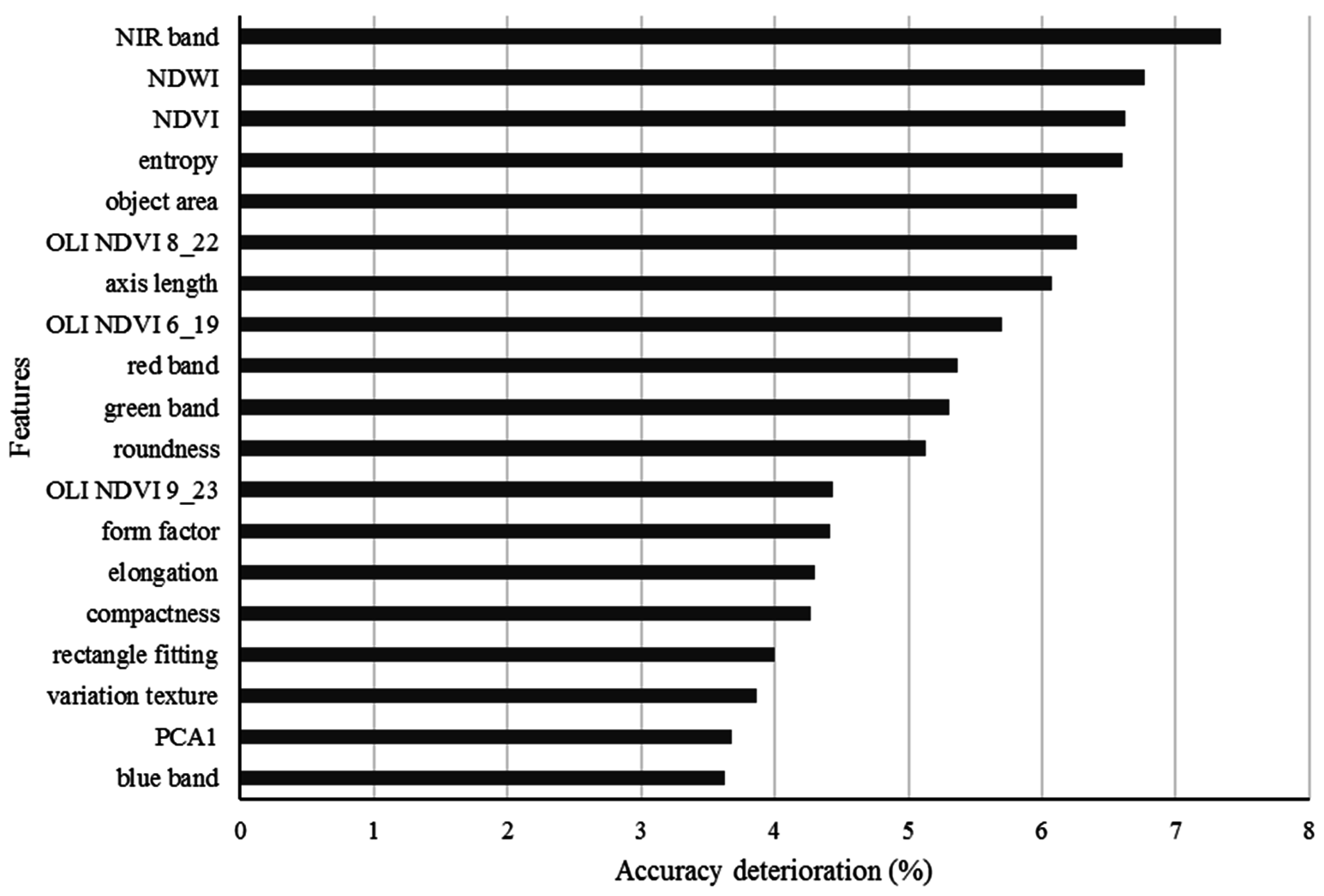
The wetland classification from remotely sensed data is usually difficult due to the extensive seasonal vegetation dynamics and hydrological fluctuation. This study presents a random forest classification approach for the retrieval of the wetland landcover in the arid regions by fusing the Pléiade-1B data with multi-date Landsat-8 data. The segmentation of the Pléiade-1B multispectral image data was performed based on an object-oriented approach, and the geometric and spectral features were extracted for the segmented image objects. The normalized difference vegetation index (NDVI) series data were also calculated from the multi-date Landsat-8 data, reflecting vegetation phenological changes in its growth cycle. The feature set extracted from the two sensors data was optimized and employed to create the random forest model for the classification of the wetland landcovers in the Ertix River in northern Xinjiang, China. Comparison with other classification methods such as support vector machine and artificial neural network classifiers indicates that the random forest classifier can achieve accurate classification with an overall accuracy of 93% and the Kappa coefficient of 0.92. The classification accuracy of the farming lands and water bodies that have distinct boundaries with the surrounding land covers was improved 5%–10% by making use of the property of geometric shapes. To remove the difficulty in the classification that was caused by the similar spectral features of the vegetation covers, the phenological difference and the textural information of co-occurrence gray matrix were incorporated into the classification, and the main wetland vegetation covers in the study area were derived from the two sensors data. The inclusion of phenological information in the classification enables the classification errors being reduced down, and the overall accuracy was improved approximately 10%. The results show that the proposed random forest classification by fusing multi-sensor data can retrieve better wetland landcover information than the other classifiers, which is significant for the monitoring and management of the wetland ecological resources in arid areas. View Full-Text
Keywords: random forest; object-oriented; phenology; arid wetland classification; texture
▼ Figures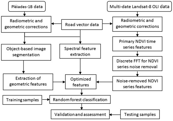
This is an open access article distributed under the Creative Commons Attribution License which permits unrestricted use, distribution, and reproduction in any medium, provided the original work is properly cited. (CC BY 4.0).
For further details log on website :
http://www.mdpi.com/2072-4292/8/11/954


No comments:
Post a Comment