1
Department of Engineering, University of Almería, Ctra. de Sacramento s/n, La Cañada de San Urbano, 04120 Almería, Spain
2
National School of Applied Sciences, University of Mohamed I, Oujda 6000, Morocco
3
High School of Technology, University of Mohamed I, Oujda 6000 Morocco
4
Department of Geography, University of Almería, Ctra Sacramento s/n, La Cañada de San Urbano, 04120 Almería, Spain
*
Author to whom correspondence should be addressed.
Academic Editors: Joanne C. White and Eric J. Jokela
Received: 5 November 2015 / Revised: 6 January 2016 / Accepted: 7 January 2016 / Published: 15 January 2016
Abstract
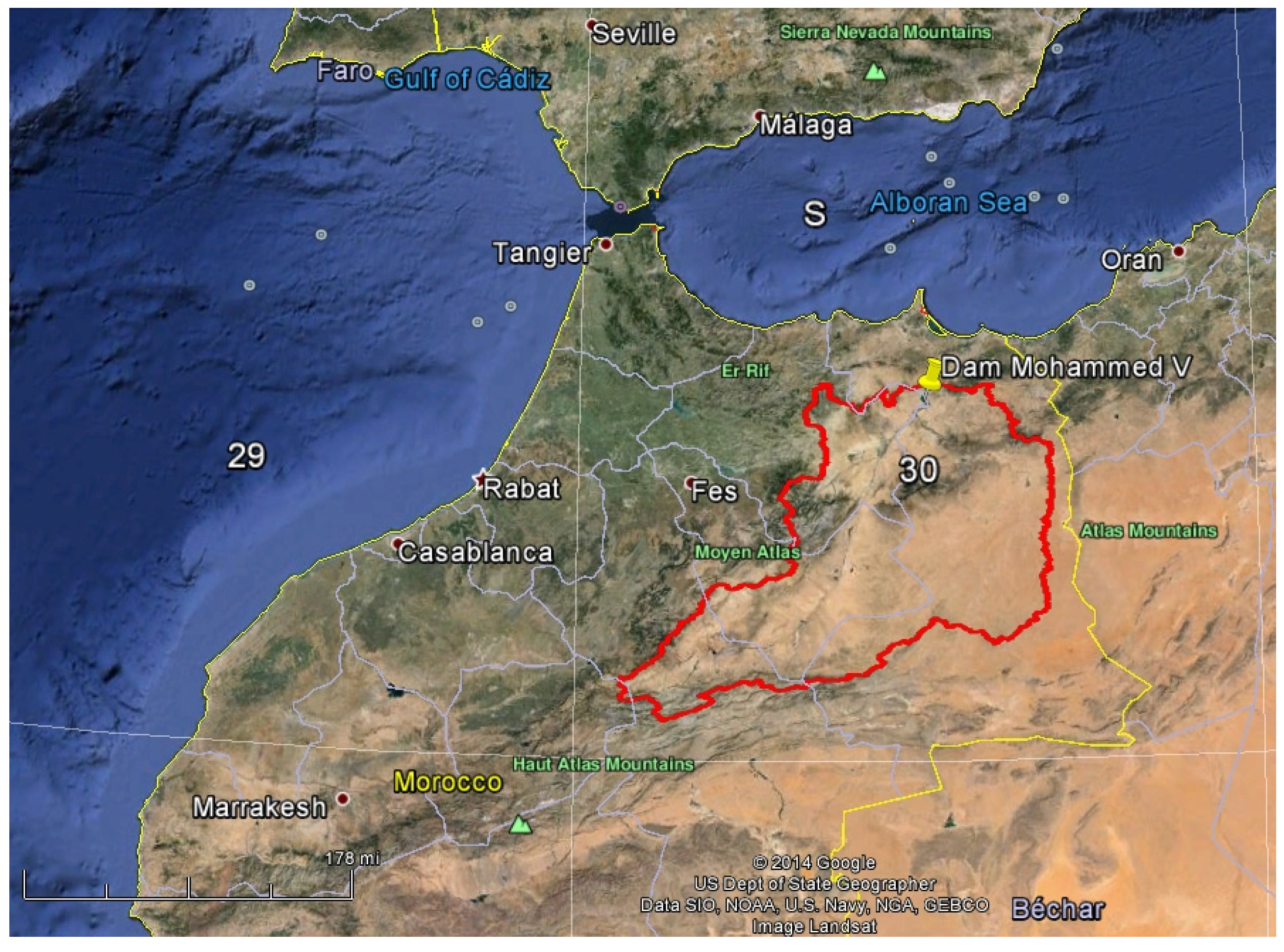
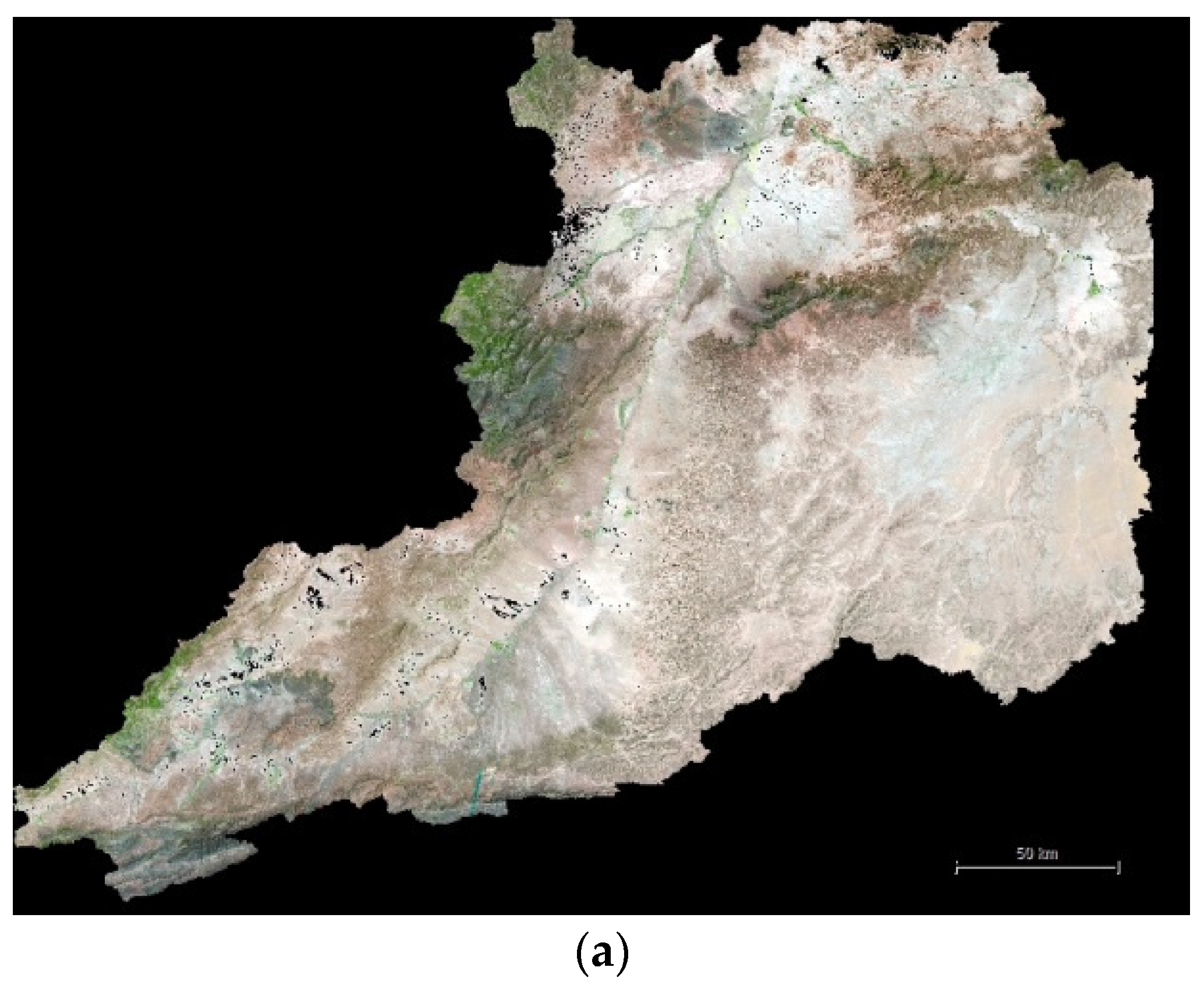
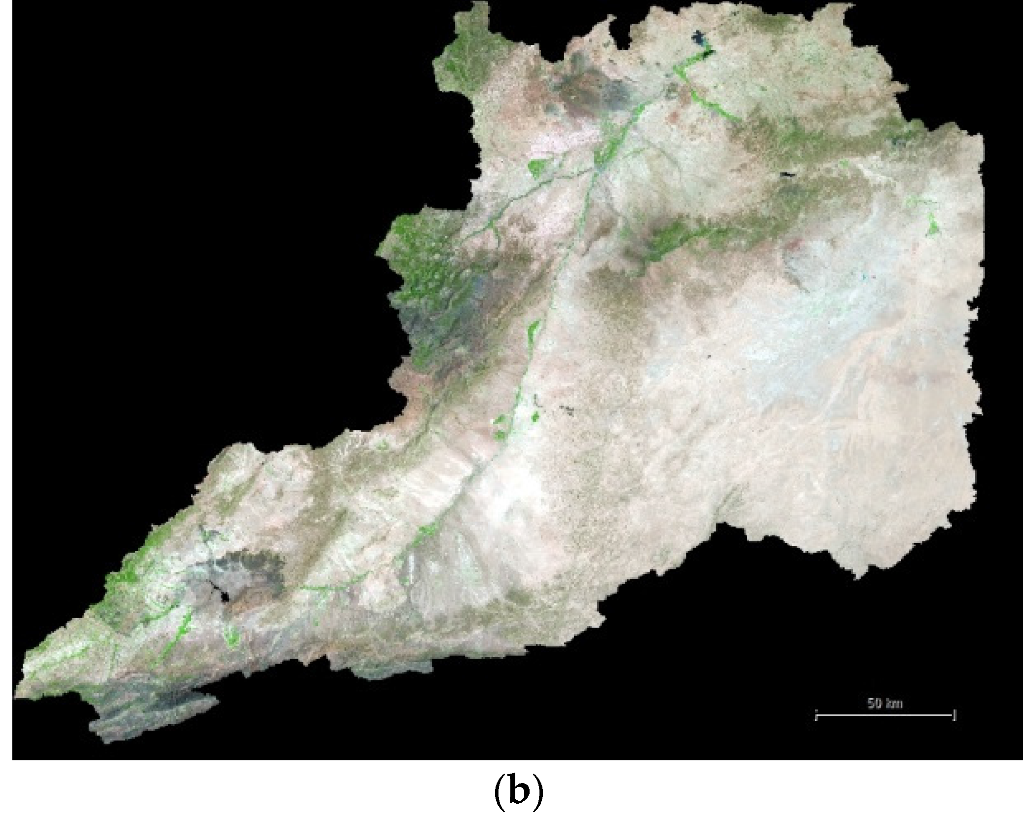
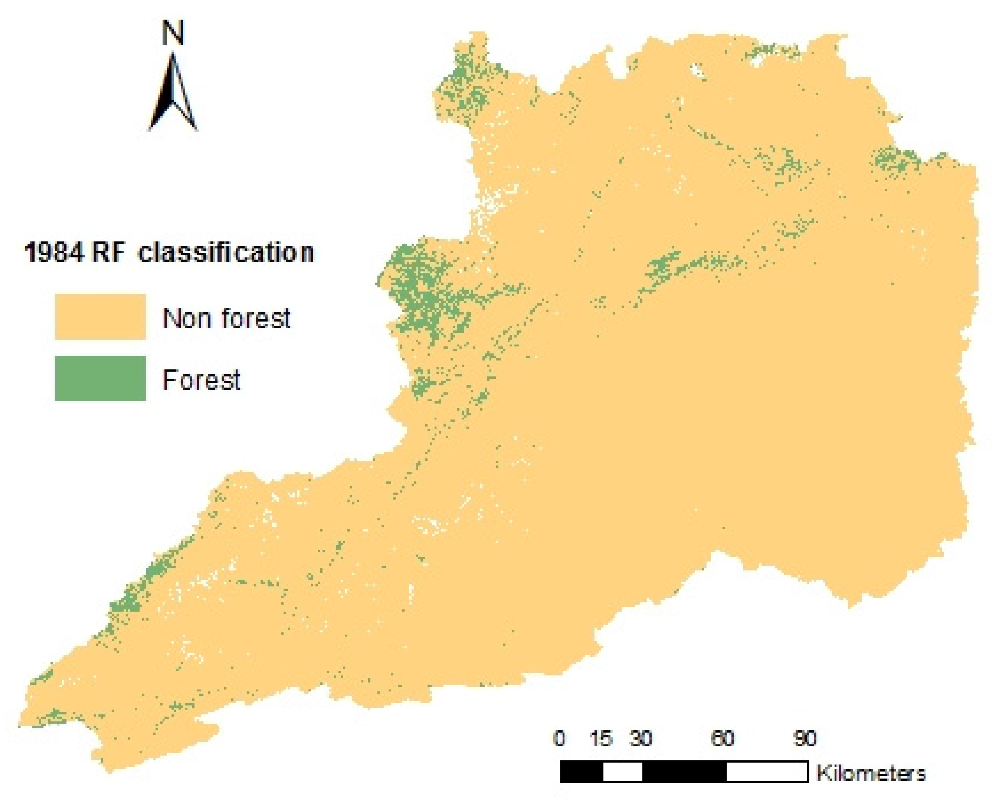
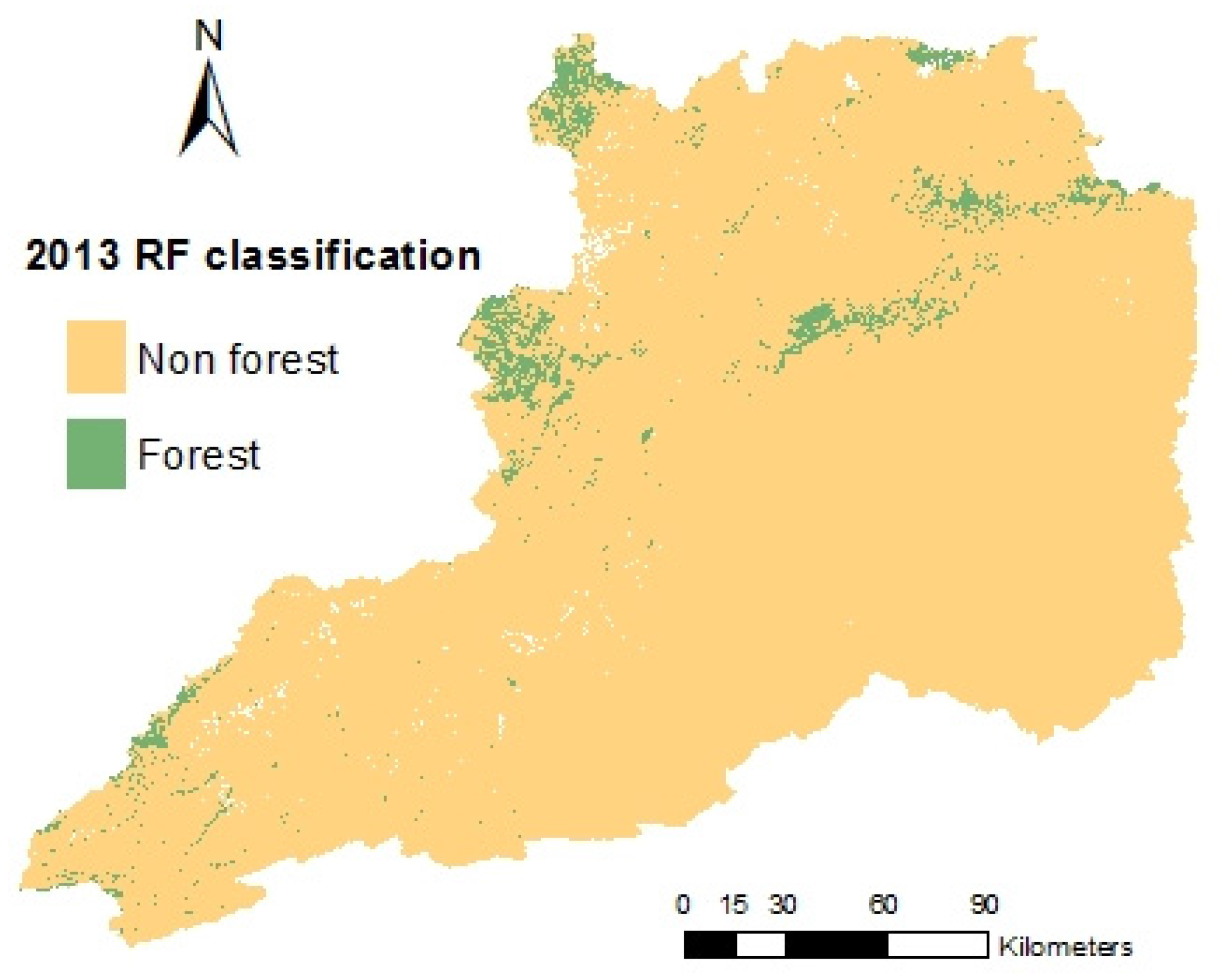
A quantitative assessment of forest cover change in the Moulouya River watershed (Morocco) was carried out by means of an innovative approach from atmospherically corrected reflectance Landsat images corresponding to 1984 (Landsat 5 Thematic Mapper) and 2013 (Landsat 8 Operational Land Imager). An object-based image analysis (OBIA) was undertaken to classify segmented objects as forested or non-forested within the 2013 Landsat orthomosaic. A Random Forest classifier was applied to a set of training data based on a features vector composed of different types of object features such as vegetation indices, mean spectral values and pixel-based fractional cover derived from probabilistic spectral mixture analysis). The very high spatial resolution image data of Google Earth 2013 were employed to train/validate the Random Forest classifier, ranking the NDVI vegetation index and the corresponding pixel-based percentages of photosynthetic vegetation and bare soil as the most statistically significant object features to extract forested and non-forested areas. Regarding classification accuracy, an overall accuracy of 92.34% was achieved. The previously developed classification scheme was applied to the 1984 Landsat data to extract the forest cover change between 1984 and 2013, showing a slight net increase of 5.3% (ca. 8800 ha) in forested areas for the whole region. View Full-Text
This is an open access article distributed under the Creative Commons Attribution License which permits unrestricted use, distribution, and reproduction in any medium, provided the original work is properly cited. (CC BY 4.0).
For further details log on website :
http://www.mdpi.com/1999-4907/7/1/23


No comments:
Post a Comment