1
State Key Laboratory of Remote Sensing Science, Institute of Remote Sensing and Digital Earth, Chinese Academy of Sciences (CAS), Beijing 100101, China
2
Department of Environmental Sciences, Policy & Management, University of California, Berkeley, CA 94720, USA
3
Ministry of Education Key Laboratory for Earth System Modeling, Center for Earth System Science, Tsinghua University, Beijing 100084, China
4
Joint Center for Global Change Studies, Beijing 100875, China
5
School of Geography and Planning, Sun Yat-sen University, Guangzhou 510275, China
*
Authors to whom correspondence should be addressed.
Academic Editors: Sangram Ganguly, Compton Tucker, Nicolas Baghdadi and Prasad S. Thenkabail
Received: 27 November 2015 / Revised: 5 January 2016 / Accepted: 8 January 2016 / Published: 14 January 2016
(This article belongs to the Special Issue Remote Sensing of Vegetation Structure and Dynamics)
Abstract
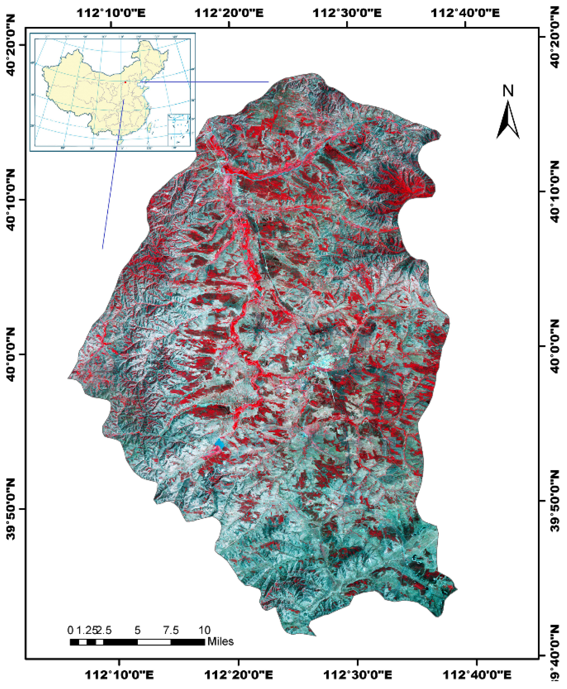
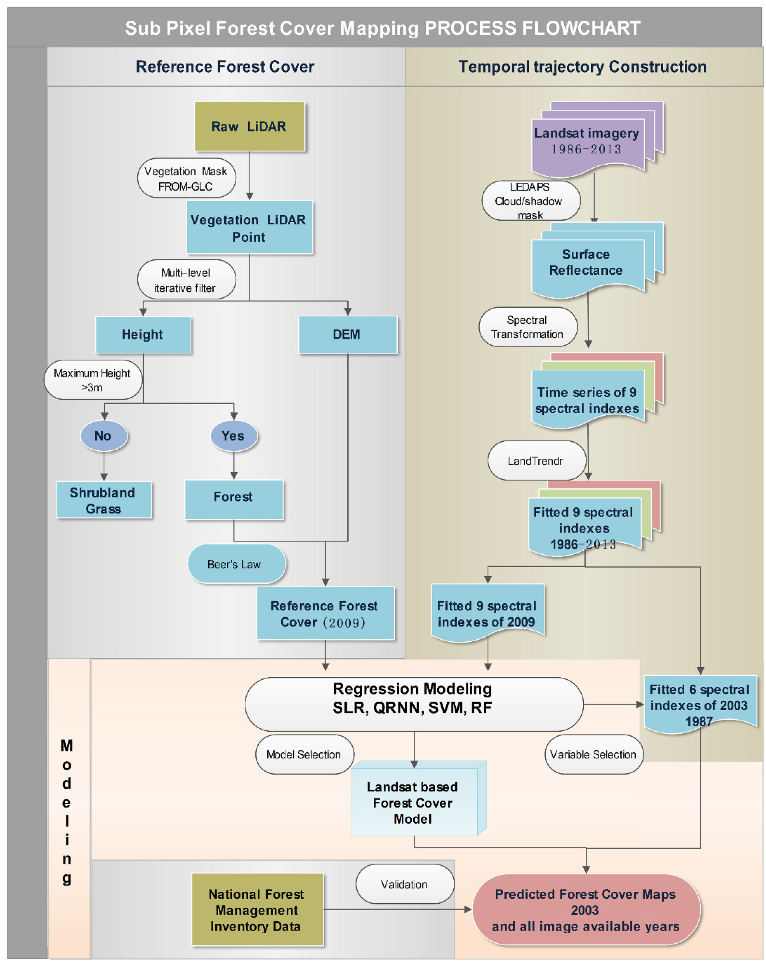
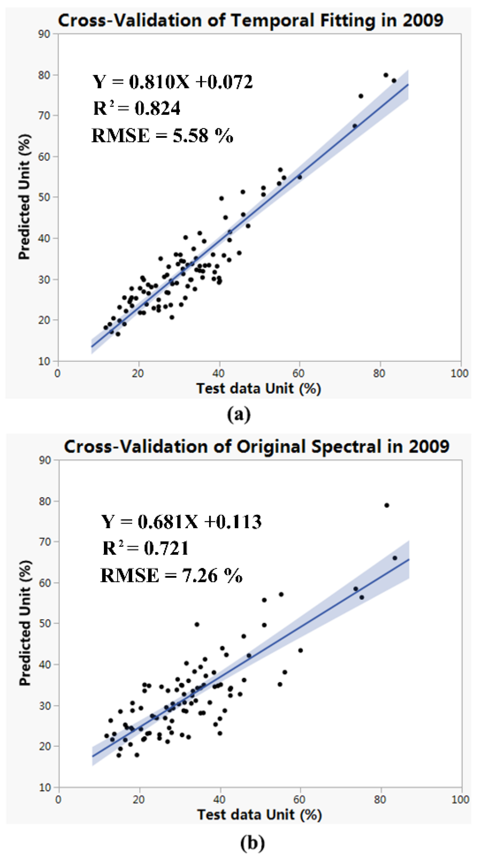
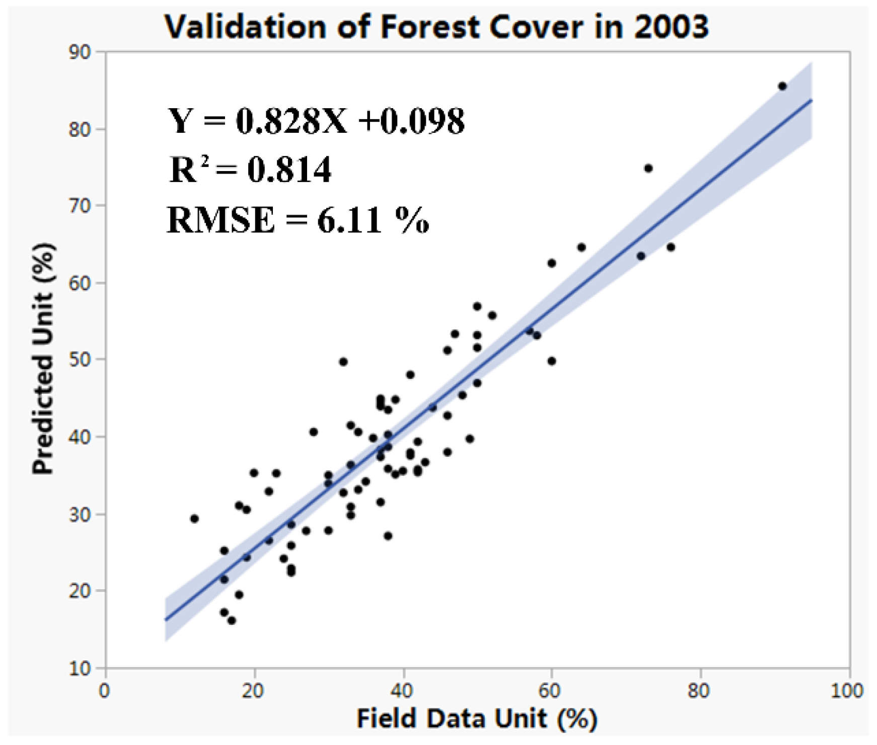
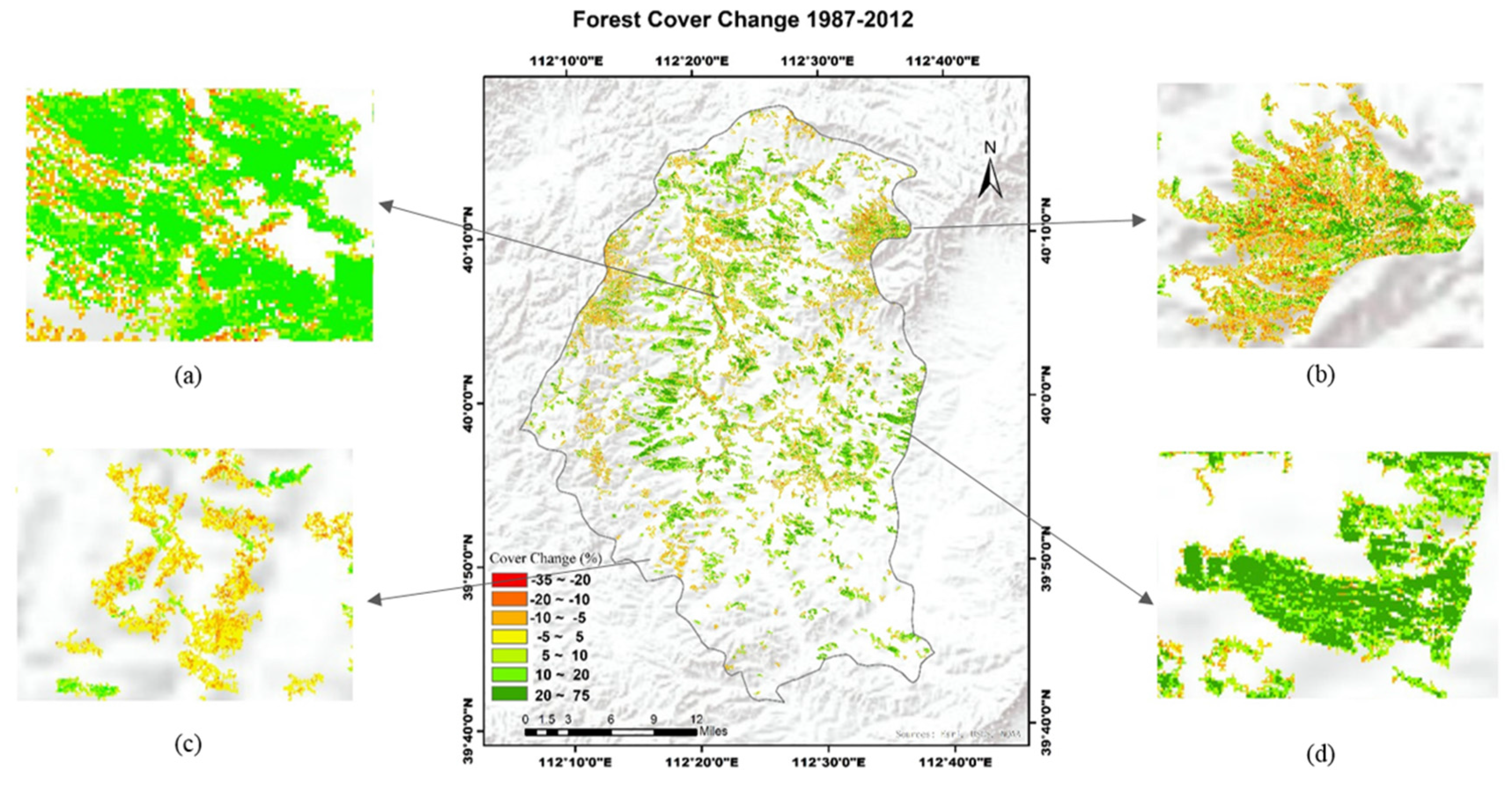
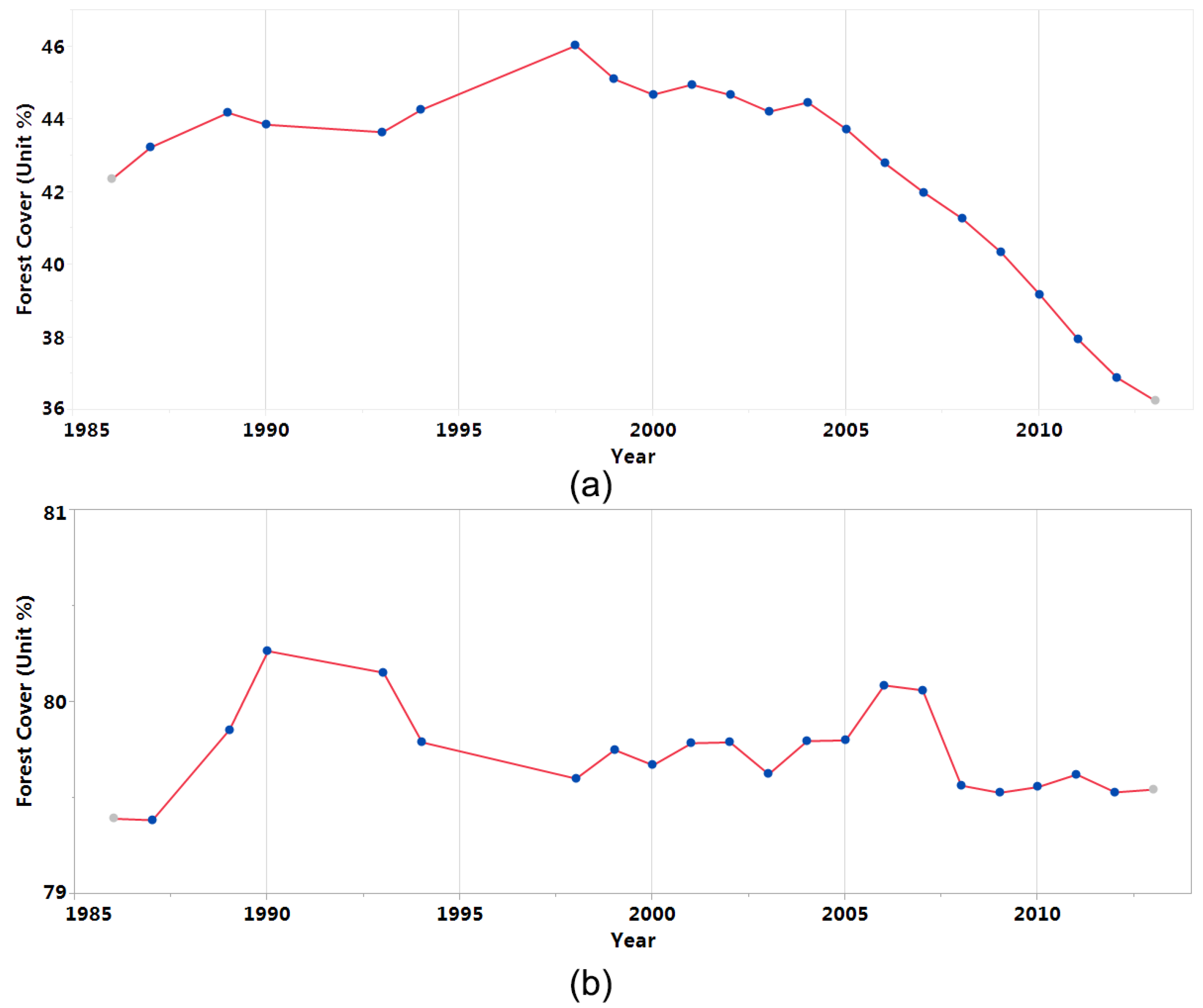
Continuous monitoring of forest cover condition is key to understanding the carbon dynamics of forest ecosystems. This paper addresses how to integrate single-year airborne LiDAR and time-series Landsat imagery to derive forest cover change information. LiDAR data were used to extract forest cover at the sub-pixel level of Landsat for a single year, and the Landtrendr algorithm was applied to Landsat spectral data to explore the temporal information of forest cover change. Four different approaches were employed to model the relationship between forest cover and Landsat spectral data. The result shows incorporating the historic information using the temporal trajectory fitting process could infuse the model with better prediction power. Random forest modeling performs the best for quantitative forest cover estimation. Temporal trajectory fitting with random forest model shows the best agreement with validation data (R2 = 0.82 and RMSE = 5.19%). We applied our approach to Youyu county in Shanxi province of China, as part of the Three North Shelter Forest Program, to map multi-decadal forest cover dynamics. With the availability of global time-series Landsat imagery and affordable airborne LiDAR data, the approach we developed has the potential to derive large-scale forest cover dynamics. View Full-Text
Keywords: forest inventory; forest monitoring; Three-North Shelter Forest Program; afforestation; time-series
▼ Figures
This is an open access article distributed under the Creative Commons Attribution License which permits unrestricted use, distribution, and reproduction in any medium, provided the original work is properly cited. (CC BY 4.0).
For further details log on website :
http://www.mdpi.com/2072-4292/8/1/62


No comments:
Post a Comment