1
Remote Sensing Research Unit, CSIR-Meraka, P.O. Box 395, Pretoria 0001, South Africa
2
Centre for Geoinformation Science, Department of Geography, Geoinformatics and Meteorology, University of Pretoria, Pretoria 0028, South Africa
3
Geospatial Sciences Center of Excellence, South Dakota State University, Brookings, SD 57007, USA
4
School of Engineering and ICT, University of Tasmania, Churchill Avenue, Hobart TAS 7005, Australia
5
Biodiversity Research and Assessment, Ezemvelo KZN Wildlife, P.O. Box 13053, Cascades 3202, South Africa
*
Author to whom correspondence should be addressed.
Academic Editors: Parth Sarathi Roy and Prasad S. Thenkabail
Received: 16 August 2016 / Revised: 17 October 2016 / Accepted: 21 October 2016 / Published: 28 October 2016
Abstract
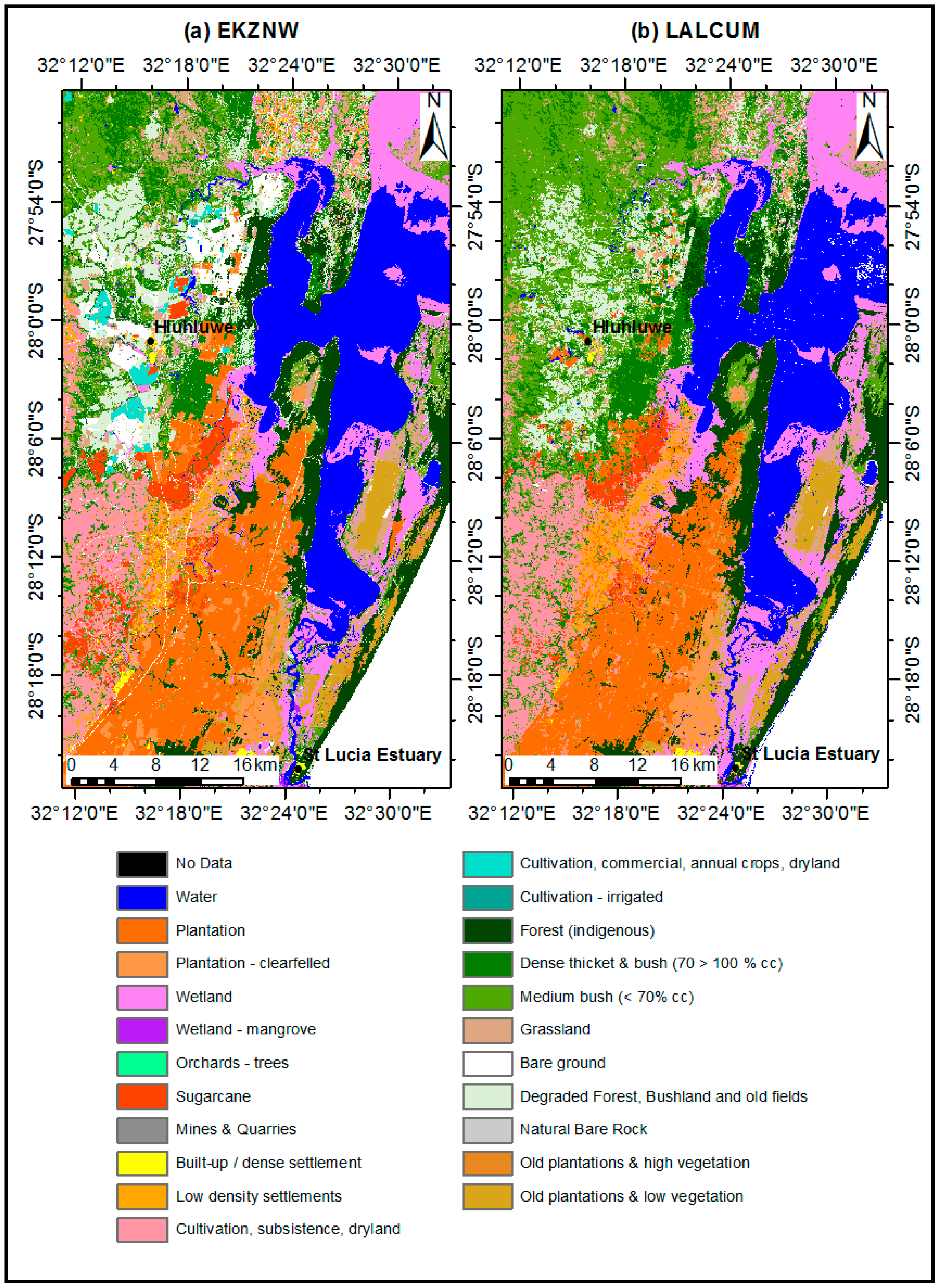
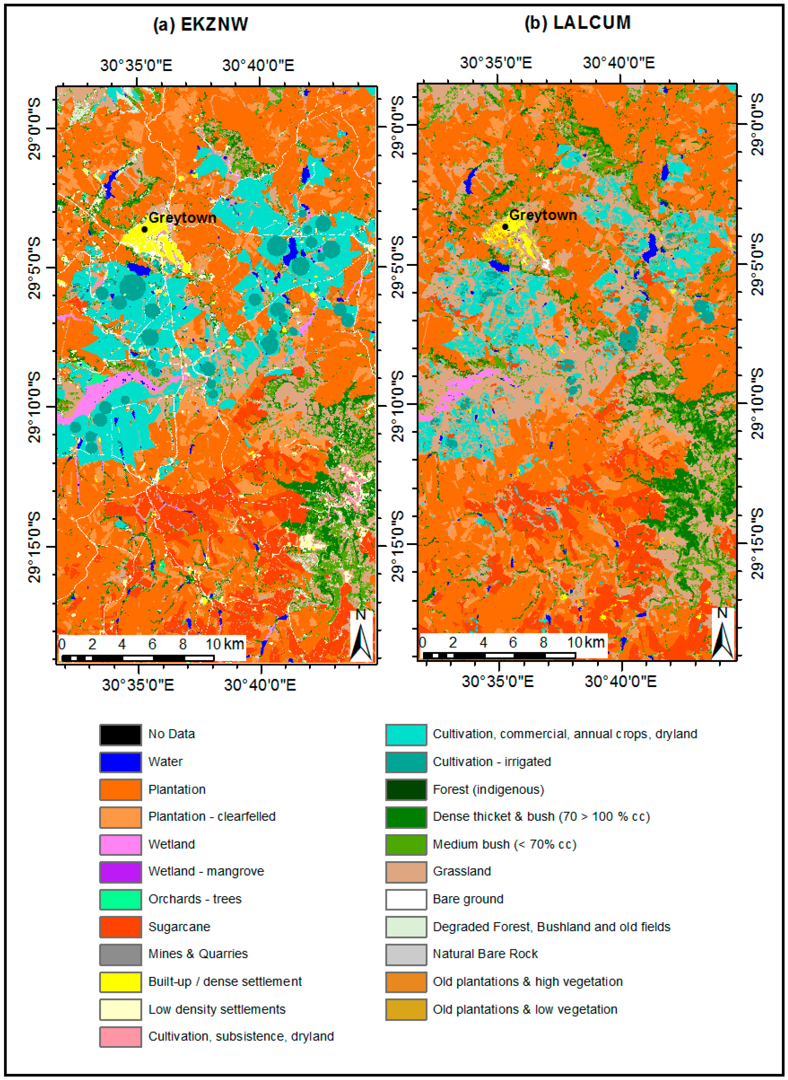
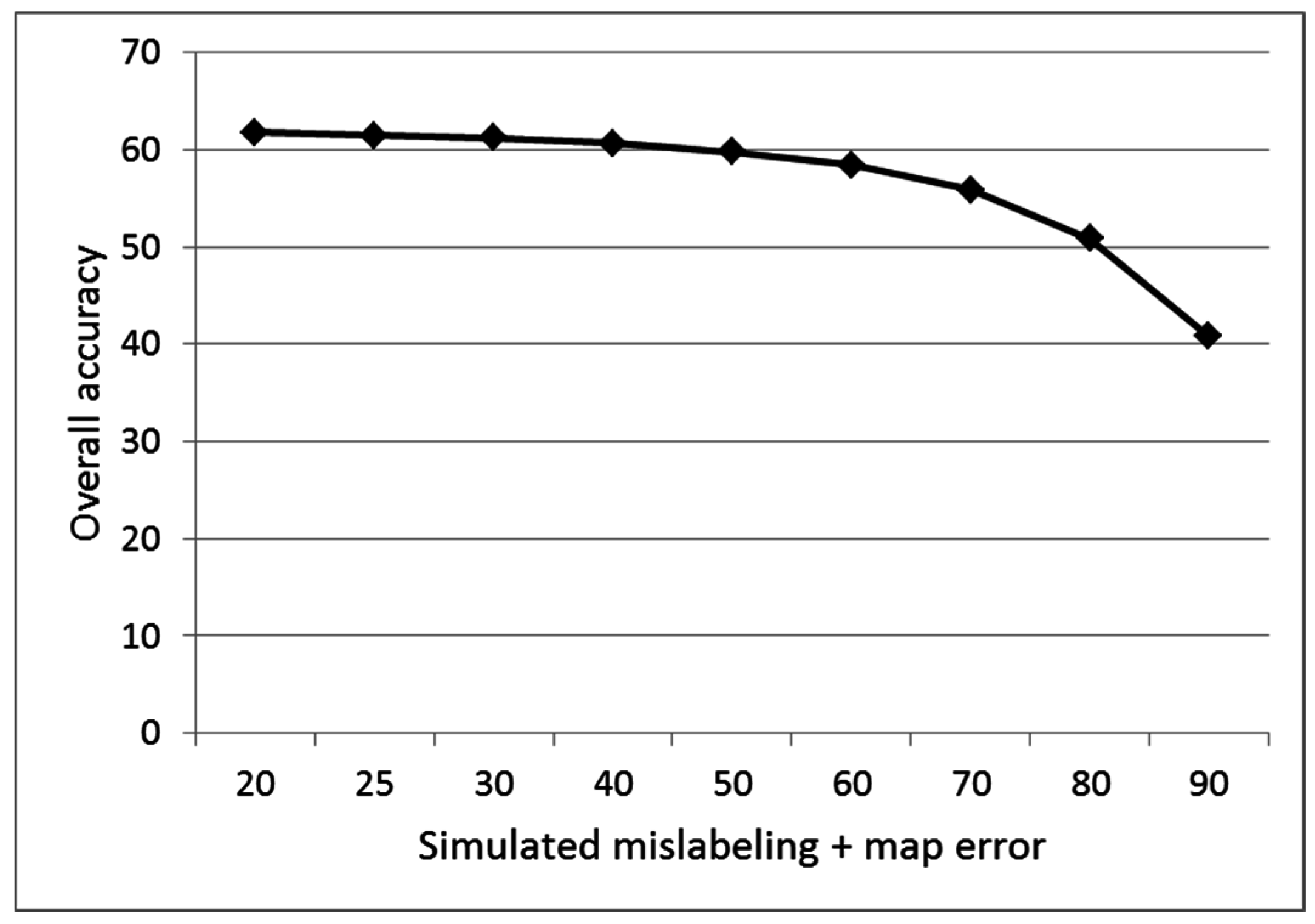
The paper evaluated the Landsat Automated Land Cover Update Mapping (LALCUM) system designed to rapidly update a land cover map to a desired nominal year using a pre-existing reference land cover map. The system uses the Iteratively Reweighted Multivariate Alteration Detection (IRMAD) to identify areas of change and no change. The system then automatically generates large amounts of training samples (n > 1 million) in the no-change areas as input to an optimized Random Forest classifier. Experiments were conducted in the KwaZulu-Natal Province of South Africa using a reference land cover map from 2008, a change mask between 2008 and 2011 and Landsat ETM+ data for 2011. The entire system took 9.5 h to process. We expected that the use of the change mask would improve classification accuracy by reducing the number of mislabeled training data caused by land cover change between 2008 and 2011. However, this was not the case due to exceptional robustness of Random Forest classifier to mislabeled training samples. The system achieved an overall accuracy of 65%–67% using 22 detailed classes and 72%–74% using 12 aggregated national classes. “Water”, “Plantations”, “Plantations—clearfelled”, “Orchards—trees”, “Sugarcane”, “Built-up/dense settlement”, “Cultivation—Irrigated” and “Forest (indigenous)” had user’s accuracies above 70%. Other detailed classes (e.g., “Low density settlements”, “Mines and Quarries”, and “Cultivation, subsistence, drylands”) which are required for operational, provincial-scale land use planning and are usually mapped using manual image interpretation, could not be mapped using Landsat spectral data alone. However, the system was able to map the 12 national classes, at a sufficiently high level of accuracy for national scale land cover monitoring. This update approach and the highly automated, scalable LALCUM system can improve the efficiency and update rate of regional land cover mapping.View Full-Text
Keywords: Landsat; land cover; change detection; automated mapping; random forest; South Africa
▼ Figures
This is an open access article distributed under the Creative Commons Attribution License which permits unrestricted use, distribution, and reproduction in any medium, provided the original work is properly cited. (CC BY 4.0).
For further details log on website :
http://www.mdpi.com/2072-4292/8/11/888


No comments:
Post a Comment