1
Conservation Ecology Center/Myanmar Program, Smithsonian Conservation Biology Institute, 1500 Remount Road, Front Royal, VA 22630, USA
2
Fauna & Flora International, 35 Shan Kone Street, San Chaung Township, Yangon 11111, Myanmar
*
Author to whom correspondence should be addressed.
Academic Editors: Krishna Prasad Vadrevu, Rama Nemani, Chris Justice, Garik Gutman, Clement Atzberger and Prasad S. Thenkabail
Received: 31 July 2016 / Revised: 29 September 2016 / Accepted: 21 October 2016 / Published: 25 October 2016
(This article belongs to the Special Issue Mapping, Monitoring and Impact Assessment of Land Cover/Land Use Changes in South and South East Asia)
Abstract
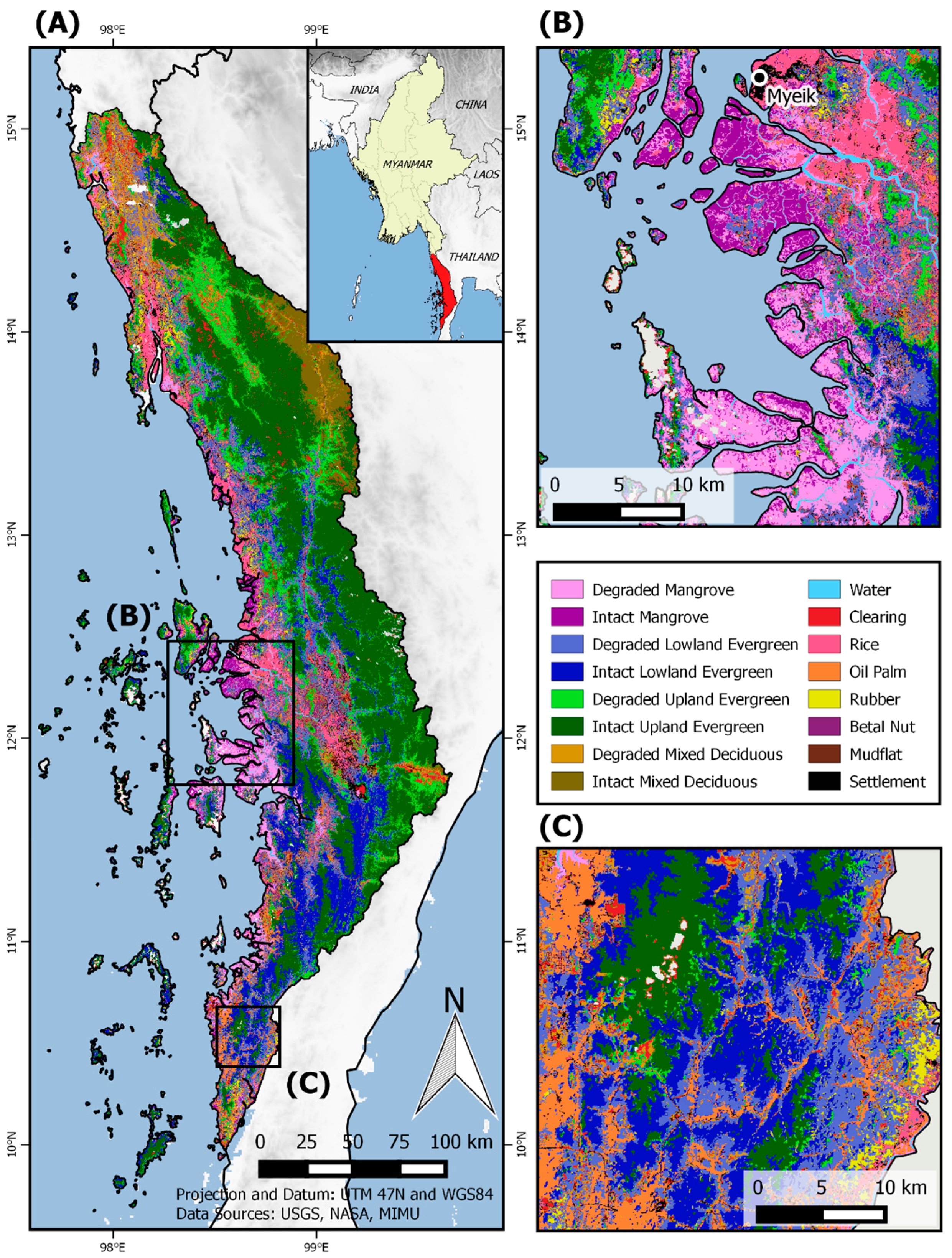
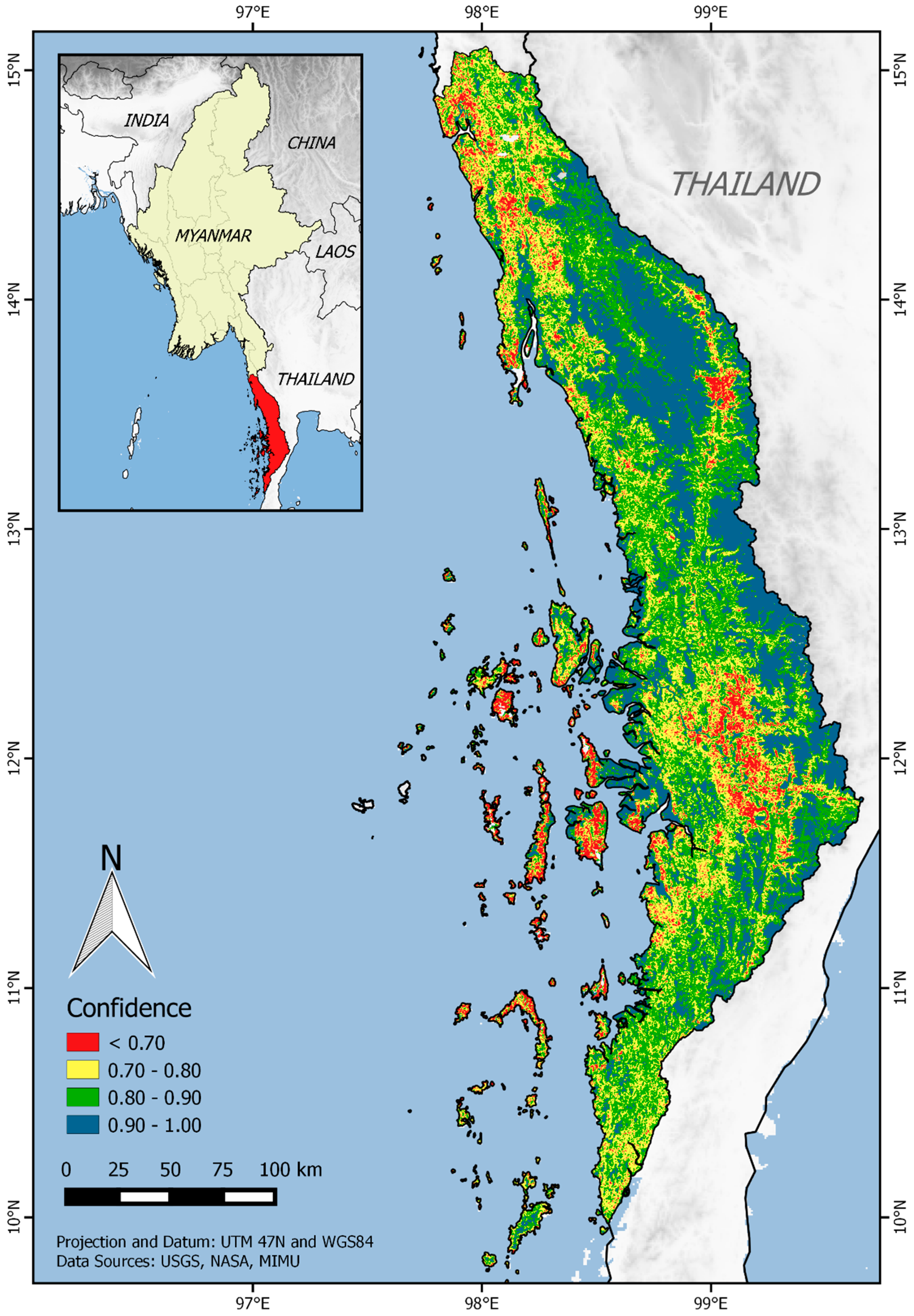
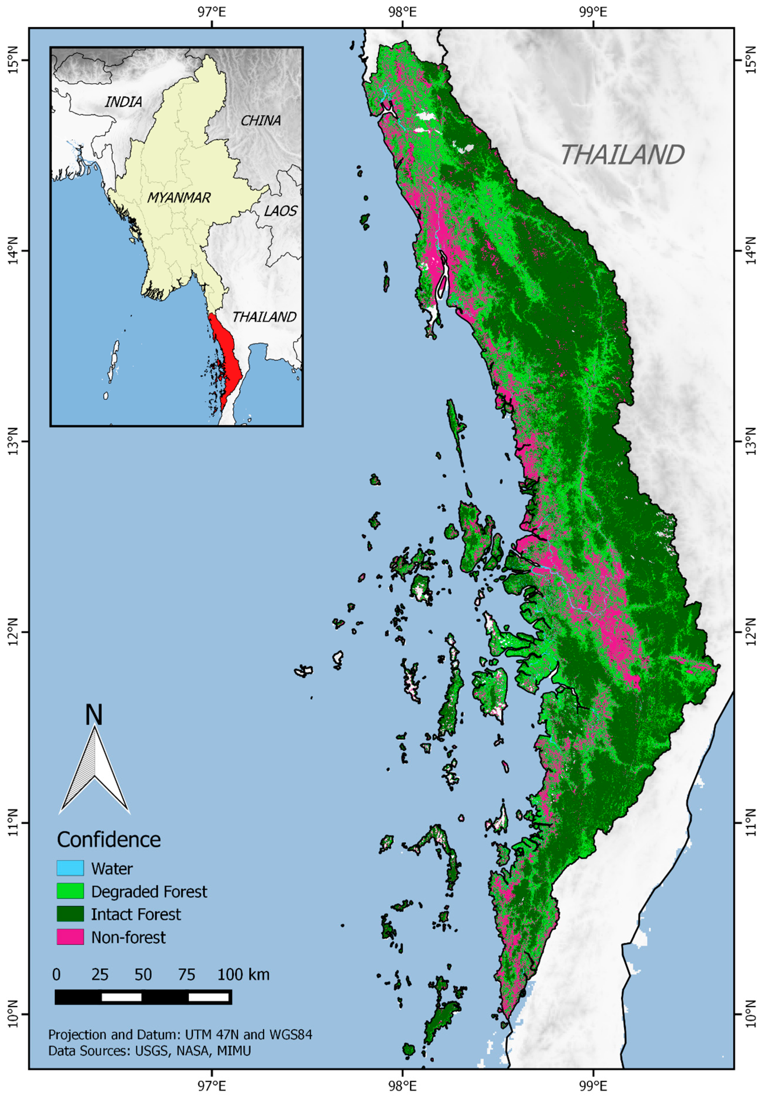
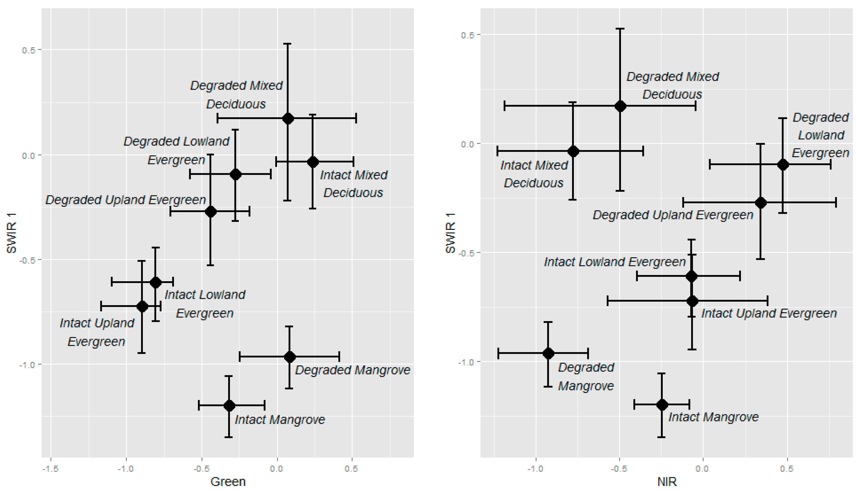
We investigated the use of multi-spectral Landsat OLI imagery for delineating mangrove, lowland evergreen, upland evergreen and mixed deciduous forest types in Myanmar’s Tanintharyi Region and estimated the extent of degraded forest for each unique forest type. We mapped a total of 16 natural and human land use classes using both a Random Forest algorithm and a multivariate Gaussian model while considering scenarios with all natural forest classes grouped into a single intact or degraded category. Overall, classification accuracy increased for the multivariate Gaussian model with the partitioning of intact and degraded forest into separate forest cover classes but slightly decreased based on the Random Forest classifier. Natural forest cover was estimated to be 80.7% of total area in Tanintharyi. The most prevalent forest types are upland evergreen forest (42.3% of area) and lowland evergreen forest (21.6%). However, while just 27.1% of upland evergreen forest was classified as degraded (on the basis of canopy cover <80%), 66.0% of mangrove forest and 47.5% of the region’s biologically-rich lowland evergreen forest were classified as degraded. This information on the current status of Tanintharyi’s unique forest ecosystems and patterns of human land use is critical to effective conservation strategies and land-use planning. View Full-Text
Keywords: remote sensing; forest types; forest classification; Landsat 8 OLI; satellite imagery; wildlife habitat; tropical forest; mangrove
▼ Figures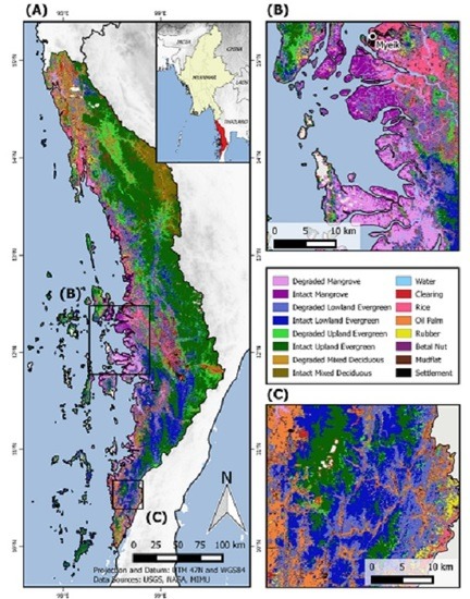
This is an open access article distributed under the Creative Commons Attribution License which permits unrestricted use, distribution, and reproduction in any medium, provided the original work is properly cited. (CC BY 4.0).
For further details log on website :
http://www.mdpi.com/2072-4292/8/11/882


No comments:
Post a Comment