1
School of Mathematical and Geospatial Sciences, RMIT University, GPO Box 2476, Melbourne, VIC 3001, Australia
2
ITC, University of Twente, PO Box 217, NL-7000 AE Enschede, The Netherlands
3
Cooperative Research Centre for Spatial Information, Level 5, 204 Lygon Street, Carlton, VIC 3053, Australia
4
Victorian Department of Environment, Water, Land and Planning, PO Box 500, East Melbourne, VIC 3002, Australia
5
Joint Remote Sensing Research Program, School of Geography, Planning and Environmental Management, University of Queensland, St Lucia, QLD 4072, Australia
6
Food and Agricultural Organisation of the United Nations, Viale delle Terme di Caracalla, Rome 00153, Italy
*
Author to whom correspondence should be addressed.
Academic Editors: Nicolas Baghdadi and Prasad S. Thenkabail
Received: 29 July 2015 / Accepted: 15 September 2015 / Published: 23 September 2015
Abstract
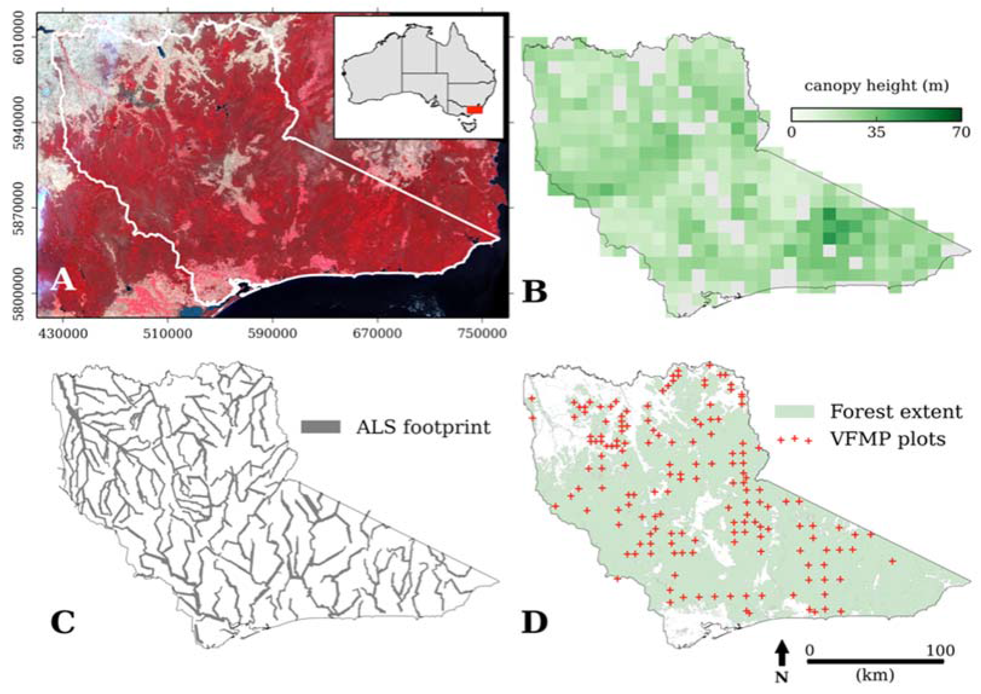
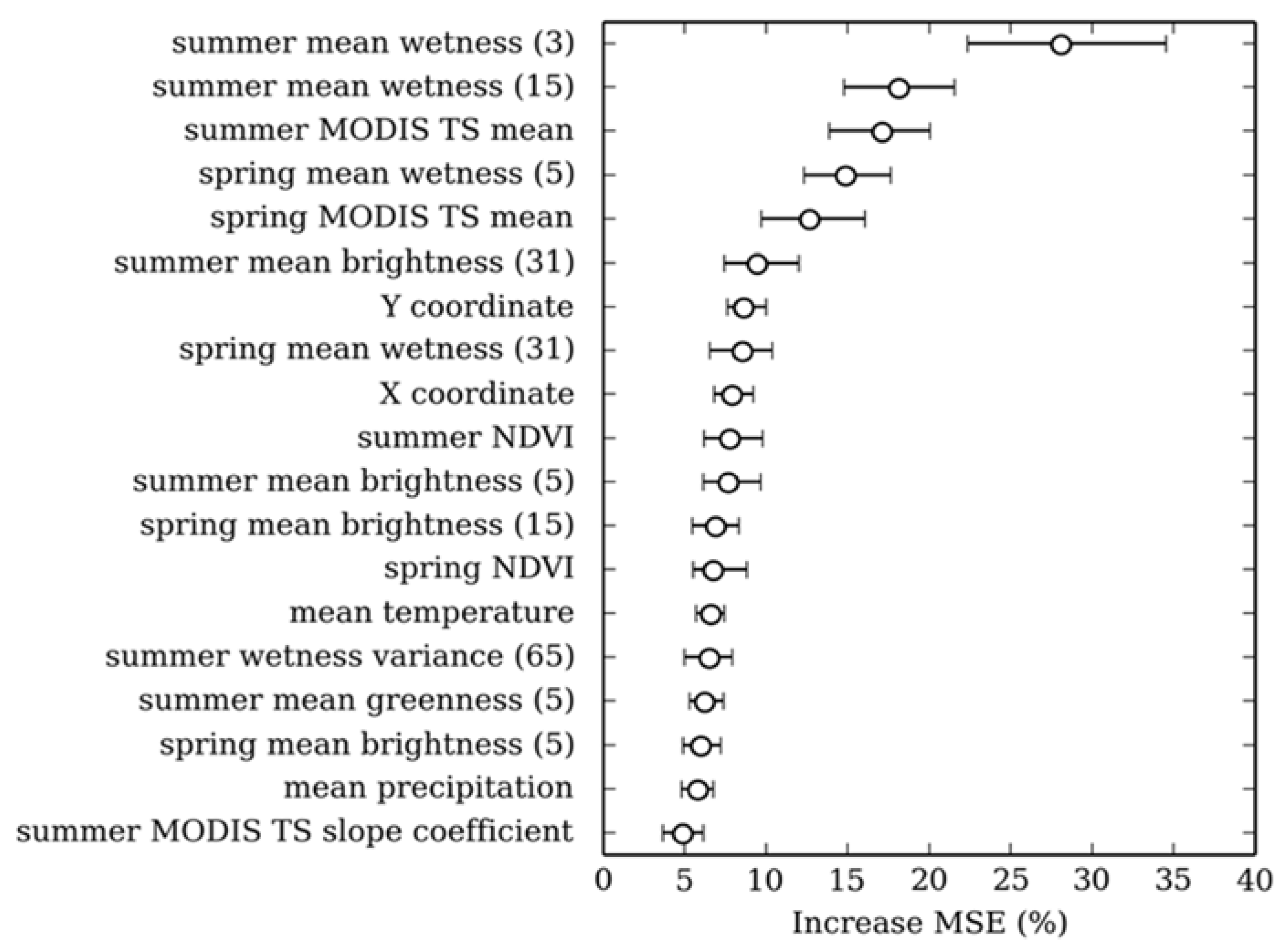
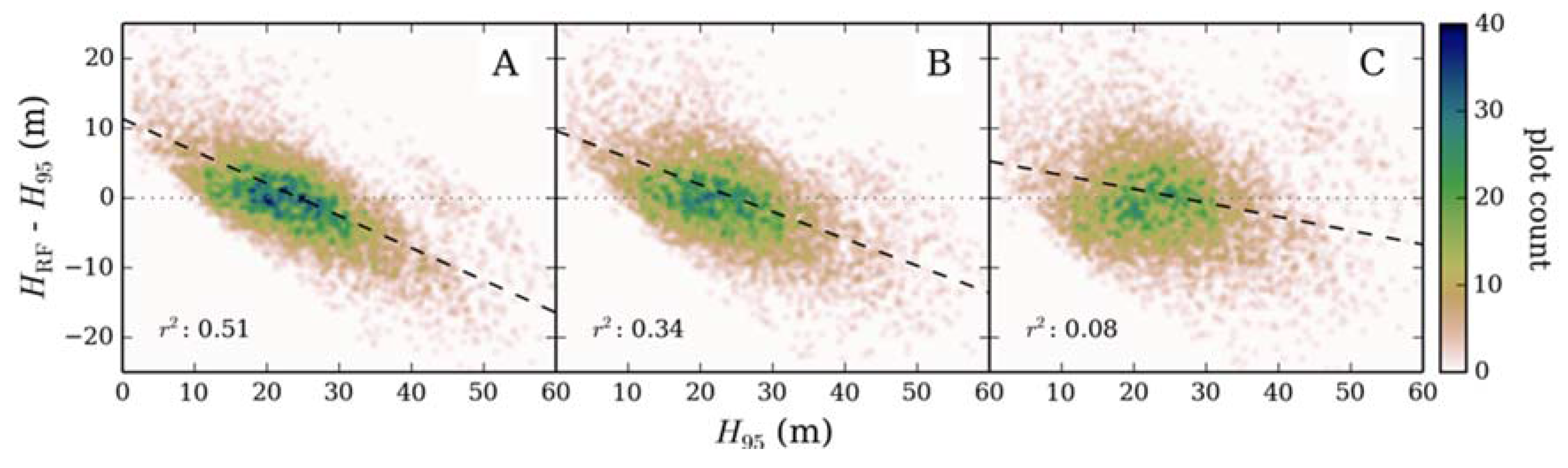
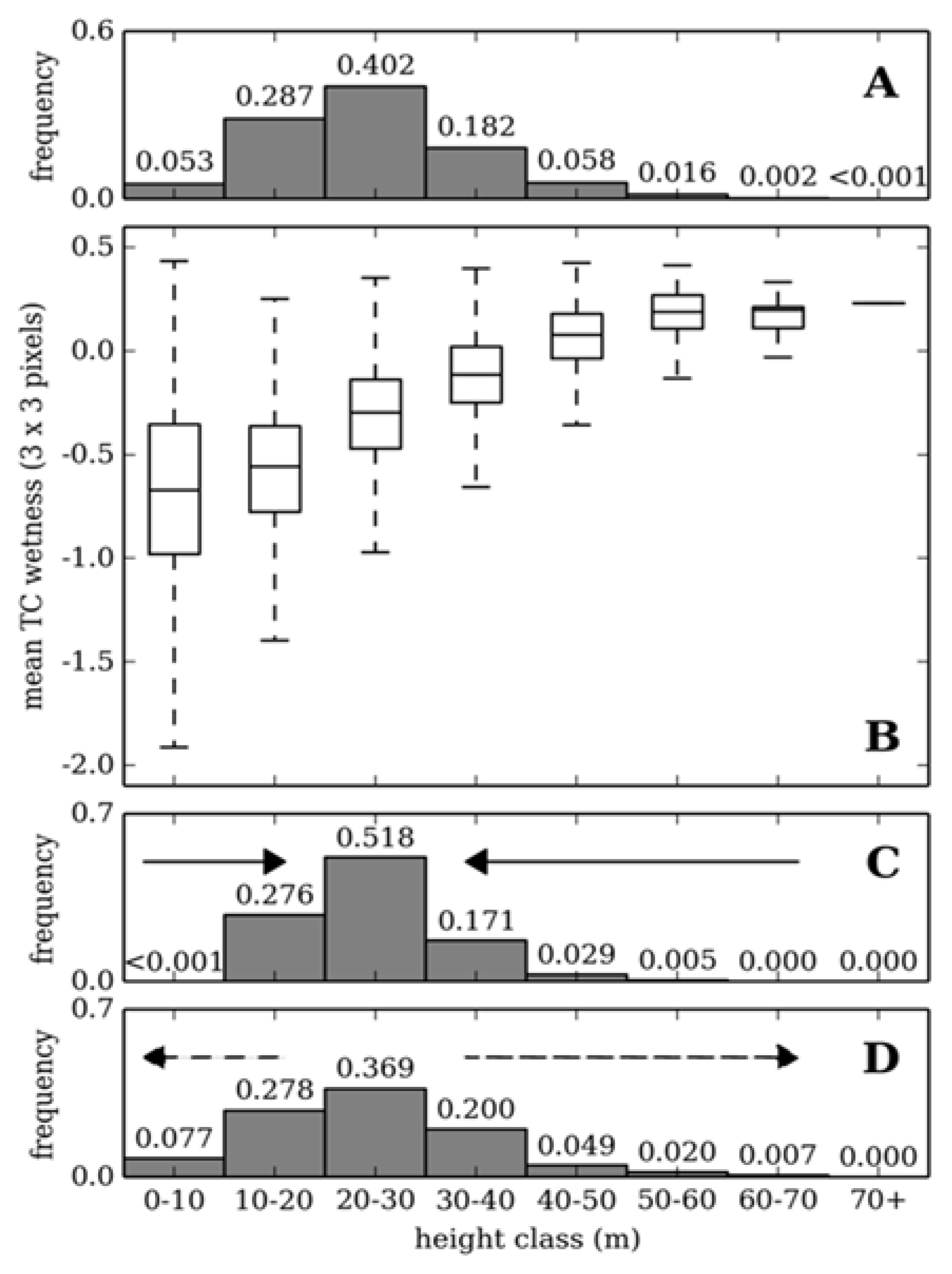
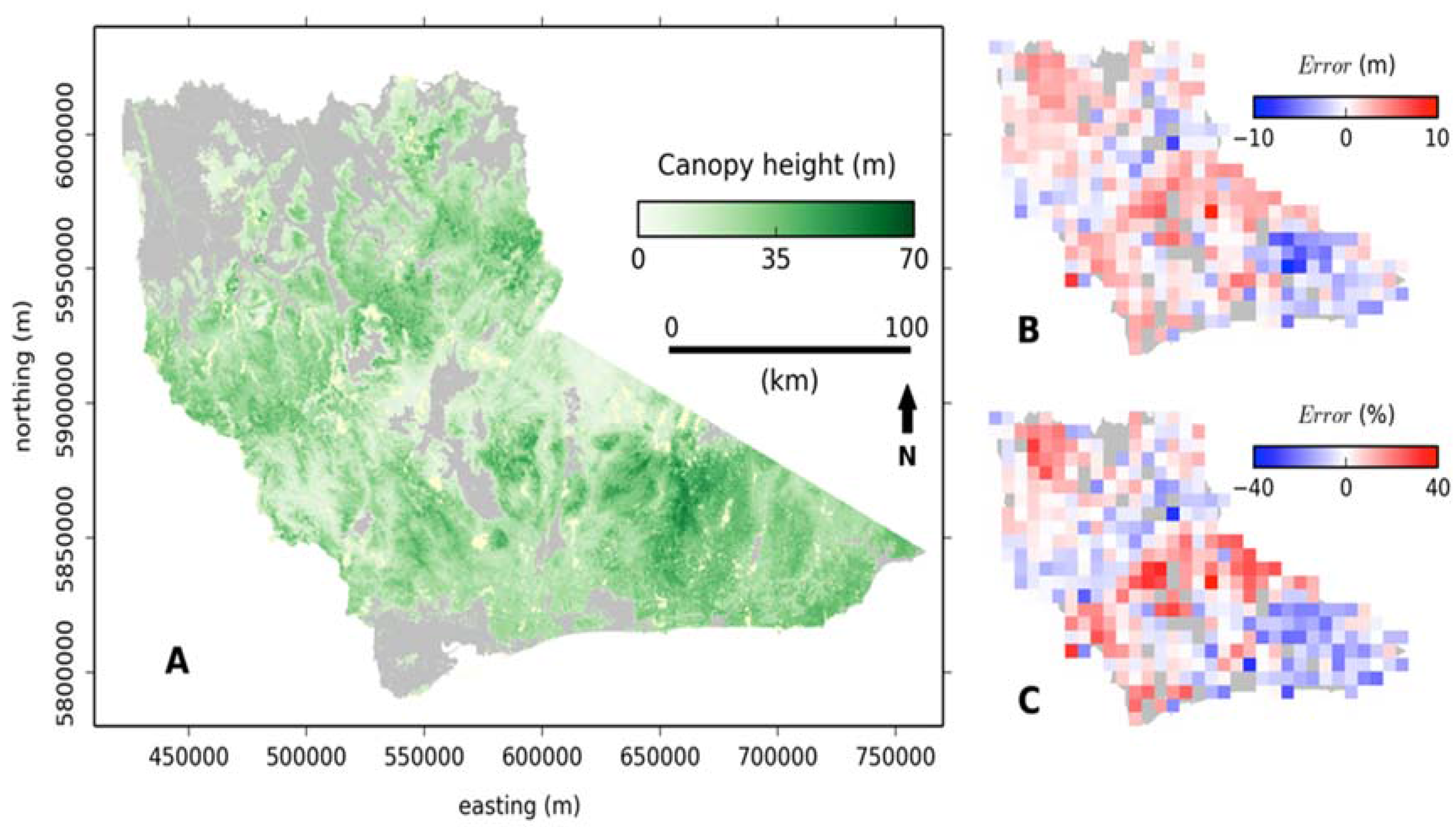
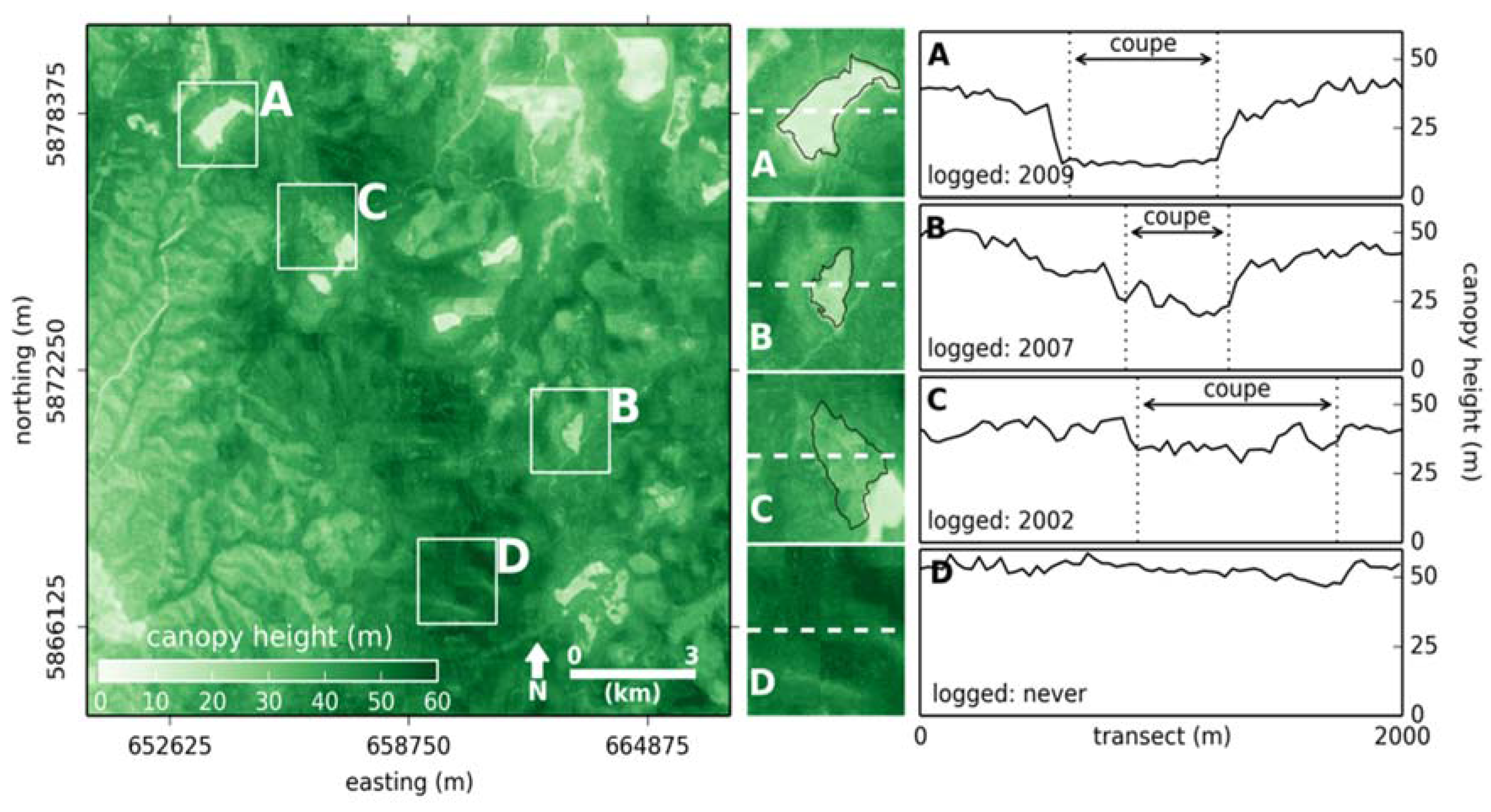
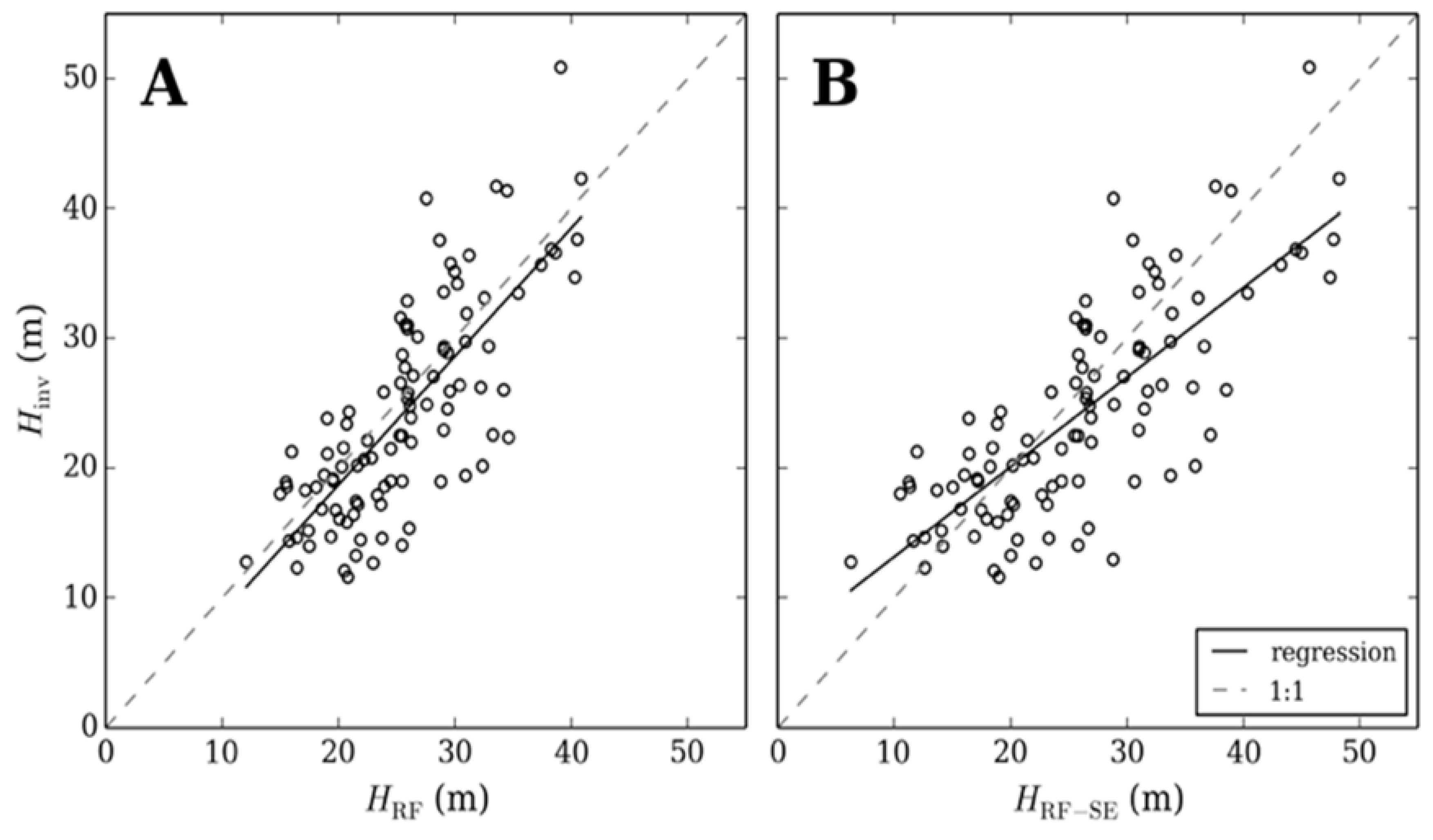
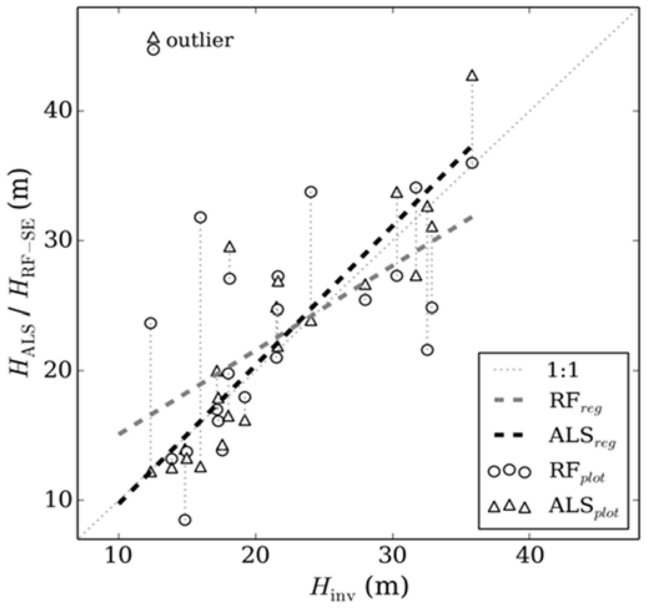
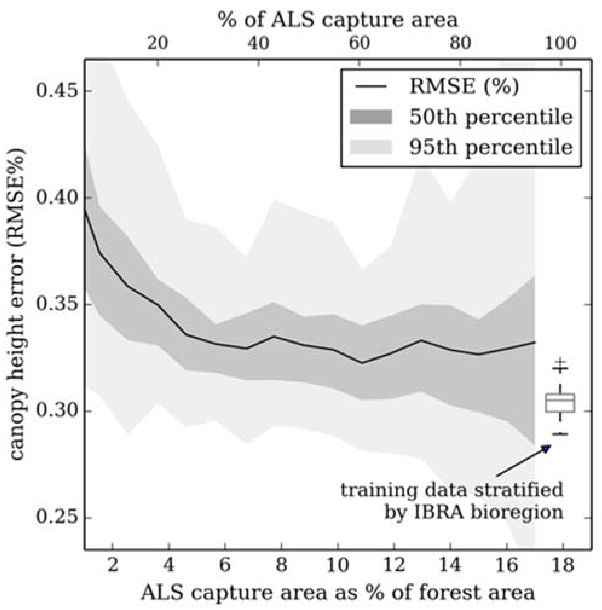
Operational assessment of forest structure is an on-going challenge for land managers, particularly over large, remote or inaccessible areas. Here, we present an easily adopted method for generating a continuous map of canopy height at a 30 m resolution, demonstrated over 2.9 million hectares of highly heterogeneous forest (canopy height 0–70 m) in Victoria, Australia. A two-stage approach was utilized where Airborne Laser Scanning (ALS) derived canopy height, captured over ~18% of the study area, was used to train a regression tree ensemble method; random forest. Predictor variables, which have a global coverage and are freely available, included Landsat Thematic Mapper (Tasselled Cap transformed), Moderate Resolution Imaging Spectroradiometer Normalized Difference Vegetation Index time series, Shuttle Radar Topography Mission elevation data and other ancillary datasets. Reflectance variables were further processed to extract additional spatial and temporal contextual and textural variables. Modeled canopy height was validated following two approaches; (i) random sample cross validation; and (ii) with 108 inventory plots from outside the ALS capture extent. Both the cross validation and comparison with inventory data indicate canopy height can be estimated with a Root Mean Square Error (RMSE) of ≤ 31% (~5.6 m) at the 95th percentile confidence interval. Subtraction of the systematic component of model error, estimated from training data error residuals, rescaled canopy height values to more accurately represent the response variable distribution tails e.g., tall and short forest. Two further experiments were carried out to test the applicability and scalability of the presented method. Results suggest that (a) no improvement in canopy height estimation is achieved when models were constructed and validated for smaller geographic areas, suggesting there is no upper limit to model scalability; and (b) training data can be captured over a small percentage of the study area (~6%) if response and predictor variable variance is captured within the training cohort, however RMSE is higher than when compared to a stratified random sample. View Full-Text
Keywords: canopy height; ALS; Landsat; open-source; large area assessment; random forest
▼ Figures
This is an open access article distributed under the Creative Commons Attribution License which permits unrestricted use, distribution, and reproduction in any medium, provided the original work is properly cited. (CC BY 4.0).
For further details log on website :
http://www.mdpi.com/2072-4292/7/9/12563


No comments:
Post a Comment