1
Interdisciplinary Program in Landscape Architecture, Seoul National University, Seoul 151-743, Korea
2
Department of Landscape Architecture and Rural System Engineering, Seoul National University, Seoul 151-743, Korea
3
Department of Environmental Science, Policy, and Management, University of California, Berkeley, CA 94720, USA
4
Plant Resources Division, National Institute of Biological Resources, Incheon 22689, Korea
*
Authors to whom correspondence should be addressed.
Academic Editors: Geoffrey M. Henebry, Forrest M. Hoffman, Jitendra Kumar, Xiaoyang Zhang, Lars T. Waser and Prasad S. Thenkabail
Received: 26 August 2016 / Revised: 25 November 2016 / Accepted: 29 November 2016 / Published: 3 December 2016
(This article belongs to the Special Issue Land Surface Phenology and Seasonality: Novel Approaches and Applications)
Abstract
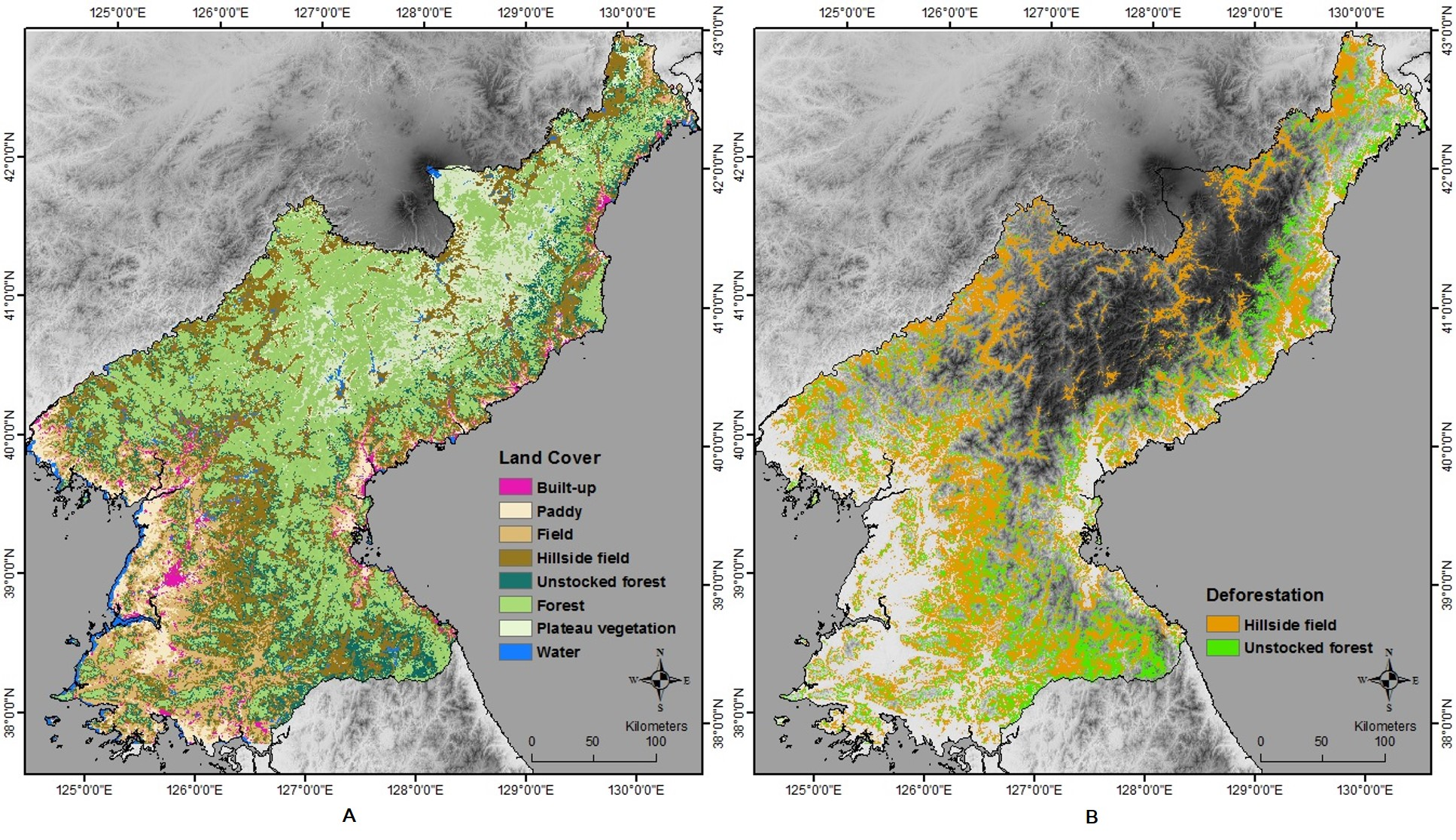
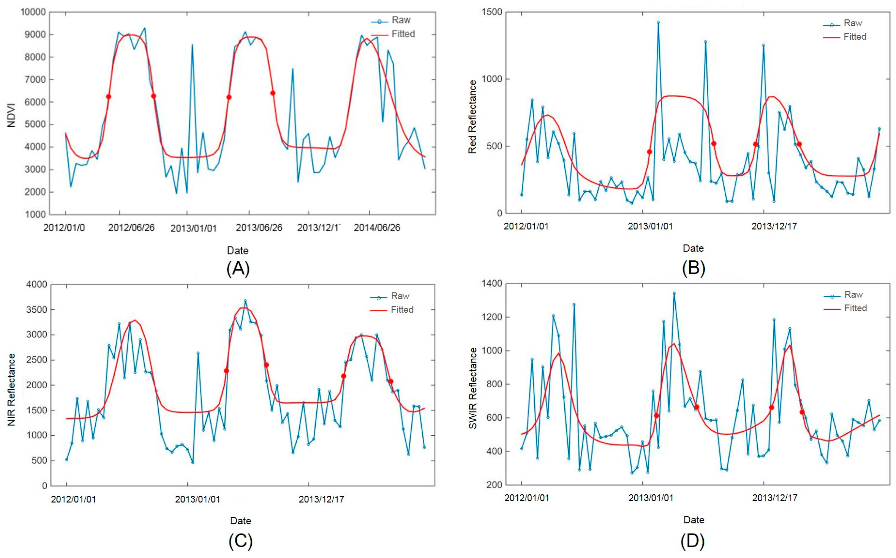
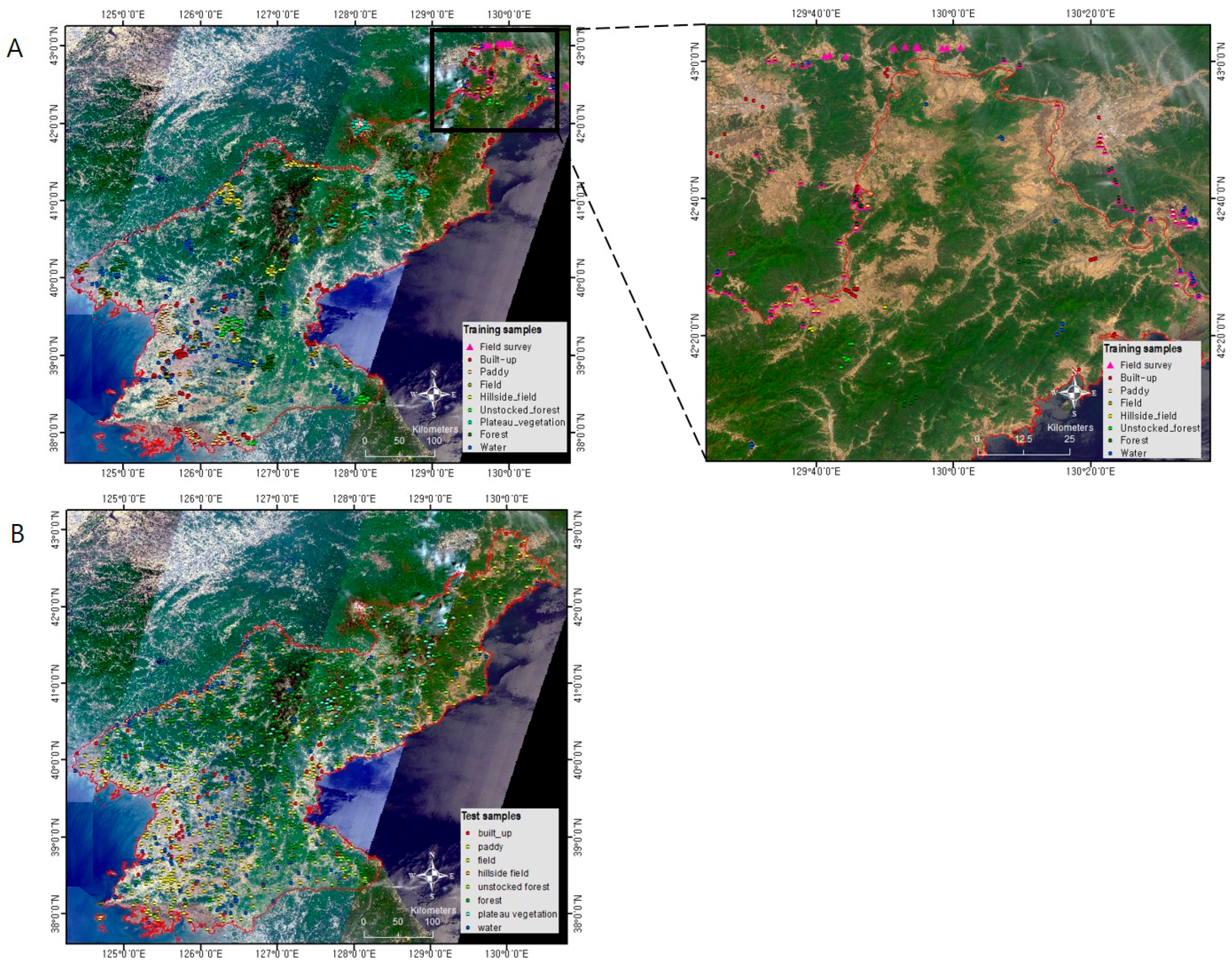
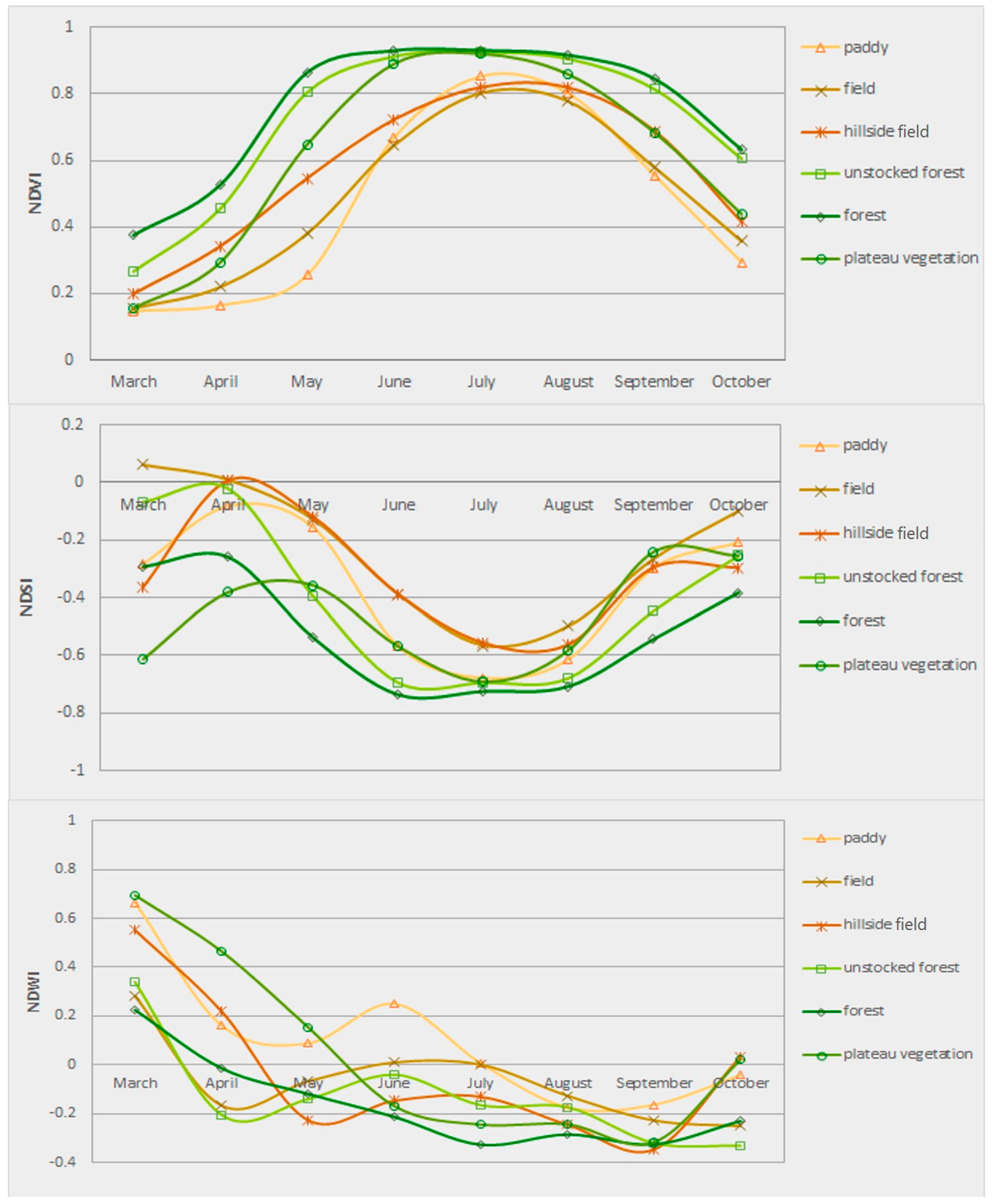
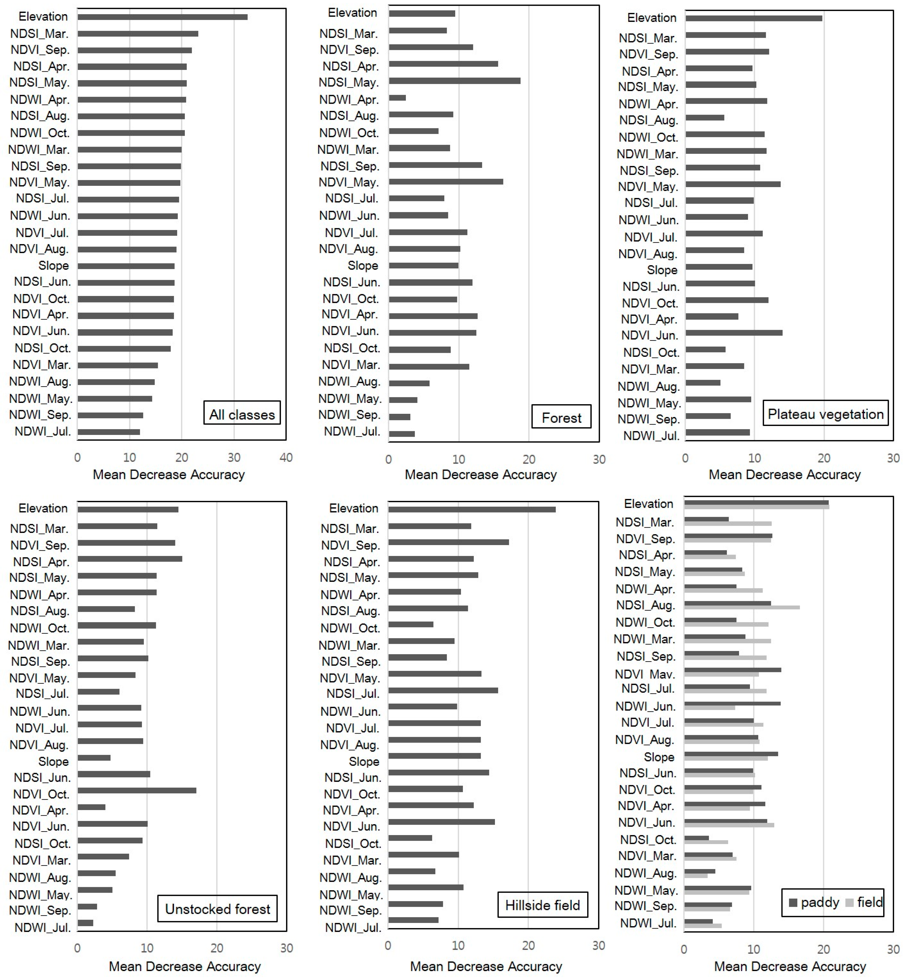
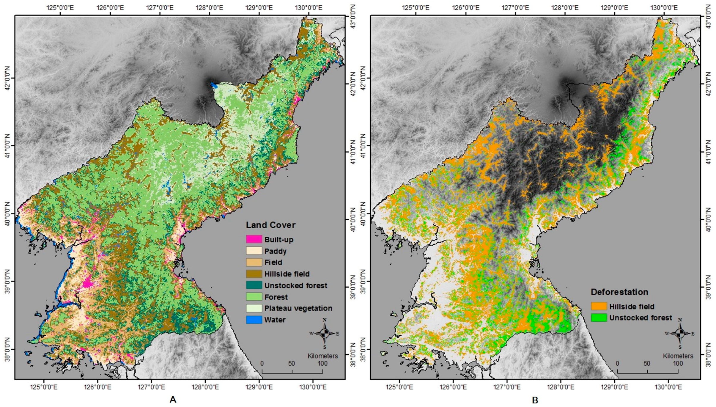
Phenology-based multi-index with the random forest (RF) algorithm can be used to overcome the shortcomings of traditional deforestation mapping that involves pixel-based classification, such as ISODATA or decision trees, and single images. The purpose of this study was to investigate methods to identify specific types of deforestation in North Korea, and to increase the accuracy of classification, using phenological characteristics extracted with multi-index and random forest algorithms. The mapping of deforestation area based on RF was carried out by merging phenology-based multi-indices (i.e., normalized difference vegetation index (NDVI), normalized difference water index (NDWI), and normalized difference soil index (NDSI)) derived from MODIS (Moderate Resolution Imaging Spectroradiometer) products and topographical variables. Our results showed overall classification accuracy of 89.38%, with corresponding kappa coefficients of 0.87. In particular, for forest and farm land categories with similar phenological characteristic (e.g., paddy, plateau vegetation, unstocked forest, hillside field), this approach improved the classification accuracy in comparison with pixel-based methods and other classes. The deforestation types were identified by incorporating point data from high-resolution imagery, outcomes of image classification, and slope data. Our study demonstrated that the proposed methodology could be used for deciding on the restoration priority and monitoring the expansion of deforestation areas. View Full-Text
Keywords: NDVI; NDSI; NDWI; unstocked forest; hillside field; vegetation phenology; MODIS
▼ Figures
This is an open access article distributed under the Creative Commons Attribution License which permits unrestricted use, distribution, and reproduction in any medium, provided the original work is properly cited. (CC BY 4.0).
For further details log on website :
http://www.mdpi.com/2072-4292/8/12/997


No comments:
Post a Comment