1
The Joint Graduate School of Energy and Environment (JGSEE) and Centre of Excellence on Energy Technology and Environment, King Mongkut’s University of Technology Thonburi, Bangkok 10140, Thailand
2
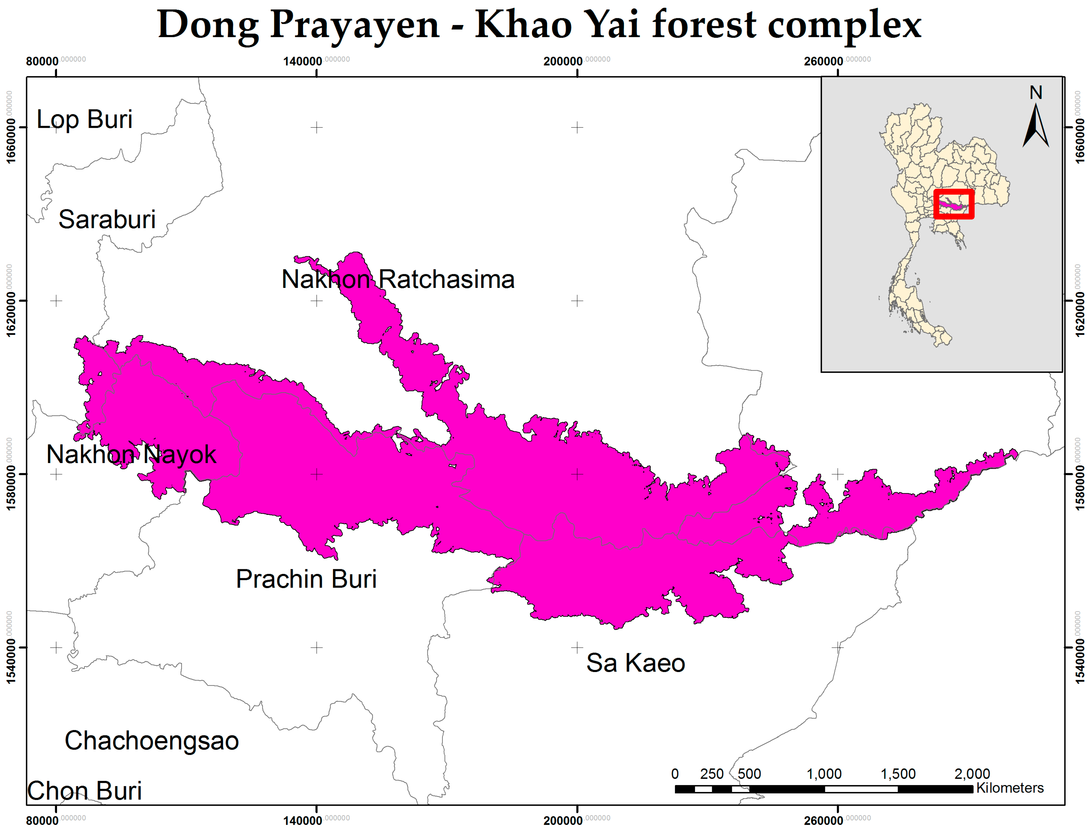
Department of Geography, Faculty of Social Sciences, Kasetsart University, Bangkok 10900, Thailand
3
European Commission, Joint Research Centre, Directorate D-Sustainable Resources-Bio-Economy Unit, 21027 Ispra (VA), Italy
4
Royal Forest Department, 61 Phaholyothin Road, Chatuchak, Bangkok 10900, Thailand
*
Author to whom correspondence should be addressed.
Academic Editors: Nabin K. Malakar, Rajan Ghimire, Jhalendra Rijal and Pradeep Wagle
Received: 10 November 2016 / Revised: 7 February 2017 / Accepted: 9 February 2017 / Published: 12 February 2017
(This article belongs to the Special Issue Sustainability in the Mountains Region)
Abstract
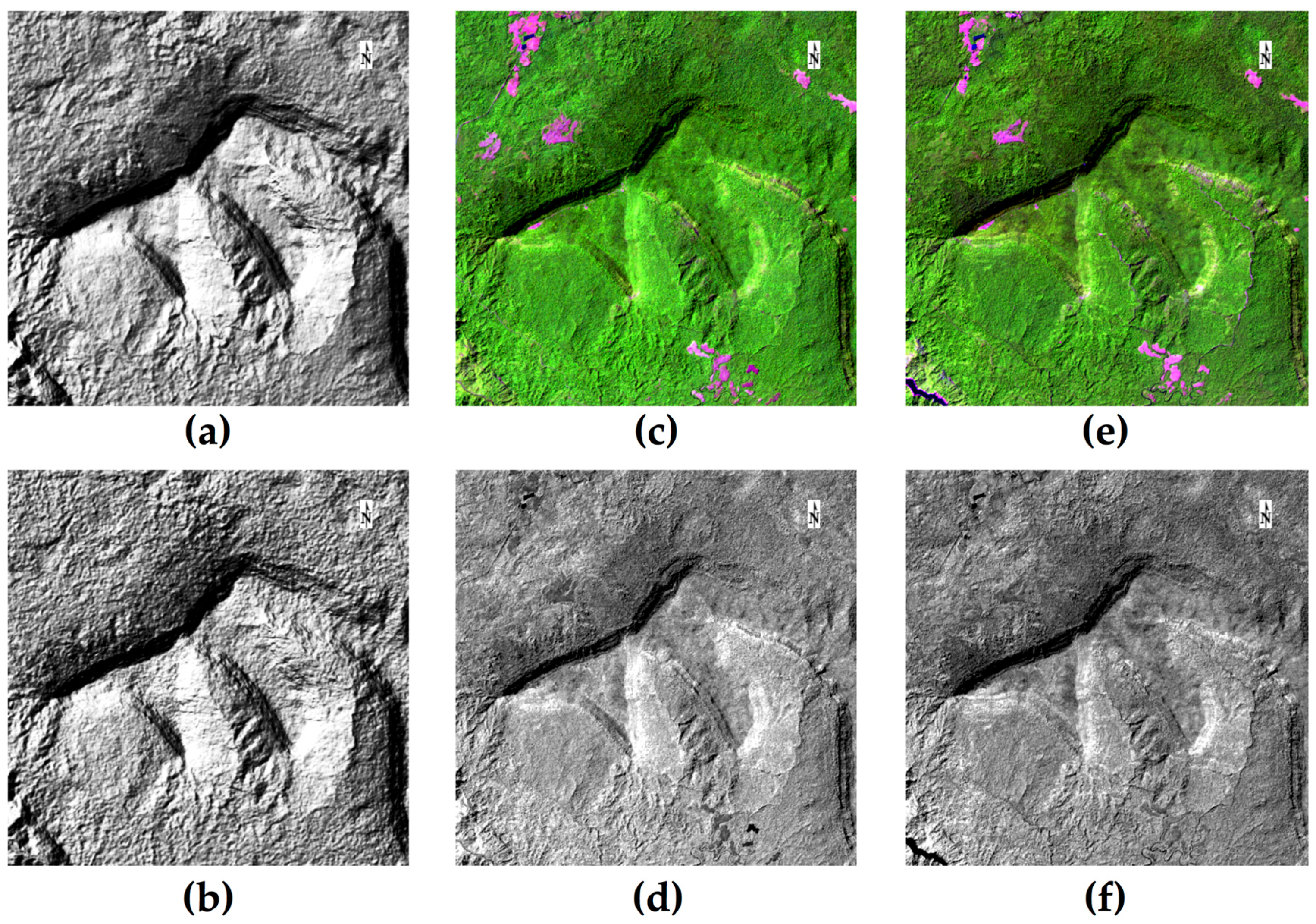
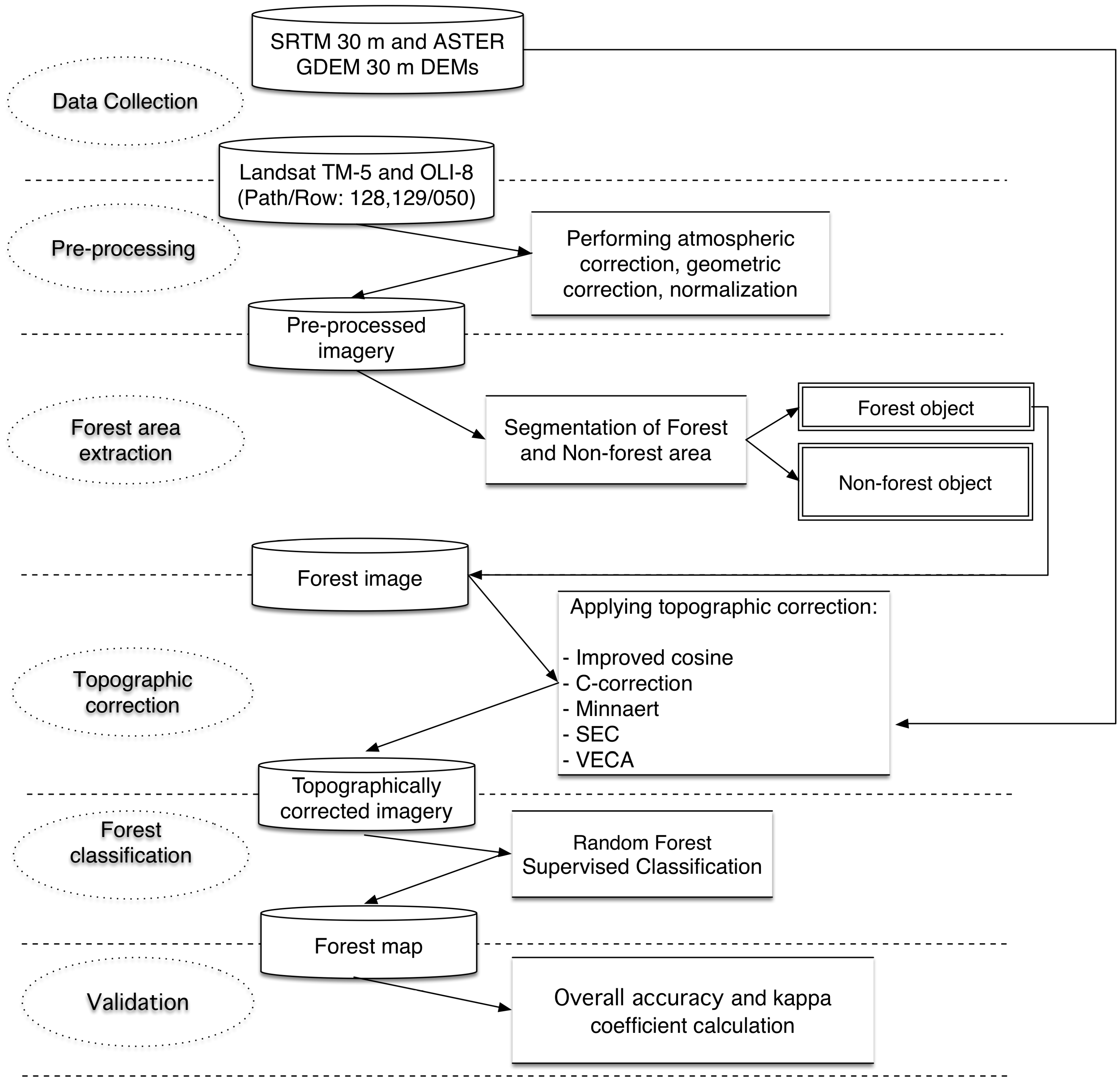
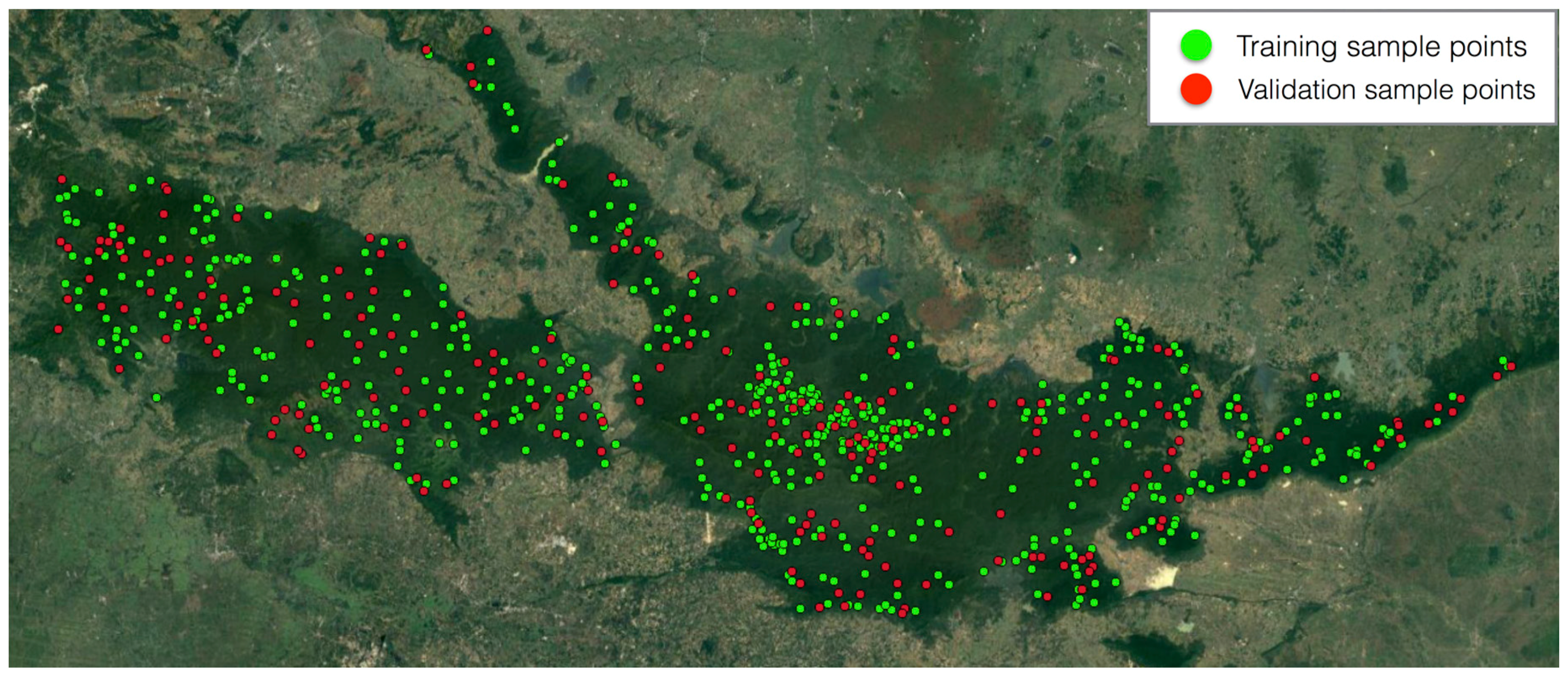
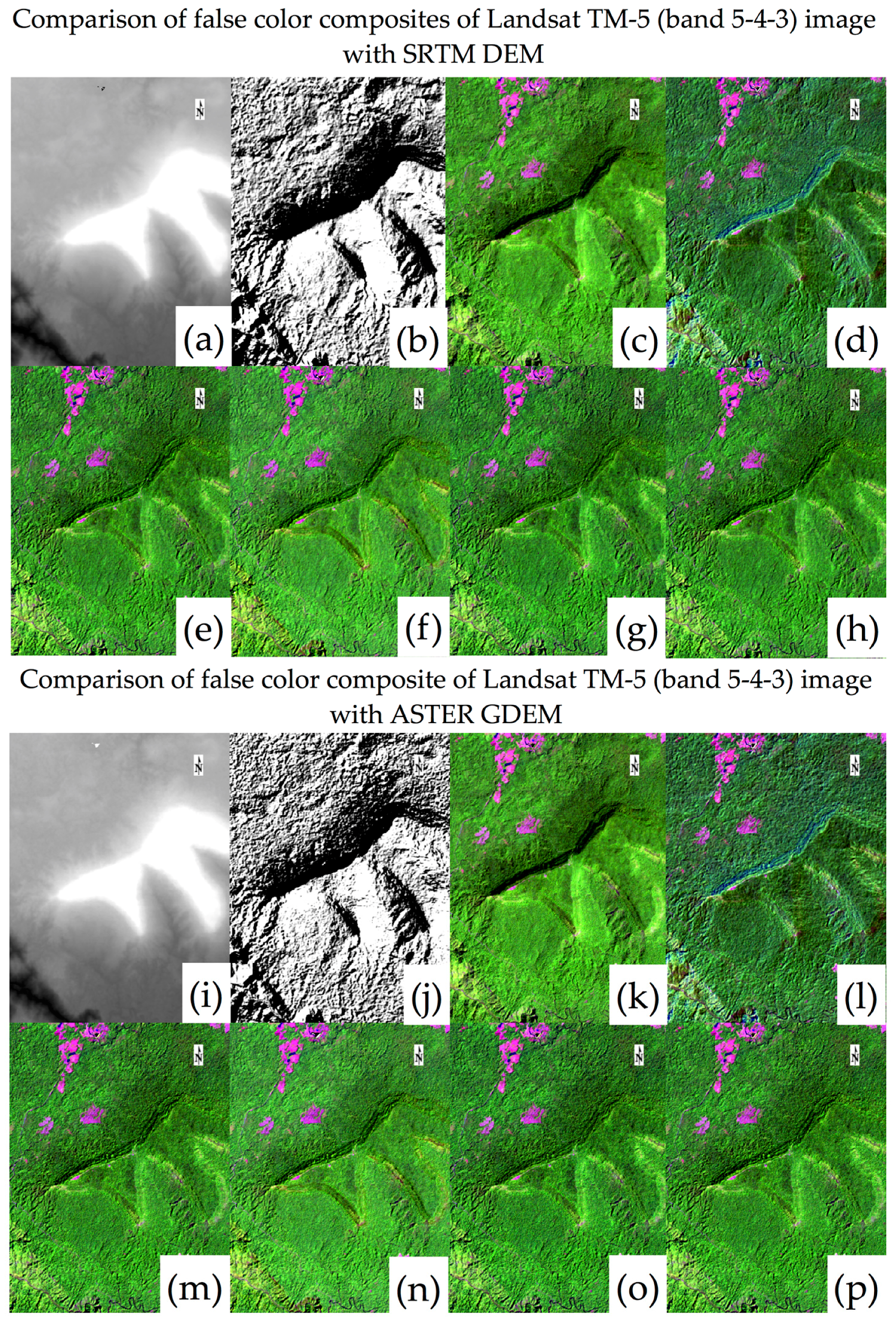
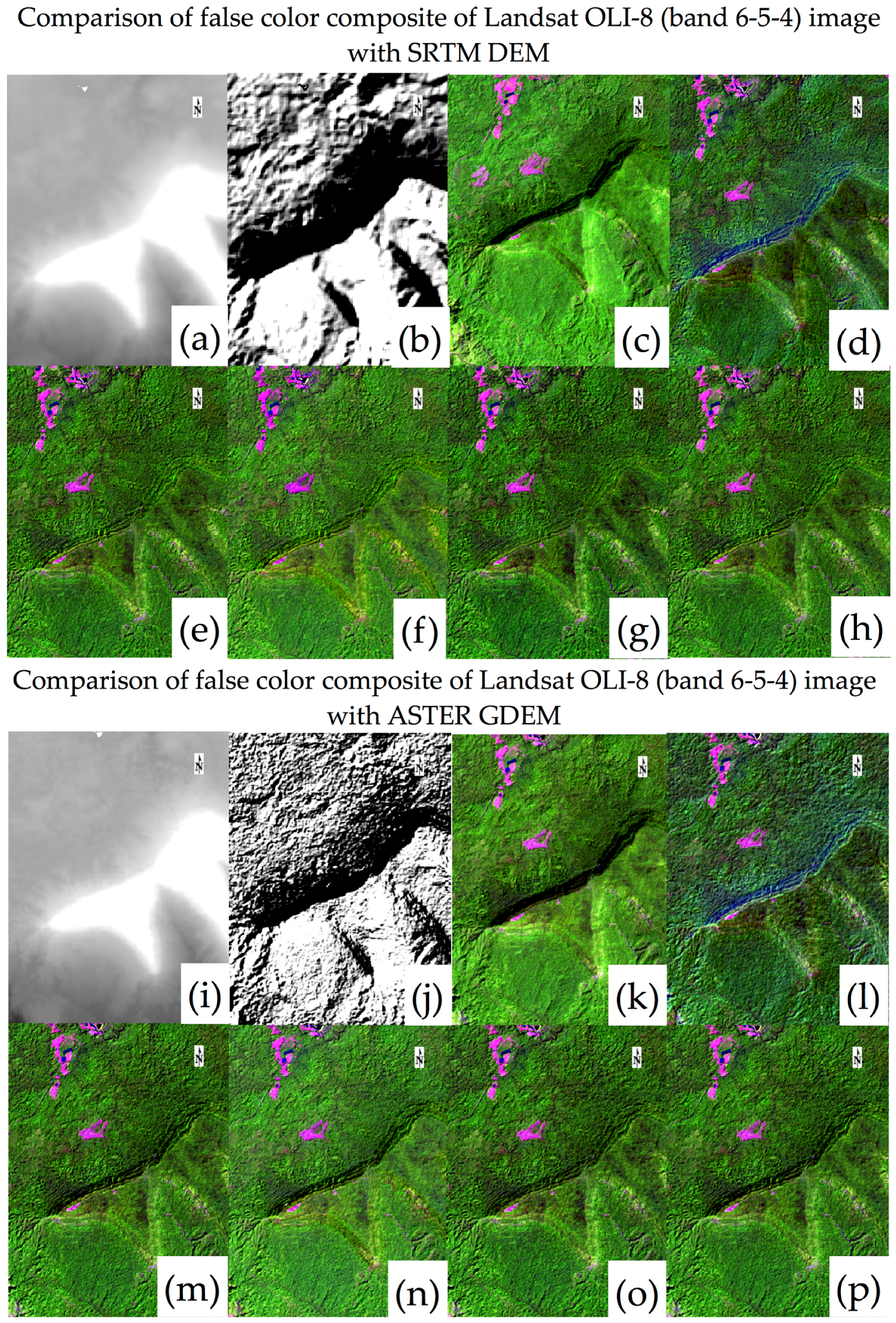
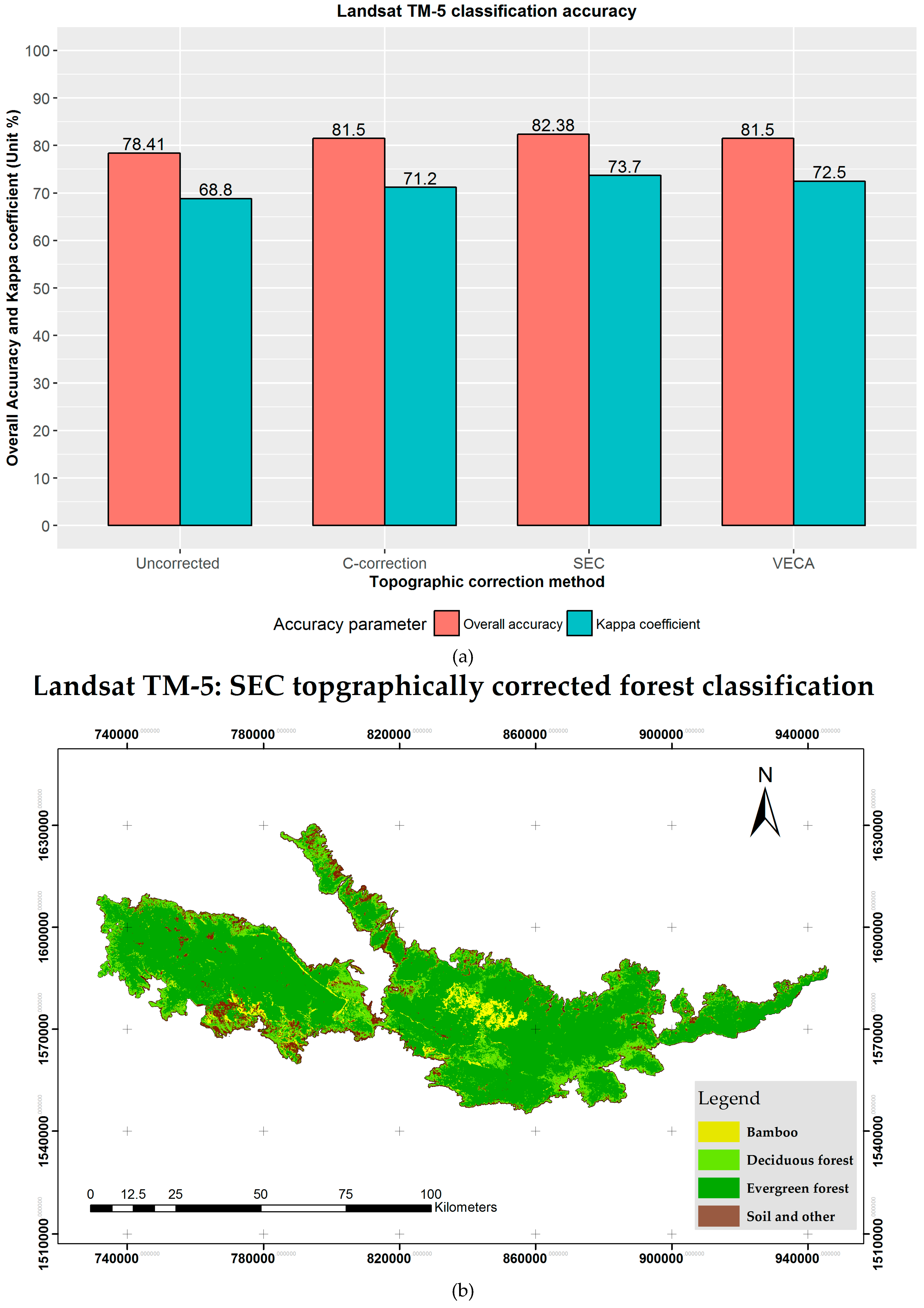
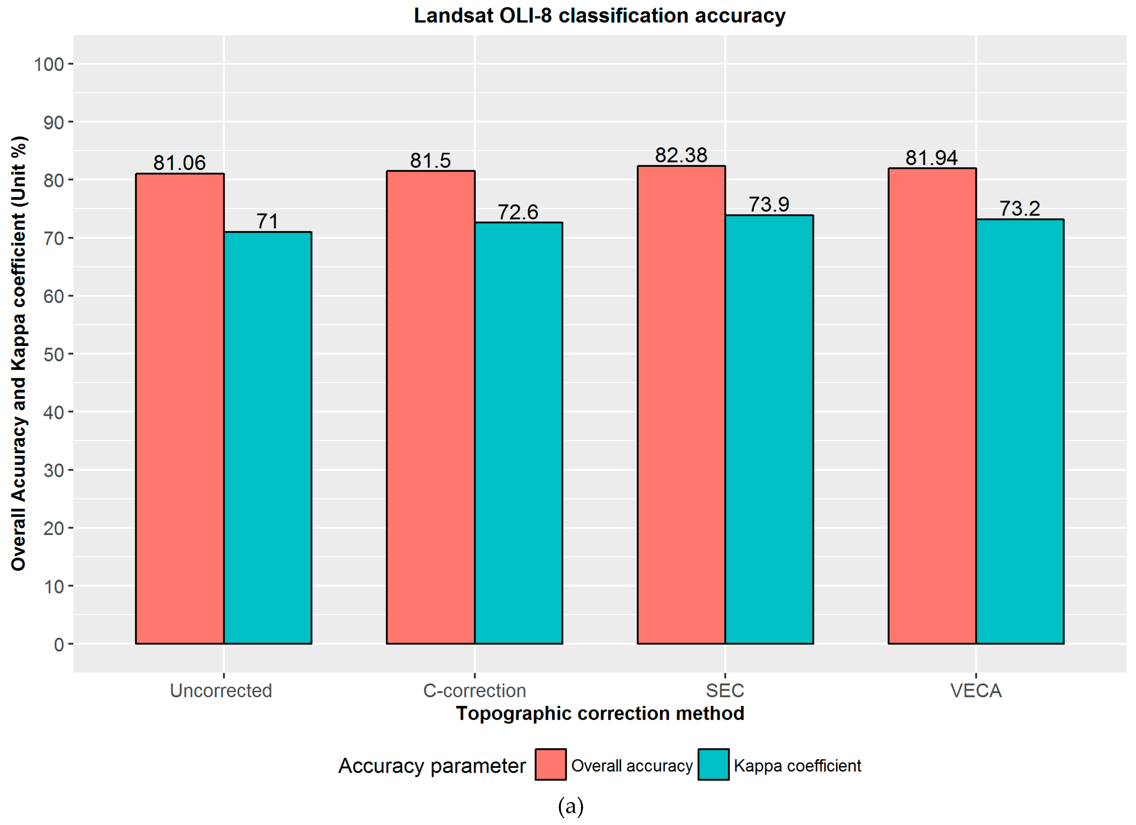
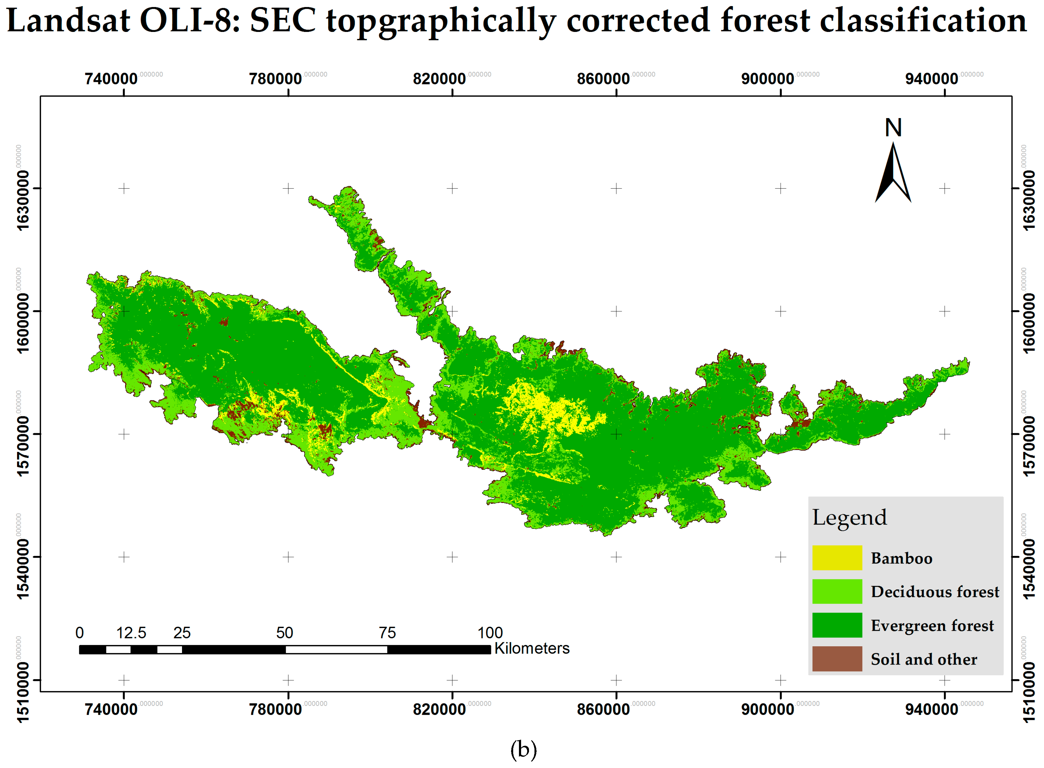
The accurate mapping and monitoring of forests is essential for the sustainable management of forest ecosystems. Advancements in the Landsat satellite series have been very useful for various forest mapping applications. However, the topographic shadows of irregular mountains are major obstacles to accurate forest classification. In this paper, we test five topographic correction methods: improved cosine correction, Minnaert, C-correction, Statistical Empirical Correction (SEC) and Variable Empirical Coefficient Algorithm (VECA), with multisource digital elevation models (DEM) to reduce the topographic relief effect in mountainous terrain produced by the Landsat Thematic Mapper (TM)-5 and Operational Land Imager (OLI)-8 sensors. The effectiveness of the topographic correction methods are assessed by visual interpretation and the reduction in standard deviation (SD), by means of the coefficient of variation (CV). Results show that the SEC performs best with the Shuttle Radar Topographic Mission (SRTM) 30 m × 30 m DEM. The random forest (RF) classifier is used for forest classification, and the overall accuracy of forest classification is evaluated to compare the performances of the topographic corrections. Our results show that the C-correction, SEC and VECA corrected imagery were able to improve the forest classification accuracy of Landsat TM-5 from 78.41% to 81.50%, 82.38%, and 81.50%, respectively, and OLI-8 from 81.06% to 81.50%, 82.38%, and 81.94%, respectively. The highest accuracy of forest type classification is obtained with the newly available high-resolution SRTM DEM and SEC method. View Full-Text
Keywords: topographic effect; topographic correction; DEM; improved cosine correction; Minnaert; C-correction; SEC; VECA; Landsat TM-5 and OLI-8; random forest
▼ Figures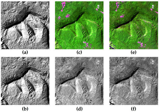
Figure 1
This is an open access article distributed under the Creative Commons Attribution License which permits unrestricted use, distribution, and reproduction in any medium, provided the original work is properly cited. (CC BY 4.0).
For further details log on website :
http://www.mdpi.com/2071-1050/9/2/258


No comments:
Post a Comment