1
College of Forestry, Nanjing Forestry University, Nanjing 210037, China
2
Co-Innovation Center for Sustainable Forestry in Southern China, Nanjing Forestry University, Nanjing 210037, China
3
Department of Geographical Sciences, University of Maryland, College Park, MD 20742, USA
4
Guangdong Provincial Center for Forest Resources Monitoring, Guangzhou 510173, China
†
These authors contributed equally to this work.
*
Author to whom correspondence should be addressed.
Academic Editors: Sangram Ganguly, Compton Tucker, Nicolas Baghdadi and Prasad S. Thenkabail
Received: 23 May 2016 / Revised: 28 June 2016 / Accepted: 7 July 2016 / Published: 13 July 2016
(This article belongs to the Special Issue Remote Sensing of Vegetation Structure and Dynamics)
Abstract
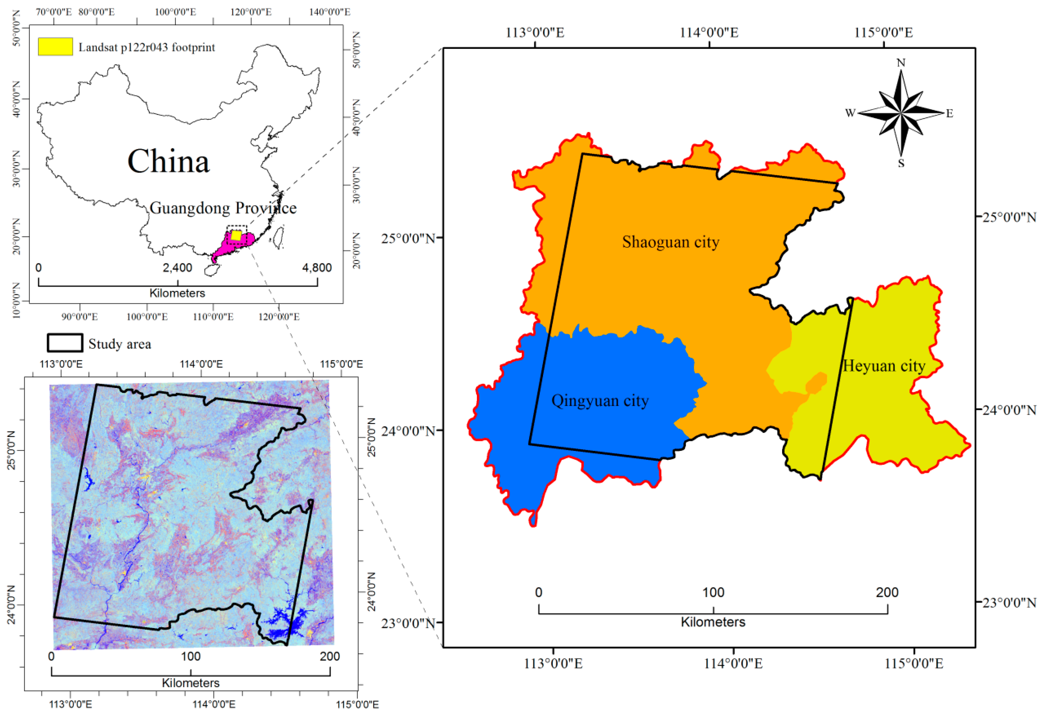
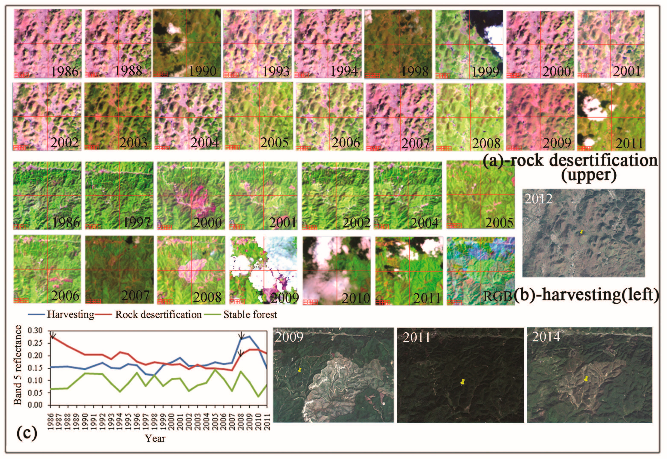
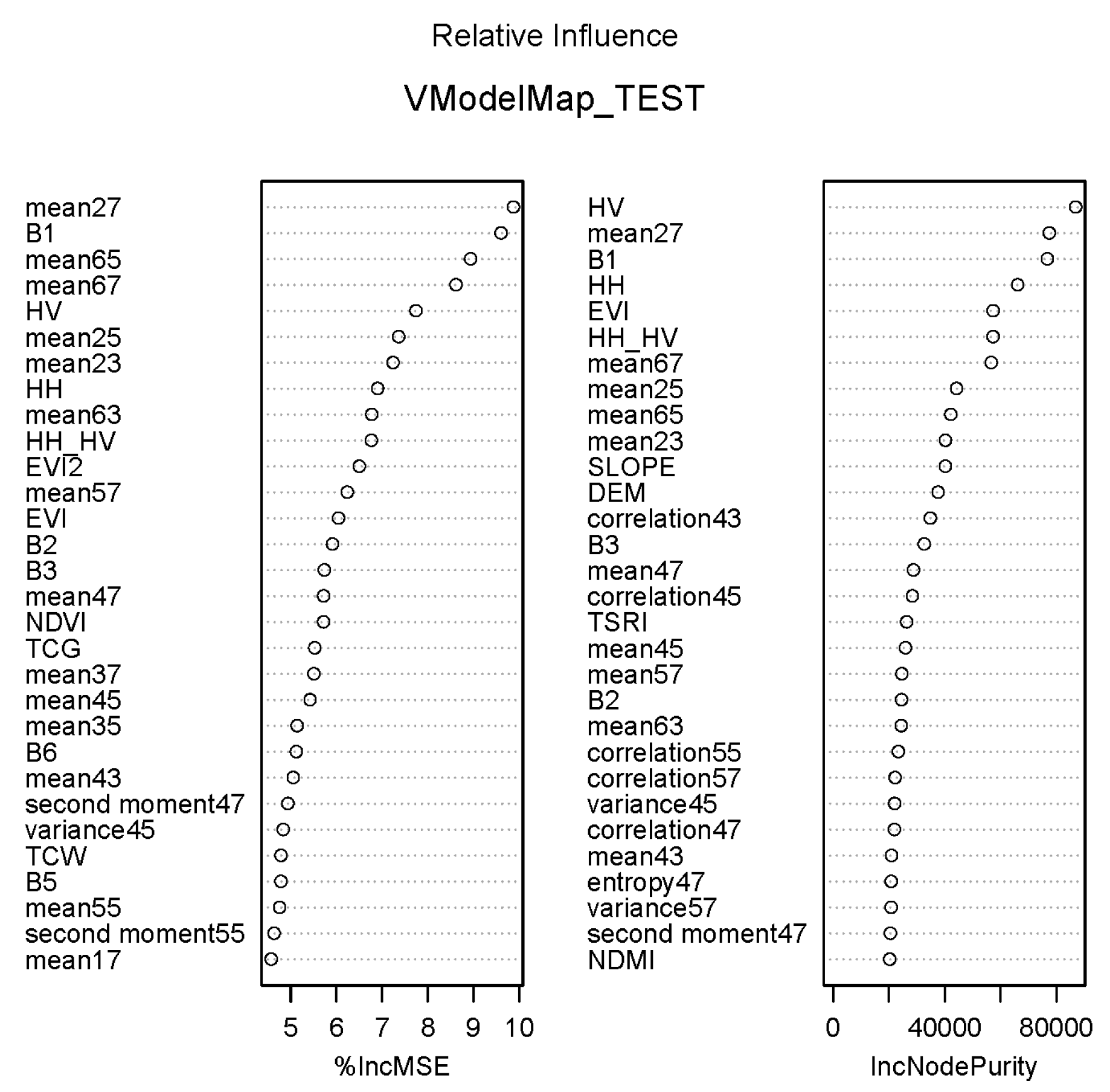
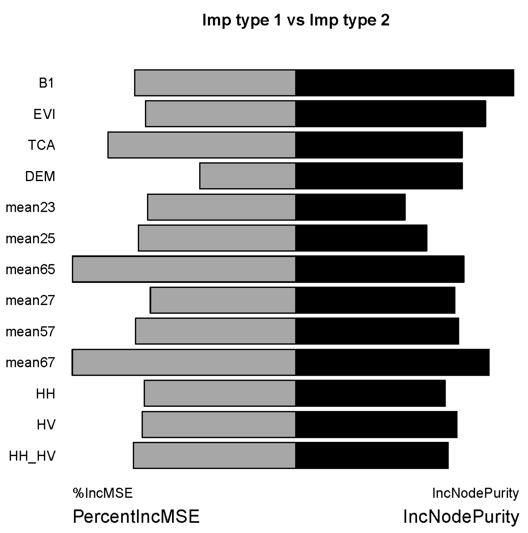
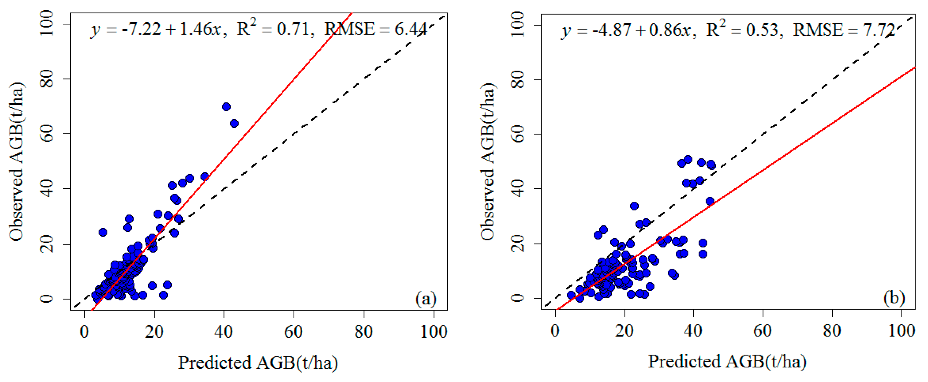
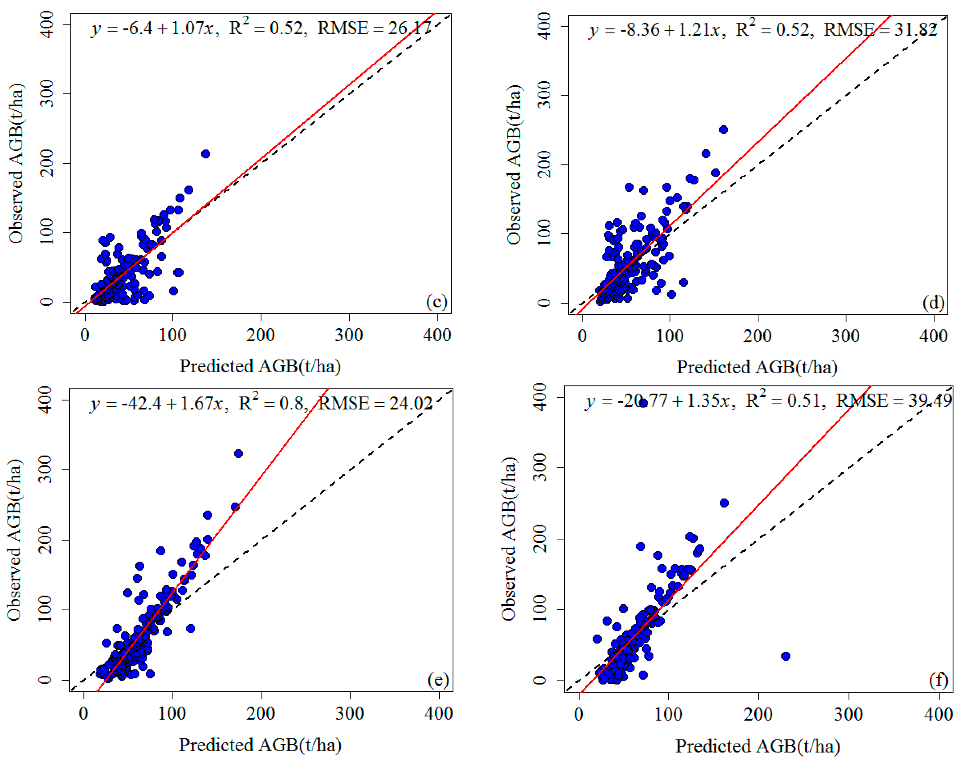
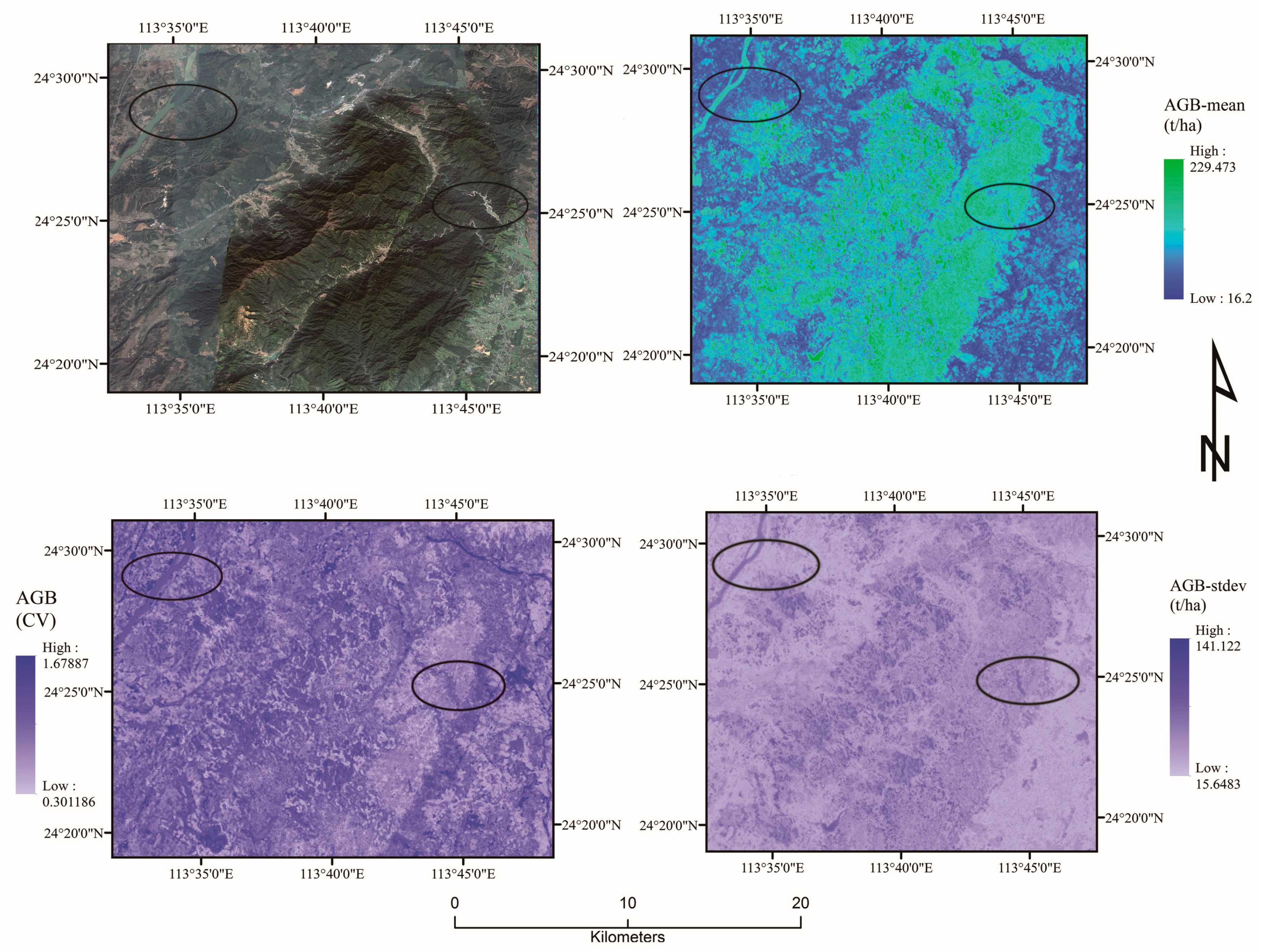
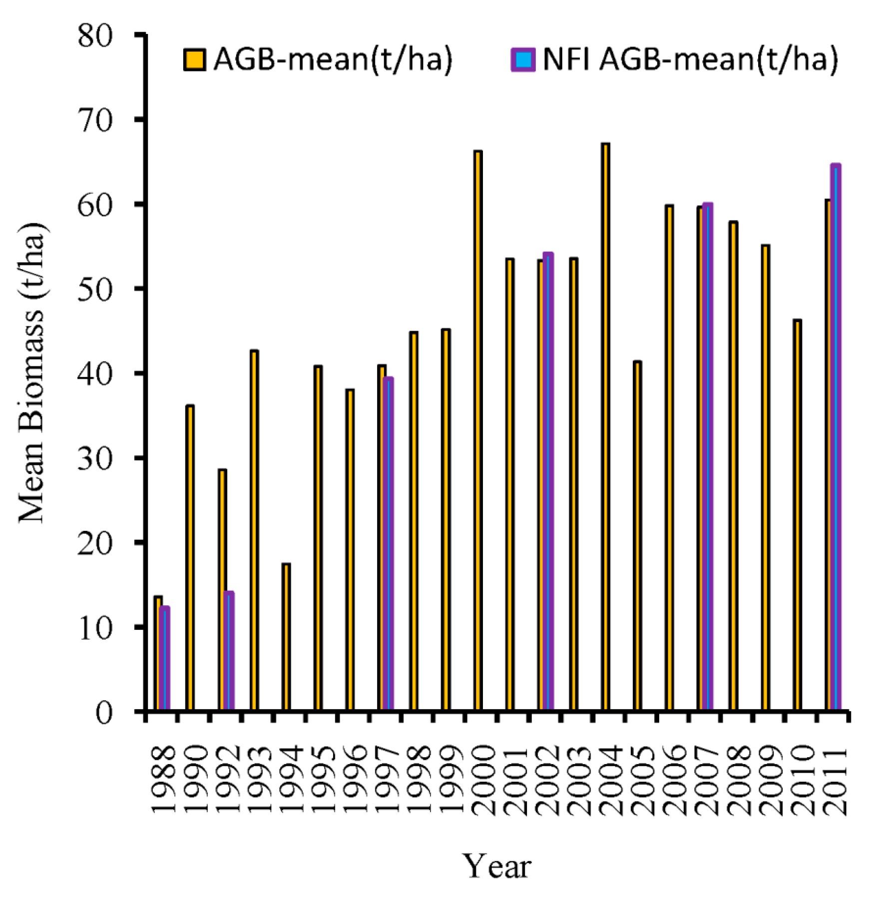
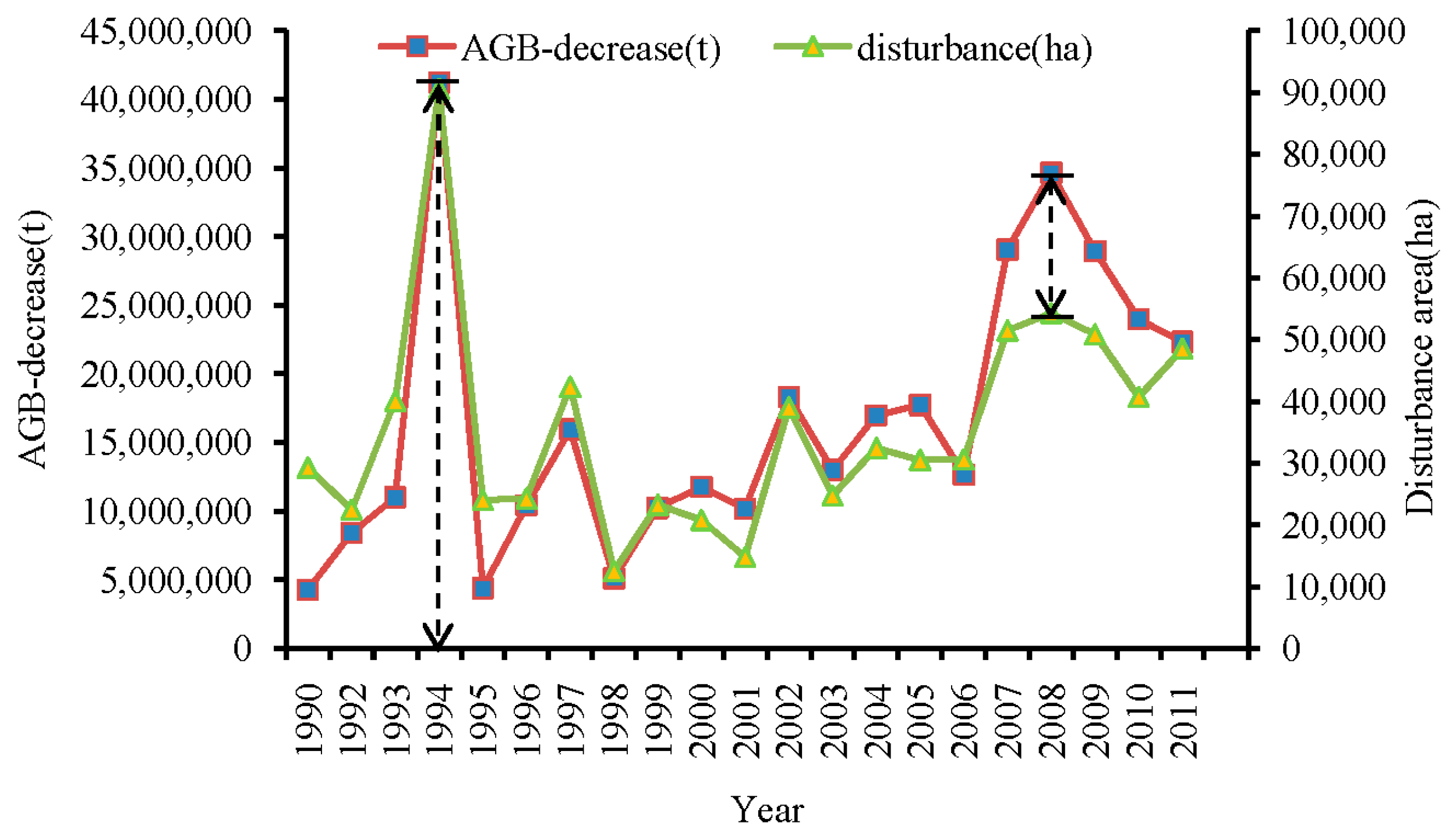
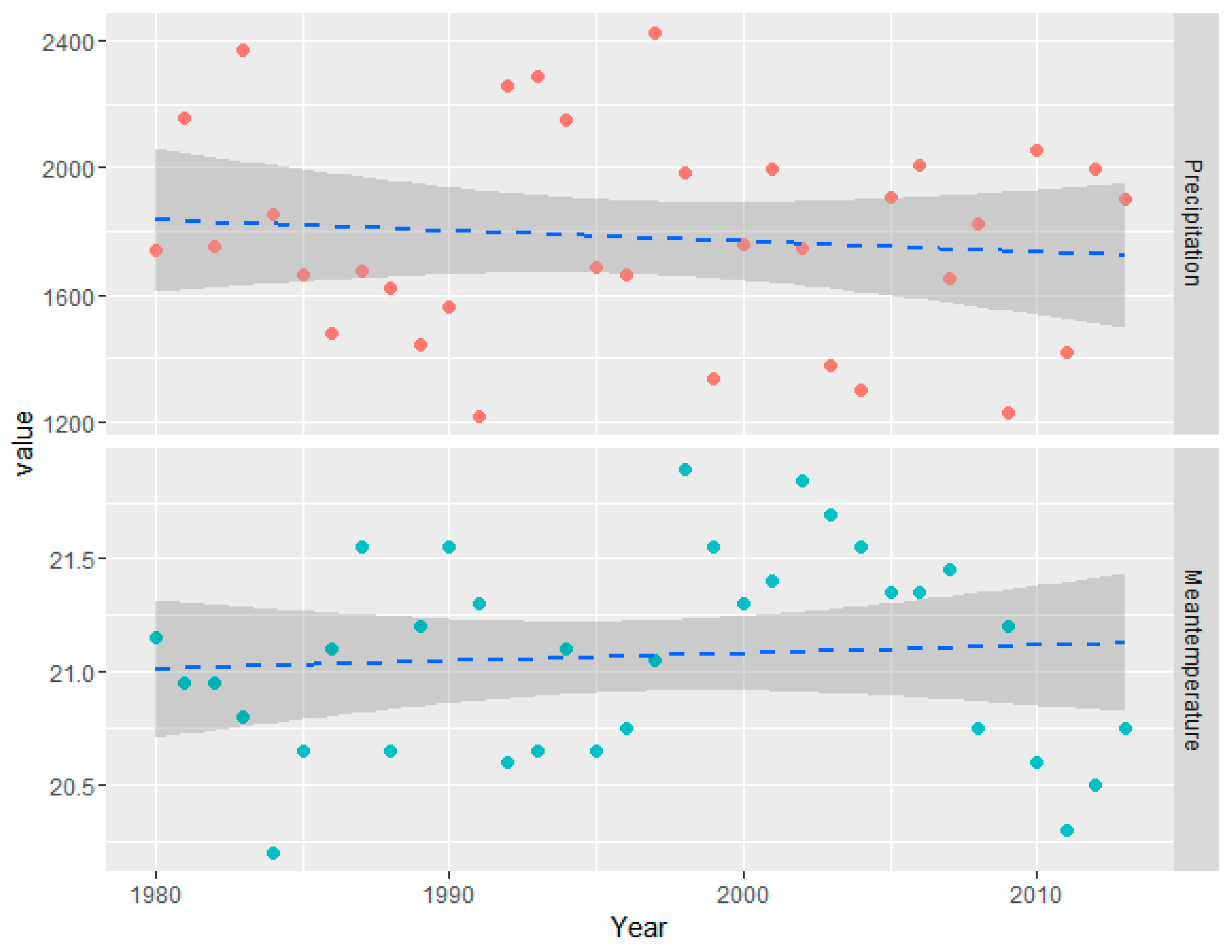
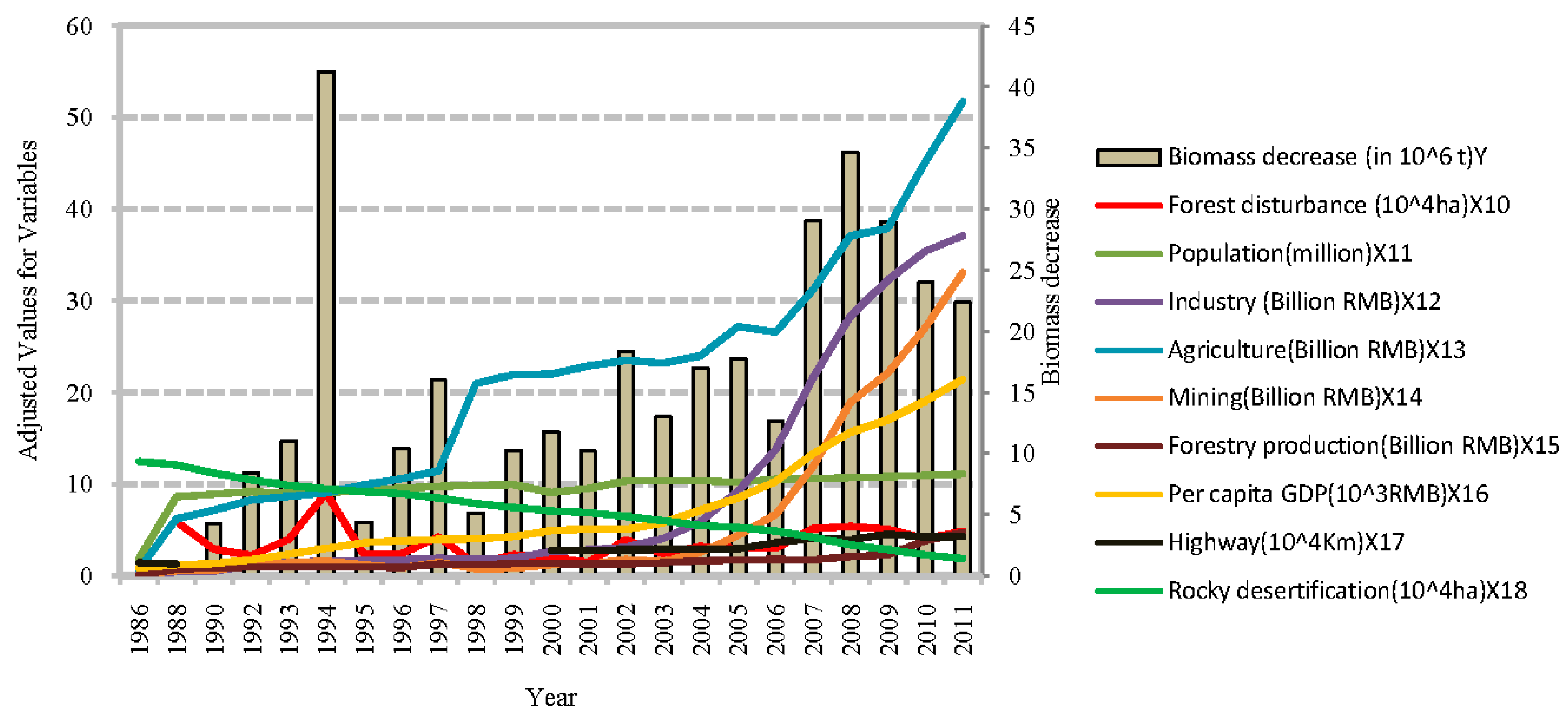
Spatially explicit knowledge of aboveground biomass (AGB) in large areas is important for accurate carbon accounting and quantifying the effect of forest disturbance on the terrestrial carbon cycle. We estimated AGB from 1990 to 2011 in northern Guangdong, China, based on a spatially explicit dataset derived from six years of national forest inventory (NFI) plots, Landsat time series imagery (1986–2011) and Advanced Land Observing Satellite (ALOS) Phased Array L-band Synthetic Aperture Radars (PALSAR) 25 m mosaic data (2007–2010). Four types of variables were derived for modeling and assessment. The random forest approach was used to seek the optimal variables for mapping and validation. The root mean square error (RMSE) of plot-level validation was between 6.44 and 39.49 (t/ha), the normalized root-mean-square error (NRMSE) was between 7.49% and 19.01% and mean absolute error (MAE) was between 5.06 and 23.84 t/ha. The highest coefficient of determination R2 of 0.8 and the lowest NRMSE of 7.49% were reported in 2006. A clear increasing trend of mean AGB from the lowest value of 13.58 t/ha to the highest value of 66.25 t/ha was witnessed between 1988 and 2000, while after 2000 there was a fluctuating ascending change, with a peak mean AGB of 67.13 t/ha in 2004. By integrating AGB change with forest disturbance, the trend in disturbance area closely corresponded with the trend in AGB decrease. To determine the driving forces of these changes, the correlation analysis was adopted and exploratory factor analysis (EFA) method was used to find a factor rotation that maximizes this variance and represents the dominant factors of nine climate elements and nine human activities elements affecting the AGB dynamics. Overall, human activities contributed more to short-term AGB dynamics than climate data. Harvesting and human-induced fire in combination with rock desertification and global warming made a strong contribution to AGB changes. This study provides valuable information for the relationships between forest AGB and climate as well as forest disturbance in subtropical zones. View Full-Text
Keywords: biomass; NFI; Landsat; ALOS PALSAR; random forest; EFA; disturbance; climate; southern China
▼ Figures
This is an open access article distributed under the Creative Commons Attribution License which permits unrestricted use, distribution, and reproduction in any medium, provided the original work is properly cited. (CC BY 4.0).
For further details log on website :
http://www.mdpi.com/2072-4292/8/7/595


No comments:
Post a Comment