Sensors 2007, 7(6), 979-1000; doi:10.3390/s7060979
Author
1
SAIC/US Geological Survey EROS/Geographic Information Science Center of Excellence, South, Dakota State University, Sioux Falls, SD, USA
2
SAIC/US Geological Survey EROS, Sioux Falls, SD, USA
3
US Geological Survey EROS, Sioux Falls, SD, USA
4
Department of Environmental Studies, Florida International University, Miami, FL, USA
*
Author to whom correspondence should be addressed.
Received: 14 May 2007 / Accepted: 12 June 2007 / Published: 15 June 2007
(This article belongs to the Special Issue Remote Sensing of Natural Resources and the Environment)
Abstract
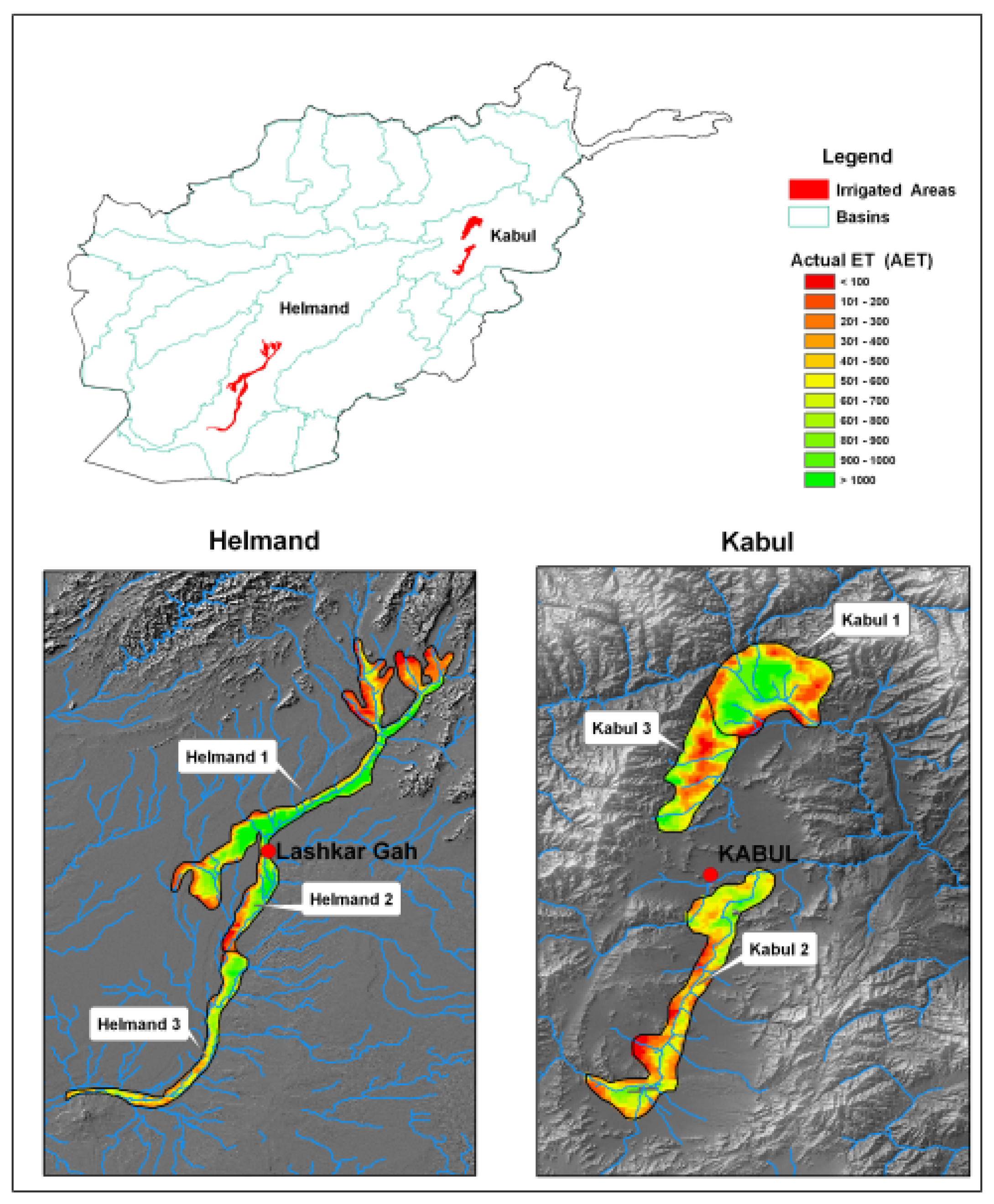
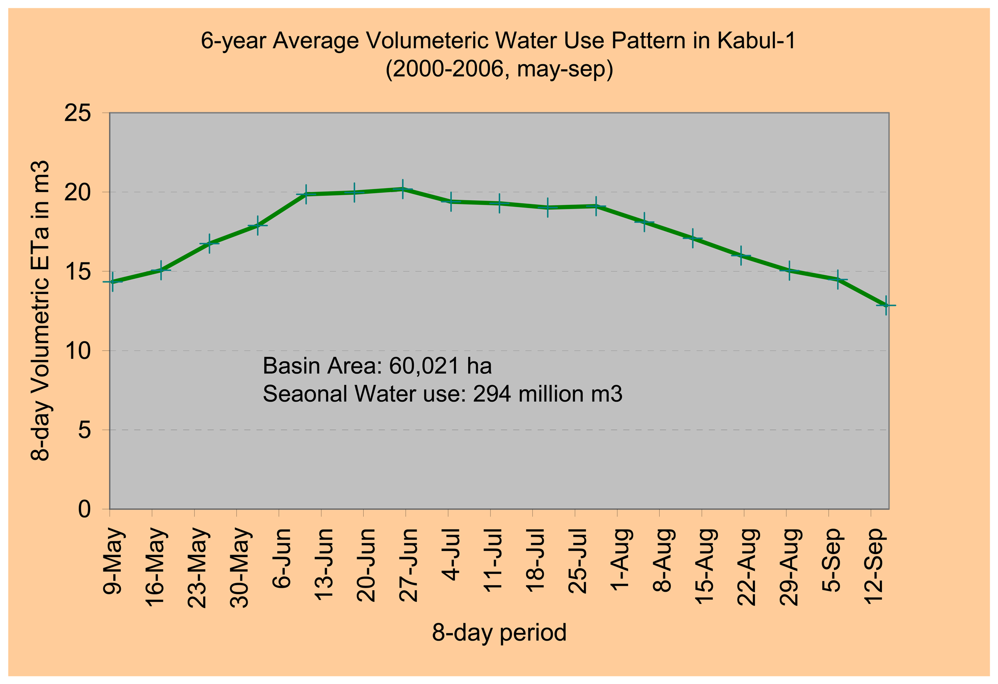
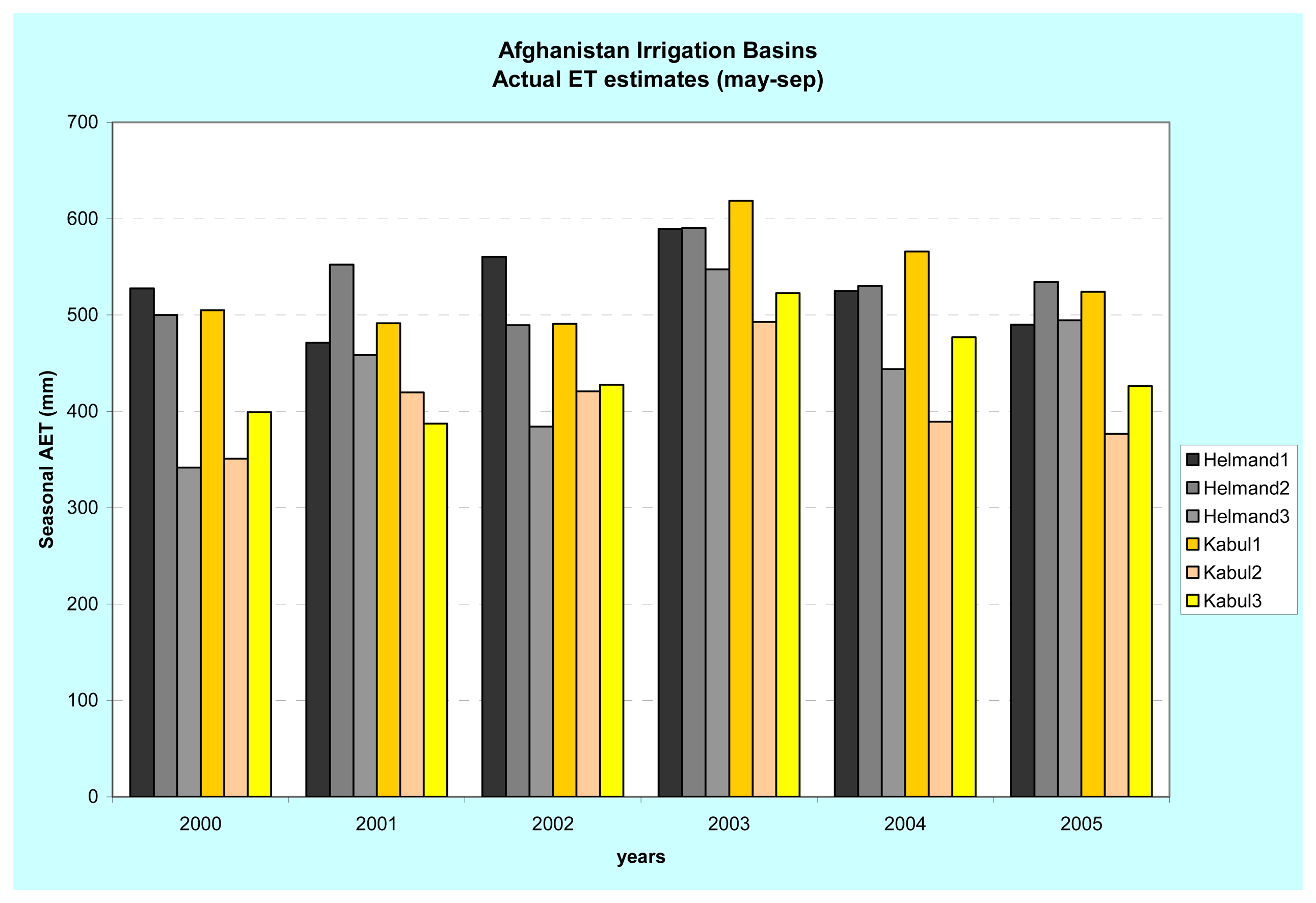
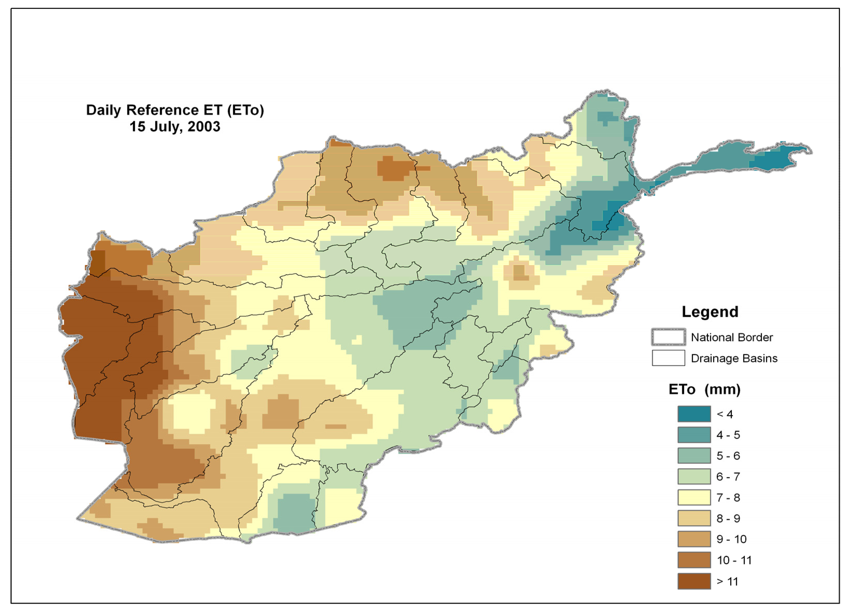
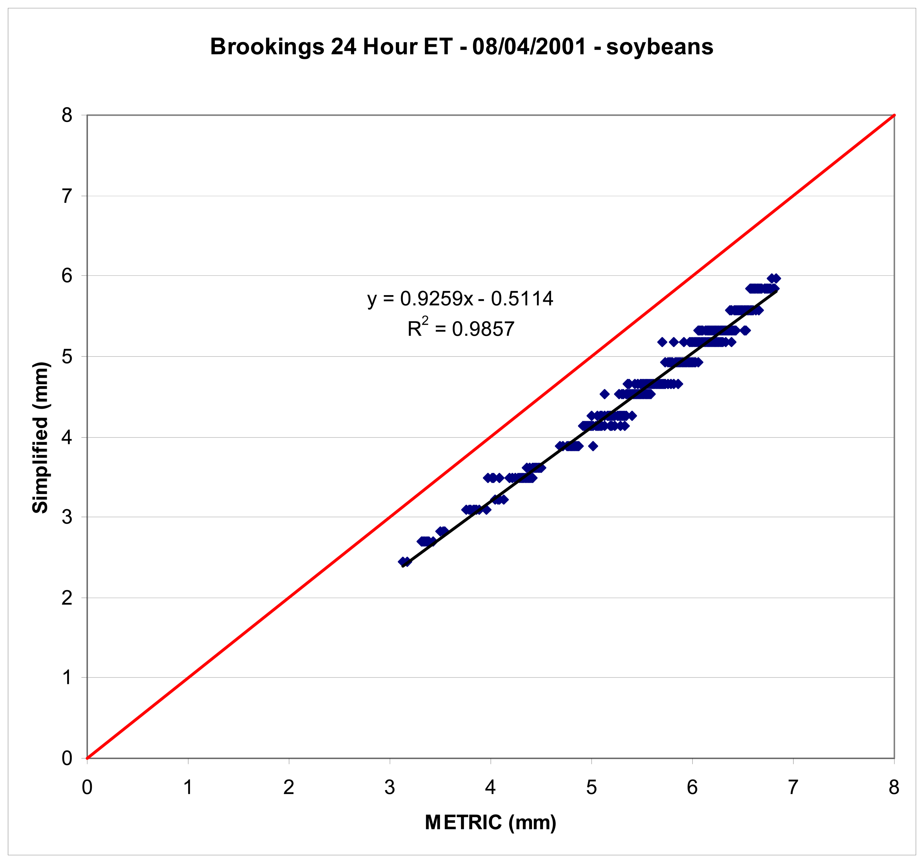
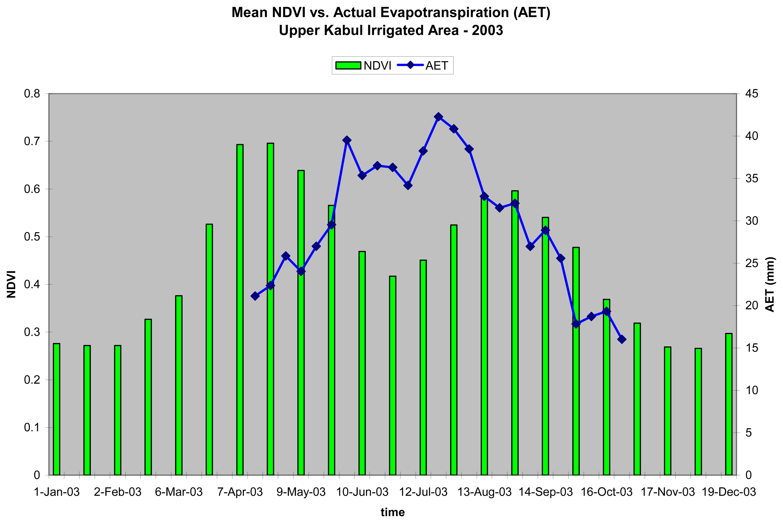
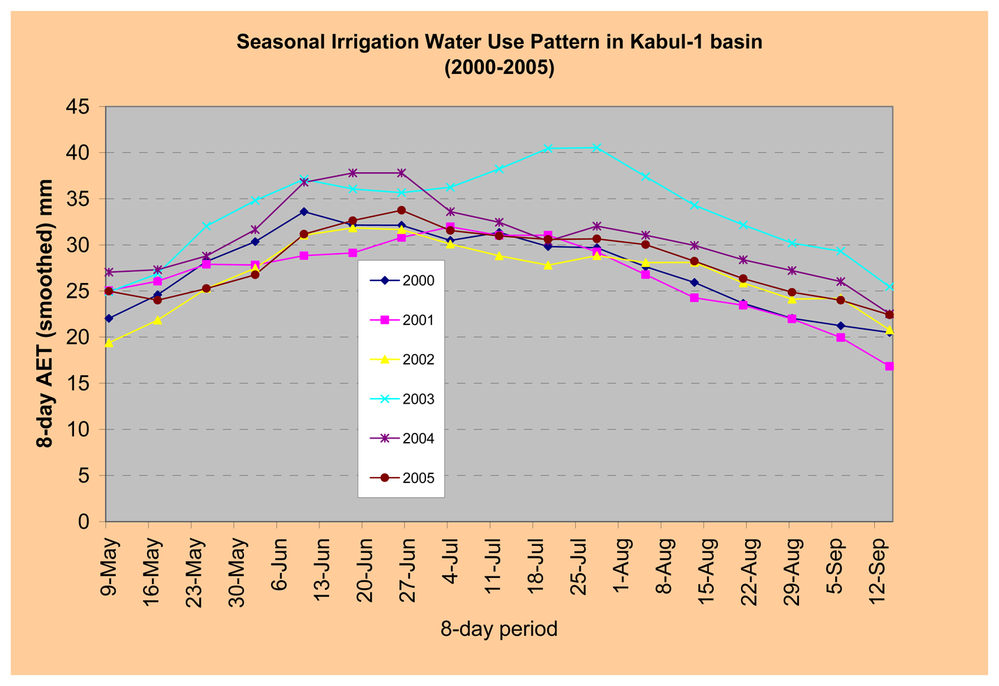
Accurate crop performance monitoring and production estimation are critical fortimely assessment of the food balance of several countries in the world. Since 2001, theFamine Early Warning Systems Network (FEWS NET) has been monitoring cropperformance and relative production using satellite-derived data and simulation models inAfrica, Central America, and Afghanistan where ground-based monitoring is limitedbecause of a scarcity of weather stations. The commonly used crop monitoring models arebased on a crop water-balance algorithm with inputs from satellite-derived rainfallestimates. These models are useful to monitor rainfed agriculture, but they are ineffectivefor irrigated areas. This study focused on Afghanistan, where over 80 percent ofagricultural production comes from irrigated lands. We developed and implemented aSimplified Surface Energy Balance (SSEB) model to monitor and assess the performanceof irrigated agriculture in Afghanistan using a combination of 1-km thermal data and 250-m Normalized Difference Vegetation Index (NDVI) data, both from the Moderate Resolution Imaging Spectroradiometer (MODIS) sensor. We estimated seasonal actual evapotranspiration (ETa) over a period of six years (2000-2005) for two major irrigated river basins in Afghanistan, the Kabul and the Helmand, by analyzing up to 19 cloud-free thermal and NDVI images from each year. These seasonal ETa estimates were used as relative indicators of year-to-year production magnitude differences. The temporal water- use pattern of the two irrigated basins was indicative of the cropping patterns specific to each region. Our results were comparable to field reports and to estimates based on watershed-wide crop water-balance model results. For example, both methods found that the 2003 seasonal ETa was the highest of all six years. The method also captured water management scenarios where a unique year-to-year variability was identified in addition to water-use differences between upstream and downstream basins. A major advantage of the energy-balance approach is that it can be used to quantify spatial extent of irrigated fields and their water-use dynamics without reference to source of water as opposed to a water- balance model which requires knowledge of both the magnitude and temporal distribution of rainfall and irrigation applied to fields. View Full-Text
Keywords: evapotranspiration; energy balance; SSEB; reference ET; irrigation
This is an open access article distributed under the Creative Commons Attribution License (CC BY 3.0).
For further details log on website :
http://www.mdpi.com/1424-8220/7/6/979?utm_source=TrendMD&utm_medium=cpc&utm_campaign=Sensors__TrendMD_0


No comments:
Post a Comment