Department of Ecology and Natural Resource Management, Norwegian University of Life Sciences, P.o. Box 5001, Ås 1432, Norway
*
Author to whom correspondence should be addressed.
Academic Editors: Sangram Ganguly, Compton Tucker, Nicolas Baghdadi and Prasad S. Thenkabail
Received: 19 January 2016 / Revised: 15 April 2016 / Accepted: 20 April 2016 / Published: 26 April 2016
(This article belongs to the Special Issue Remote Sensing of Vegetation Structure and Dynamics)
Abstract
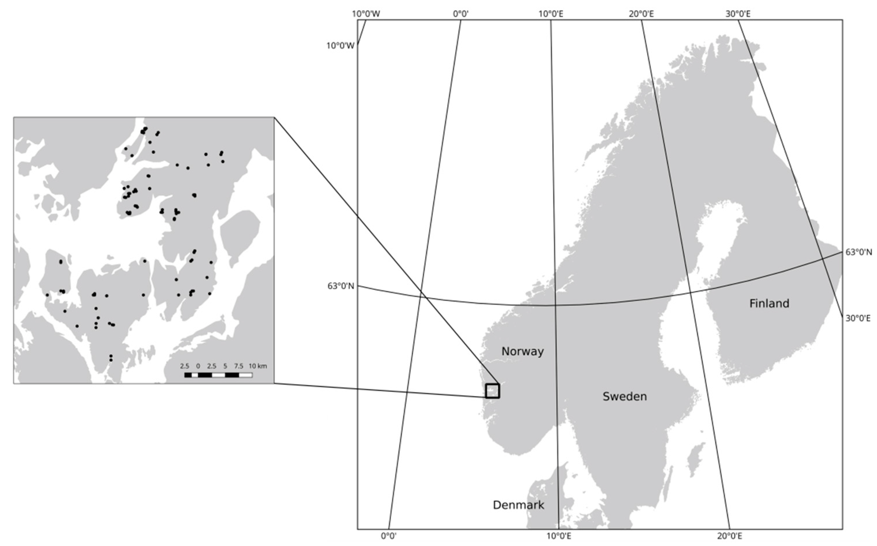
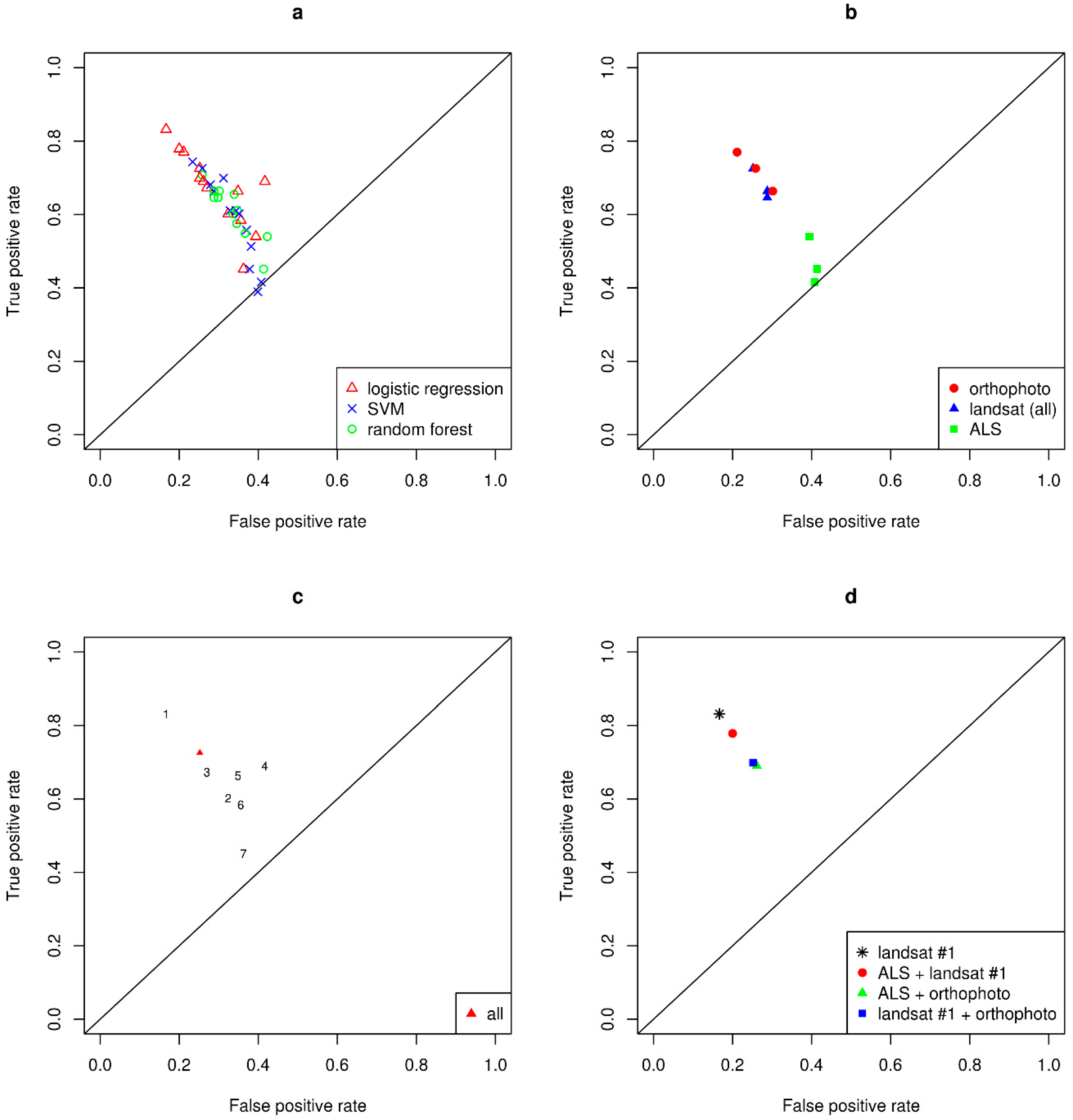
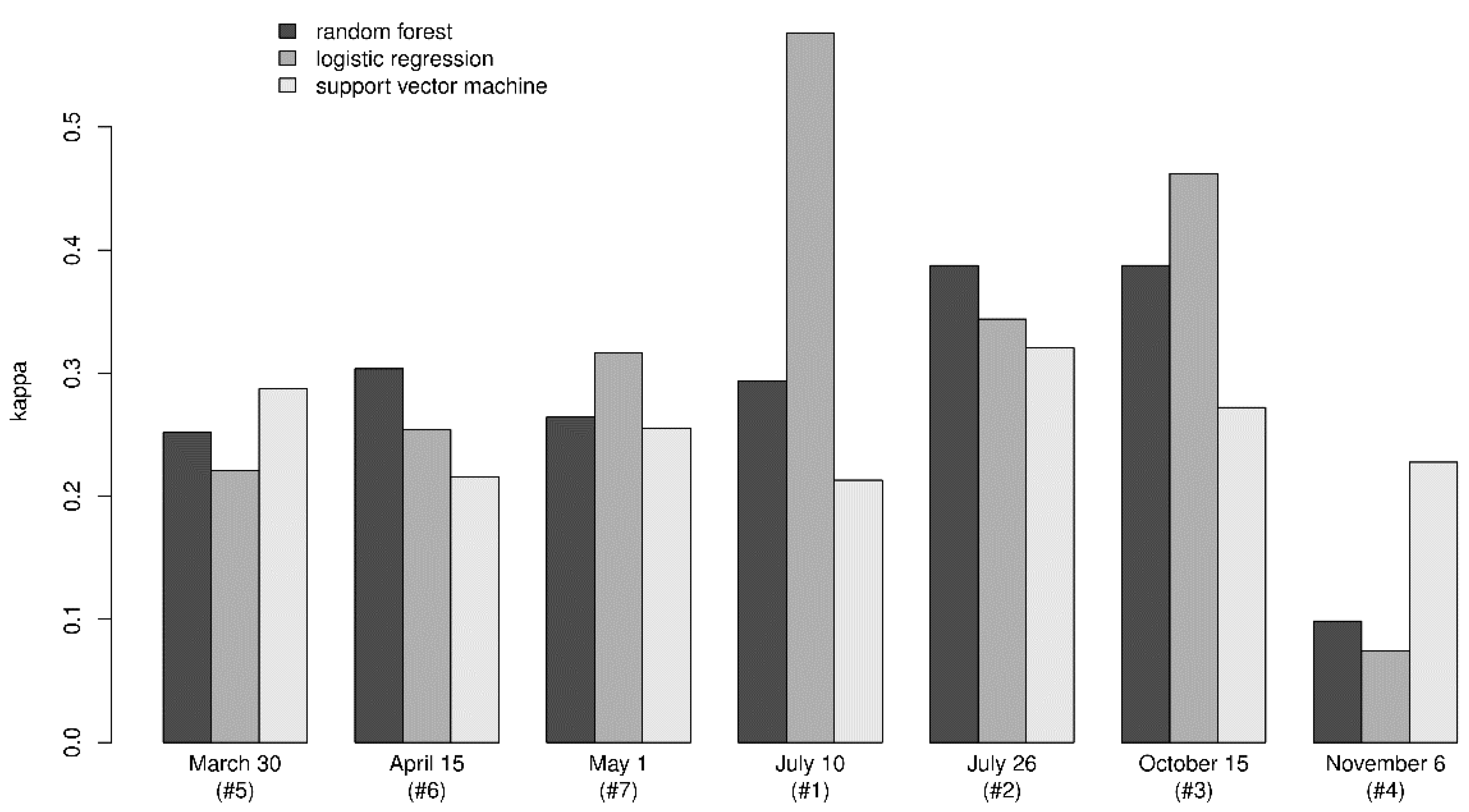
Invasive species can be considered a threat to biodiversity, and remote sensing has been proposed as a tool for detection and monitoring of invasive species. In this study, we test the ability to discriminate between two tree species of the same genera, using data from Landsat 8 satellite imagery, aerial images, and airborne laser scanning. Ground observations from forest stands dominated by either Norway spruce (Picea abies) or Sitka spruce (Picea sitchensis) were coupled with variables derived from each of the three sets of remote sensing data. Random forest, support vector machine, and logistic regression classification models were fit to the data, and the classification accuracy tested by performing a cross-validation. Classification accuracies were compared for different combinations of remote sensing data and classification methods. The overall classification accuracy varied from 0.53 to 0.79, with the highest accuracy obtained using logistic regression with a combination of data derived from Landsat imagery and aerial images. The corresponding kappa value was 0.58. The contribution to the classification accuracy from using airborne data in addition to Landsat imagery was not substantial in this study. The classification accuracy varied between models using data from individual Landsat images. View Full-Text
Keywords: tree species classification; invasive species
▼ Figures
This is an open access article distributed under the Creative Commons Attribution License which permits unrestricted use, distribution, and reproduction in any medium, provided the original work is properly cited. (CC BY 4.0).
For further details log on website :
http://www.mdpi.com/2072-4292/8/5/363?utm_source=TrendMD&utm_medium=cpc&utm_campaign=Remote_Sens_TrendMD_0


No comments:
Post a Comment