1
Research Institute for the Environment and Livelihoods, Charles Darwin University, Ellengowan Drive, Casuarina, NT 0909, Australia
2
Environmental Research Institute of the Supervising Scientist, Department of the Environment, G.P.O. Box 461, Darwin, NT 0801, Australia
*
Author to whom correspondence should be addressed.
Received: 25 March 2014 / Revised: 20 June 2014 / Accepted: 23 June 2014 / Published: 27 June 2014
Abstract
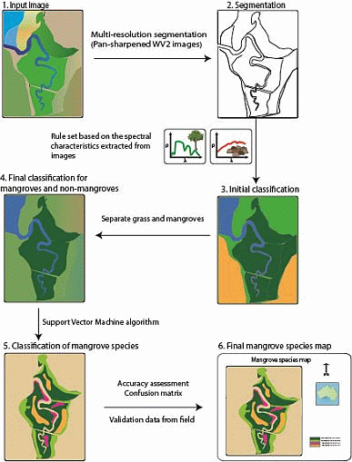
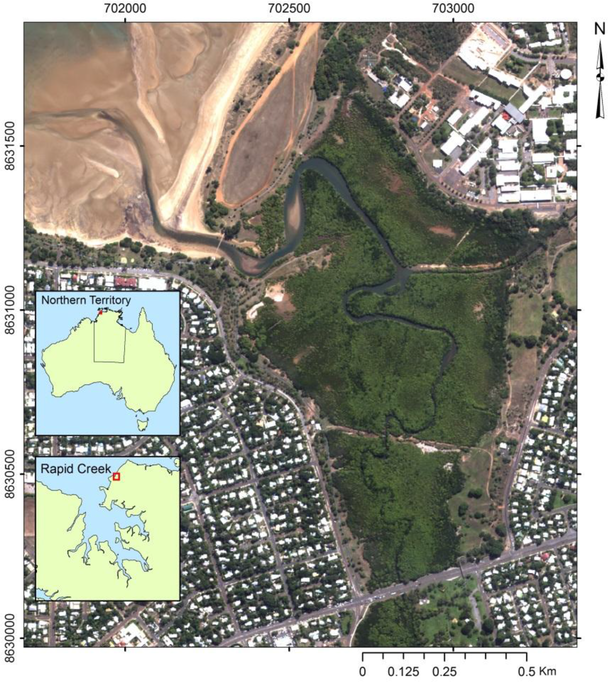
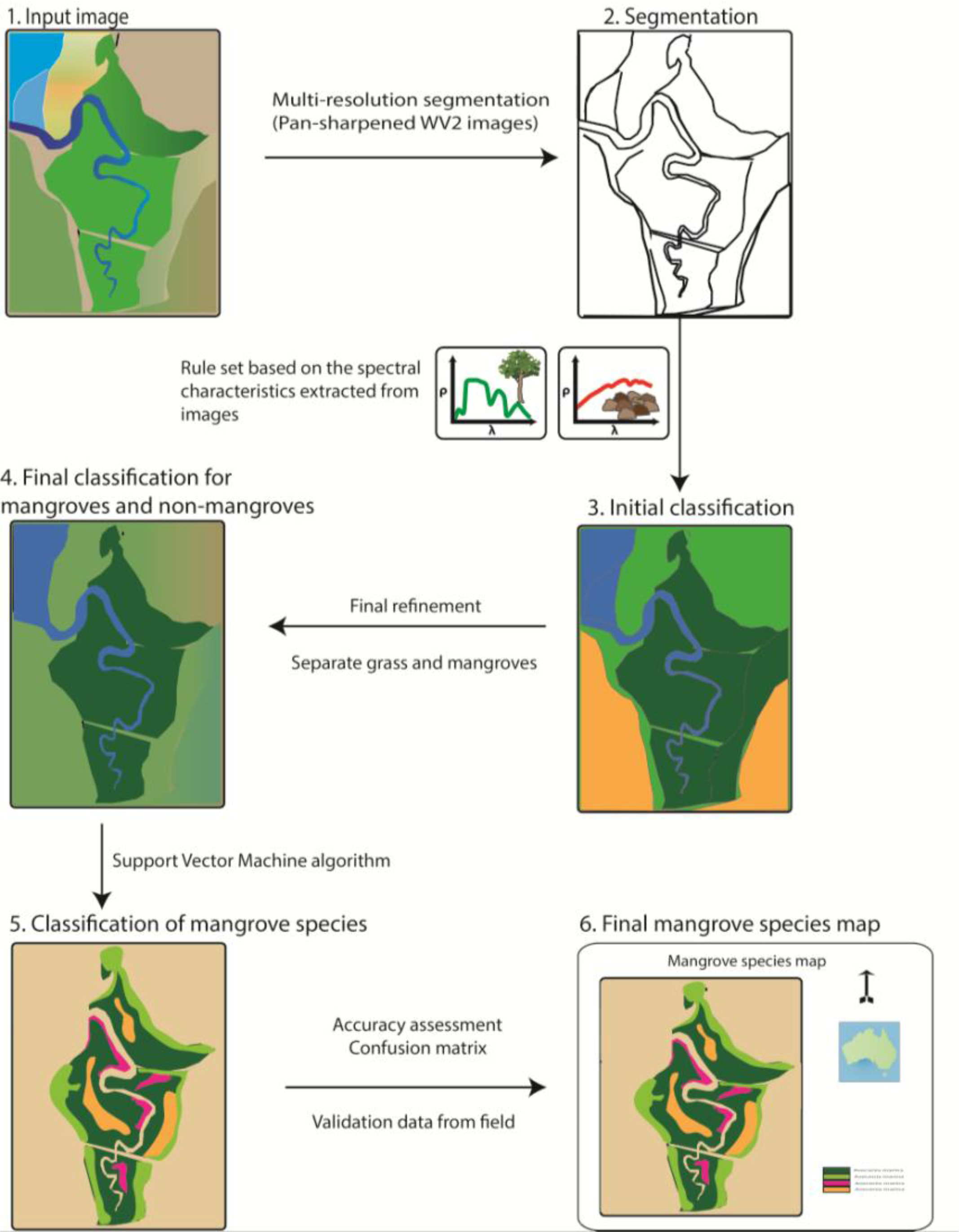
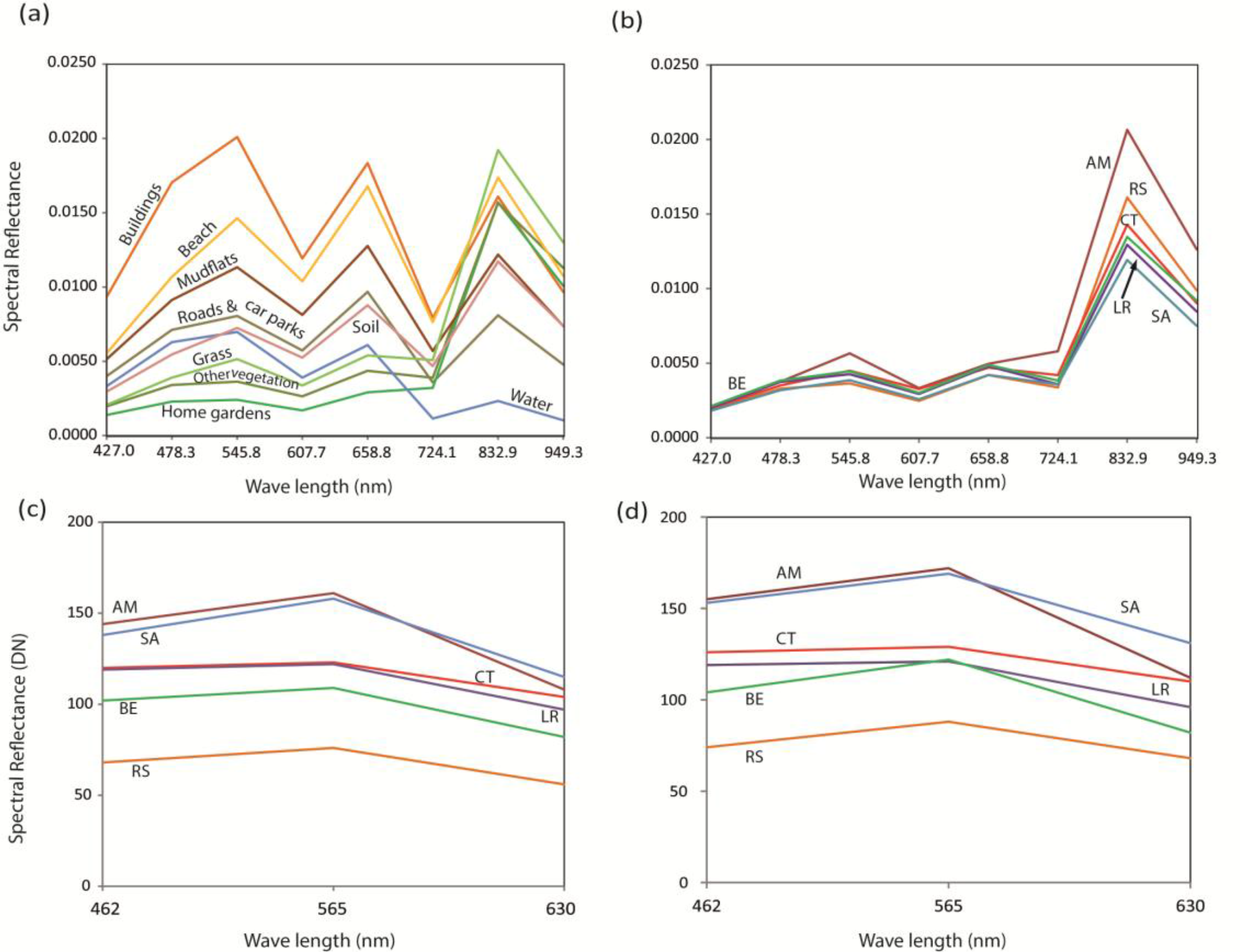
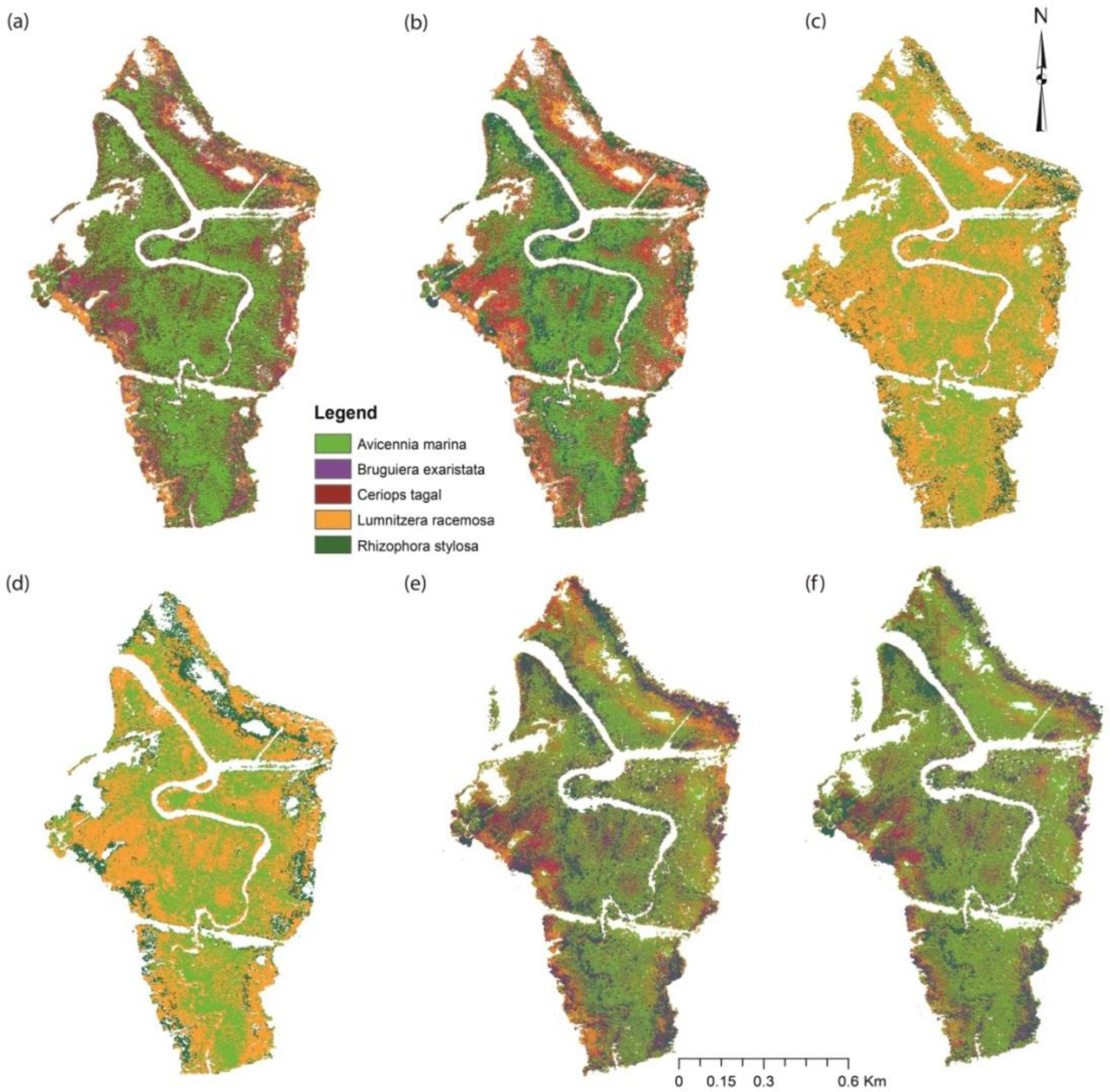
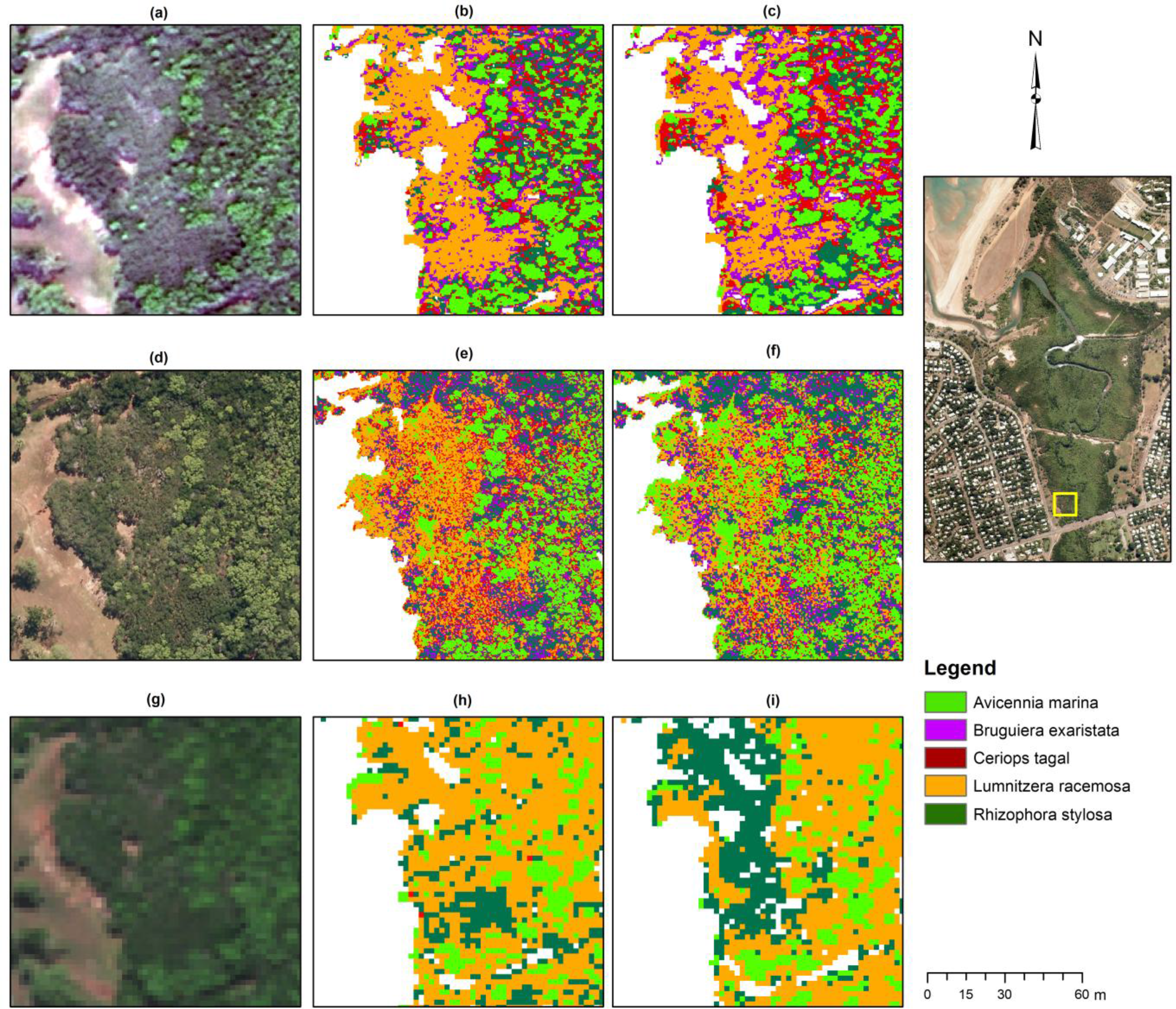
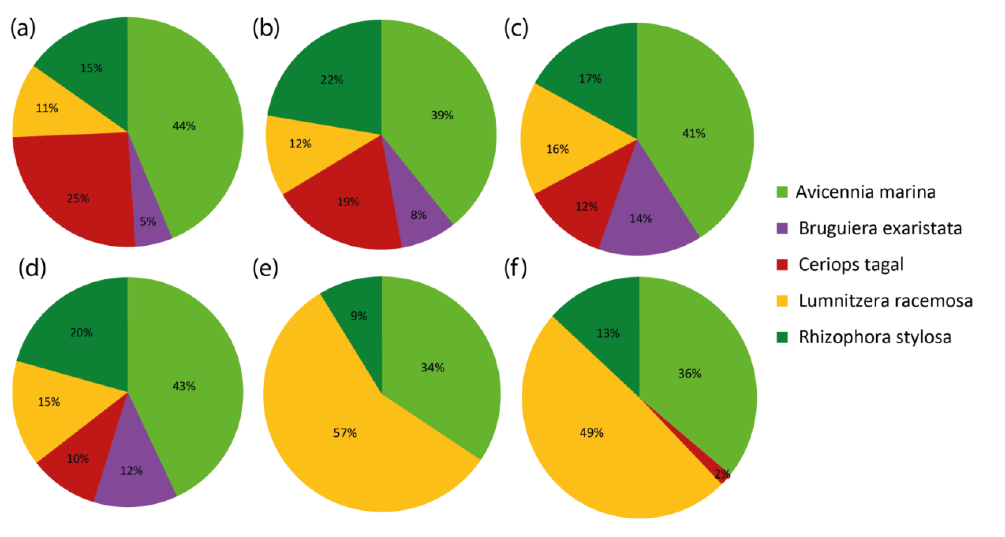
Remote sensing plays a critical role in mapping and monitoring mangroves. Aerial photographs and visual image interpretation techniques have historically been known to be the most common approach for mapping mangroves and species discrimination. However, with the availability of increased spectral resolution satellite imagery, and advances in digital image classification algorithms, there is now a potential to digitally classify mangroves to the species level. This study compares the accuracy of mangrove species maps derived from two different layer combinations of WorldView-2 images with those generated using high resolution aerial photographs captured by an UltraCamD camera over Rapid Creek coastal mangrove forest, Darwin, Australia. Mangrove and non-mangrove areas were discriminated using object-based image classification. Mangrove areas were then further classified into species using a support vector machine algorithm with best-fit parameters. Overall classification accuracy for the WorldView-2 data within the visible range was 89%. Kappa statistics provided a strong correlation between the classification and validation data. In contrast to this accuracy, the error matrix for the automated classification of aerial photographs indicated less promising results. In summary, it can be concluded that mangrove species mapping using a support vector machine algorithm is more successful with WorldView-2 data than with aerial photographs. View Full-Text
Keywords: mangrove species mapping; object-based image analysis; support vector machine; WorldView-2; aerial photographs
▼ Figures
This is an open access article distributed under the Creative Commons Attribution License (CC BY 3.0).
For further details log on website :
http://www.mdpi.com/2072-4292/6/7/6064?utm_source=TrendMD&utm_medium=cpc&utm_campaign=Remote_Sens_TrendMD_0#stats?utm_source=trendmdwidget&utm_medium=cpc&utm_campaign=trendmd


No comments:
Post a Comment