Department of Geography and Center for Galapagos Studies, University of North Carolina at Chapel Hill, Campus Box 3220, Chapel Hill, NC 27599, USA
†
Current Address: Department of Geography and Global Environmental and Climate Change Centre, McGill University, Burnside Hall Room 705, 805 Sherbrooke St. West, Montreal, QC H3A 2K6, Canada
Received: 20 September 2011 / Revised: 8 November 2011 / Accepted: 10 November 2011 / Published: 17 November 2011
(This article belongs to the Special Issue Object-Based Image Analysis)
Abstract
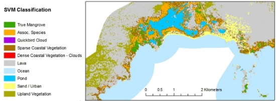
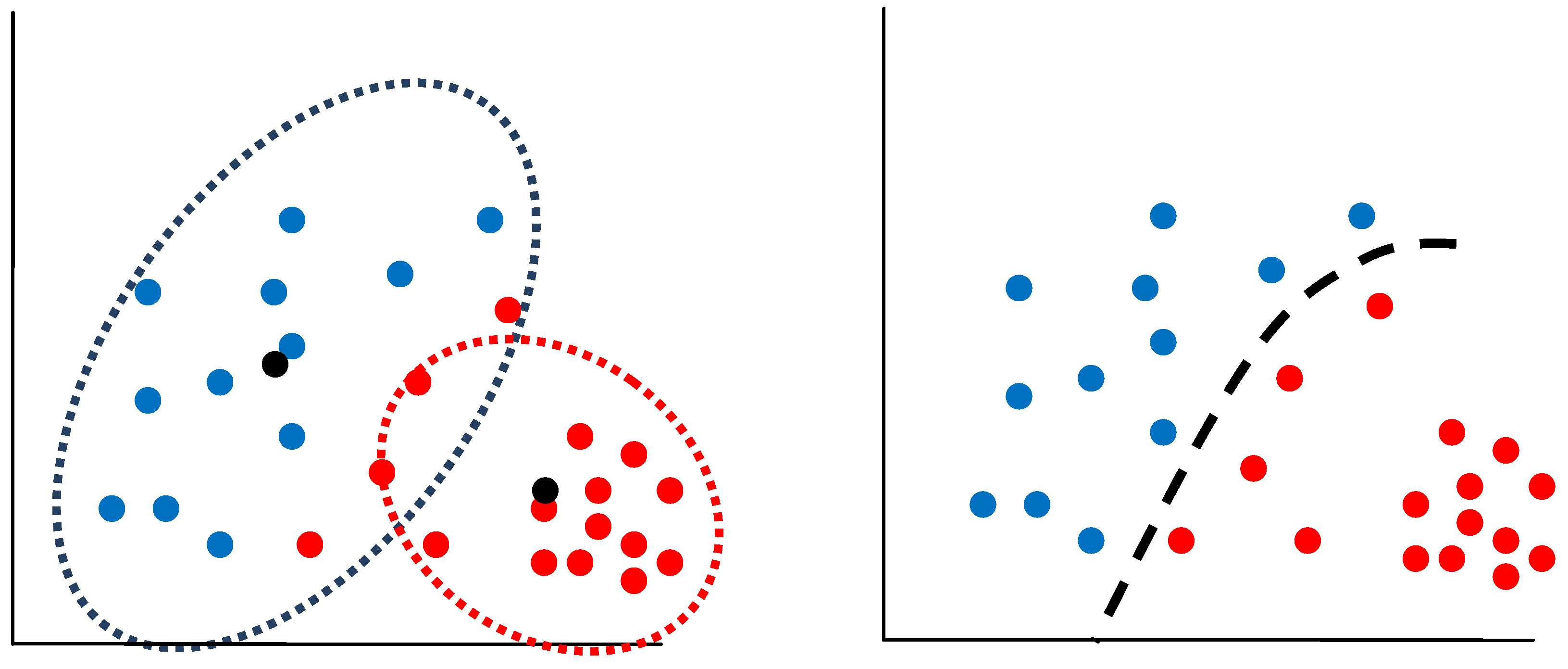
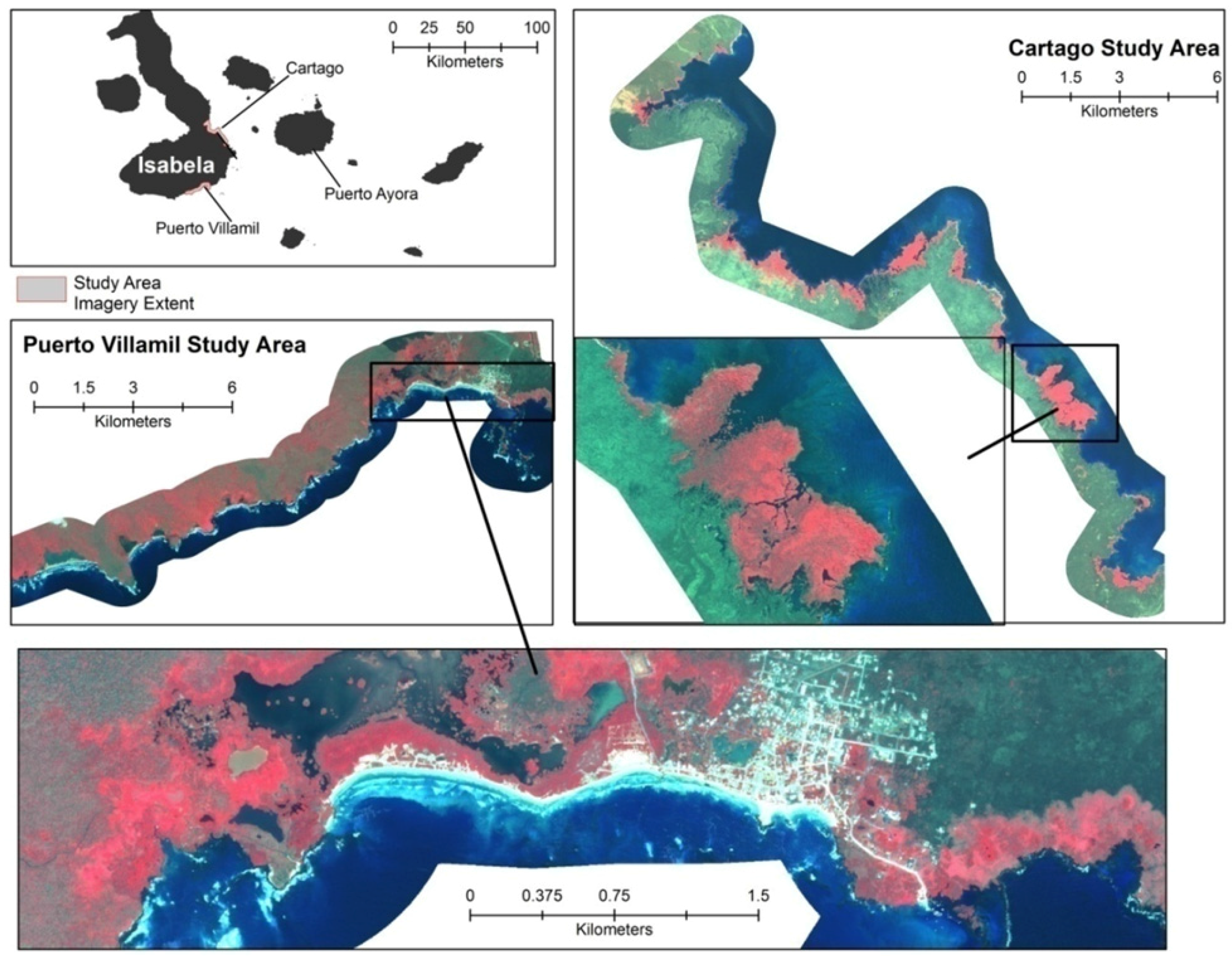
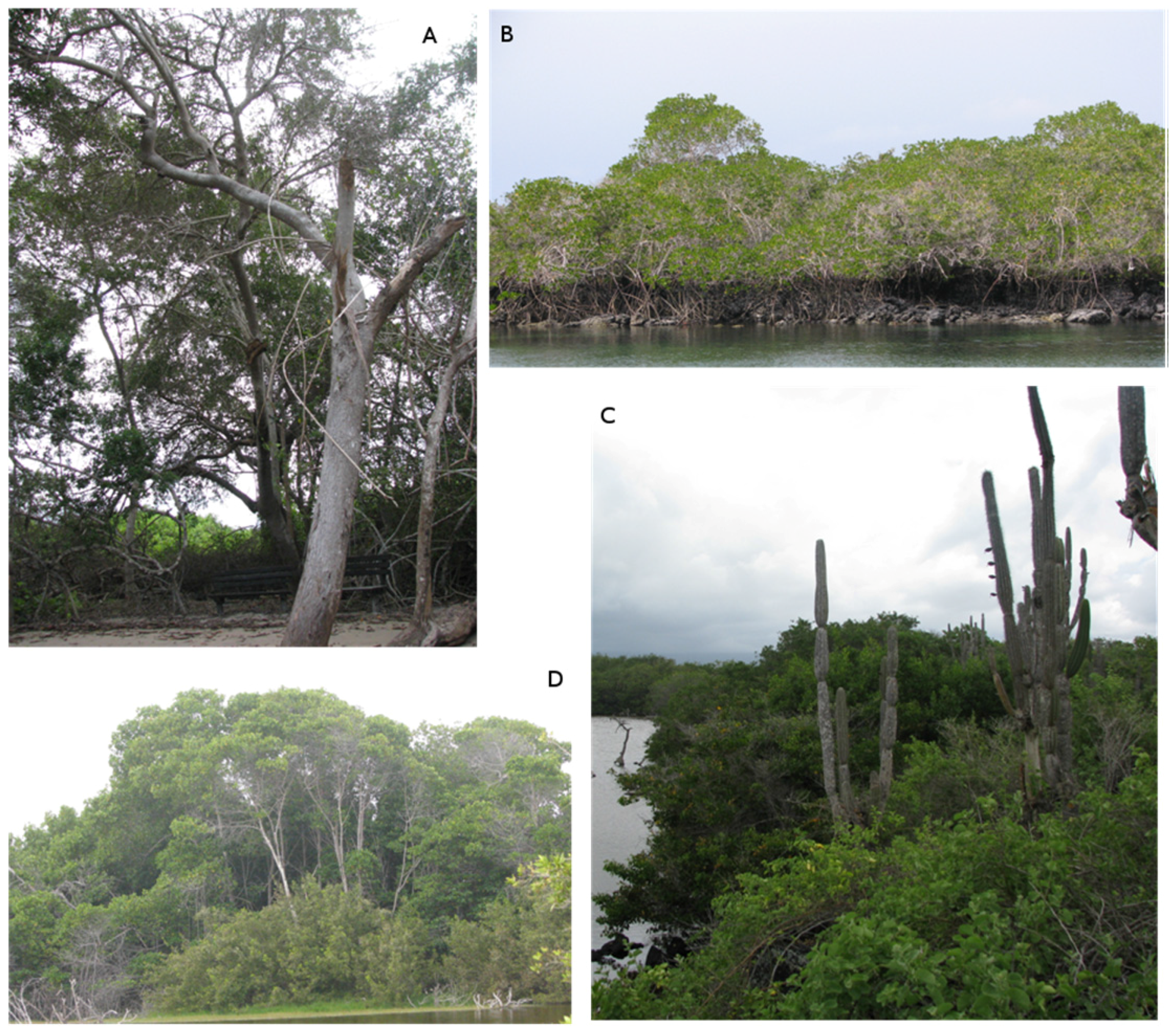
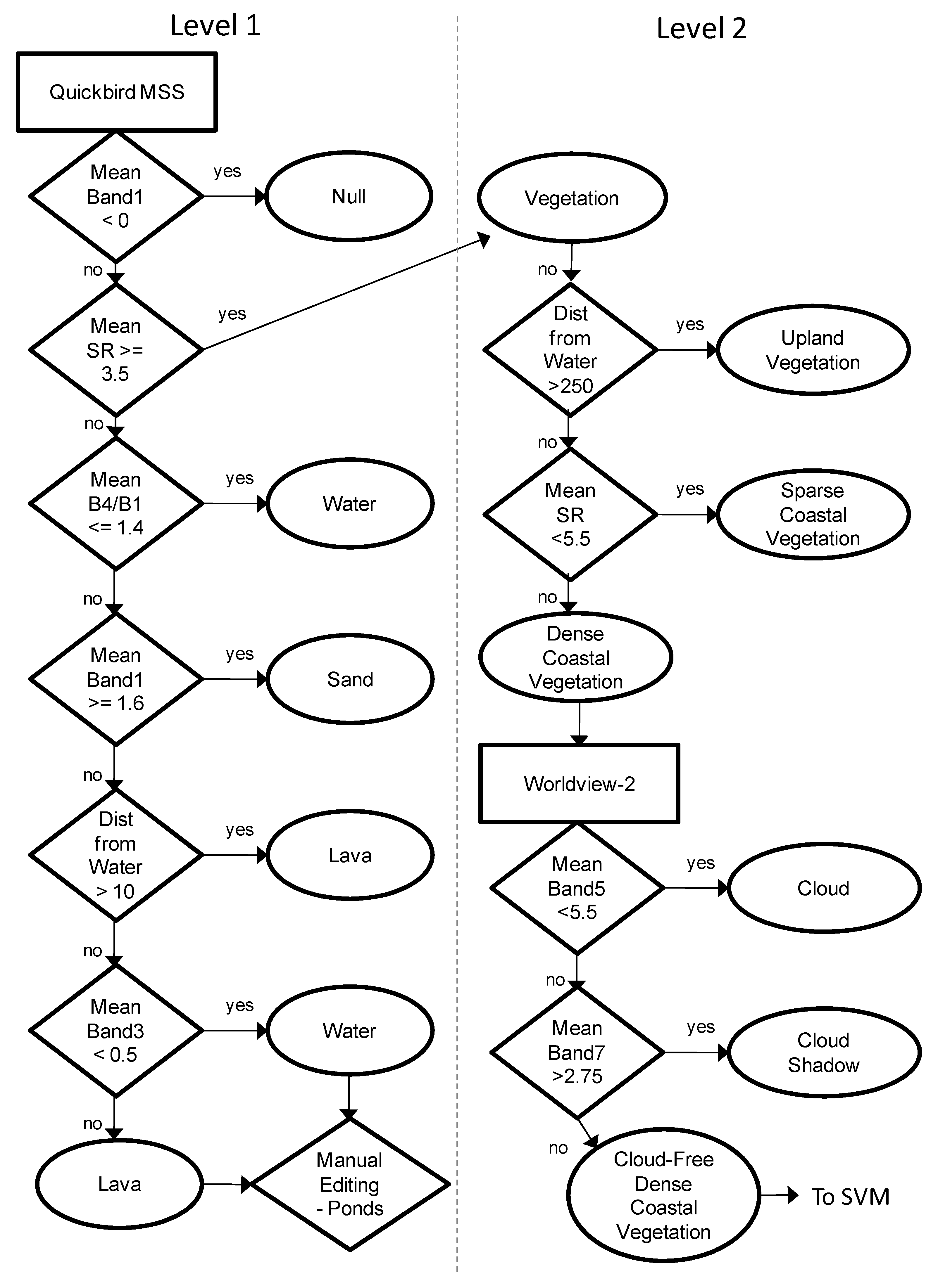
Mangroves provide valuable ecosystem goods and services such as carbon sequestration, habitat for terrestrial and marine fauna, and coastal hazard mitigation. The use of satellite remote sensing to map mangroves has become widespread as it can provide accurate, efficient, and repeatable assessments. Traditional remote sensing approaches have failed to accurately map fringe mangroves and true mangrove species due to relatively coarse spatial resolution and/or spectral confusion with landward vegetation. This study demonstrates the use of the new Worldview-2 sensor, Object-based image analysis (OBIA), and support vector machine (SVM) classification to overcome both of these limitations. An exploratory spectral separability showed that individual mangrove species could not be spectrally separated, but a distinction between true and associate mangrove species could be made. An OBIA classification was used that combined a decision-tree classification with the machine-learning SVM classification. Results showed an overall accuracy greater than 94% (kappa = 0.863) for classifying true mangroves species and other dense coastal vegetation at the object level. There remain serious challenges to accurately mapping fringe mangroves using remote sensing data due to spectral similarity of mangrove and associate species, lack of clear zonation between species, and mixed pixel effects, especially when vegetation is sparse or degraded. View Full-Text
Keywords: mangroves; OBIA; support vector machine; Galapagos Islands; decision-tree; classification
▼ Figures
This is an open access article distributed under the Creative Commons Attribution License (CC BY 3.0).
For further details log on website :
http://www.mdpi.com/2072-4292/3/11/2440?utm_source=TrendMD&utm_medium=cpc&utm_campaign=Remote_Sens_TrendMD_0


No comments:
Post a Comment