1
Institut National Agronomique de Tunisie/Université de Carthage, 43 Avenue Charles Nicolle, 1082 Tunis Mahrajène, Tunisie
2
Centre d'Etudes Spatiales de la Biosphère, 18 Av. Edouard Belin, BP 2801, 31401 Toulouse Cedex 9, France
*
Author to whom correspondence should be addressed.
Academic Editors: Benjamin Koetz, Magaly Koch and Prasad S. Thenkabail
Received: 1 June 2015 / Revised: 20 August 2015 / Accepted: 9 September 2015 / Published: 1 October 2015
(This article belongs to the Special Issue Lessons Learned from the SPOT4 (Take5): Experiment in Preparation for Sentinel-2)
Abstract
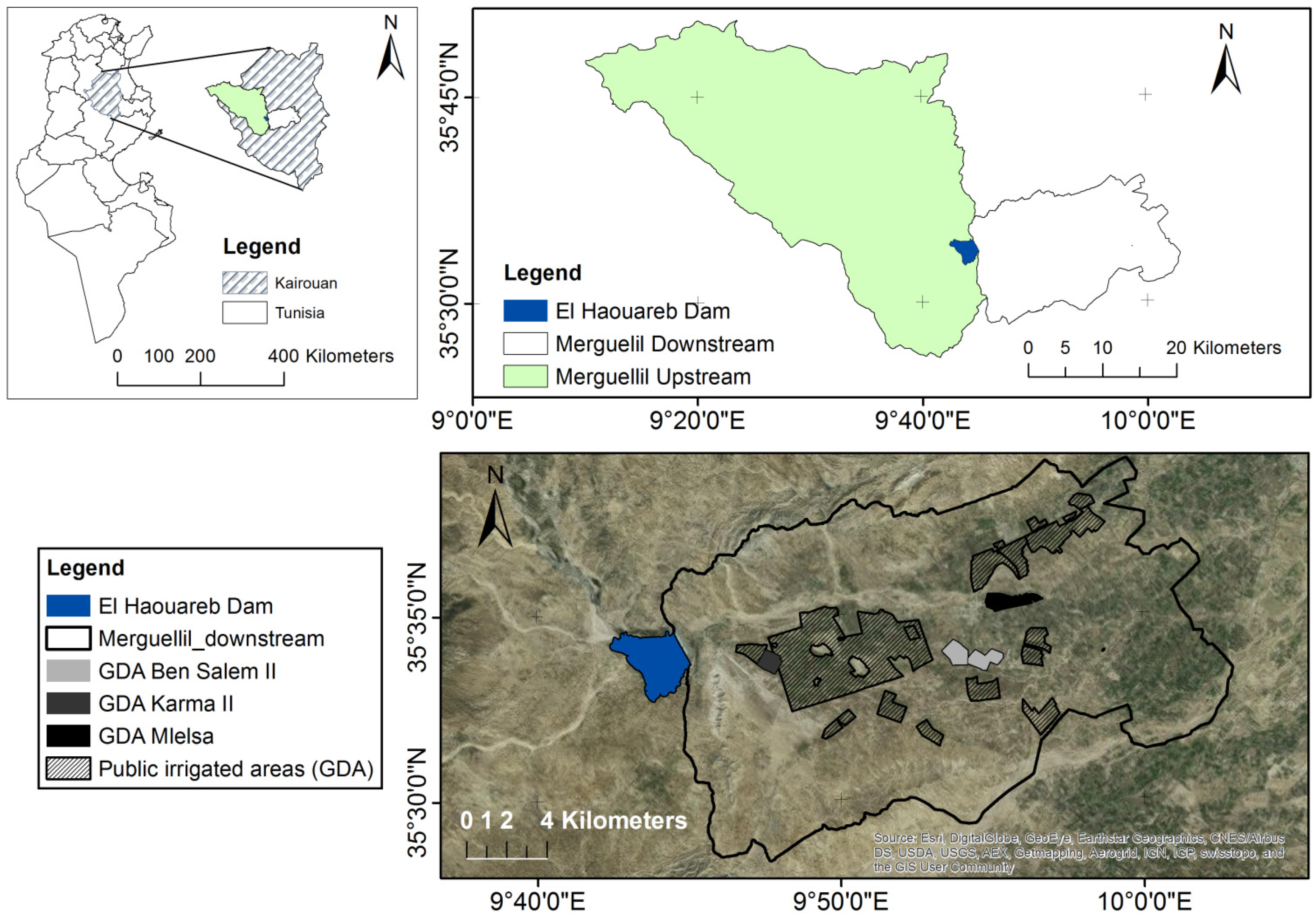
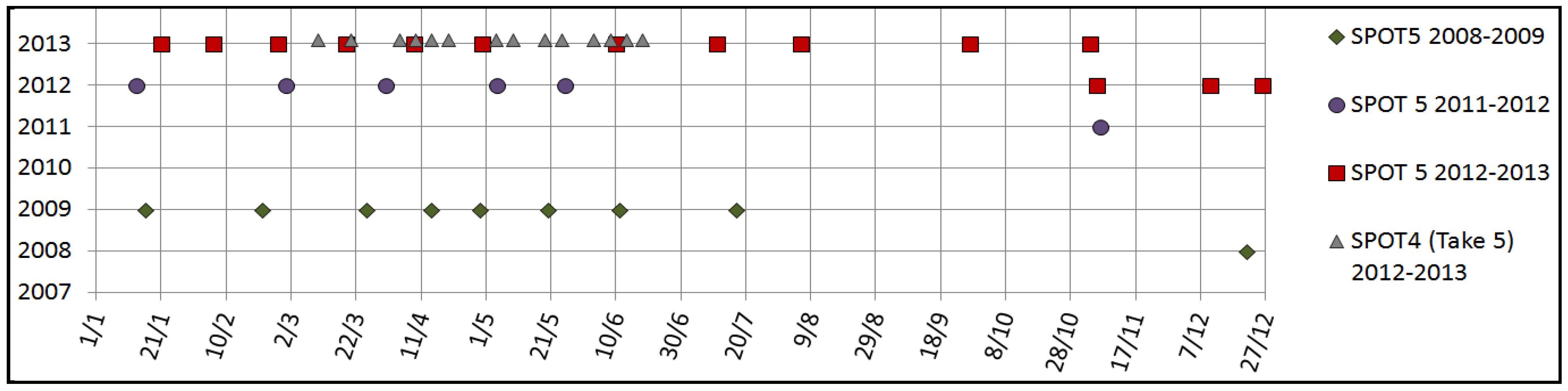
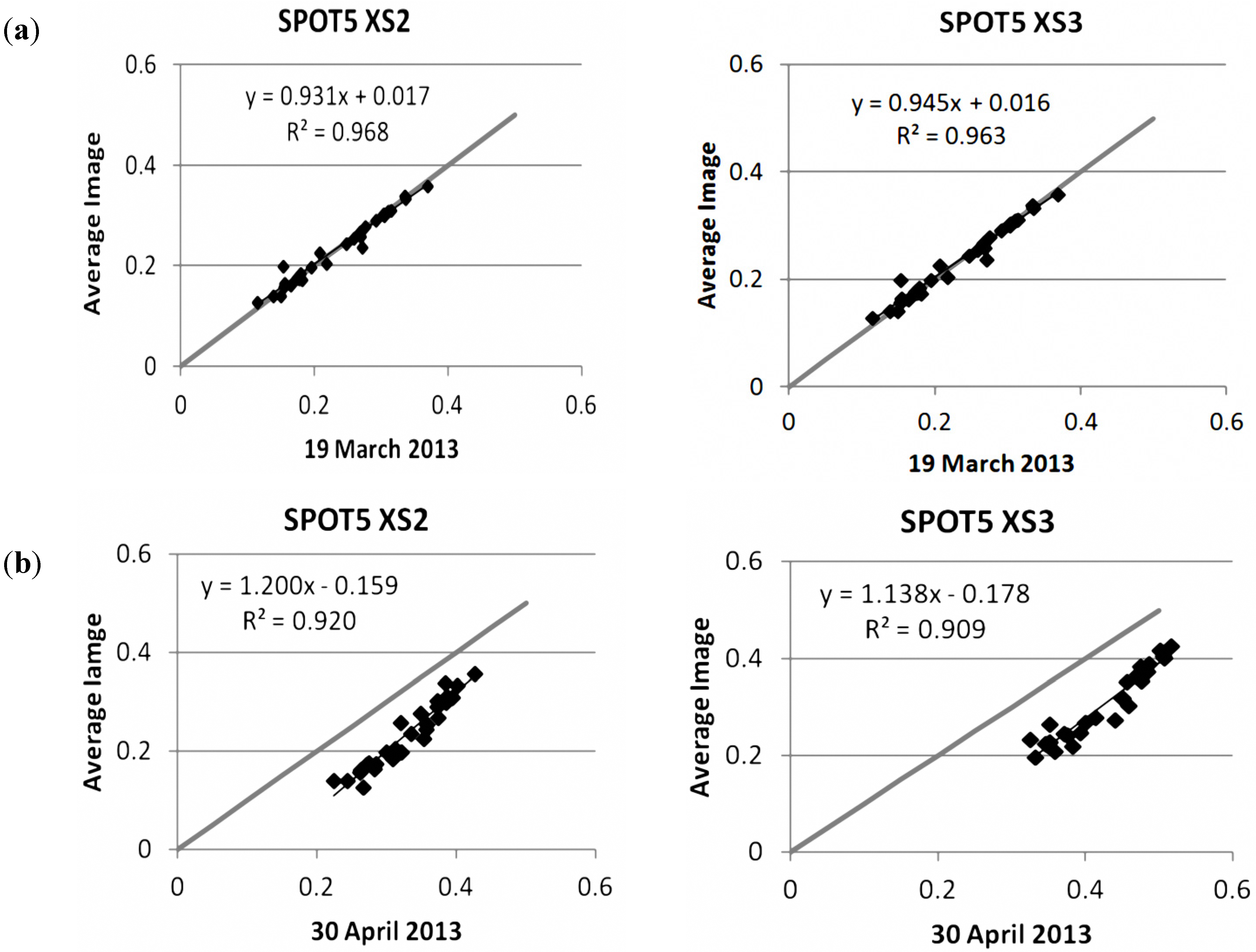
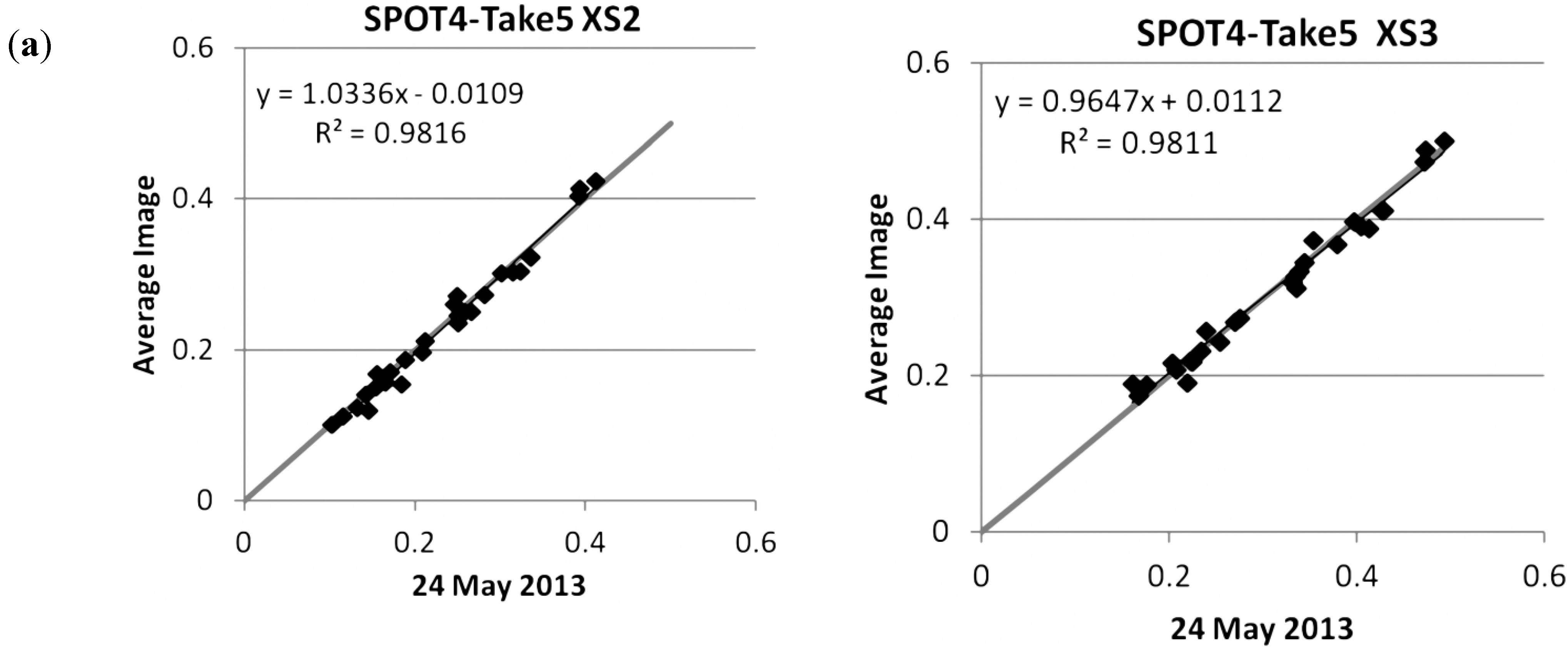
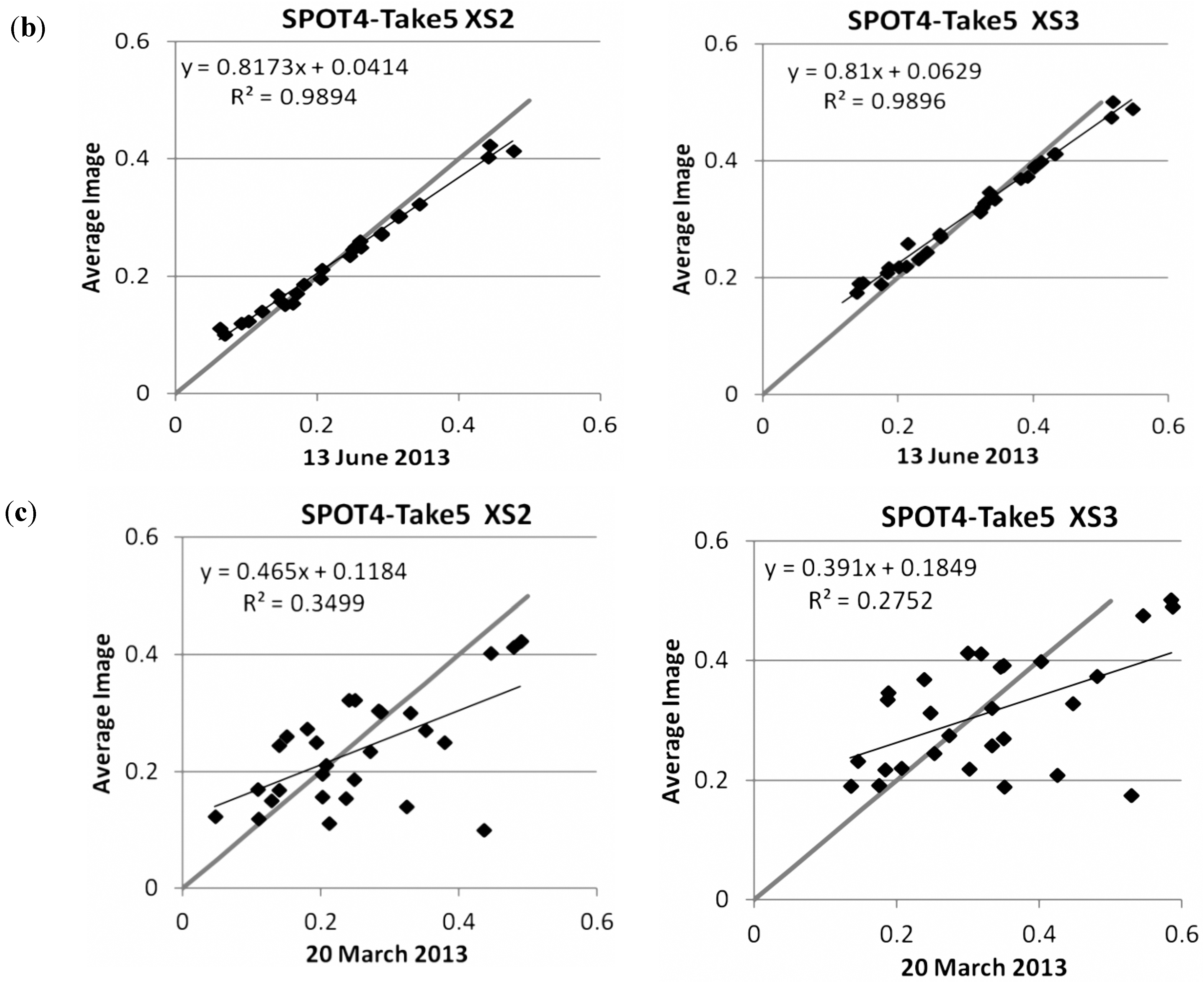
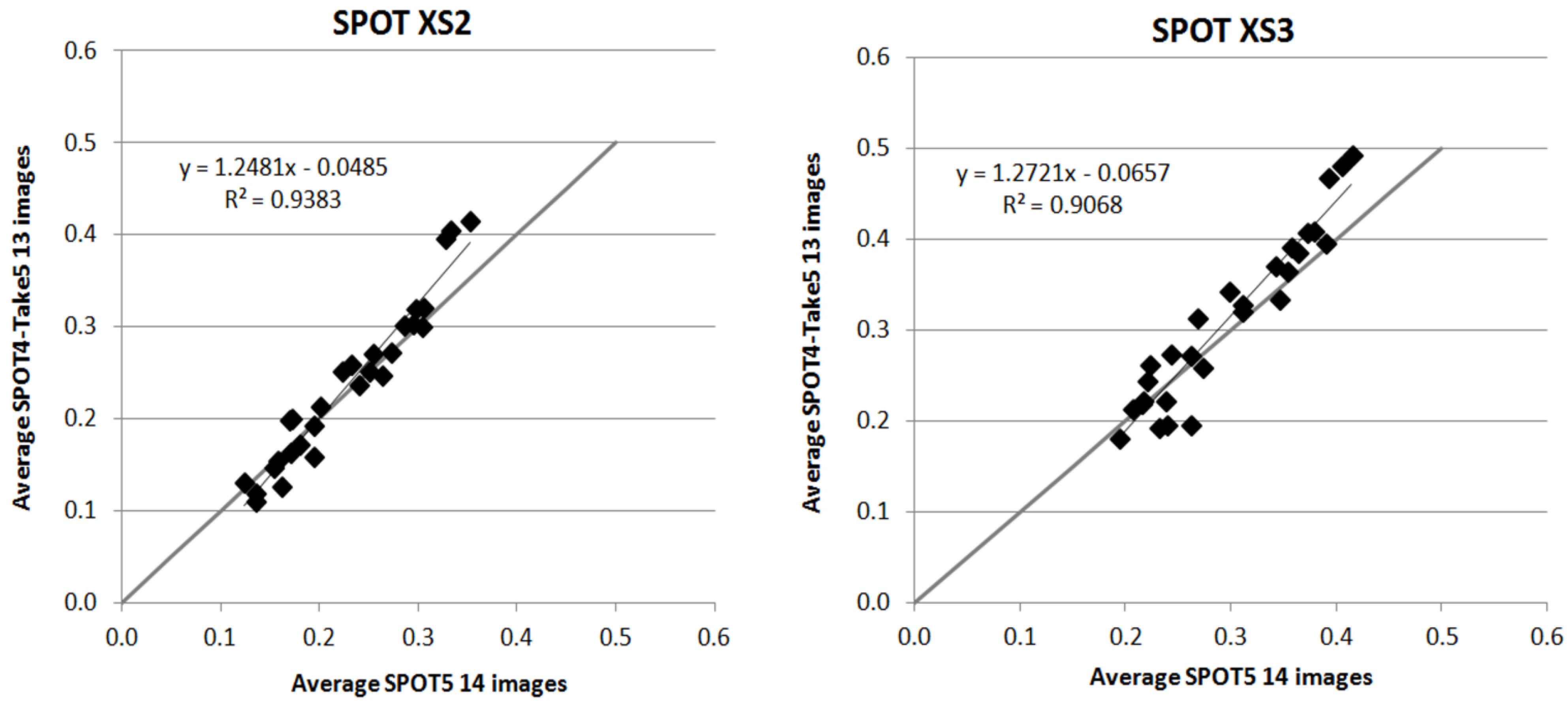
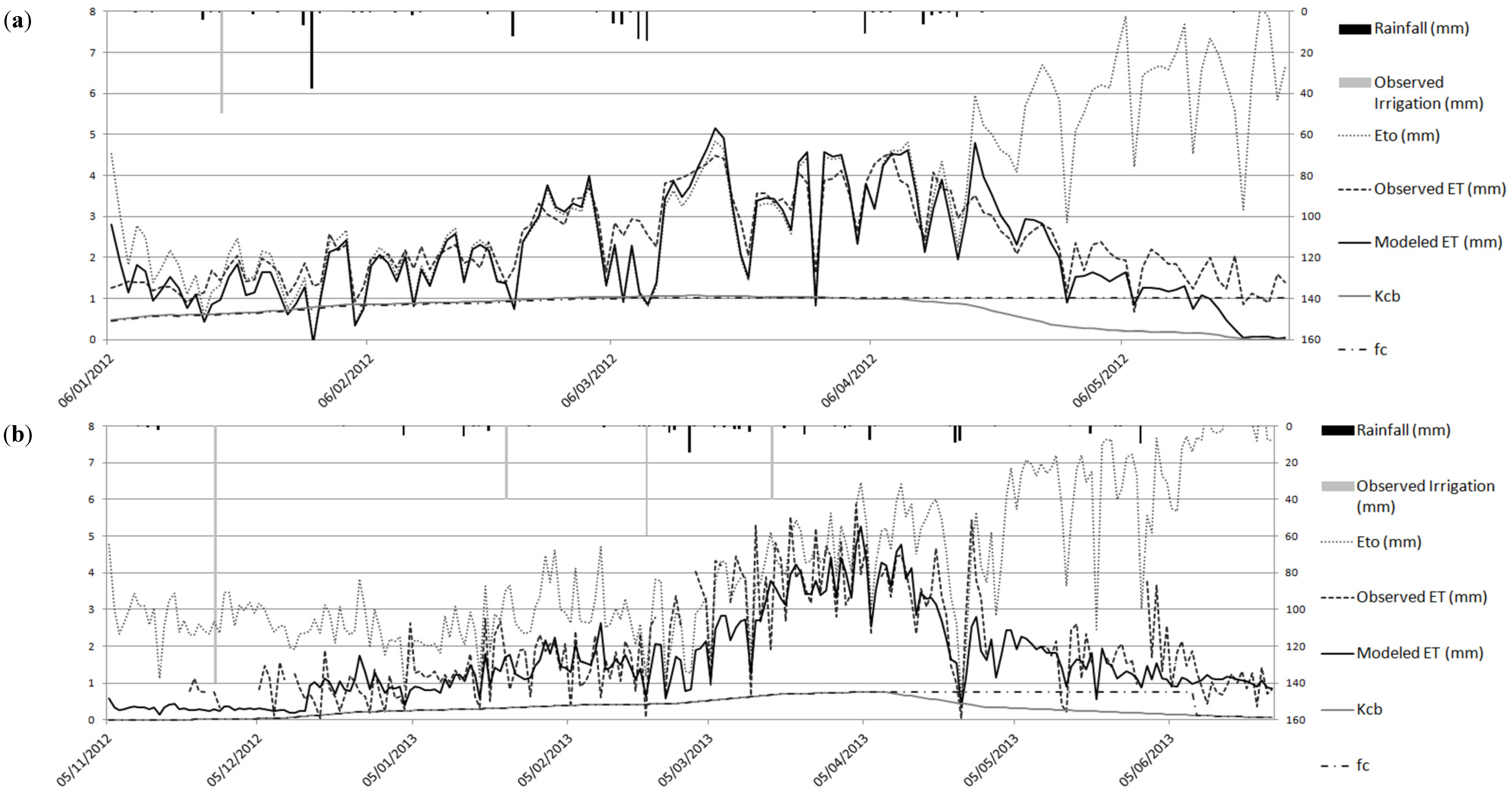
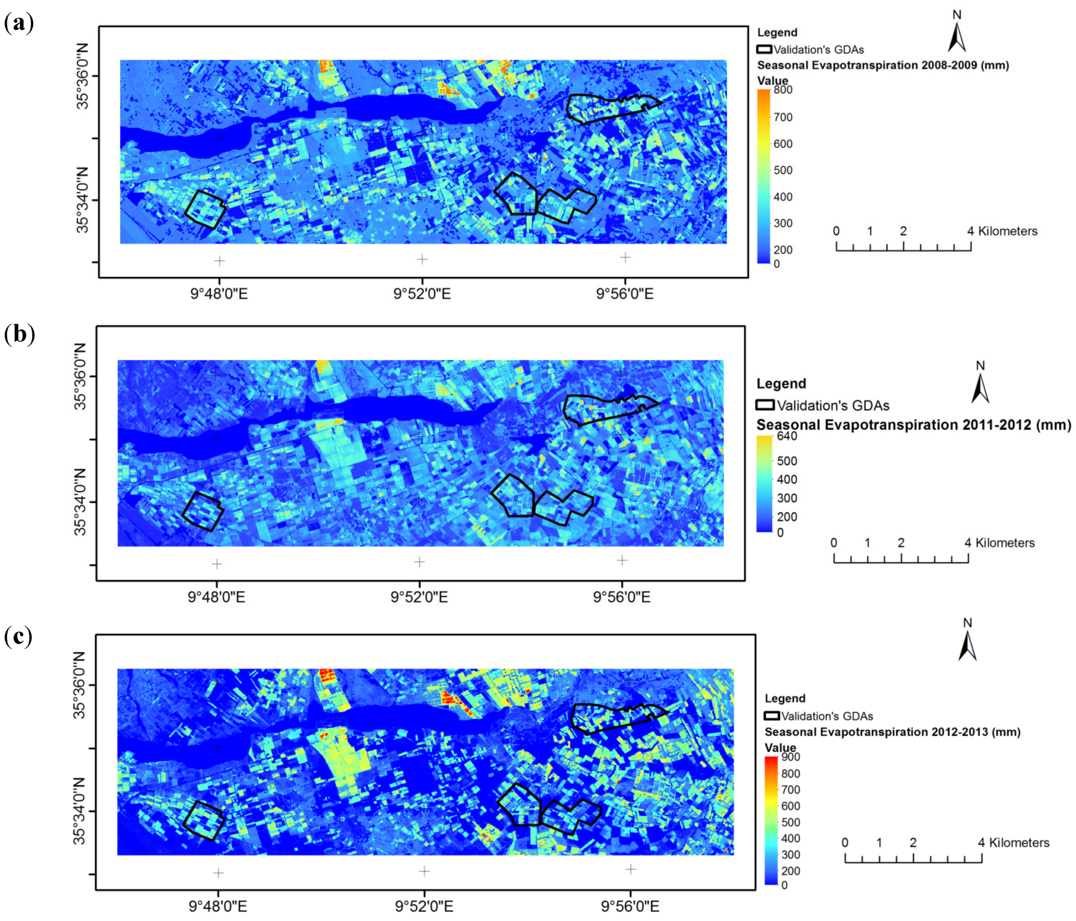
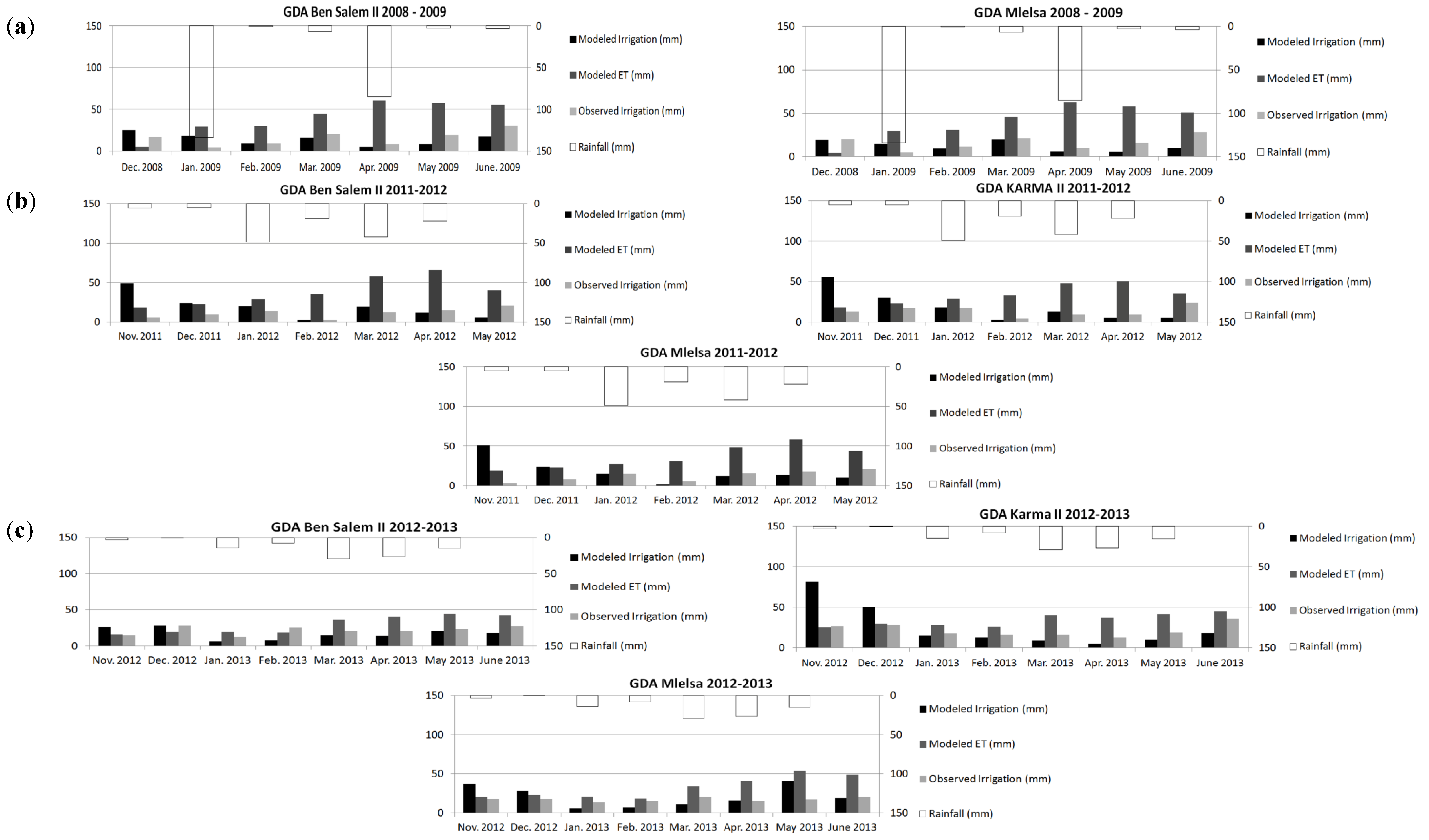
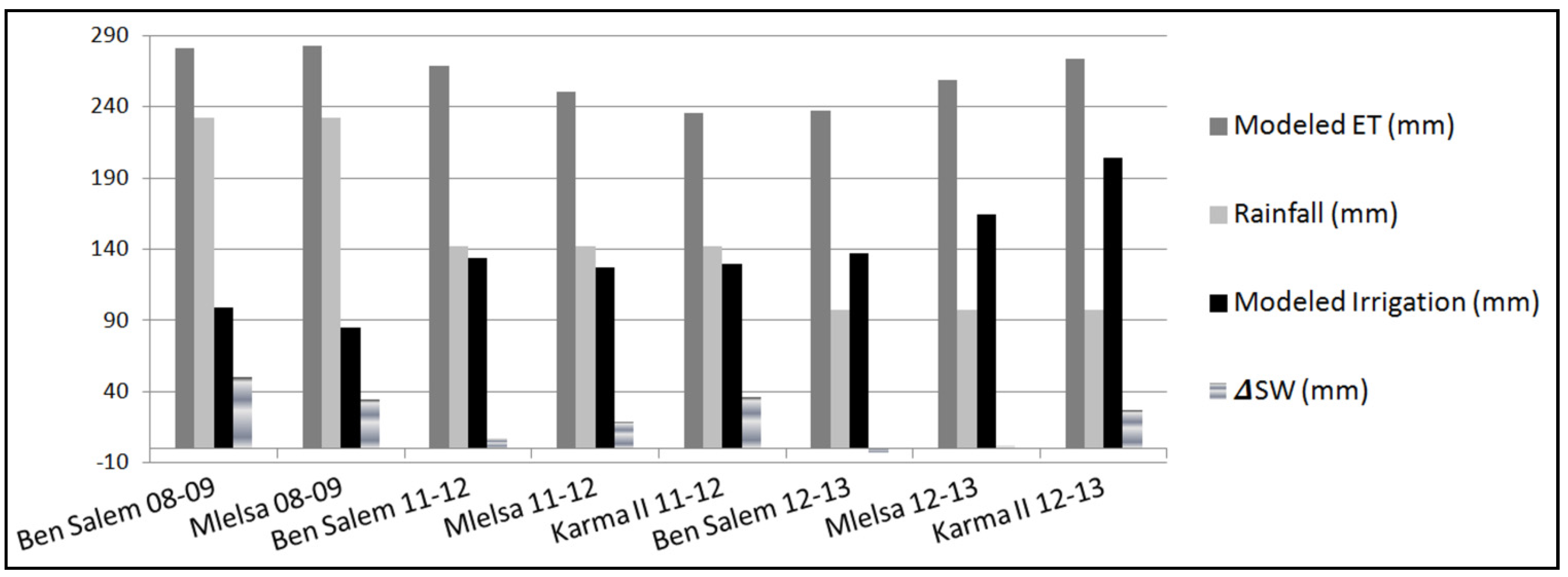
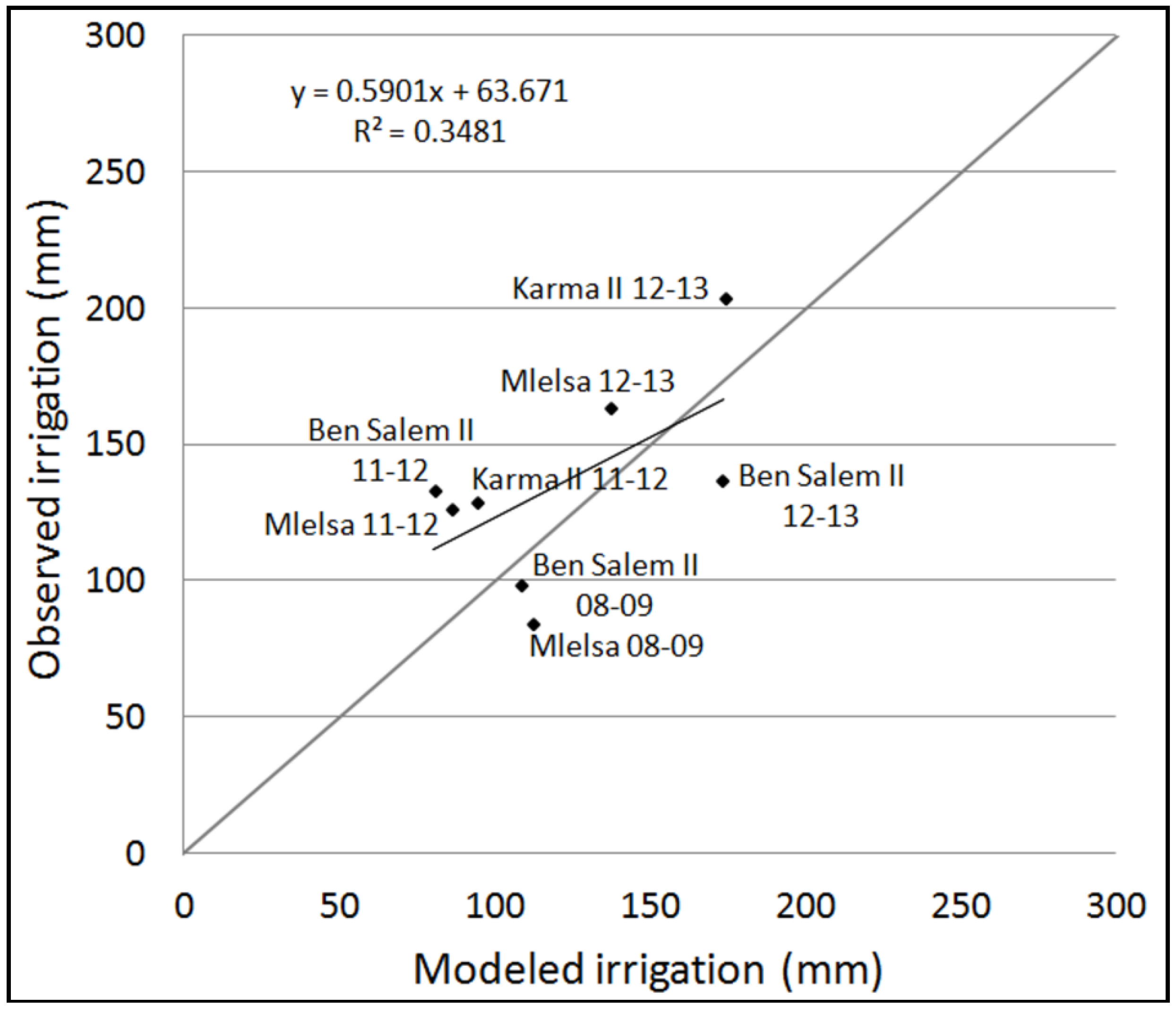
Water scarcity is one of the main factors limiting agricultural development in semi-arid areas. Remote sensing has long been used as an input for crop water balance monitoring. The increasing availability of high resolution high repetitivity remote sensing (forthcoming Sentinel-2 mission) offers an unprecedented opportunity to improve this monitoring. In this study, regional crop water consumption was estimated with the SAMIR software (SAtellite Monitoring of IRrigation) using the FAO-56 dual crop coefficient water balance model fed with high resolution NDVI image time series providing estimates of both the actual basal crop coefficient and the vegetation fraction cover. Three time series of SPOT5 images have been acquired over an irrigated area in central Tunisia along with a SPOT4 time series acquired in the frame of the SPOT4-Take5 experiment, which occurred during the first half of 2013. Using invariant objects located in the scene, normalization of the SPOT5 time series was realized based on the SPOT4-Take5 time series. Hence, a NDVI time profile was generated for each pixel. The operationality and accuracy of the SAMIR tool was assessed at both plot scale (calibration based on evapotranspiration ground measurements) and perimeter scale (irrigation volumes) when several land use types, irrigation and agricultural practices are intertwined in a given landscape. Results at plot scale gave after calibration an average Nash efficiency of 0.57 between observed and modeled evapotranspiration for two plots (barley and wheat). When aggregated for the whole season, modeled irrigation volumes at perimeter scale for all campaigns were close to observed ones (resp. 135 and 121 mm, overestimation of 11.5%). However, spatialized evapotranspiration and irrigation volumes need to be improved at finer timescales. View Full-Text
Keywords: remote sensing; water balance; FAO paper 56; evapotranspiration; irrigation; semi-arid Mediterranean; SPOT.
▼ Figures
This is an open access article distributed under the Creative Commons Attribution License which permits unrestricted use, distribution, and reproduction in any medium, provided the original work is properly cited. (CC BY 4.0).
For further details log on website :
http://www.mdpi.com/2072-4292/7/10/13005?utm_source=TrendMD&utm_medium=cpc&utm_campaign=Remote_Sens_TrendMD_0


No comments:
Post a Comment