1
State Key Laboratory of Remote Sensing Science, Institute of Remote Sensing and Digital Earth Chinese Academy of Sciences, No. 20 Datun Road, Chaoyang District, Beijing 100101, China
2
Zhejiang-Chinese Academy of Sciences (CAS) Application Center for Geoinformatics, No. 568 Jinyang East Road, Jiashan 314100, China
*
Author to whom correspondence should be addressed.
Academic Editor: Yong Wang
Received: 30 November 2014 / Revised: 13 March 2015 / Accepted: 25 March 2015 / Published: 31 March 2015
(This article belongs to the Special Issue Advances in Remote Sensing of Flooding)
Abstract
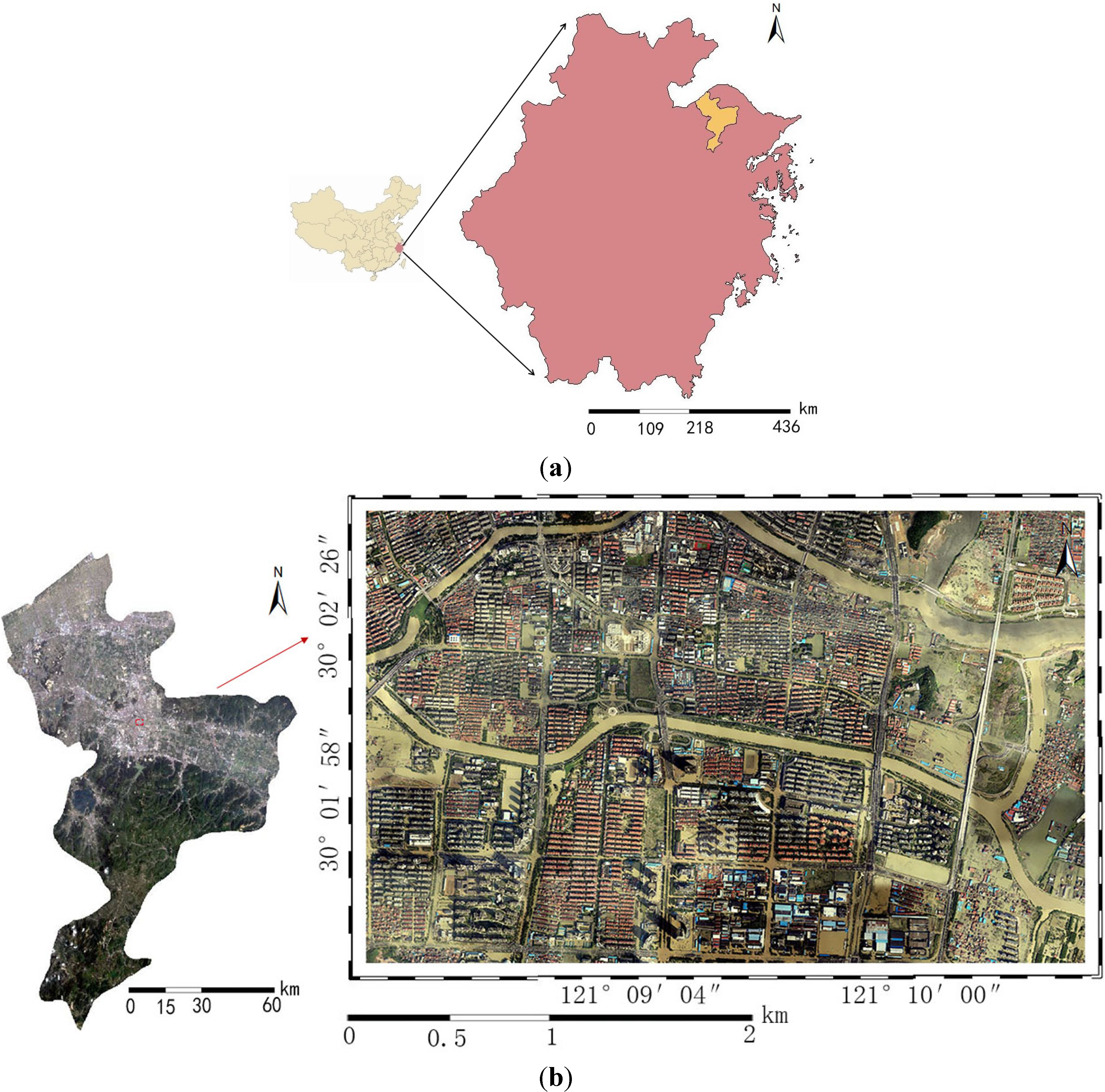
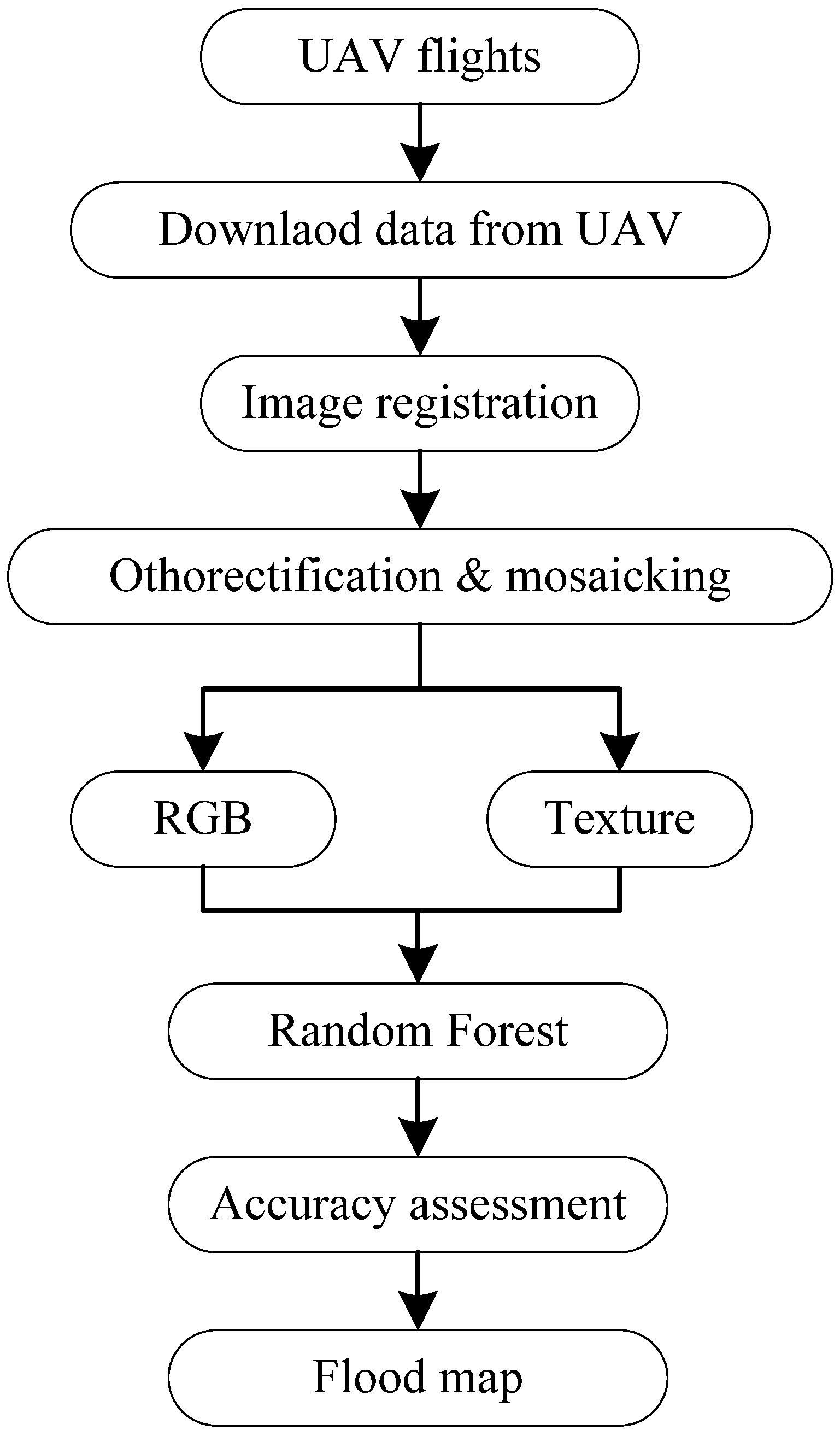
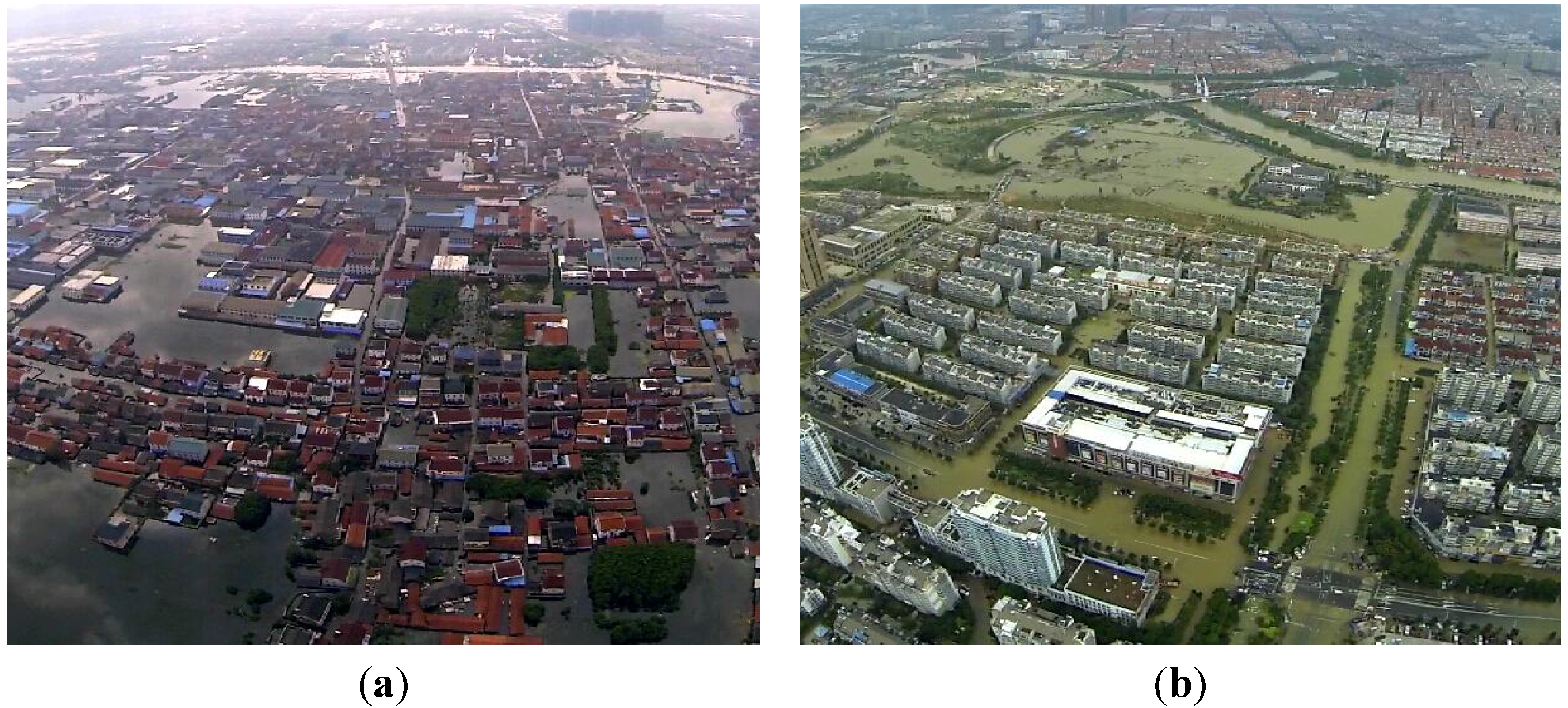
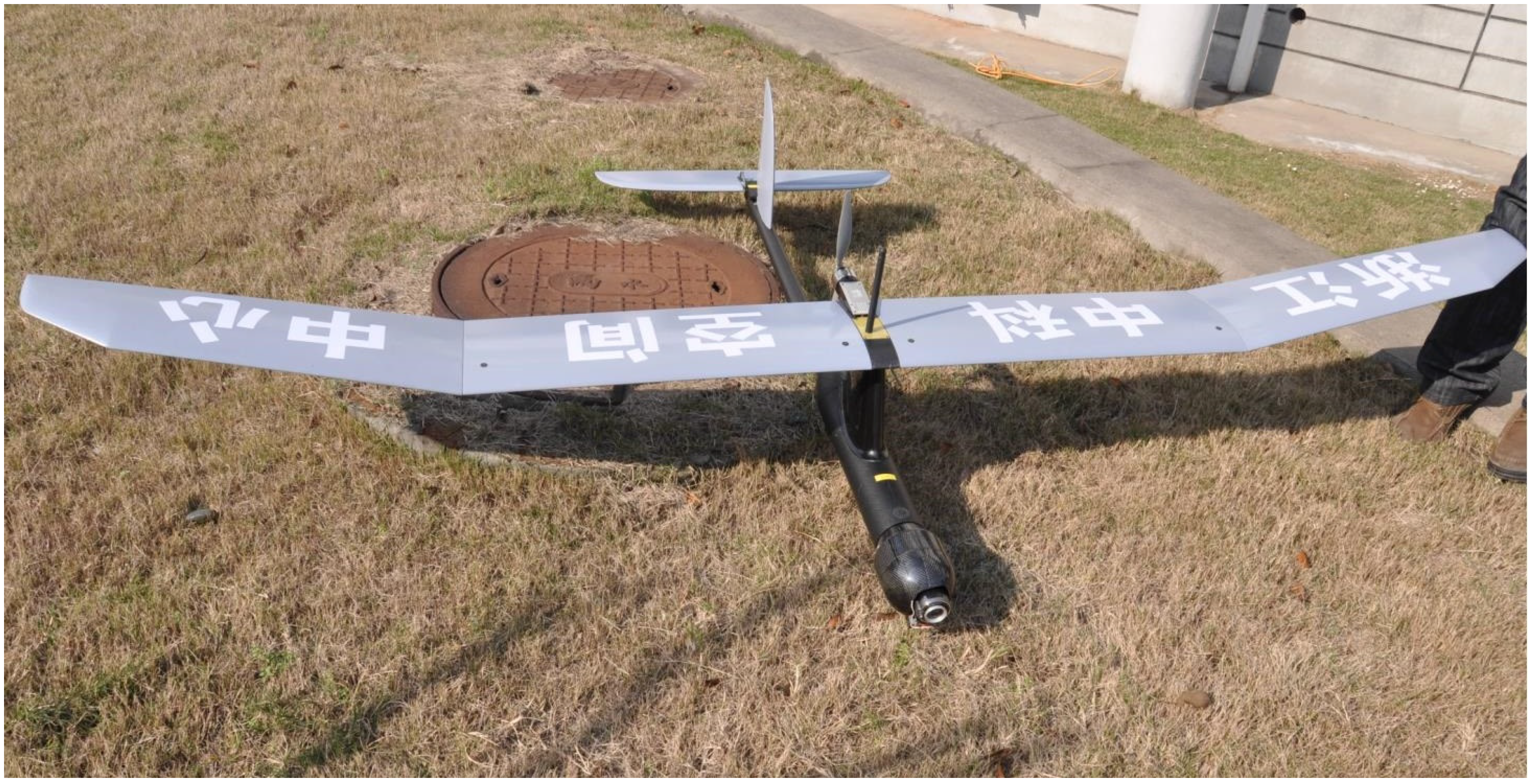
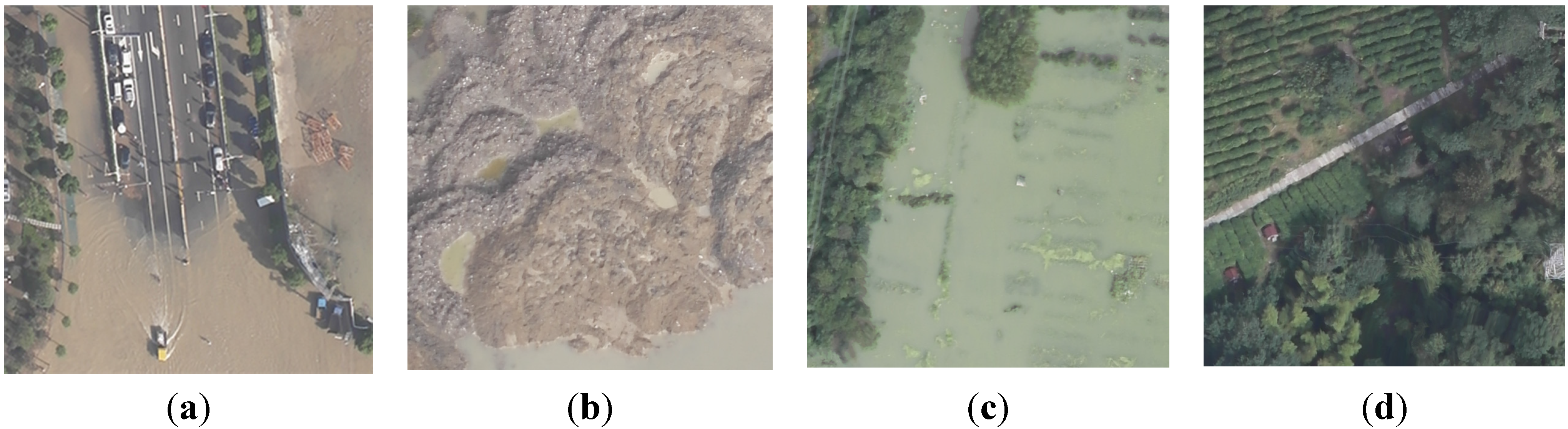
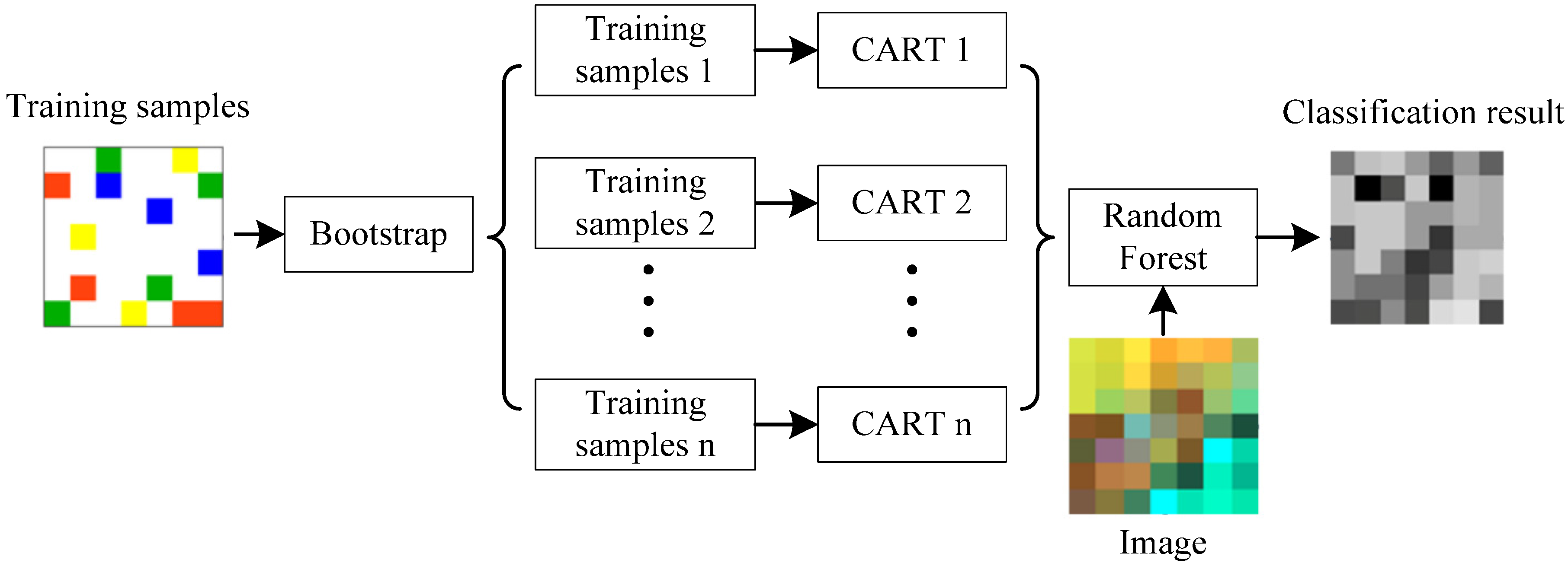
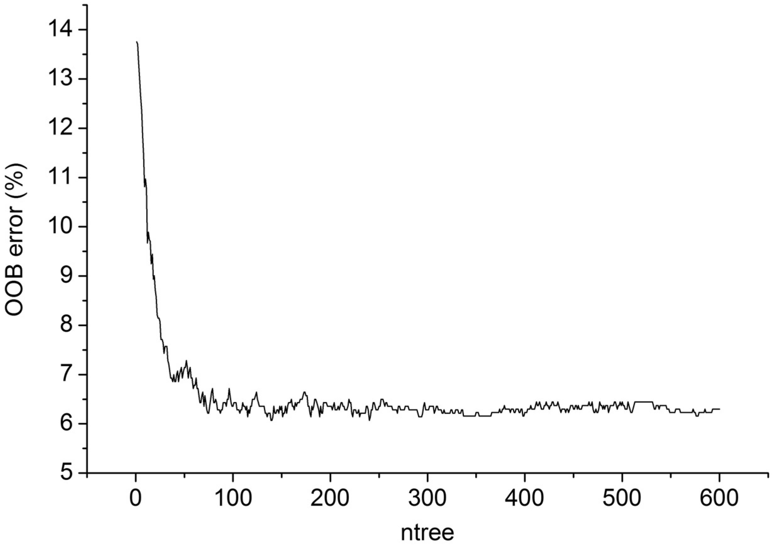
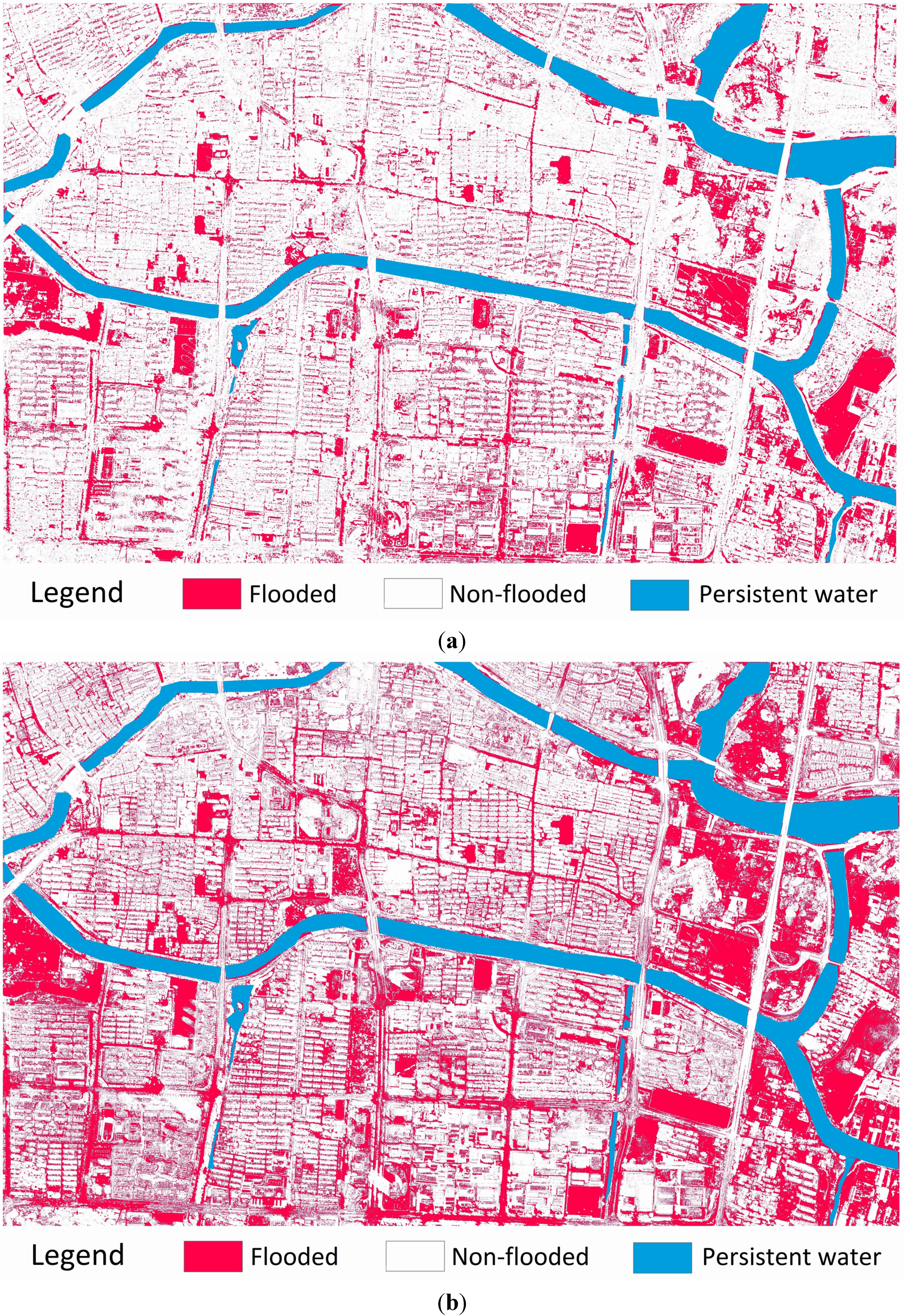
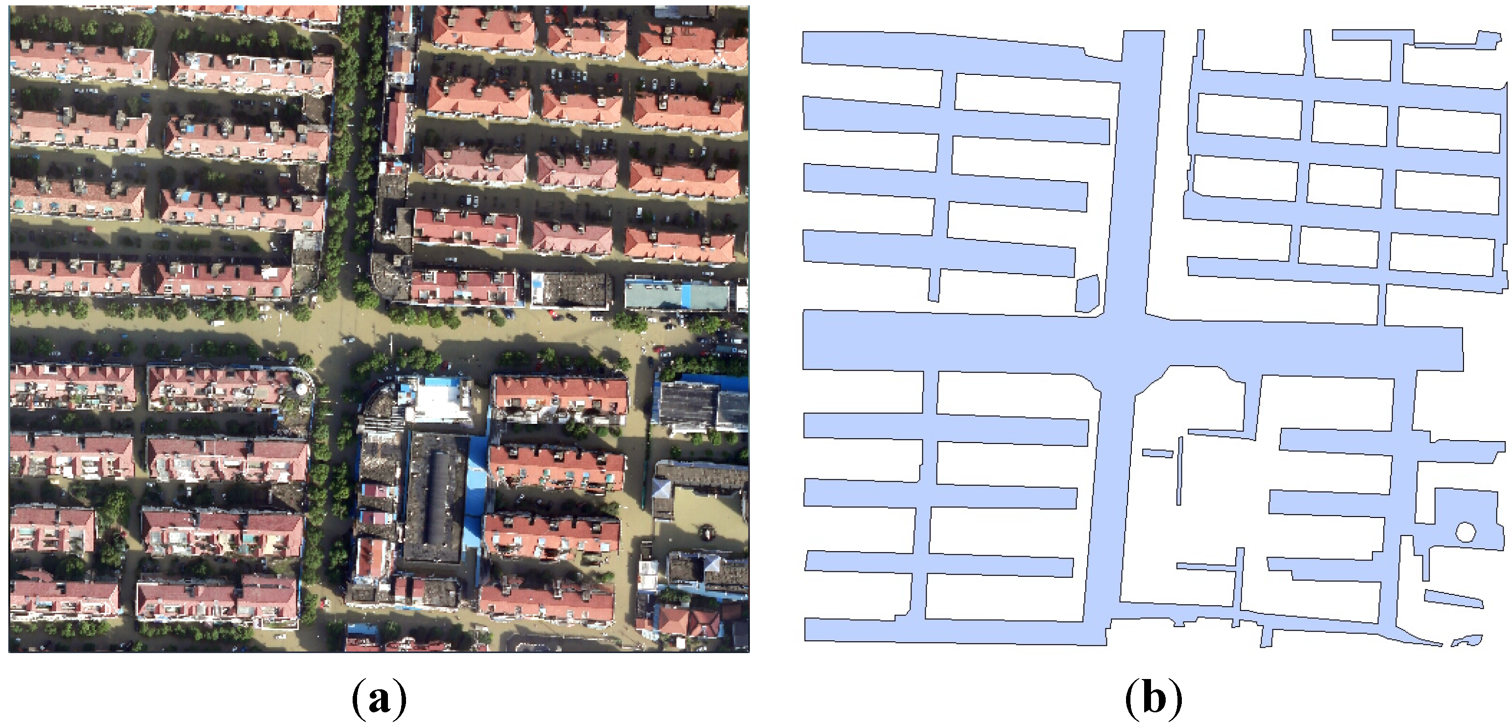
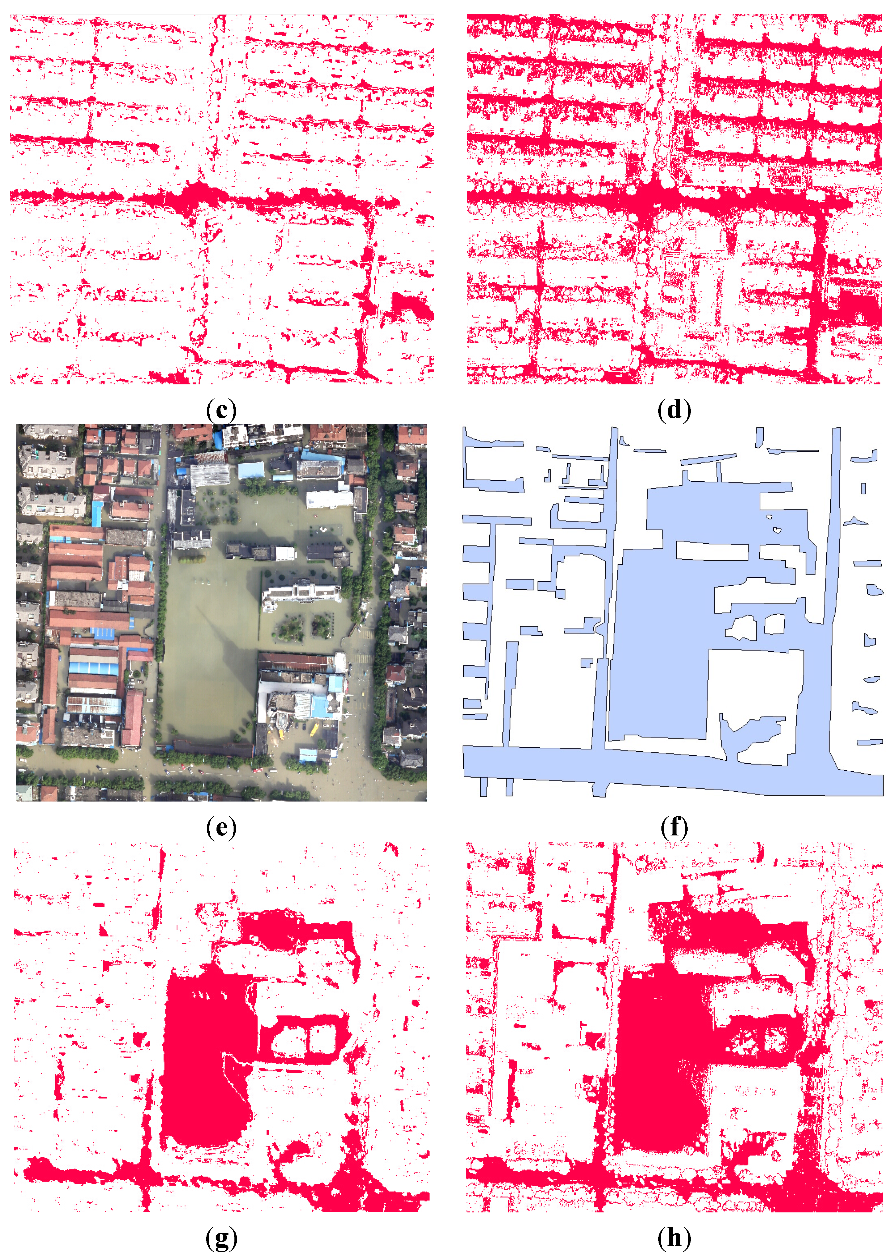
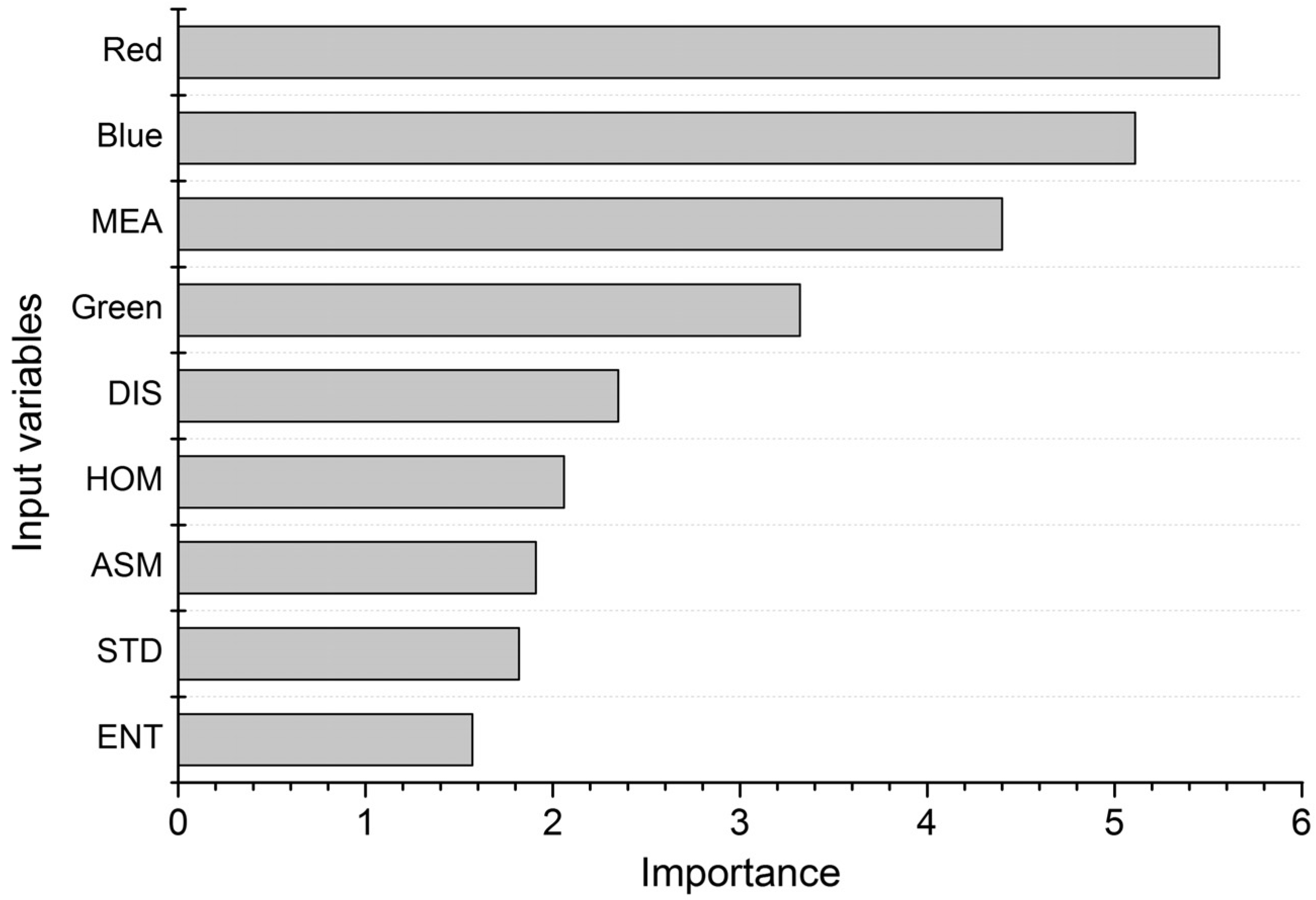
Flooding is a severe natural hazard, which poses a great threat to human life and property, especially in densely-populated urban areas. As one of the fastest developing fields in remote sensing applications, an unmanned aerial vehicle (UAV) can provide high-resolution data with a great potential for fast and accurate detection of inundated areas under complex urban landscapes. In this research, optical imagery was acquired by a mini-UAV to monitor the serious urban waterlogging in Yuyao, China. Texture features derived from gray-level co-occurrence matrix were included to increase the separability of different ground objects. A Random Forest classifier, consisting of 200 decision trees, was used to extract flooded areas in the spectral-textural feature space. Confusion matrix was used to assess the accuracy of the proposed method. Results indicated the following: (1) Random Forest showed good performance in urban flood mapping with an overall accuracy of 87.3% and a Kappa coefficient of 0.746; (2) the inclusion of texture features improved classification accuracy significantly; (3) Random Forest outperformed maximum likelihood and artificial neural network, and showed a similar performance to support vector machine. The results demonstrate that UAV can provide an ideal platform for urban flood monitoring and the proposed method shows great capability for the accurate extraction of inundated areas. View Full-Text
Keywords: UAV; flood mapping; urban landscape; random forest; texture analysis
▼ Figures
This is an open access article distributed under the Creative Commons Attribution License which permits unrestricted use, distribution, and reproduction in any medium, provided the original work is properly cited. (CC BY 4.0).
For further details log on website :
http://www.mdpi.com/2073-4441/7/4/1437


No comments:
Post a Comment