Remote Sens. 2011, 3(10), 2243-2262; doi:10.3390/rs3102243
Author
1
Remote Sensing and Geospatial Analysis Laboratory, School of Forest Resources, College of the Environment, University of Washington, Seattle, WA 98195, USA
2
Department of Geosciences and Natural Resources, College of Arts and Sciences, Western Carolina University, Cullowhee, NC 28723, USA
*
Author to whom correspondence should be addressed.
Received: 11 August 2011 / Revised: 14 October 2011 / Accepted: 14 October 2011 / Published: 21 October 2011
(This article belongs to the Special Issue Urban Remote Sensing)
Abstract
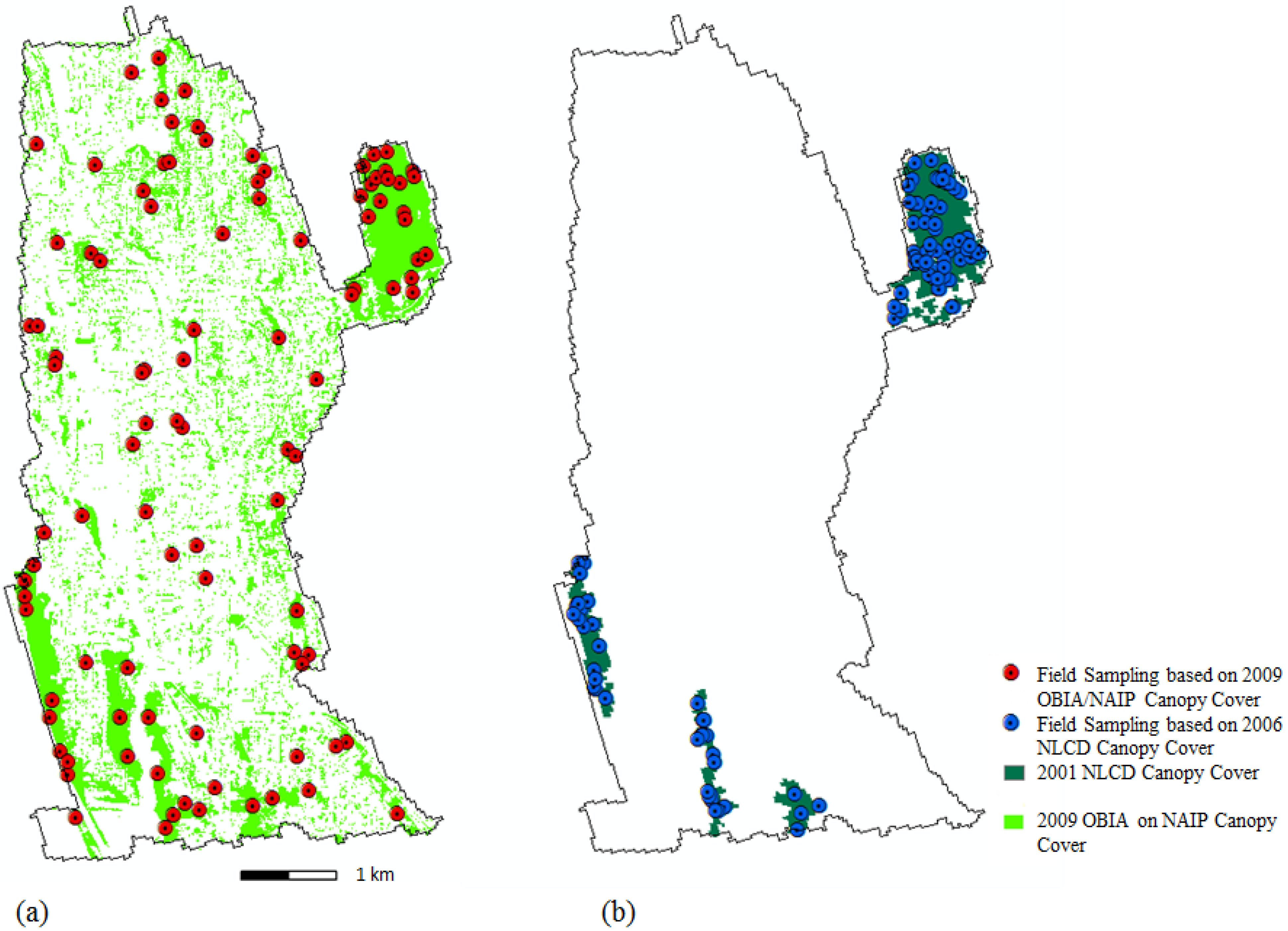
Urban forest ecosystems provide a range of social and ecological services, but due to the heterogeneity of these canopies their spatial extent is difficult to quantify and monitor. Traditional per-pixel classification methods have been used to map urban canopies, however, such techniques are not generally appropriate for assessing these highly variable landscapes. Landsat imagery has historically been used for per-pixel driven land use/land cover (LULC) classifications, but the spatial resolution limits our ability to map small urban features. In such cases, hyperspatial resolution imagery such as aerial or satellite imagery with a resolution of 1 meter or below is preferred. Object-based image analysis (OBIA) allows for use of additional variables such as texture, shape, context, and other cognitive information provided by the image analyst to segment and classify image features, and thus, improve classifications. As part of this research we created LULC classifications for a pilot study area in Seattle, WA, USA, using OBIA techniques and freely available public aerial photography. We analyzed the differences in accuracies which can be achieved with OBIA using multispectral and true-color imagery. We also compared our results to a satellite based OBIA LULC and discussed the implications of per-pixel driven vs. OBIA-driven field sampling campaigns. We demonstrated that the OBIA approach can generate good and repeatable LULC classifications suitable for tree cover assessment in urban areas. Another important finding is that spectral content appeared to be more important than spatial detail of hyperspatial data when it comes to an OBIA-driven LULC. View Full-Text
Keywords: urban forest; object-based image analysis (OBIA); segmentation; tree canopies; tree cover assessment; hyperspatial; public domain data
This is an open access article distributed under the Creative Commons Attribution License (CC BY 3.0).
For further details log on website :
http://www.mdpi.com/2072-4292/3/10/2243?utm_source=TrendMD&utm_medium=cpc&utm_campaign=Remote_Sens_TrendMD_0


No comments:
Post a Comment