1
State Key Laboratory of Remote Sensing Science, Institute of Remote Sensing and Digital Earth Chinese Academy of Sciences, No.20, Datun Road, Chaoyang District, 100101 Beijing, China
2
Zhejiang-CAS Application Center for Geoinformatics, No.568, Jinyang East Road, 314100 Jiashan, China
*
Author to whom correspondence should be addressed.
Academic Editors: Guy J-P. Schumann and Prasad S. Thenkabail
Received: 8 July 2015 / Accepted: 14 September 2015 / Published: 23 September 2015
(This article belongs to the Special Issue Remote Sensing in Flood Monitoring and Management)
Abstract
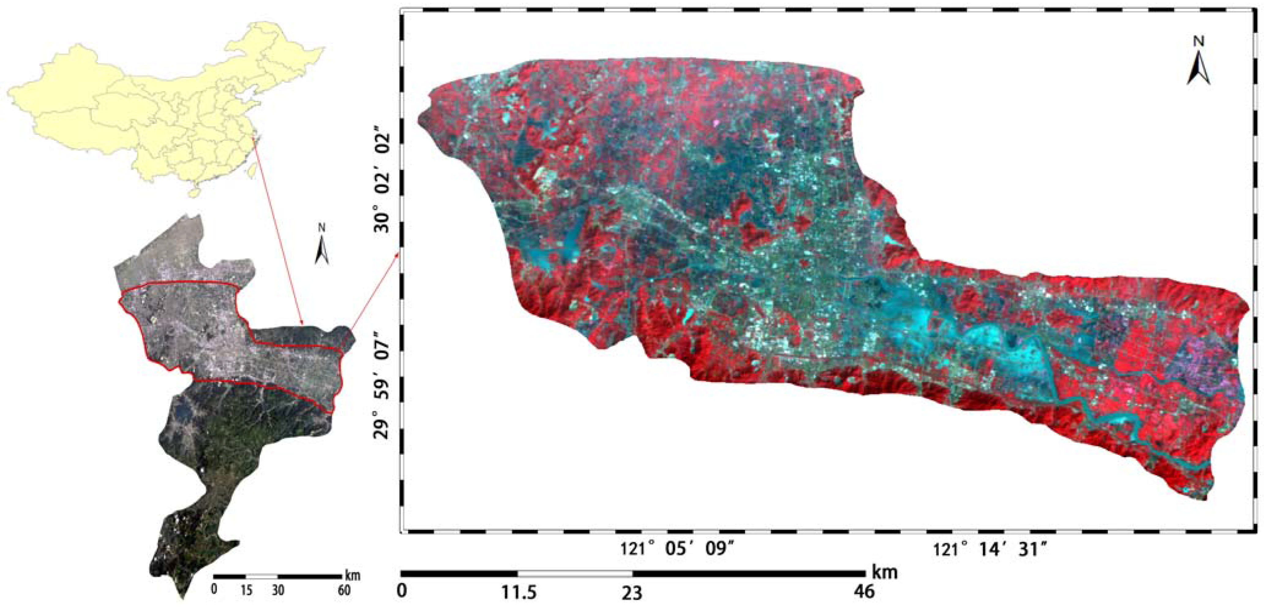
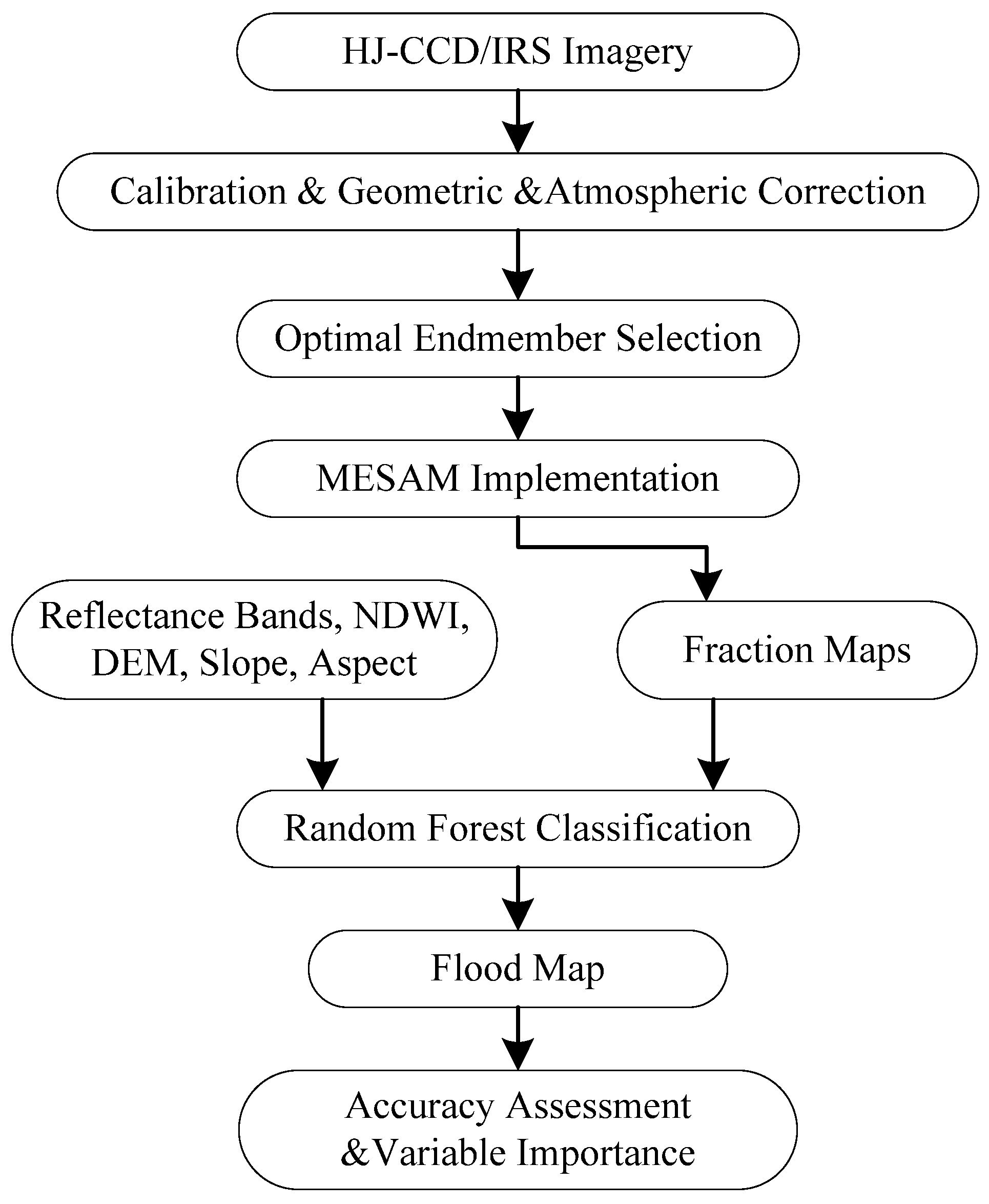
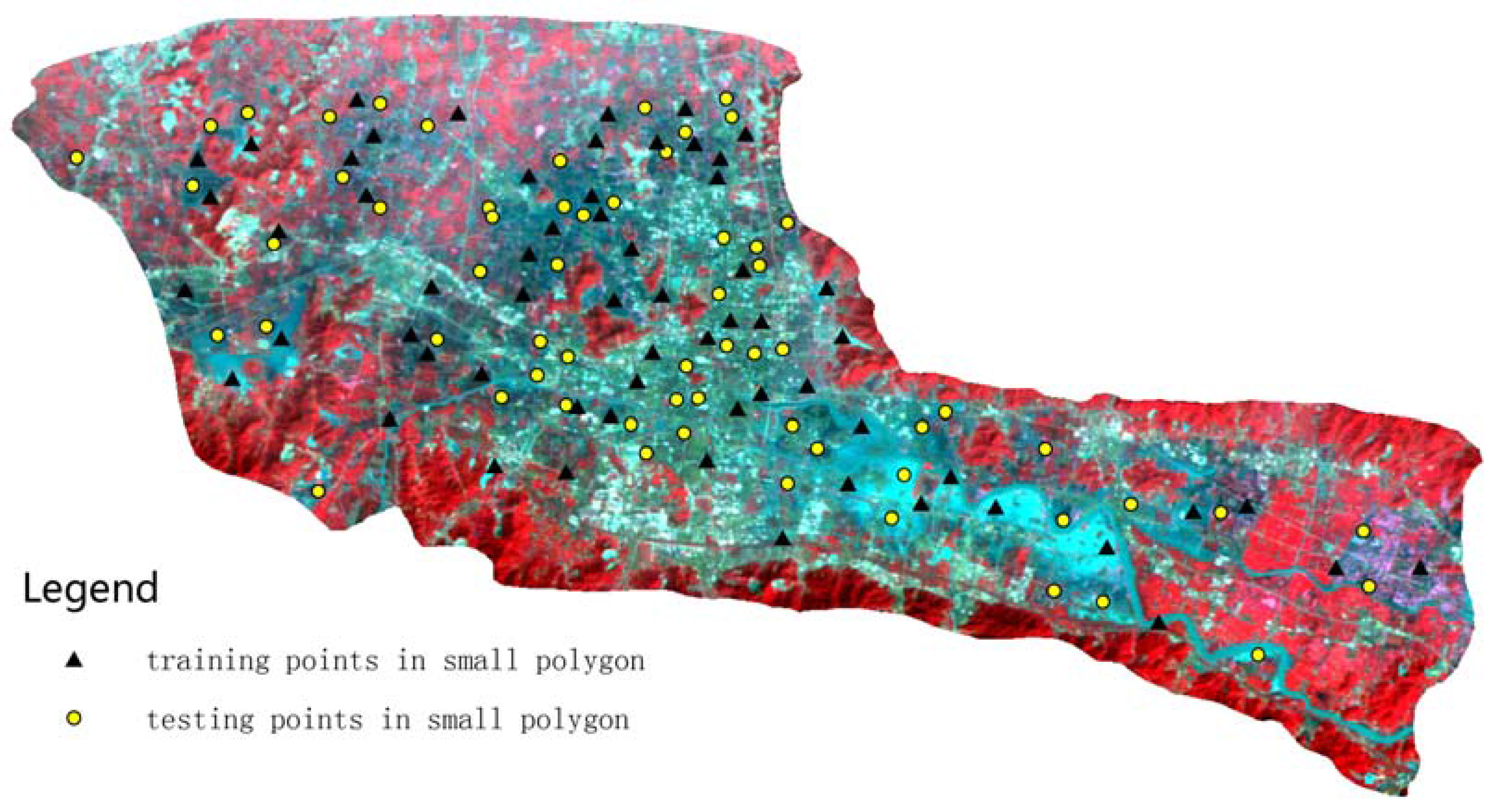
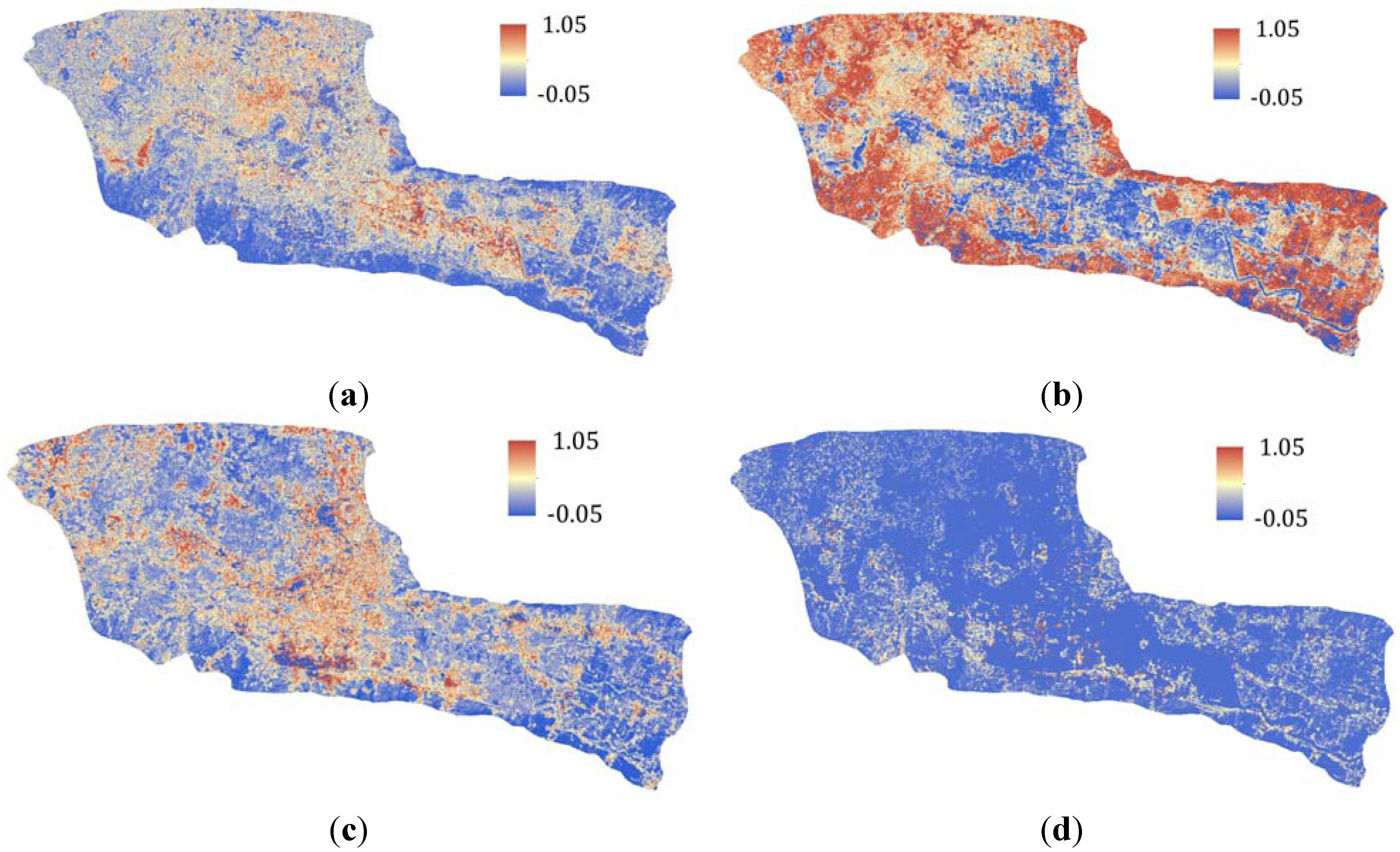
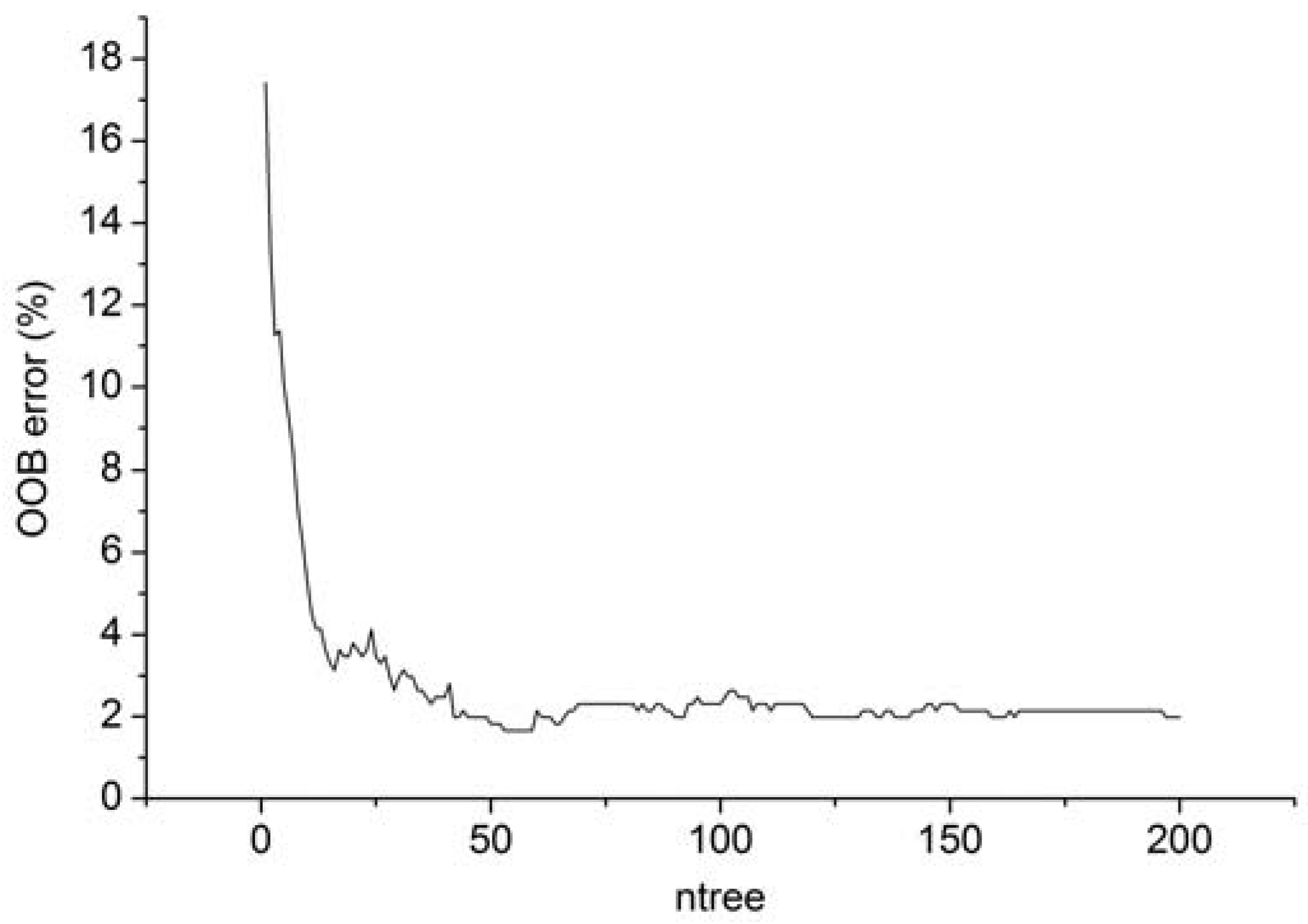
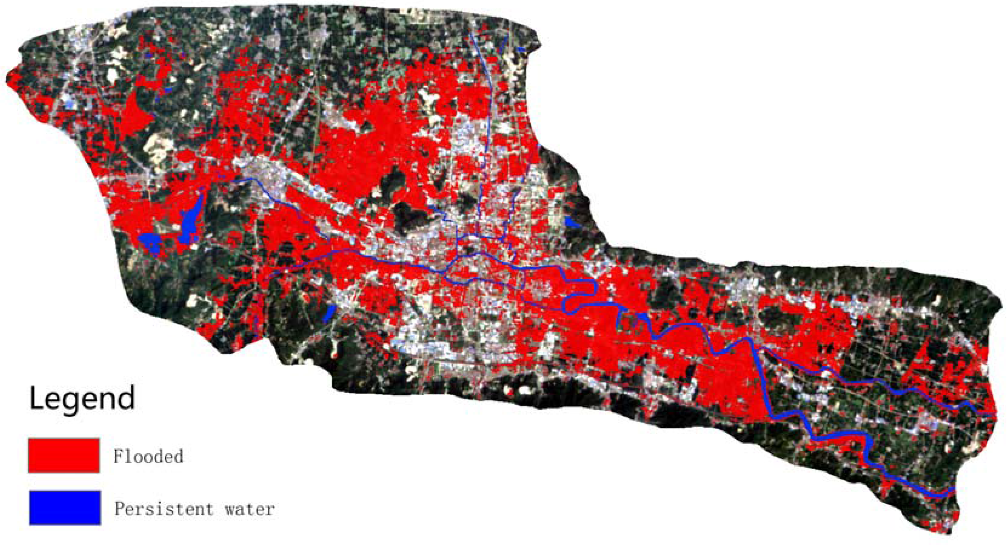
Remote sensing is recognized as a valuable tool for flood mapping due to its synoptic view and continuous coverage of the flooding event. This paper proposed a hybrid approach based on multiple endmember spectral analysis (MESMA) and Random Forest classifier to extract inundated areas in Yuyao City in China using medium resolution optical imagery. MESMA was adopted to tackle the mixing pixel problem induced by medium resolution data. Specifically, 35 optimal endmembers were selected to construct a total of 3111 models in the MESMA procedure to derive accurate fraction information. A multi-dimensional feature space was constructed including the normalized difference water index (NDWI), topographical parameters of height, slope, and aspect together with the fraction maps. A Random Forest classifier consisting of 200 decision trees was adopted to classify the post-flood image based on the above multi-features. Experimental results indicated that the proposed method can extract the inundated areas precisely with a classification accuracy of 94% and a Kappa index of 0.88. The inclusion of fraction information can help improve the mapping accuracy with an increase of 2.5%. Moreover, the proposed method also outperformed the maximum likelihood classifier and the NDWI thresholding method. This research provided a useful reference for flood mapping using medium resolution optical remote sensing imagery. View Full-Text
This is an open access article distributed under the Creative Commons Attribution License which permits unrestricted use, distribution, and reproduction in any medium, provided the original work is properly cited. (CC BY 4.0).
For further details log on website :
http://www.mdpi.com/2072-4292/7/9/12539


No comments:
Post a Comment