Department of Environmental Sciences, Policy, and Management, College of Natural Resources, University of California at Berkeley, Berkeley, CA 94720, USA
*
Author to whom correspondence should be addressed.
Received: 20 September 2011 / Revised: 9 November 2011 / Accepted: 10 November 2011 / Published: 16 November 2011
(This article belongs to the Special Issue Object-Based Image Analysis)
Abstract
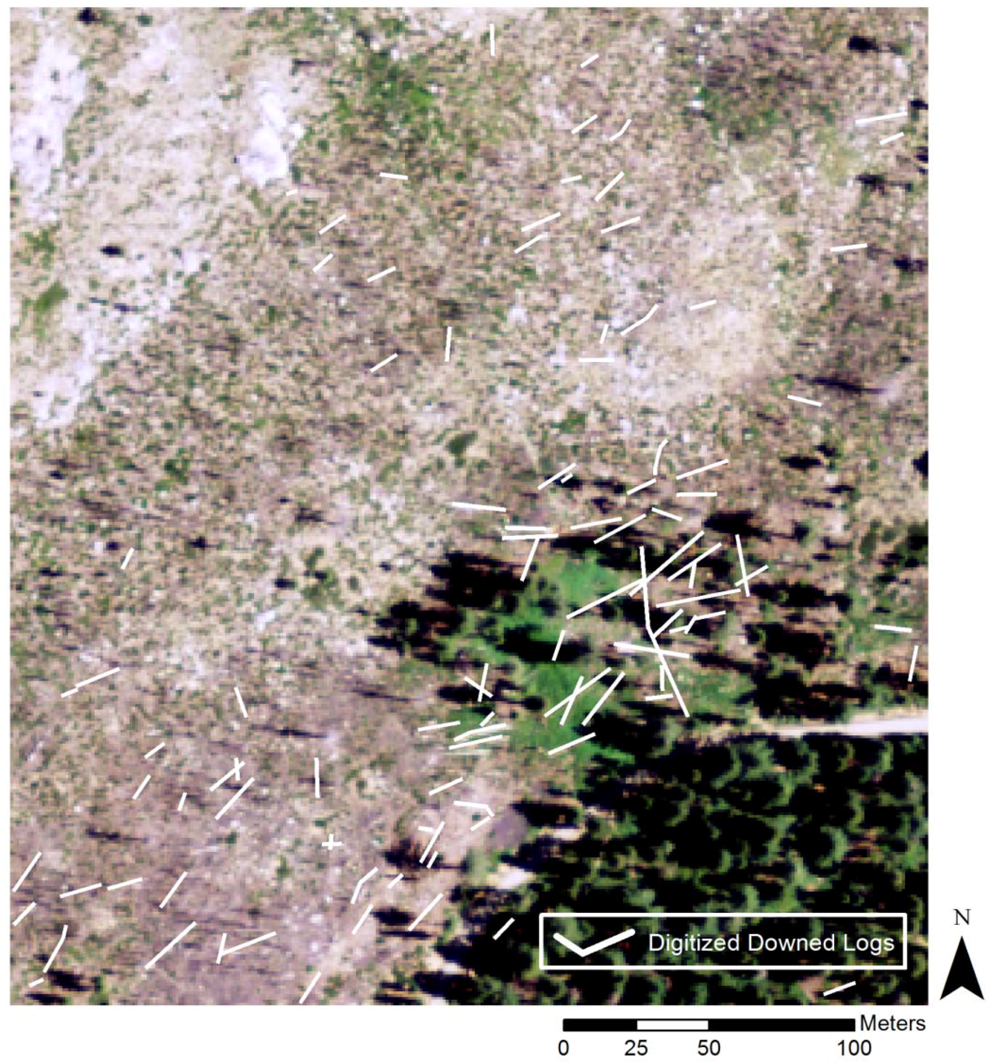
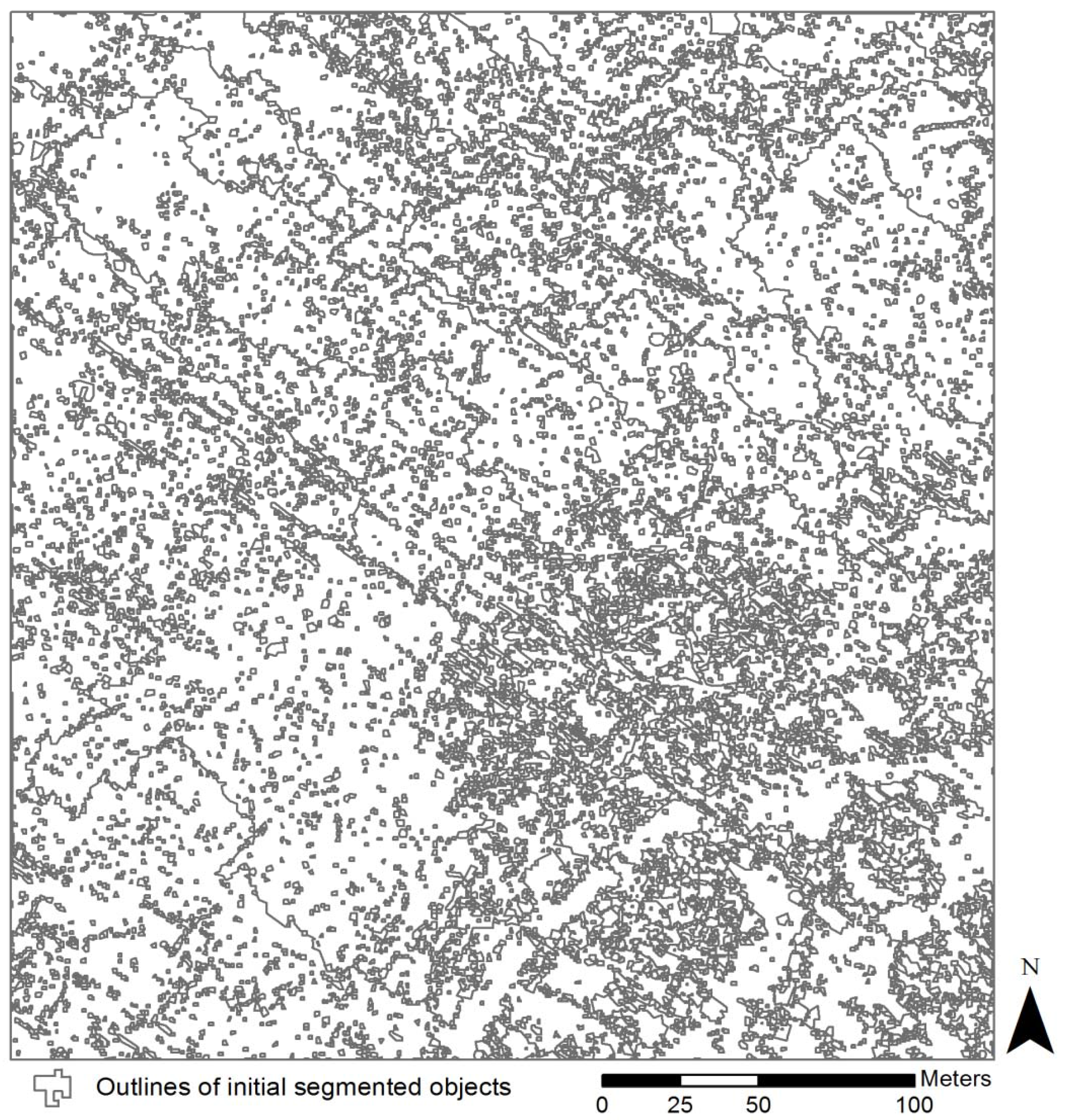
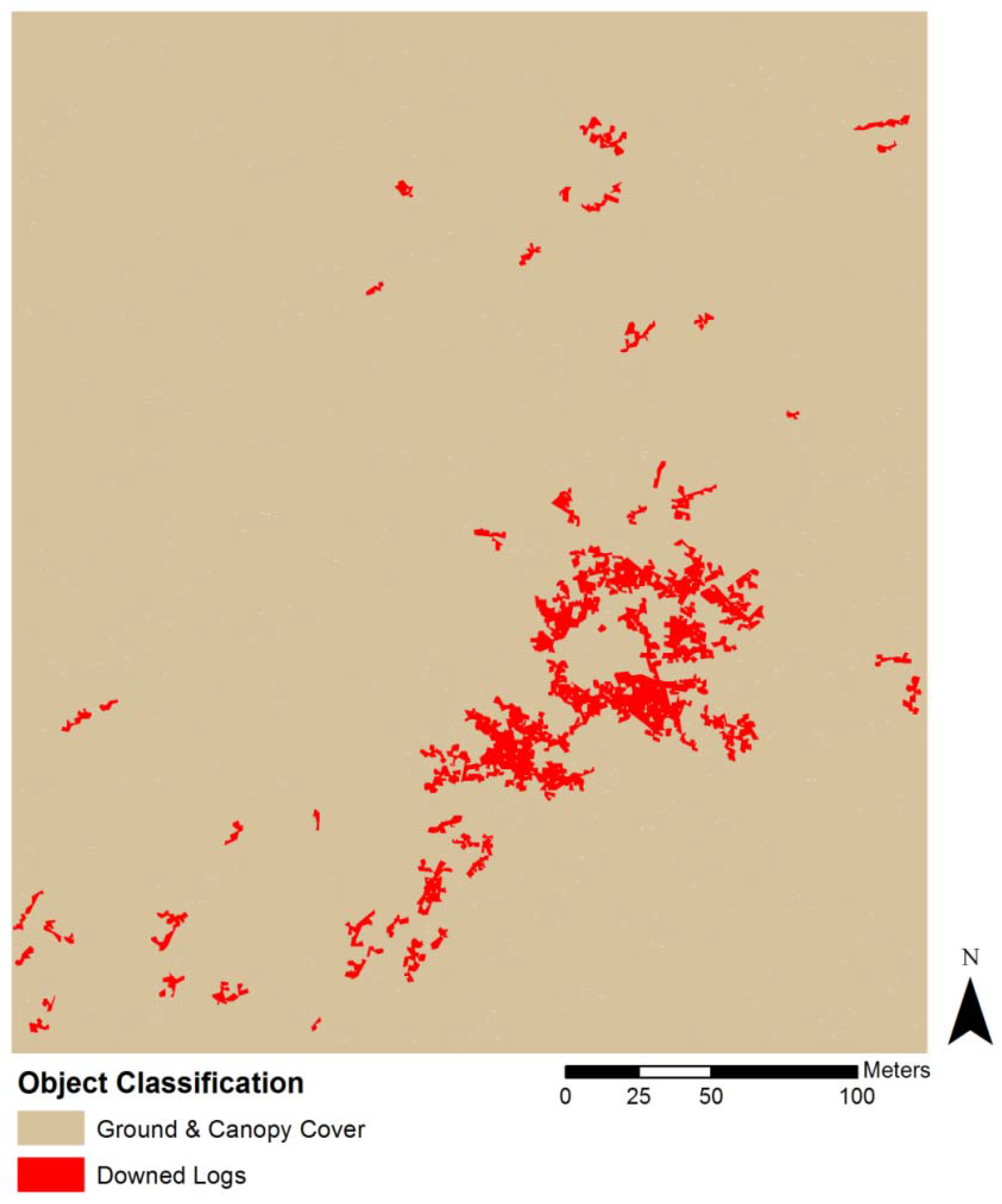
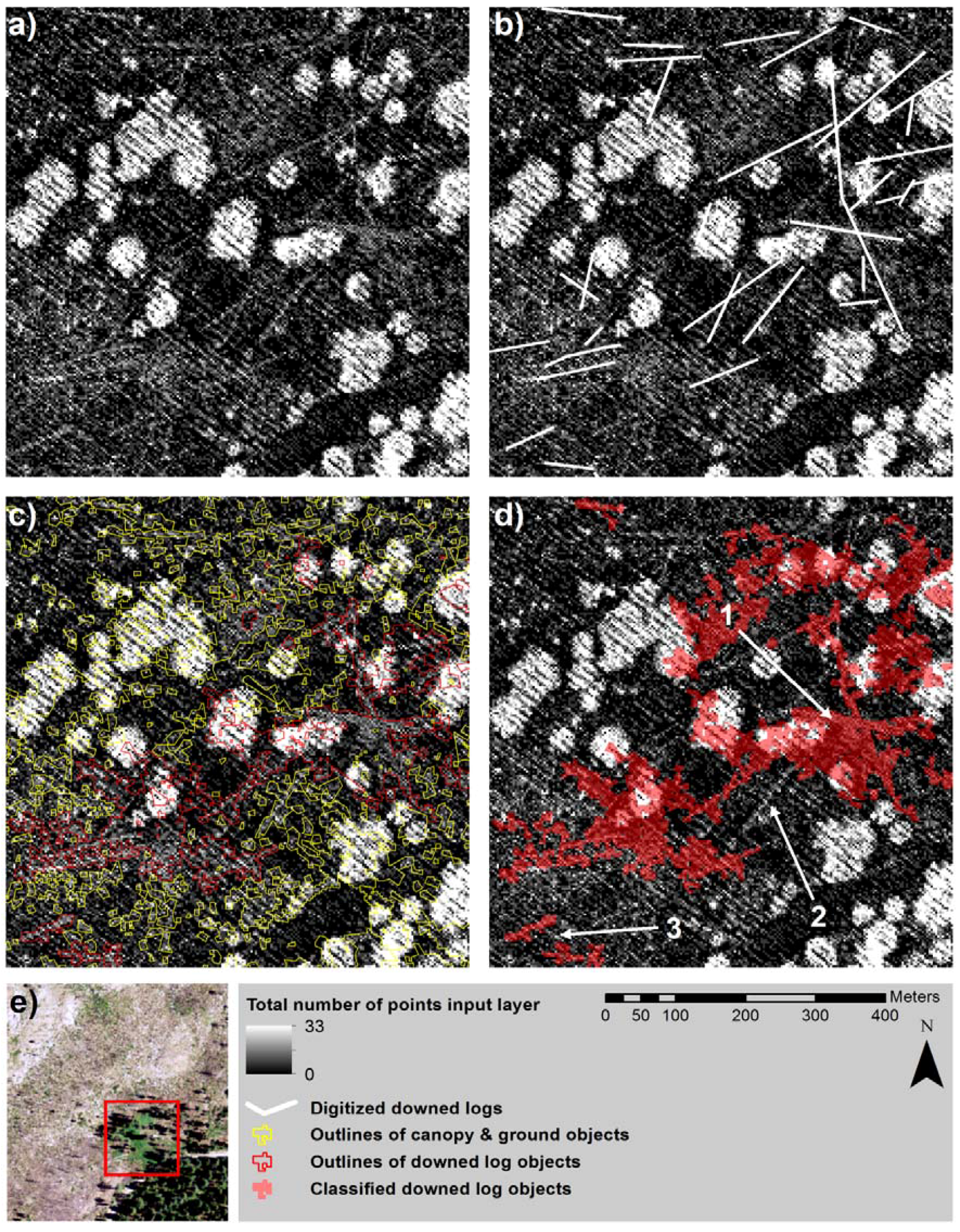
Downed logs on the forest floor provide habitat for species, fuel for forest fires, and function as a key component of forest nutrient cycling and carbon storage. Ground-based field surveying is a conventional method for mapping and characterizing downed logs but is limited. In addition, optical remote sensing methods have not been able to map these ground targets due to the lack of optical sensor penetrability into the forest canopy and limited sensor spectral and spatial resolutions. Lidar (light detection and ranging) sensors have become a more viable and common data source in forest science for detailed mapping of forest structure. This study evaluates the utility of discrete, multiple return airborne lidar-derived data for image object segmentation and classification of downed logs in a disturbed forested landscape and the efficiency of rule-based object-based image analysis (OBIA) and classification algorithms. Downed log objects were successfully delineated and classified from lidar derived metrics using an OBIA framework. 73% of digitized downed logs were completely or partially classified correctly. Over classification occurred in areas with large numbers of logs clustered in close proximity to one another and in areas with vegetation and tree canopy. The OBIA methods were found to be effective but inefficient in terms of automation and analyst’s time in the delineation and classification of downed logs in the lidar data. View Full-Text
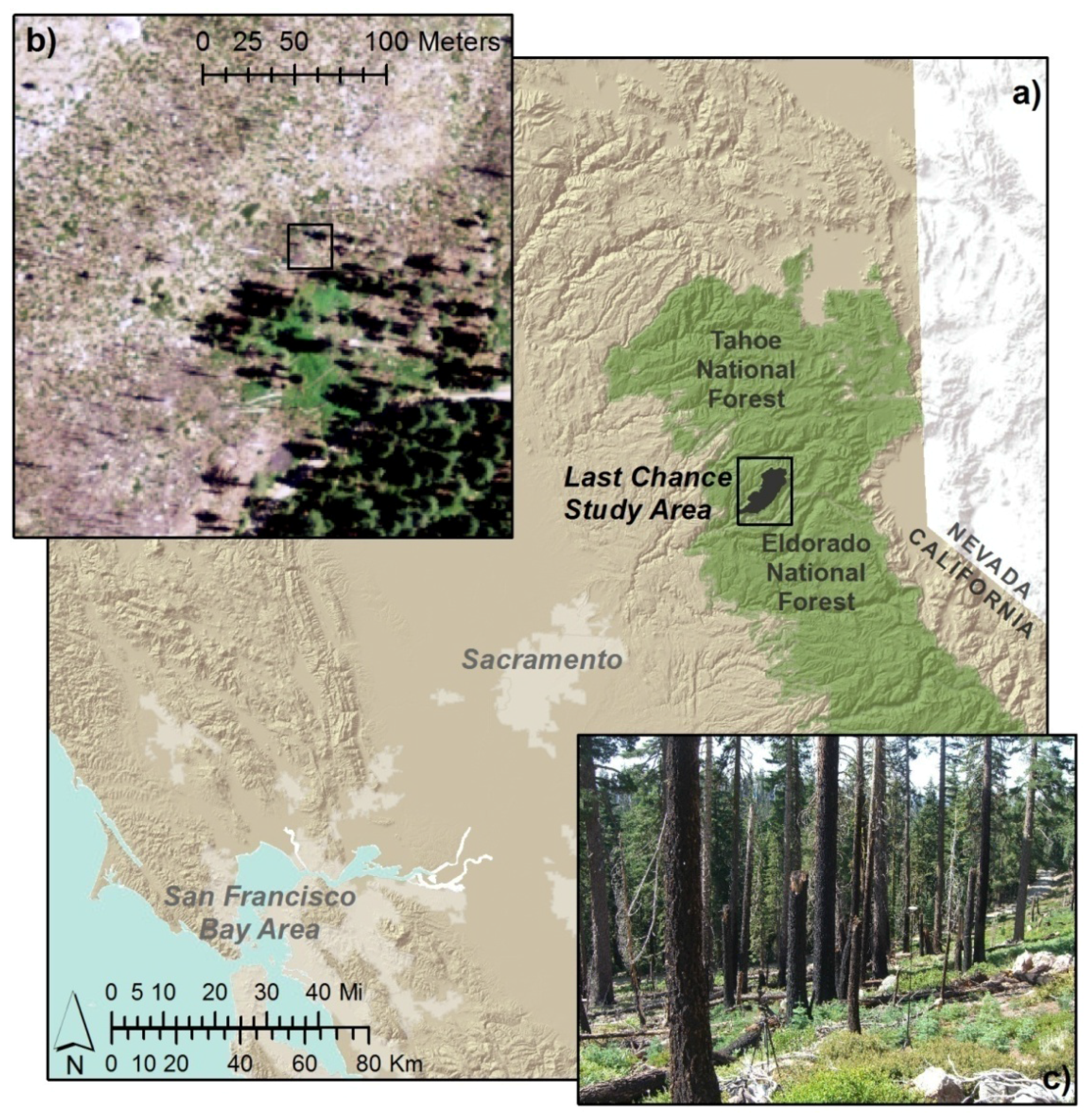
Figure 1
This is an open access article distributed under the Creative Commons Attribution License (CC BY 3.0).
For further details log on website :
http://www.mdpi.com/2072-4292/3/11/2420?utm_source=TrendMD&utm_medium=cpc&utm_campaign=Remote_Sens_TrendMD_0


No comments:
Post a Comment