1
CSIRO Land & Water, PMB 1, Aspendale VIC 3195, Australia
2
CSIRO Land & Water, Clunies Ross St., Black Mountain ACT 2601, Australia
*
Author to whom correspondence should be addressed.
Academic Editors: Karsten Grunewald, Olaf Bastian and Marc A. Rosen
Received: 1 April 2016 / Revised: 31 July 2016 / Accepted: 6 August 2016 / Published: 11 August 2016
(This article belongs to the Special Issue Maintaining Ecosystem Services to Support Urban Needs)
Abstract
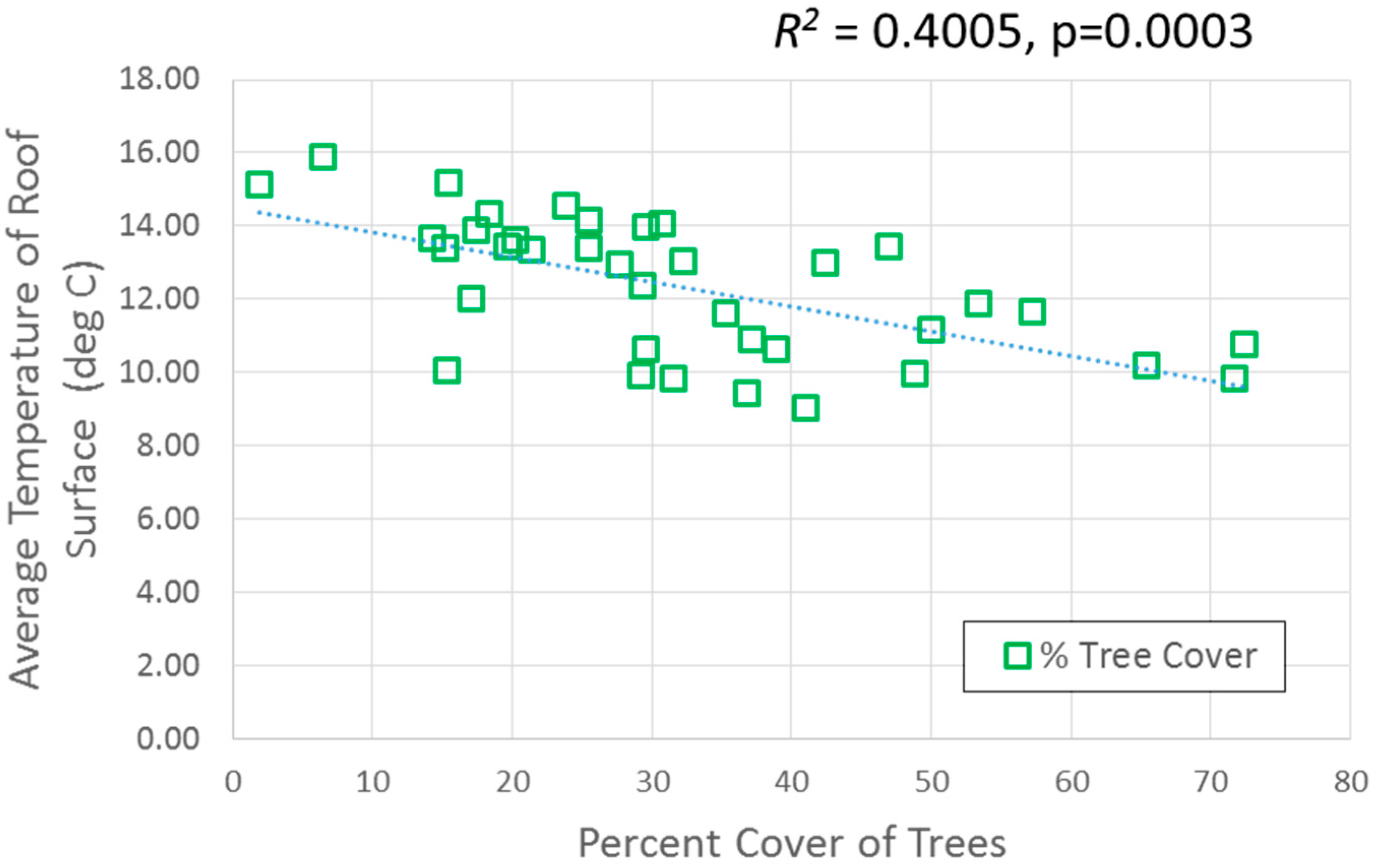
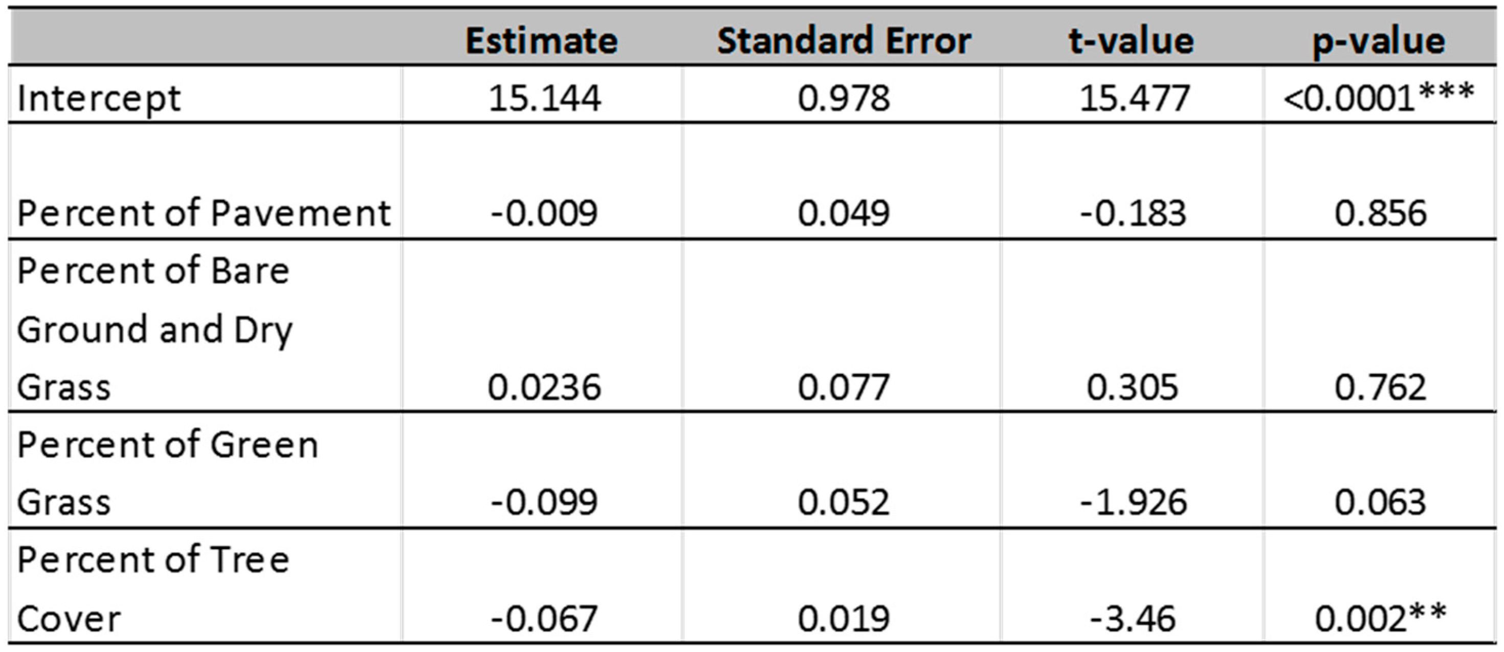
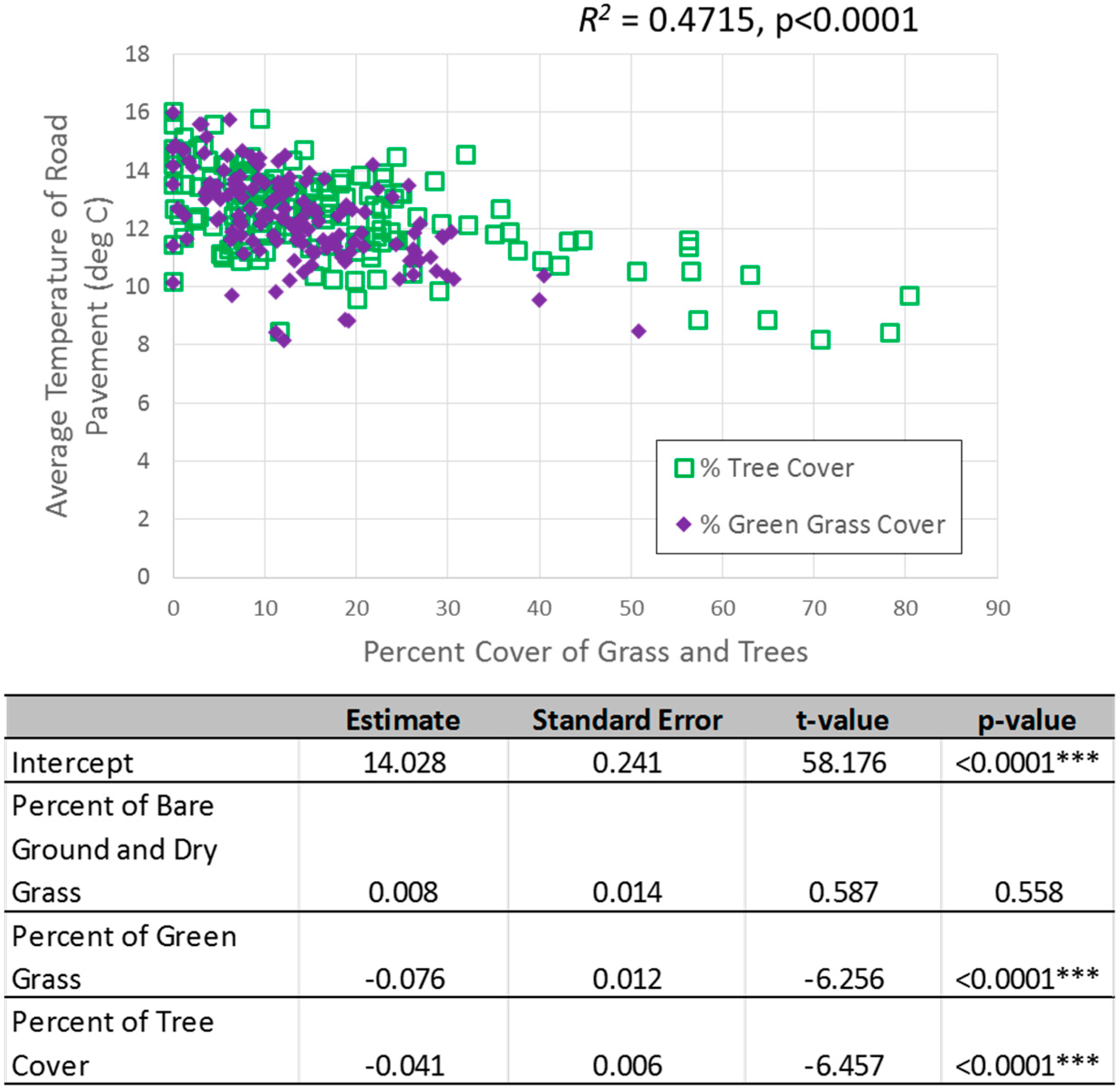
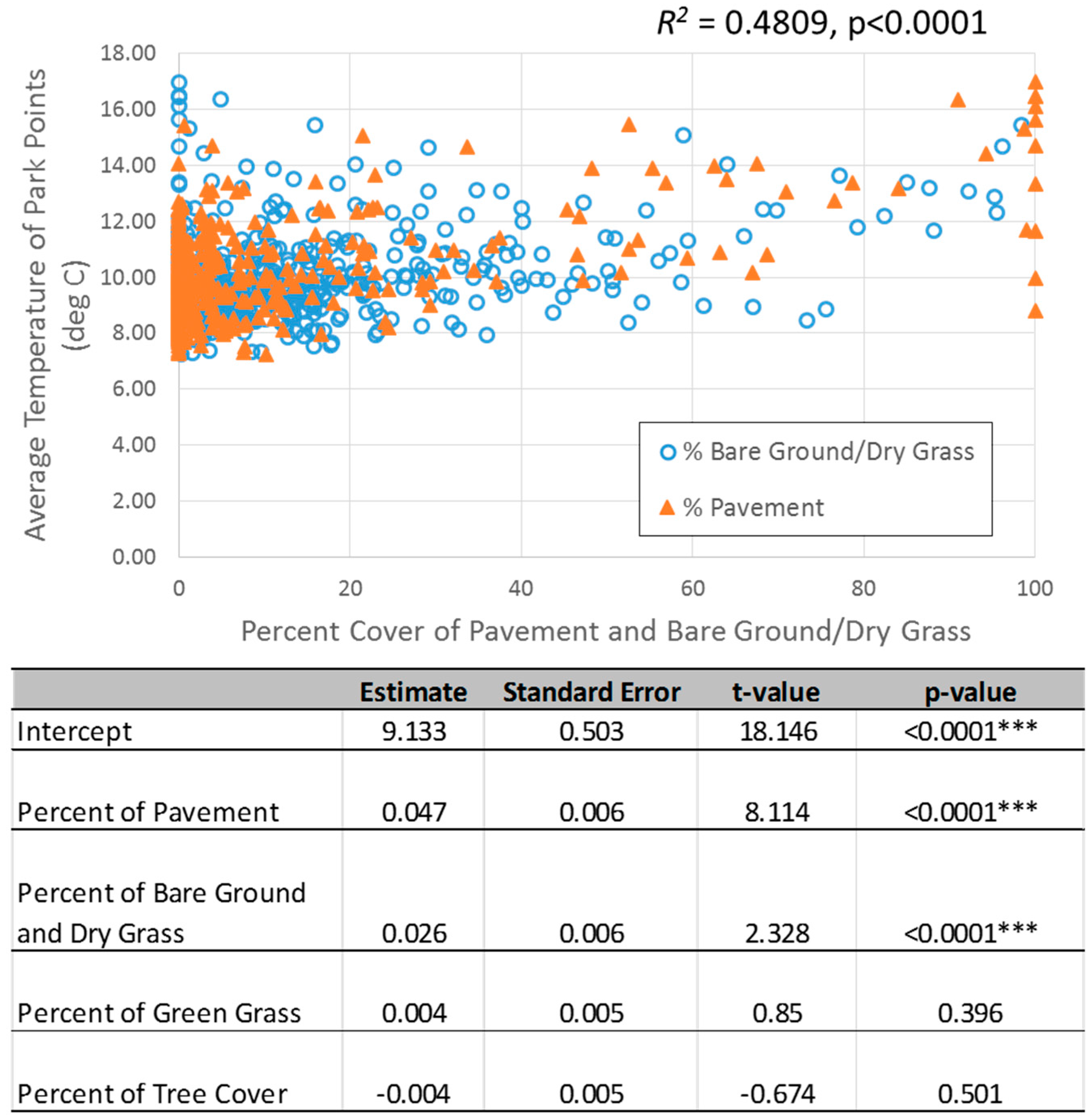
In many parts of the world, urban planning has a renewed focus on addressing the multiple challenges associated with population growth and climate change. Focused on local needs and priorities, these planning processes are raising tensions between more compact and dense urban form to reduce energy use and associated emissions and the provision of urban green infrastructure for ecosystem services and climate adaptation. In this study, we investigated the spatial distribution of green infrastructure at the neighbourhood scale in Sydney, Australia and examined how a mix of landscape types (pavement, bare soil/dry grass, green grass, and tree cover) affect temperature variation in three important locations for urban residents—around the home, in the roads and footpaths where people walk, and in parkland areas. Considering that residential and parkland areas contribute to the majority of green space in Sydney, it is important to understand how changes in landscape mix within these three neighbourhood areas will affect local temperature for urban residents. For residential houses, it was found that the percentage of tree canopy cover around the house had a significant negative relationship (p = 0.002) with surface temperatures of rooftops where greater tree cover led to lower rooftop temperatures. In streetscapes, both the percentage of tree cover (p < 0.0001) and the percentage of green grass (p < 0.0001) within the road segment had a significant negative relationship with the surface temperature of the road pavement. In the parks, the percentage of pavement (p < 0.0001) and the percentage of bare soil/dry grass (p < 0.0001) showed a significantly positive trend with land surface temperatures where greater land cover in the form of pavement and bare soil/dry grass led to higher temperatures. Collectively, these findings highlight the importance of promoting or reducing certain landscape covers depending on the land use type in order to maximise the cooling potential of green infrastructure. View Full-Text
Keywords: urban planning; land surface temperature; urban trees; remote sensing; climate change adaptation; urban cooling
▼ Figures
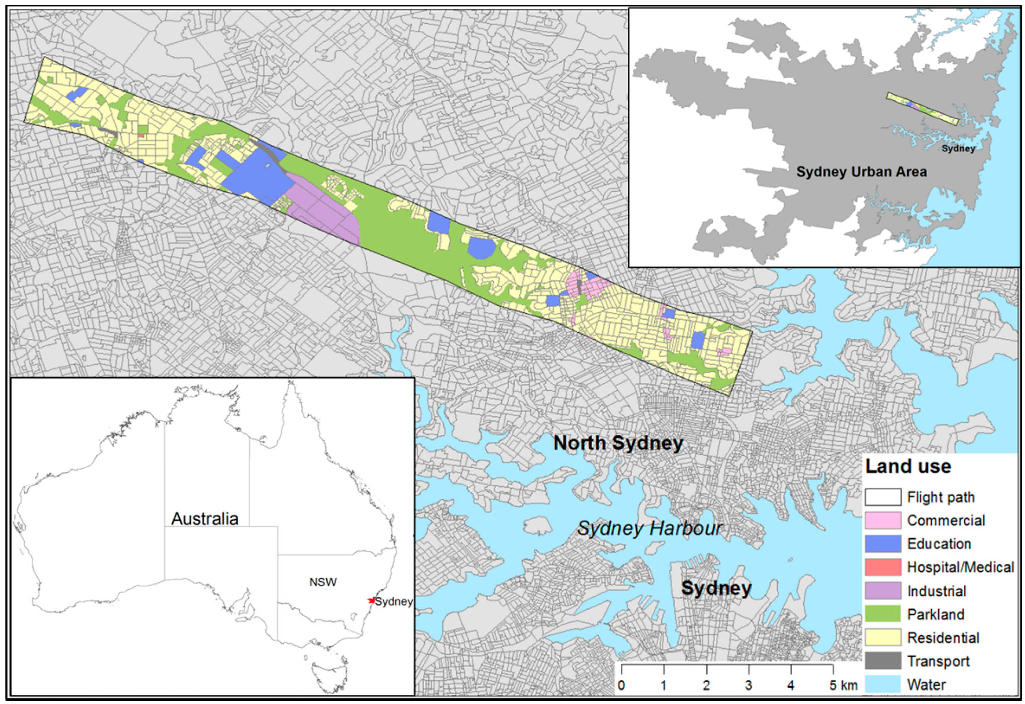
Figure 1
This is an open access article distributed under the Creative Commons Attribution License which permits unrestricted use, distribution, and reproduction in any medium, provided the original work is properly cited. (CC BY 4.0).
For further details log on website :
http://www.mdpi.com/2071-1050/8/8/788


No comments:
Post a Comment