Blog List

Friday, 10 March 2017

Urban Green Infrastructure Impacts on Climate Regulation Services in Sydney, Australia

Sustainability 20168(8), 788; doi:10.3390/su8080788

Author 

1
CSIRO Land & Water, PMB 1, Aspendale VIC 3195, Australia
2
CSIRO Land & Water, Clunies Ross St., Black Mountain ACT 2601, Australia
*
Author to whom correspondence should be addressed. 
Academic Editors: Karsten Grunewald, Olaf Bastian and Marc A. Rosen
Received: 1 April 2016 / Revised: 31 July 2016 / Accepted: 6 August 2016 / Published: 11 August 2016
(This article belongs to the Special Issue Maintaining Ecosystem Services to Support Urban Needs)
View Full-Text   |     Download PDF [3326 KB, uploaded 11 August 2016]   |    
 

Abstract 

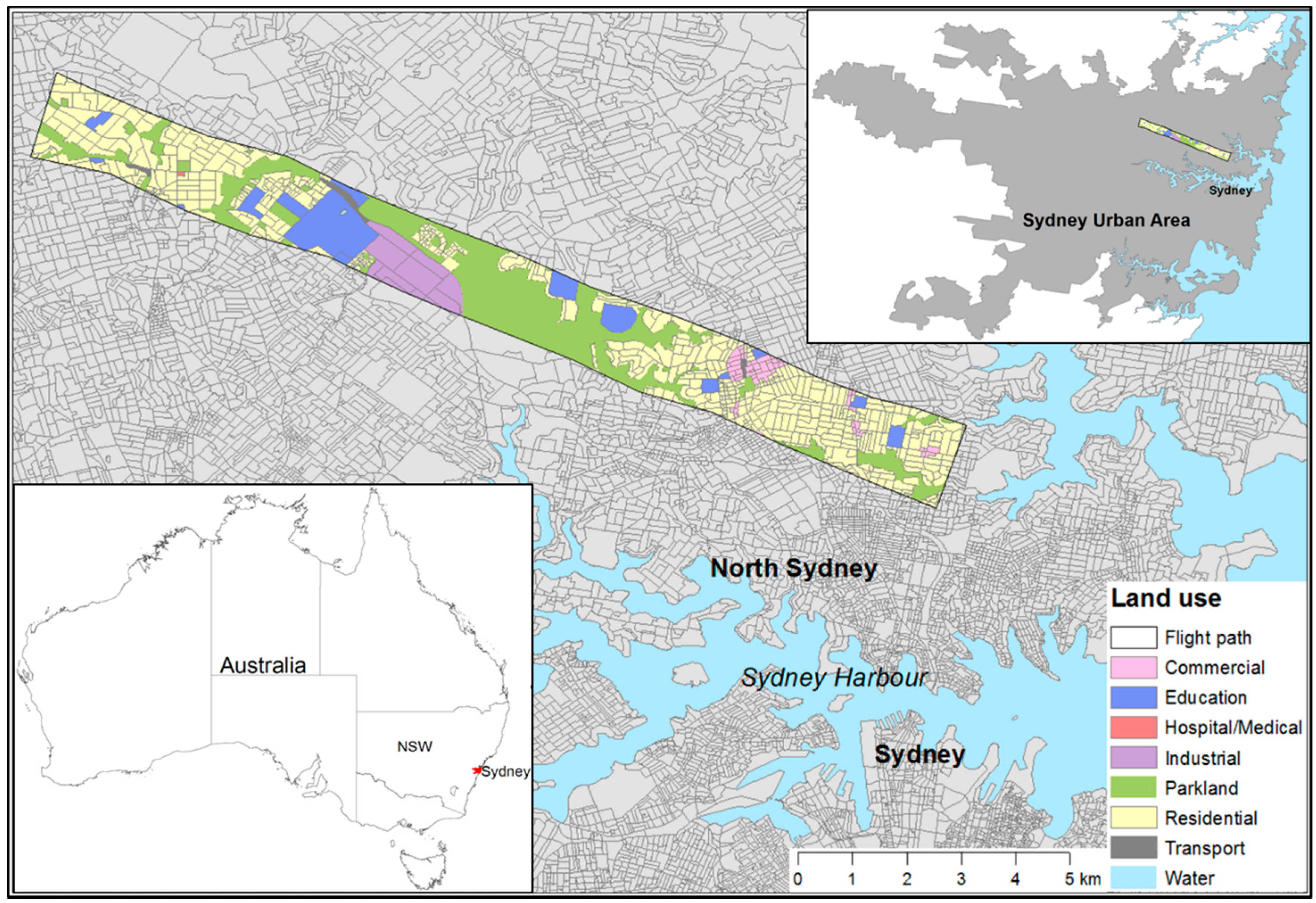
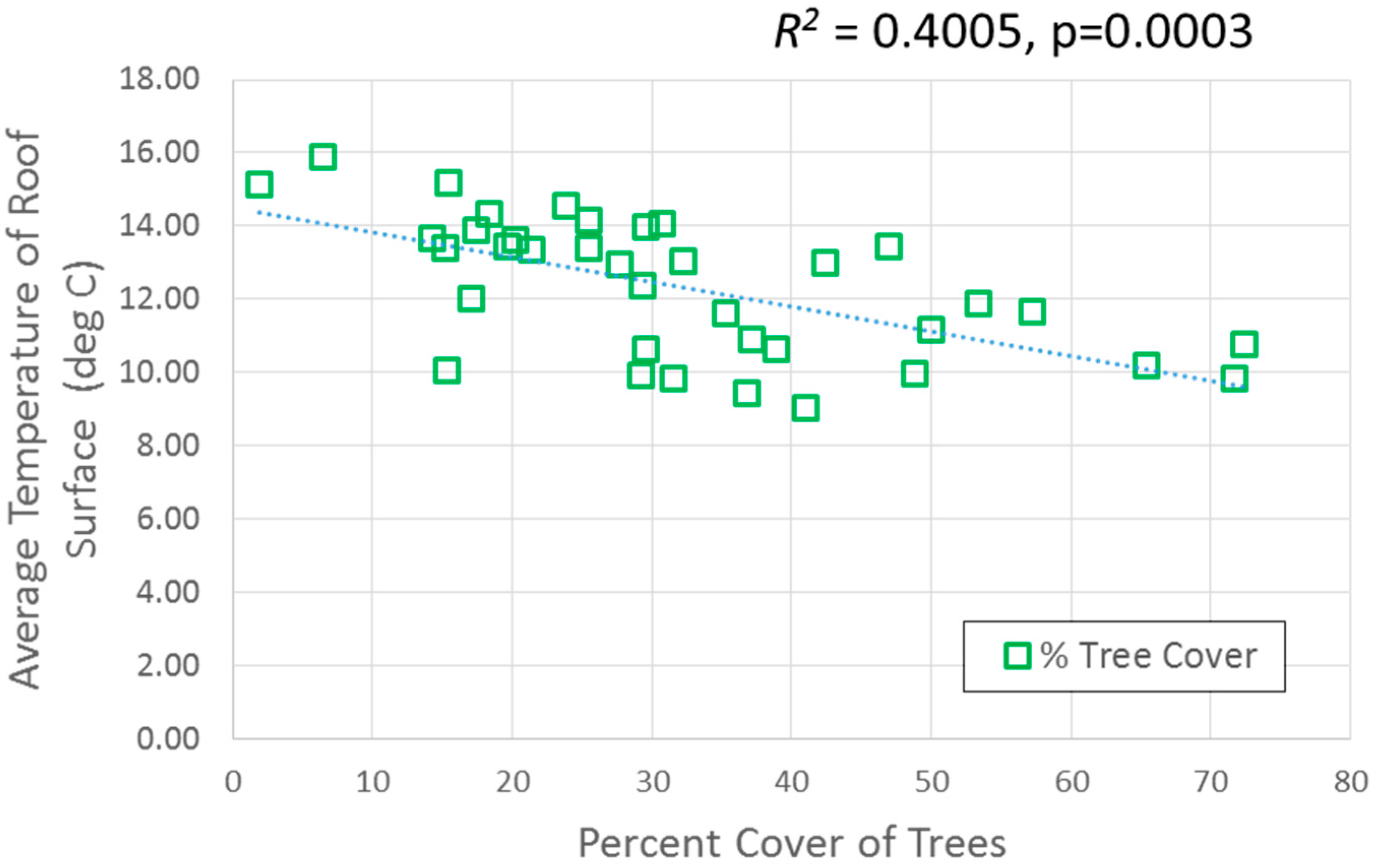
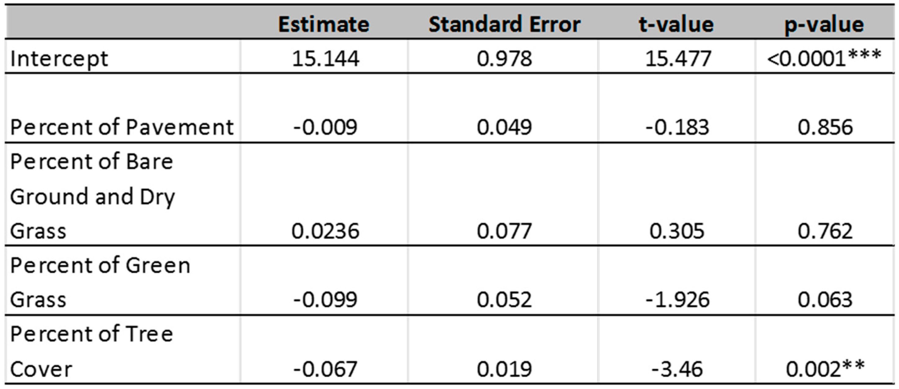
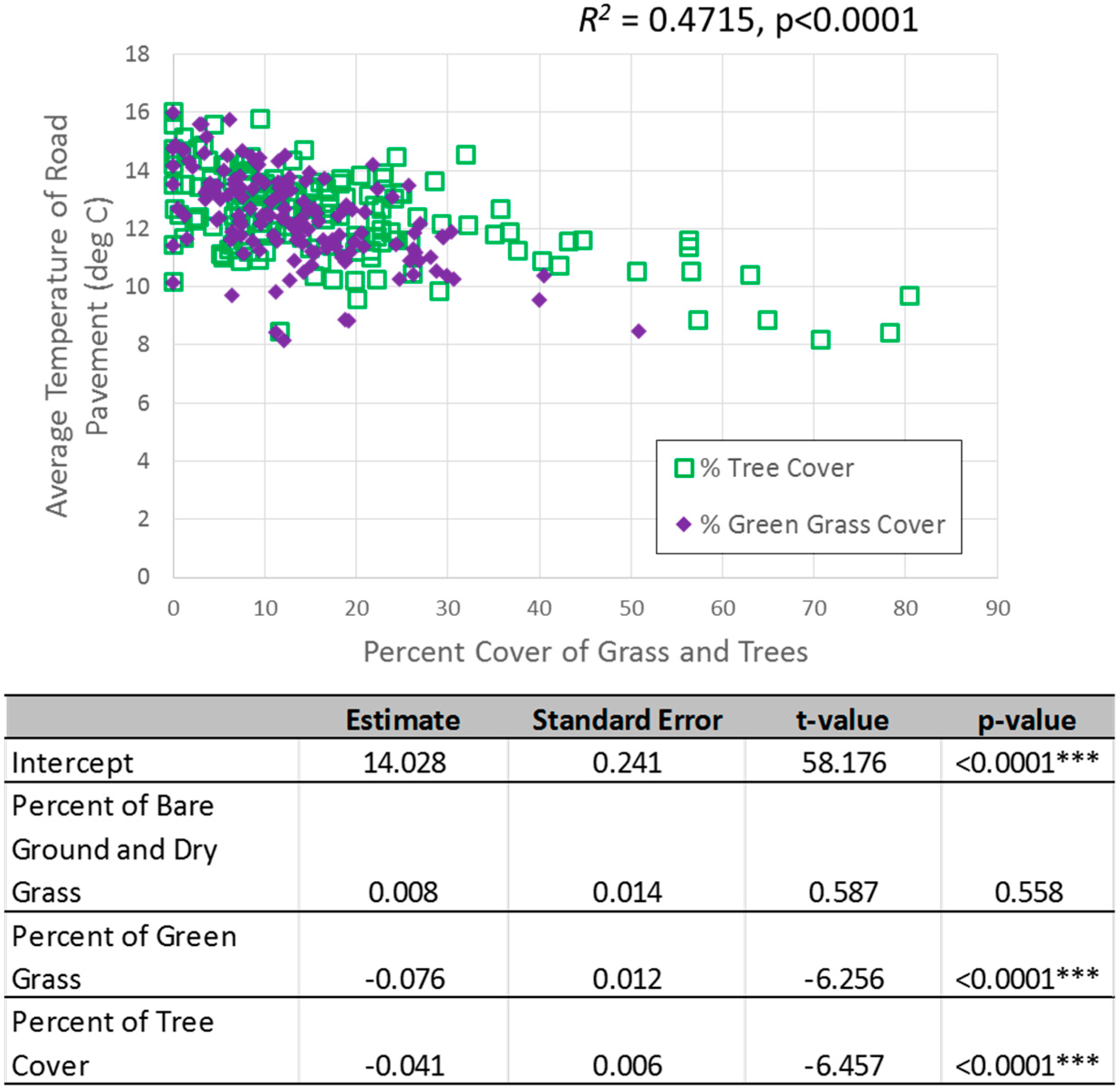
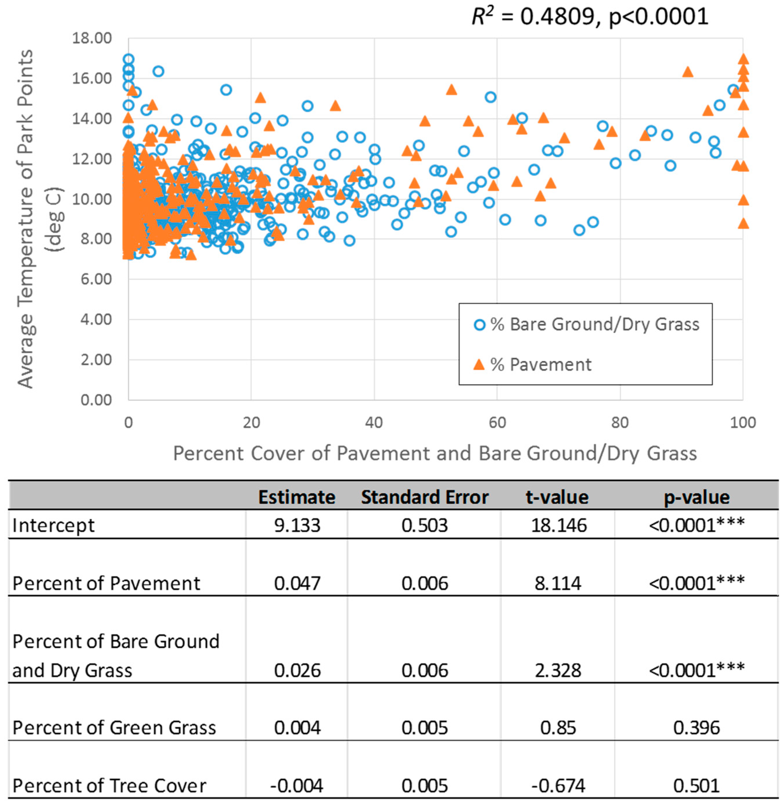
In many parts of the world, urban planning has a renewed focus on addressing the multiple challenges associated with population growth and climate change. Focused on local needs and priorities, these planning processes are raising tensions between more compact and dense urban form to reduce energy use and associated emissions and the provision of urban green infrastructure for ecosystem services and climate adaptation. In this study, we investigated the spatial distribution of green infrastructure at the neighbourhood scale in Sydney, Australia and examined how a mix of landscape types (pavement, bare soil/dry grass, green grass, and tree cover) affect temperature variation in three important locations for urban residents—around the home, in the roads and footpaths where people walk, and in parkland areas. Considering that residential and parkland areas contribute to the majority of green space in Sydney, it is important to understand how changes in landscape mix within these three neighbourhood areas will affect local temperature for urban residents. For residential houses, it was found that the percentage of tree canopy cover around the house had a significant negative relationship (p = 0.002) with surface temperatures of rooftops where greater tree cover led to lower rooftop temperatures. In streetscapes, both the percentage of tree cover (p < 0.0001) and the percentage of green grass (p < 0.0001) within the road segment had a significant negative relationship with the surface temperature of the road pavement. In the parks, the percentage of pavement (p < 0.0001) and the percentage of bare soil/dry grass (p < 0.0001) showed a significantly positive trend with land surface temperatures where greater land cover in the form of pavement and bare soil/dry grass led to higher temperatures. Collectively, these findings highlight the importance of promoting or reducing certain landscape covers depending on the land use type in order to maximise the cooling potential of green infrastructure. View Full-Text
 Figures

Figure 1
This is an open access article distributed under the Creative Commons Attribution License which permits unrestricted use, distribution, and reproduction in any medium, provided the original work is properly cited. (CC BY 4.0).

For further details log on website :
http://www.mdpi.com/2071-1050/8/8/788

Re-Thinking Urban Flood Management—Time for a Regime Shift

Water 20168(8), 332; doi:10.3390/w8080332

Author 

1
Water Resources Engineering, Lund University, Lund SE-221 00, Sweden
2
GIS Centre/Physical Geography and Ecosystem Science, Lund University, Lund SE-221 00, Sweden
3
Architecture and Built Environment, Lund University, Lund SE-221 00, Sweden
4
Water and Environmental Engineering, Lund University, Lund SE-221 00, Sweden
5
Faculty of Culture and Society, Malmö University, Malmö SE-205 06, Sweden
6
AgriFood, Economics Centre, Lund University, Lund SE-220 07, Sweden
7
Risk Management and Societal Safety, Lund University, Lund SE-221 00, Sweden
8
Center for Middle Eastern Studies, Lund University, Lund SE-221 00, Sweden
9
VA Syd, Malmö SE-211 20, Sweden
*
Author to whom correspondence should be addressed. 
Academic Editor: Peter J. Coombes
Received: 7 June 2016 / Revised: 27 July 2016 / Accepted: 2 August 2016 / Published: 4 August 2016
(This article belongs to the Special Issue Urban Water Challenges)
View Full-Text   |     Download PDF [3081 KB, uploaded 9 August 2016]   |    
 

Abstract 

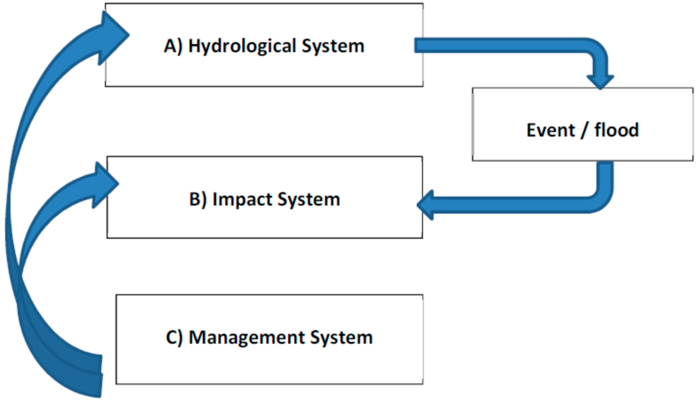
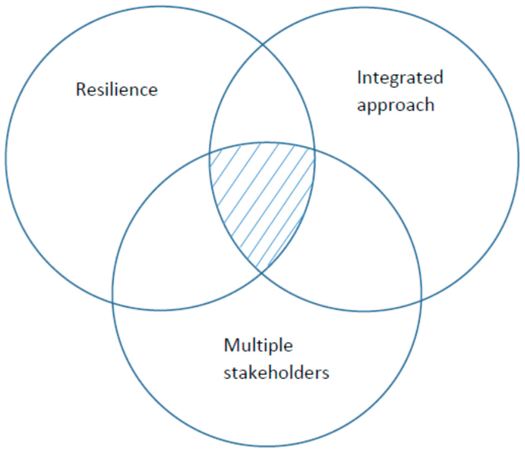
Urban flooding is of growing concern due to increasing densification of urban areas, changes in land use, and climate change. The traditional engineering approach to flooding is designing single-purpose drainage systems, dams, and levees. These methods, however, are known to increase the long-term flood risk and harm the riverine ecosystems in urban as well as rural areas. In the present paper, we depart from resilience theory and suggest a concept to improve urban flood resilience. We identify areas where contemporary challenges call for improved collaborative urban flood management. The concept emphasizes resiliency and achieved synergy between increased capacity to handle stormwater runoff and improved experiential and functional quality of the urban environments. We identify research needs as well as experiments for improved sustainable and resilient stormwater management namely, flexibility of stormwater systems, energy use reduction, efficient land use, priority of transport and socioeconomic nexus, climate change impact, securing critical infrastructure, and resolving questions regarding responsibilities. View Full-Text
 Figures

This is an open access article distributed under the Creative Commons Attribution License which permits unrestricted use, distribution, and reproduction in any medium, provided the original work is properly cited. (CC BY 4.0).

For further details log on website :
http://www.mdpi.com/2073-4441/8/8/332

Assessing Urban Forest Structure, Ecosystem Services, and Economic Benefits on Vacant Land

Sustainability 20168(7), 679; doi:10.3390/su8070679

Author 

Landscape Architecture Program, Arizona State University, PO Box 871605, Tempe, AZ 85287-1605, USA
Academic Editor: Thomas Seifert
Received: 5 March 2016 / Revised: 8 July 2016 / Accepted: 13 July 2016 / Published: 16 July 2016
(This article belongs to the Special Issue Decision Support for Forest Ecosystem Management Sustainability)
View Full-Text   |     Download PDF [3354 KB, uploaded 20 July 2016]   |    
 

Abstract 

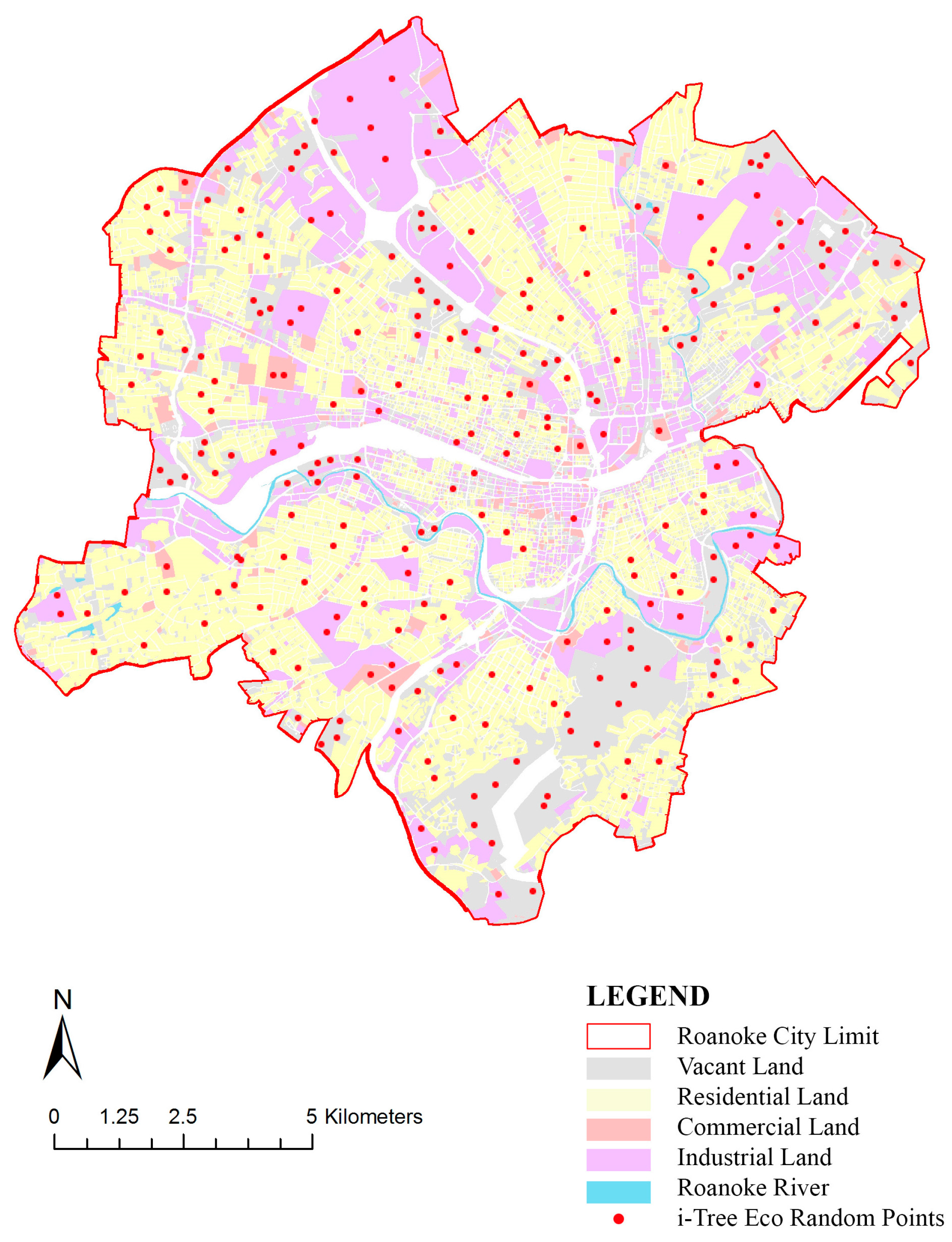
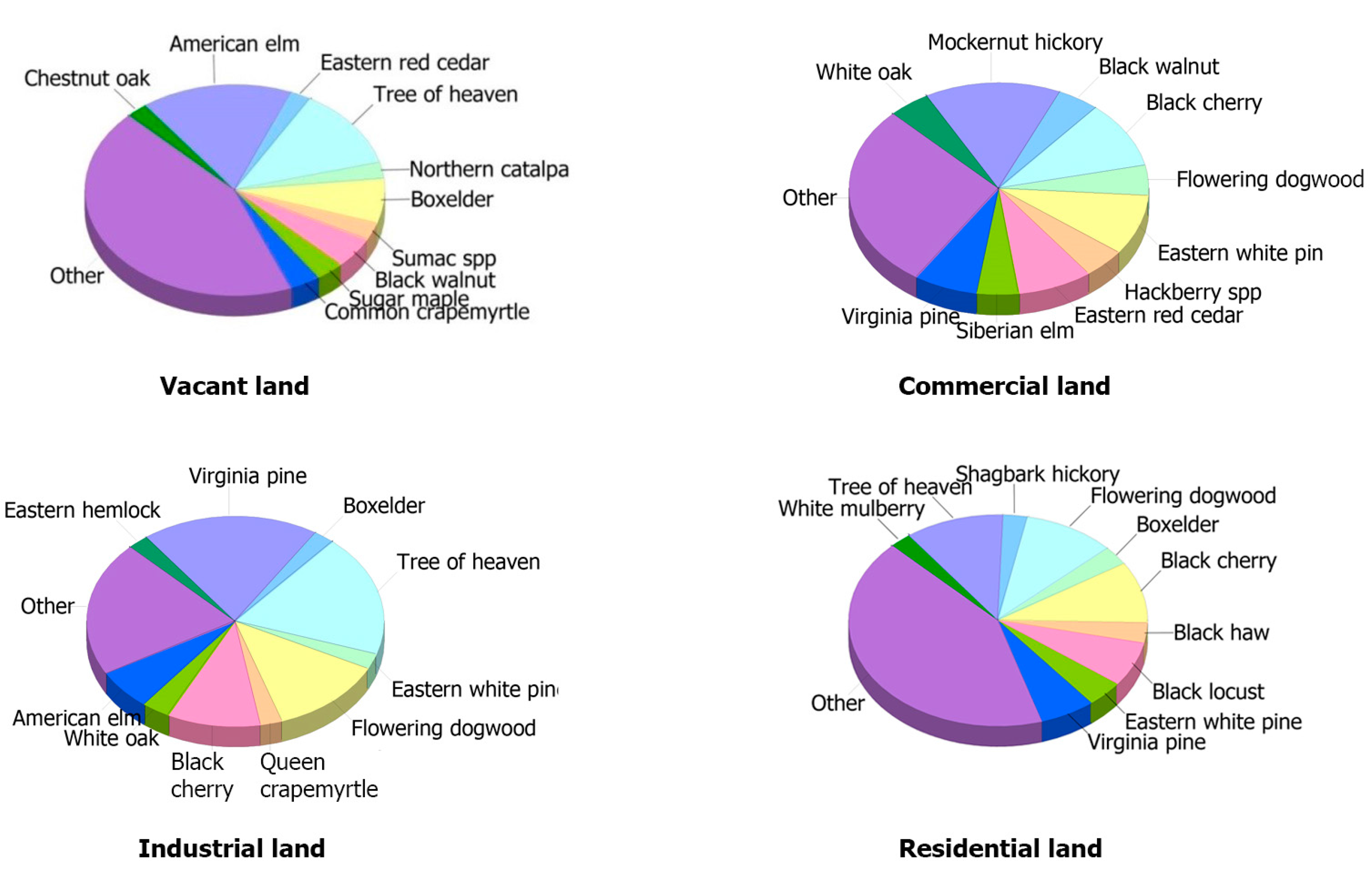
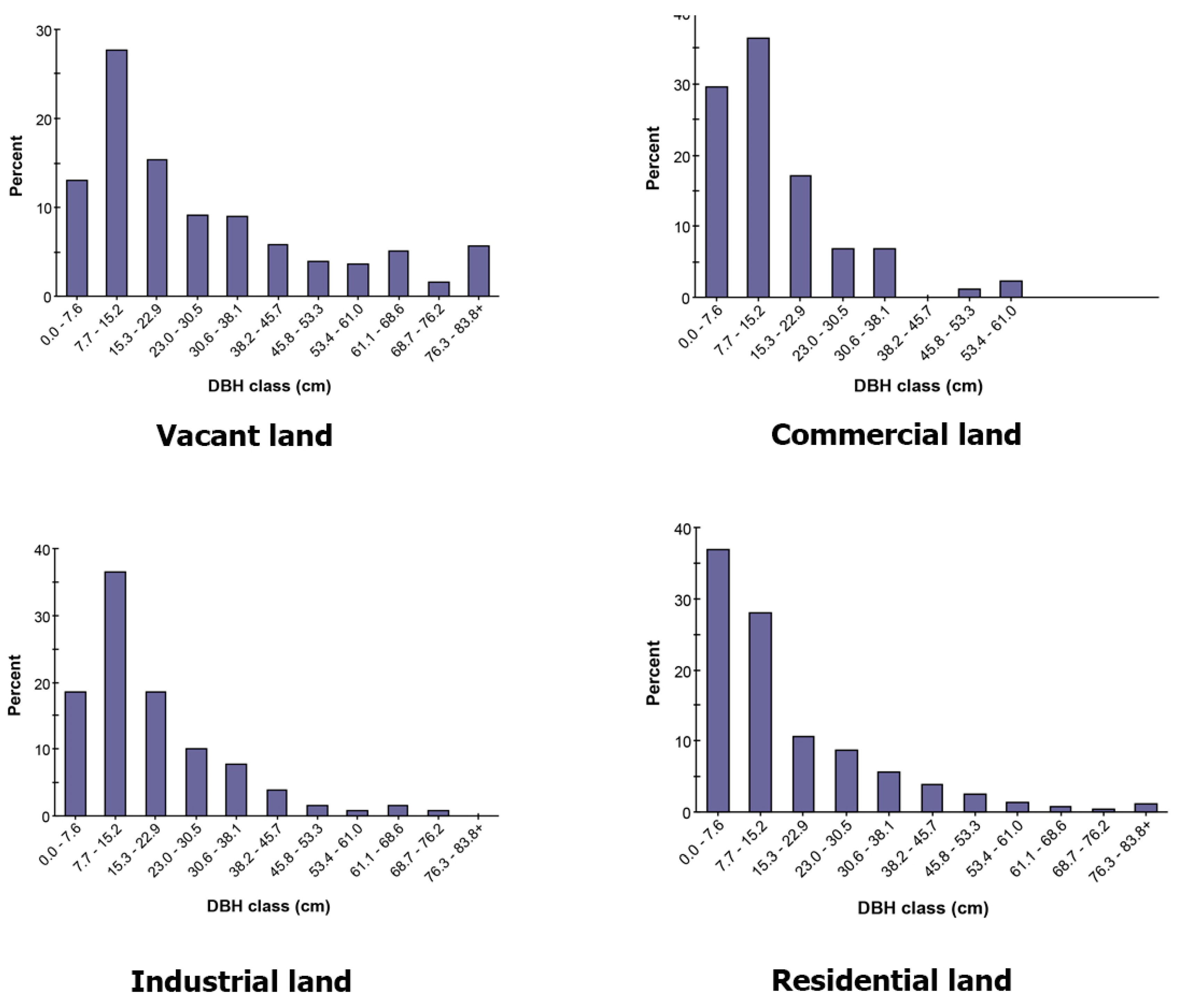
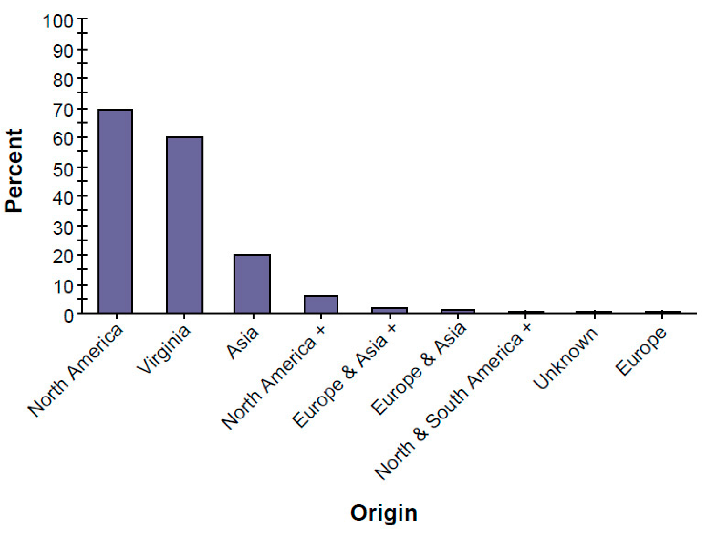
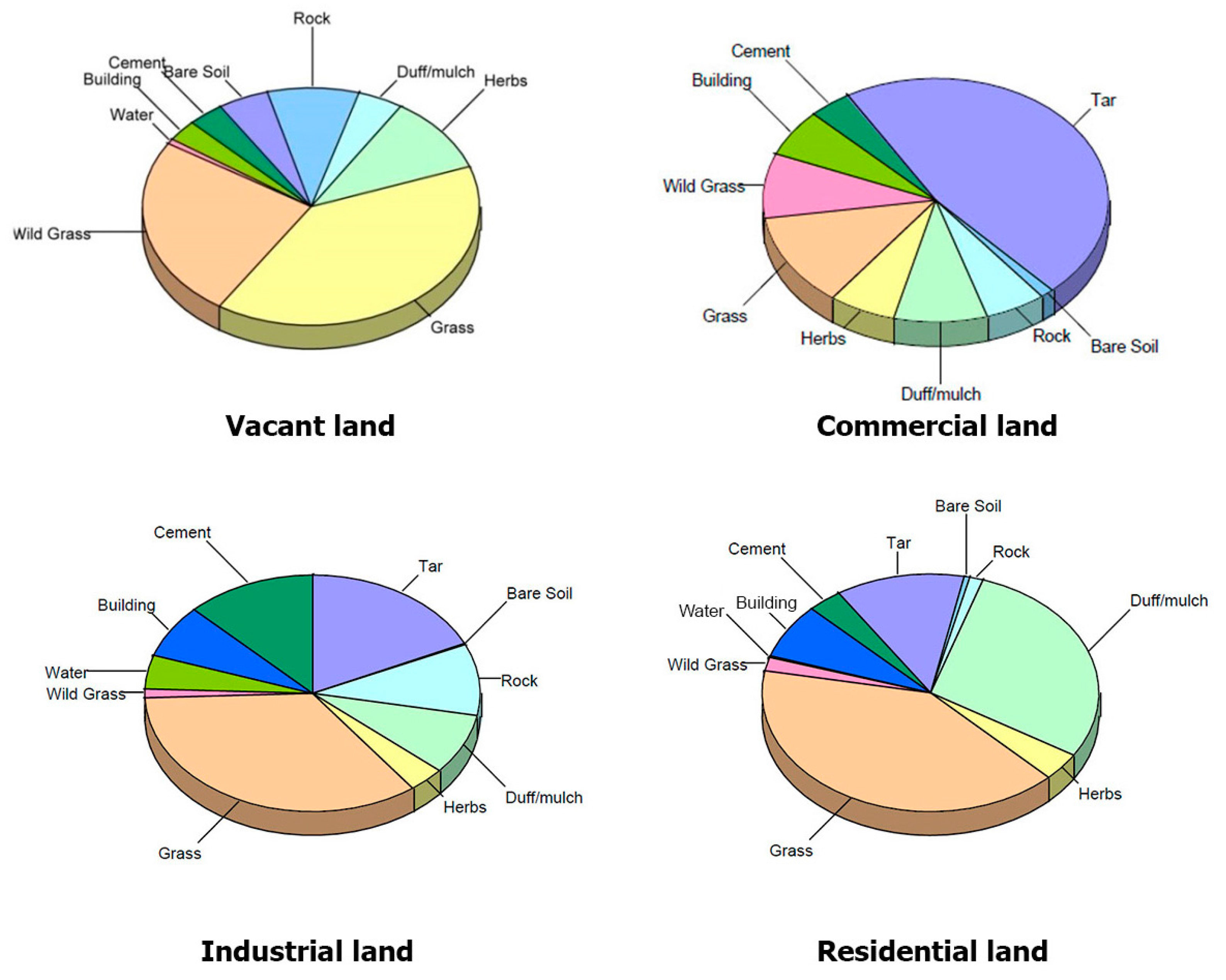
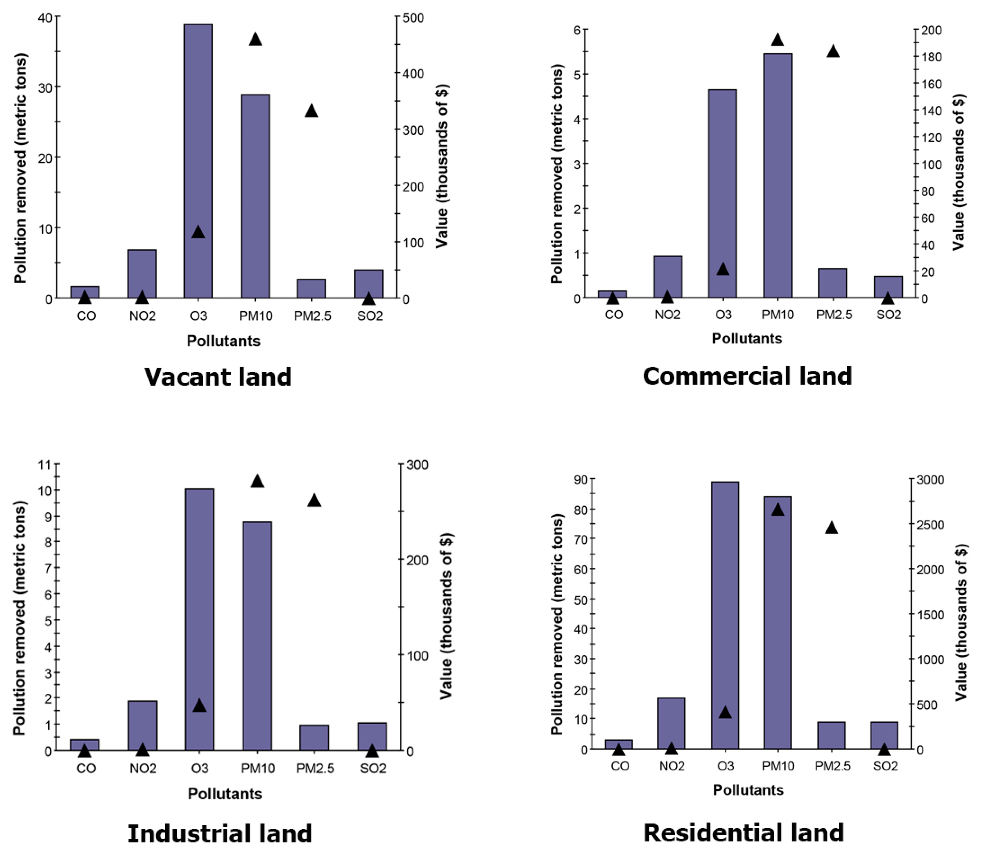
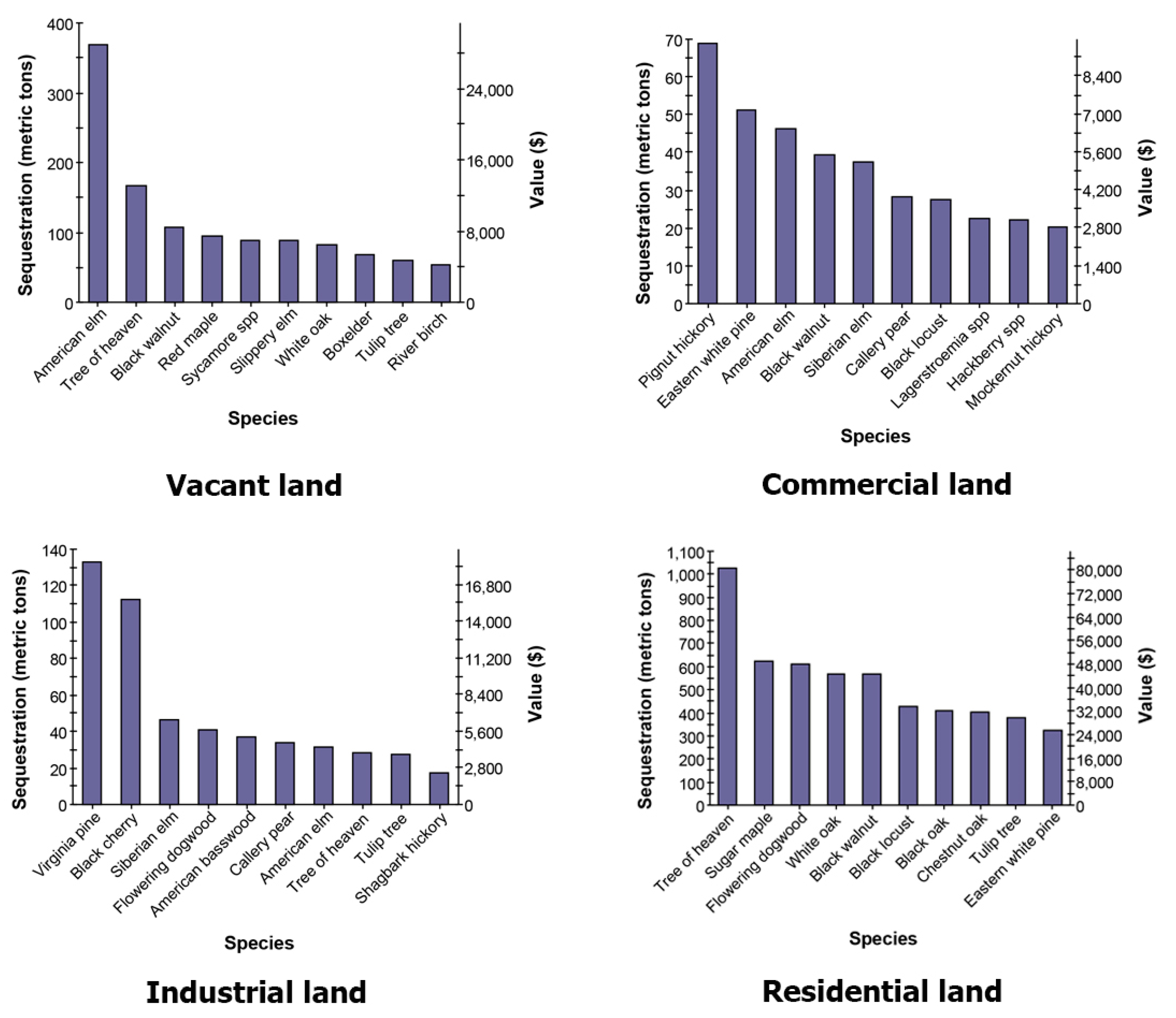
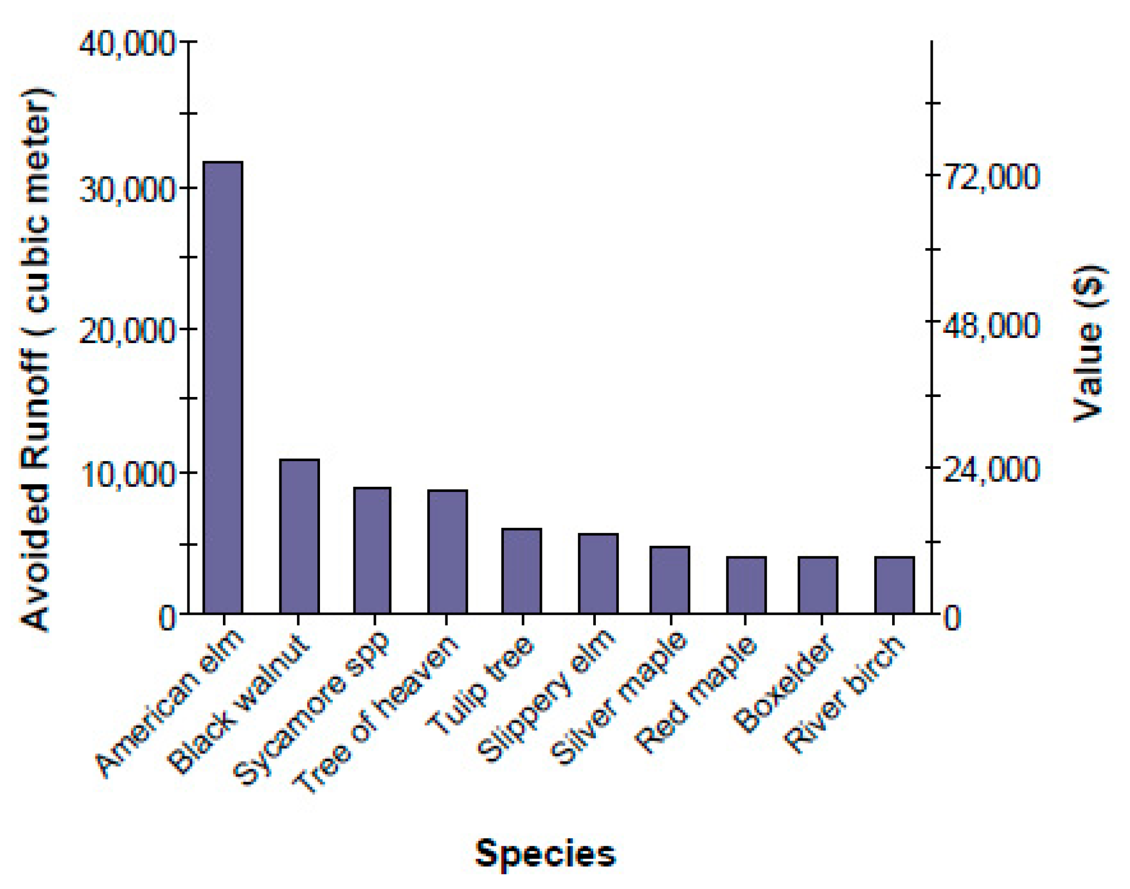
An urban forest assessment is essential for developing a baseline from which to measure changes and trends. The most precise way to assess urban forests is to measure and record every tree on a site, but although this may work well for relatively small populations (e.g., street trees, small parks), it is prohibitively expensive for large tree populations. Thus, random sampling offers a cost-effective way to assess urban forest structure and the associated ecosystem services for large-scale assessments. The methodology applied to assess ecosystem services in this study can also be used to assess the ecosystem services provided by vacant land in other urban contexts and improve urban forest policies, planning, and the management of vacant land. The study’s findings support the inclusion of trees on vacant land and contribute to a new vision of vacant land as a valuable ecological resource by demonstrating how green infrastructure can be used to enhance ecosystem health and promote a better quality of life for city residents. View Full-Text
This is an open access article distributed under the Creative Commons Attribution License which permits unrestricted use, distribution, and reproduction in any medium, provided the original work is properly cited. (CC BY 4.0).

For further details log on website :
http://www.mdpi.com/2071-1050/8/7/679

Evolutionary and Holistic Assessment of Green-Grey Infrastructure for CSO Reduction

Water 20168(9), 402; doi:10.3390/w8090402

Author 

1
Environmental Engineering and Water Technology Department, UNESCO-IHE, Westvest 7, 2611 AX Delft, The Netherlands
2
Hydroinformatics and Knowledge Management Department, UNESCO-IHE, Westvest 7, 2611 AX Delft, The Netherlands
3
School of Engineering and Technology, AIT Asian Institute of Technology, P.O. Box 4, Klong Luang, Pathumthani 12120, Thailand
*
Author to whom correspondence should be addressed. 
Academic Editor: Ataur Rahman
Received: 11 August 2016 / Revised: 5 September 2016 / Accepted: 9 September 2016 / Published: 15 September 2016
(This article belongs to the Special Issue Hydroinformatics and Urban Water Systems)
View Full-Text   |     Download PDF [3099 KB, uploaded 21 September 2016]   |    
 

Abstract 

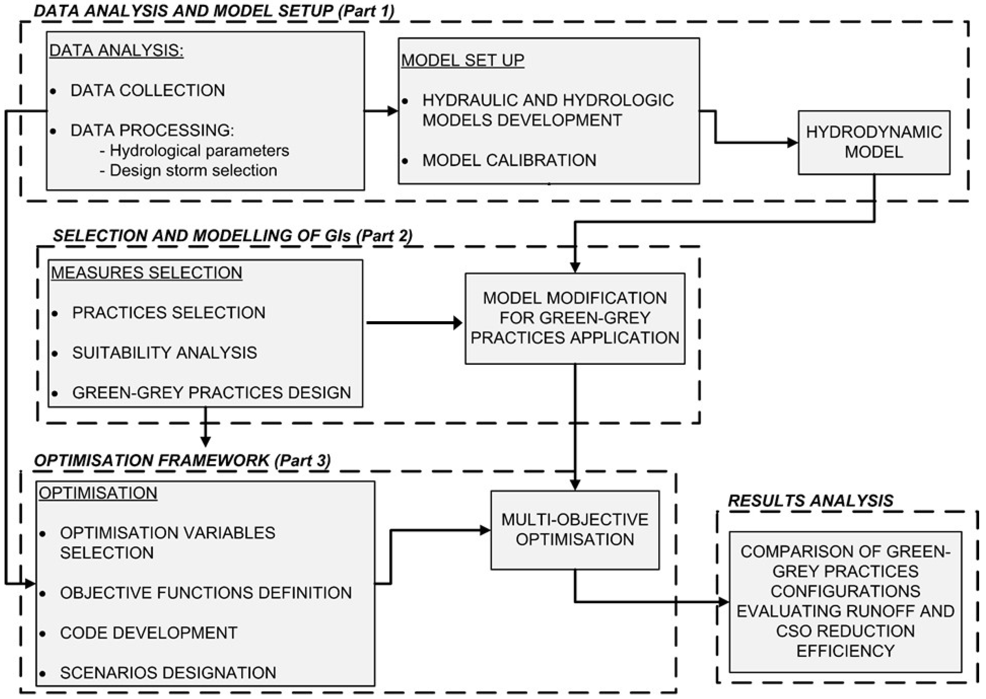
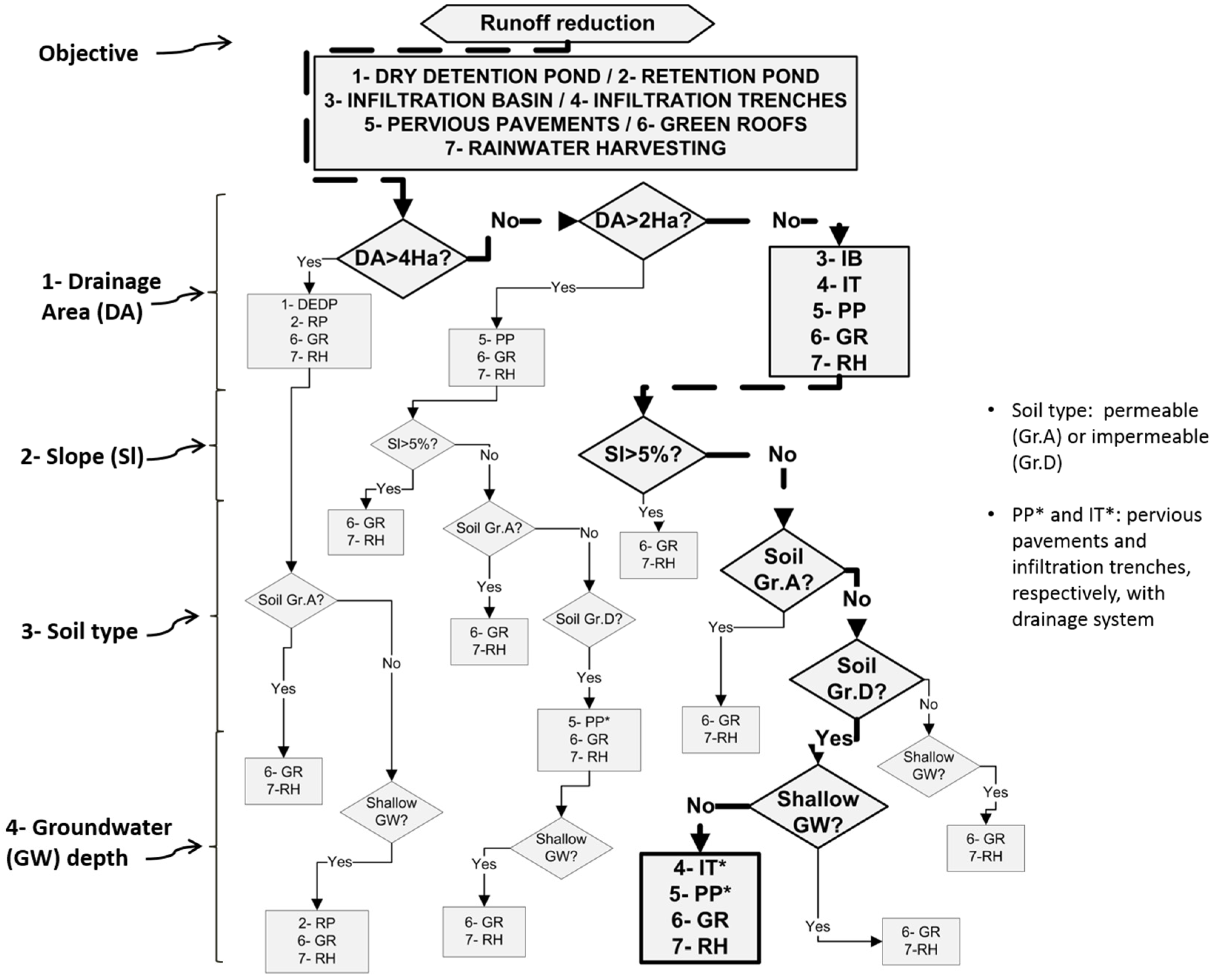
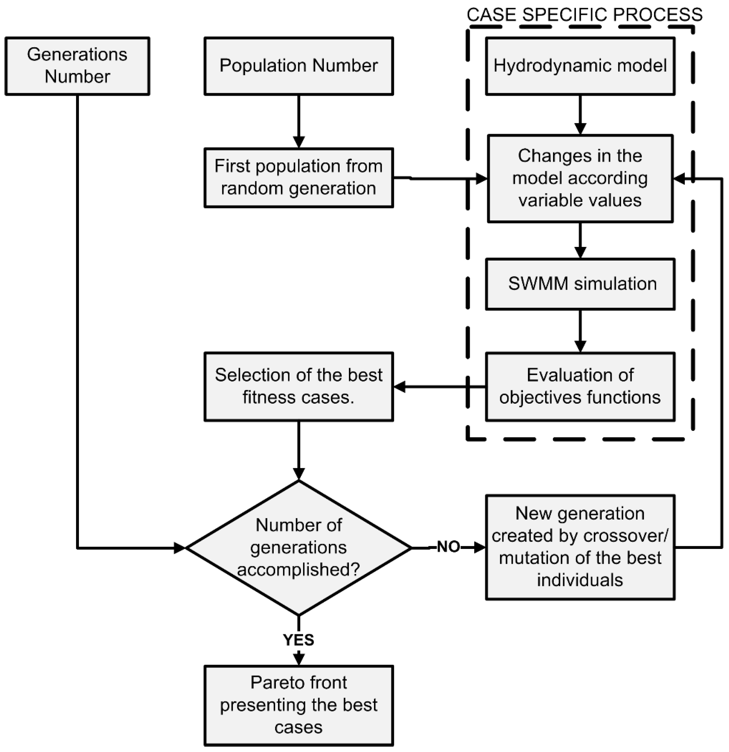
Recent research suggests future alterations in rainfall patterns due to climate variability, affecting public safety and health in urban areas. Urban growth, one of the main drivers of change in the current century, will also affect these conditions. Traditional drainage approaches using grey infrastructure offer low adaptation to an uncertain future. New methodologies of stormwater management focus on decentralized approaches in a long-term planning framework, including the use of Green Infrastructure (GI). This work presents a novel methodology to select, evaluate, and place different green-grey practices (or measures) for retrofitting urban drainage systems. The methodology uses a hydrodynamic model and multi-objective optimization to design solutions at a watershed level. The method proposed in this study was applied in a highly urbanized watershed to evaluate the effect of these measures on Combined Sewer Overflows (CSO) quantity. This approach produced promising results and may become a useful tool for planning and decision making of drainage systems. View Full-Text
 Figures

Figure 1
This is an open access article distributed under the Creative Commons Attribution License which permits unrestricted use, distribution, and reproduction in any medium, provided the original work is properly cited. (CC BY 4.0).

For further details log on website :
http://www.mdpi.com/2073-4441/8/9/402

Advantages and Disadvantages of Fasting for Runners

Author BY   ANDREA CESPEDES  Food is fuel, especially for serious runners who need a lot of energy. It may seem counterintuiti...