1
College of Urban and Environmental Sciences and MOE Laboratory for Earth Surface Processes, Peking University, Beijing 100871, China
2
College of Resources Science and Technology, Beijing Normal University, Beijing 100875, China
3
Institute of Surface-Earth System Science, Tianjin University, Tianjin 300072, China
*
Author to whom correspondence should be addressed.
Received: 25 October 2016 / Revised: 20 December 2016 / Accepted: 28 December 2016 / Published: 2 January 2017
Abstract
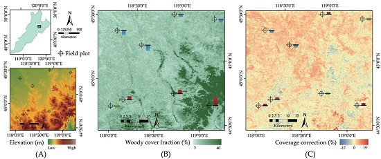
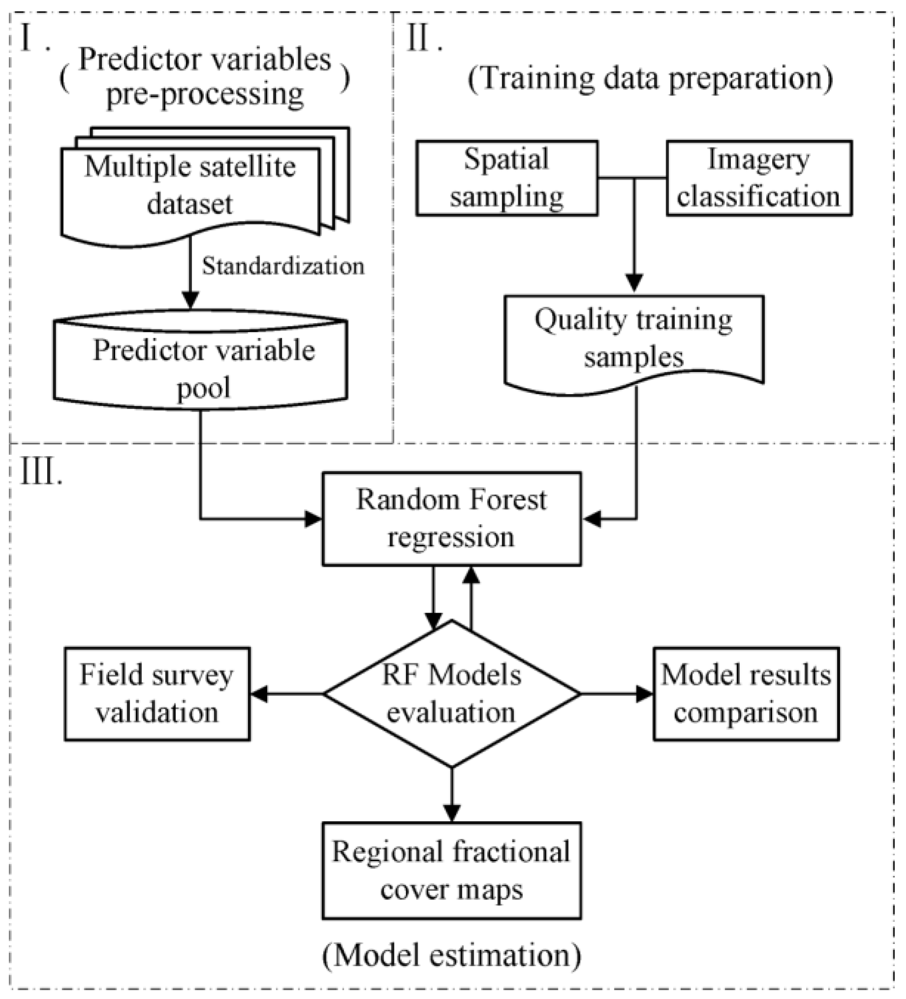
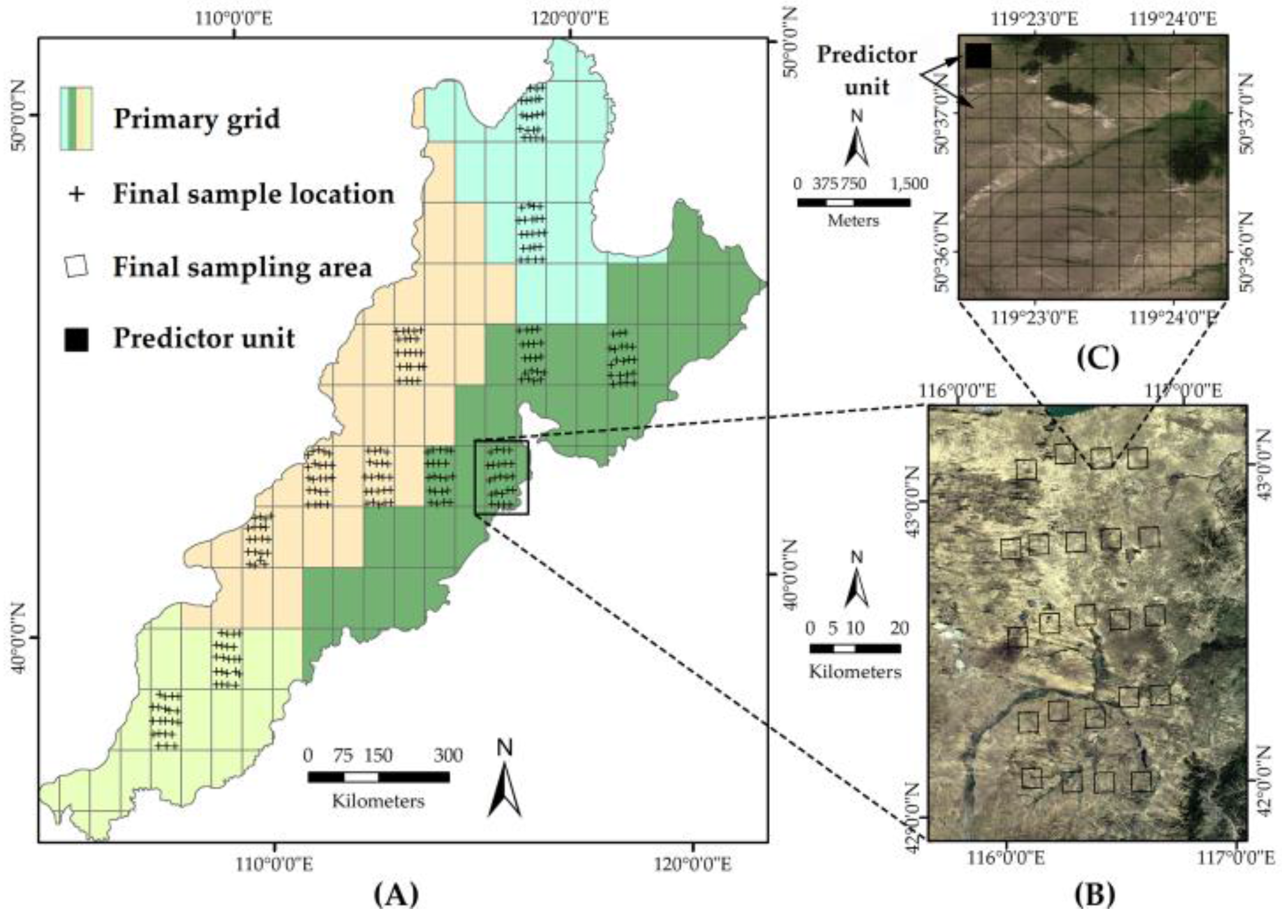
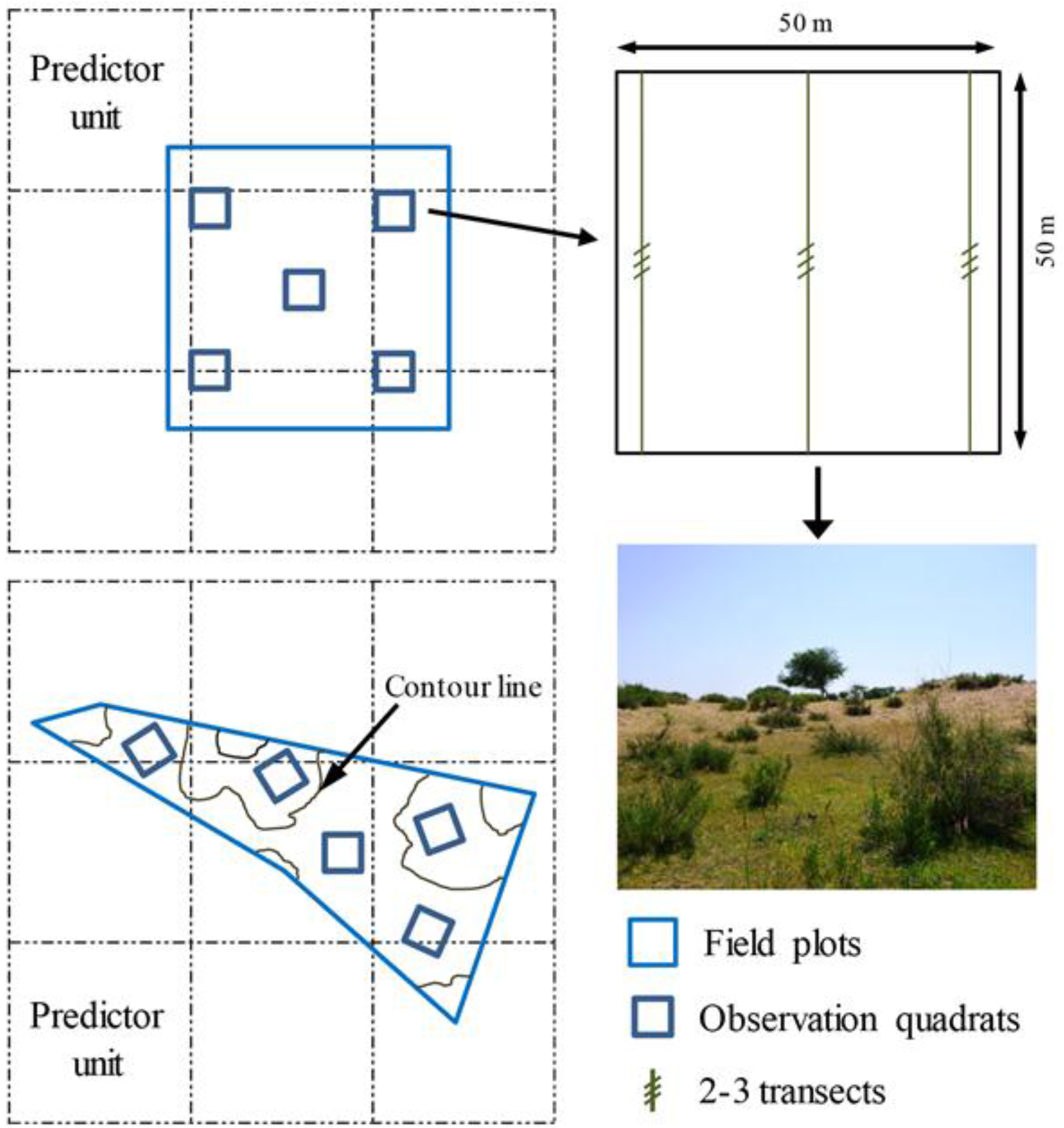
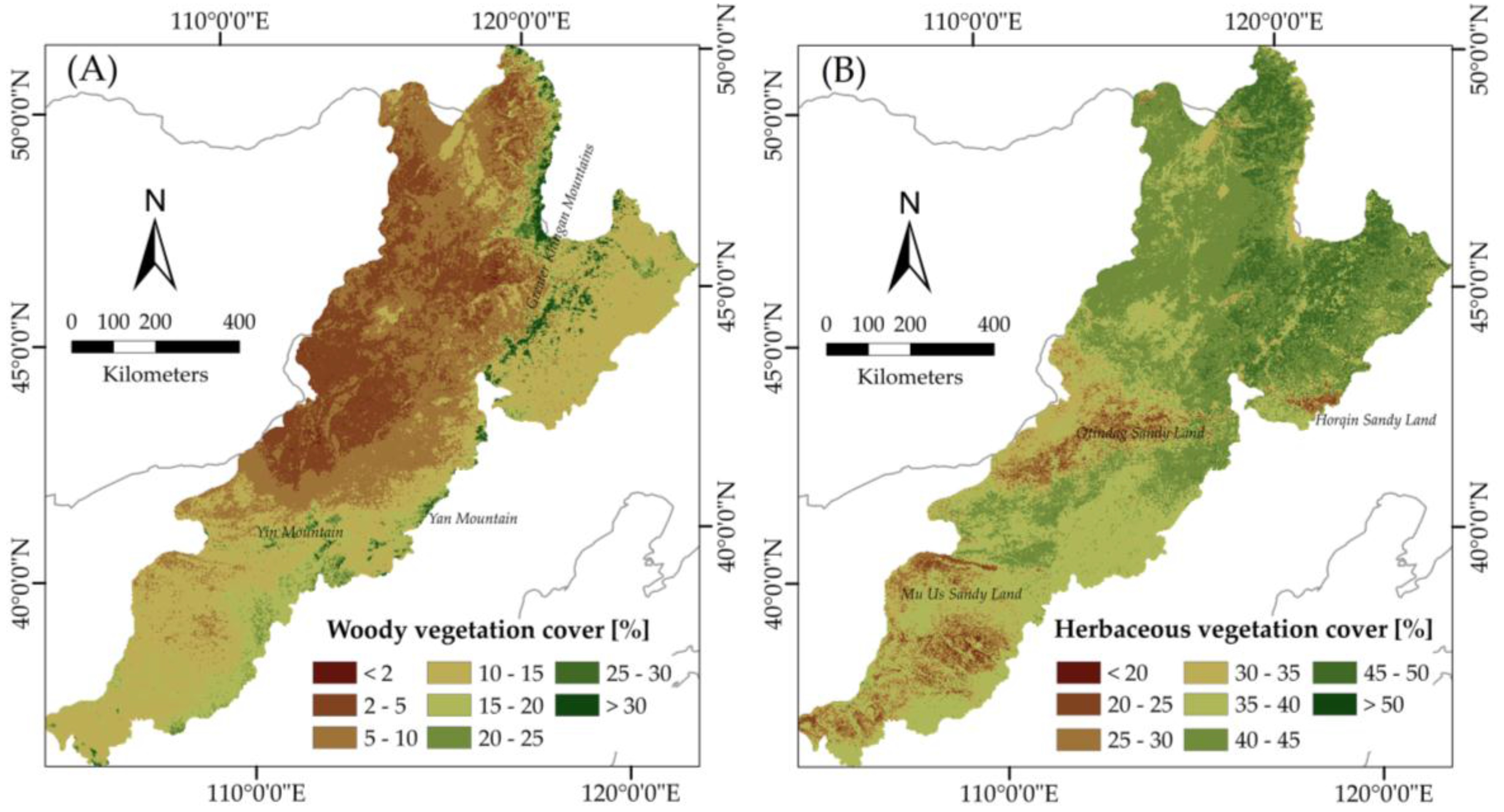
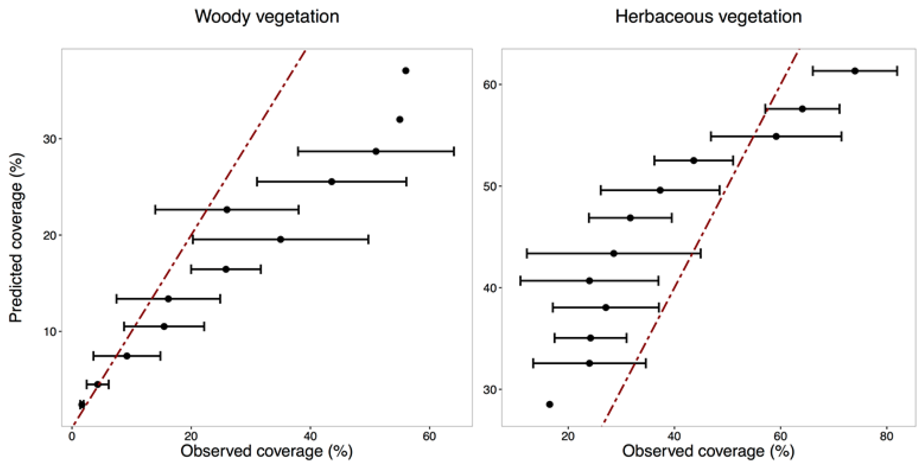
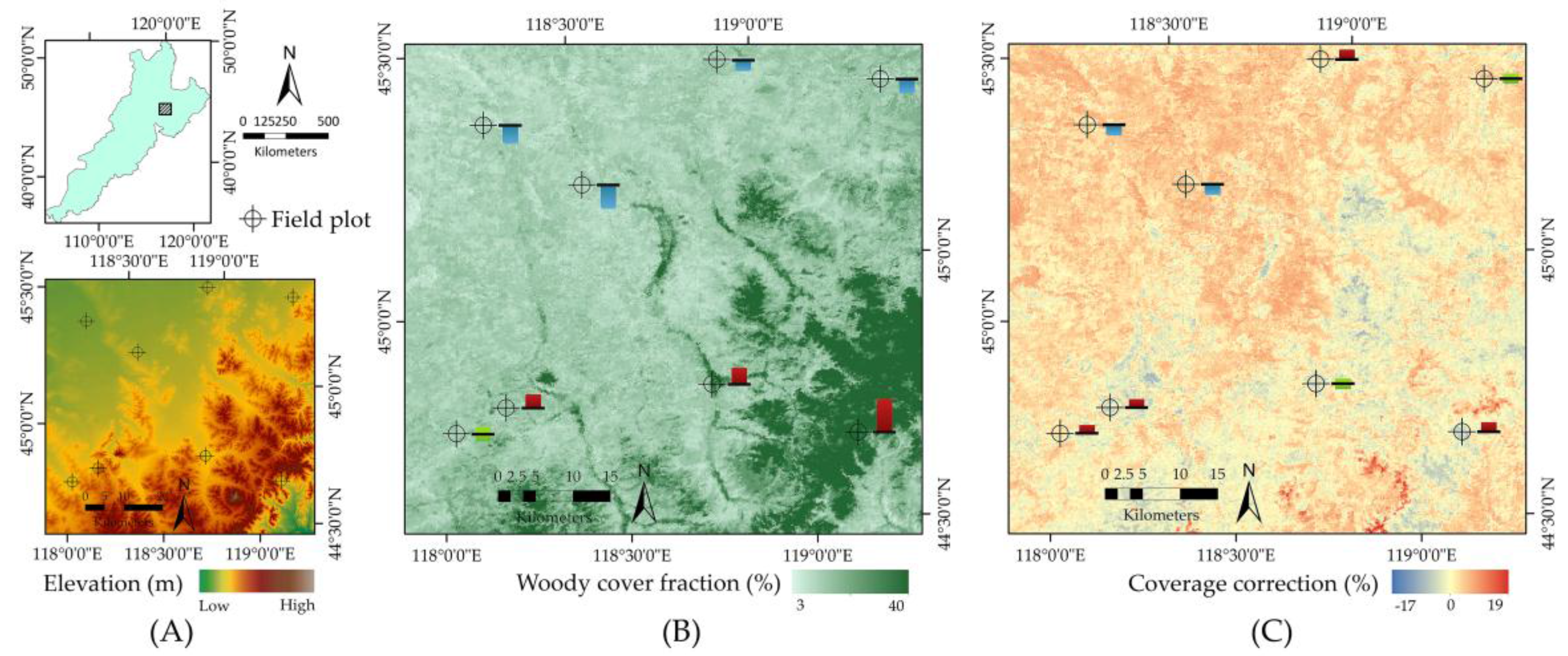
Mapping vegetation cover is critical for understanding and monitoring ecosystem functions in semi-arid biomes. As existing estimates tend to underestimate the woody cover in areas with dry deciduous shrubland and woodland, we present an approach to improve the regional estimation of woody and herbaceous fractional cover in the East Asia steppe. This developed approach uses Random Forest models by combining multiple remote sensing data—training samples derived from high-resolution image in a tailored spatial sampling and model inputs composed of specific metrics from MODIS sensor and ancillary variables including topographic, bioclimatic, and land surface information. We emphasize that effective spatial sampling, high-quality classification, and adequate geospatial information are important prerequisites of establishing appropriate model inputs and achieving high-quality training samples. This study suggests that the optimal models improve estimation accuracy (NMSE 0.47 for woody and 0.64 for herbaceous plants) and show a consistent agreement with field observations. Compared with existing woody estimate product, the proposed woody cover estimation can delineate regions with subshrubs and shrubs, showing an improved capability of capturing spatialized detail of vegetation signals. This approach can be applicable over sizable semi-arid areas such as temperate steppes, savannas, and prairies. View Full-Text
Keywords: vegetation fractional cover; semi-arid area; MODIS; satellite data integration; spatial sampling design; image classification; Random Forest regression; model performance evaluation
▼ Figures
This is an open access article distributed under the Creative Commons Attribution License which permits unrestricted use, distribution, and reproduction in any medium, provided the original work is properly cited. (CC BY 4.0).
For further details log on website :
http://www.mdpi.com/2072-4292/9/1/32


No comments:
Post a Comment