ISPRS Int. J. Geo-Inf. 2016, 5(1), 2; doi:10.3390/ijgi5010002
Author
Geology Department, External Geodynamics Area, Faculty of Sciences, University of Salamanca, Plaza Merced s/n, 37008 Salamanca, Spain
*
Author to whom correspondence should be addressed.
Academic Editor: Wolfgang Kainz
Received: 1 July 2015 / Revised: 15 November 2015 / Accepted: 30 November 2015 / Published: 6 January 2016
Abstract
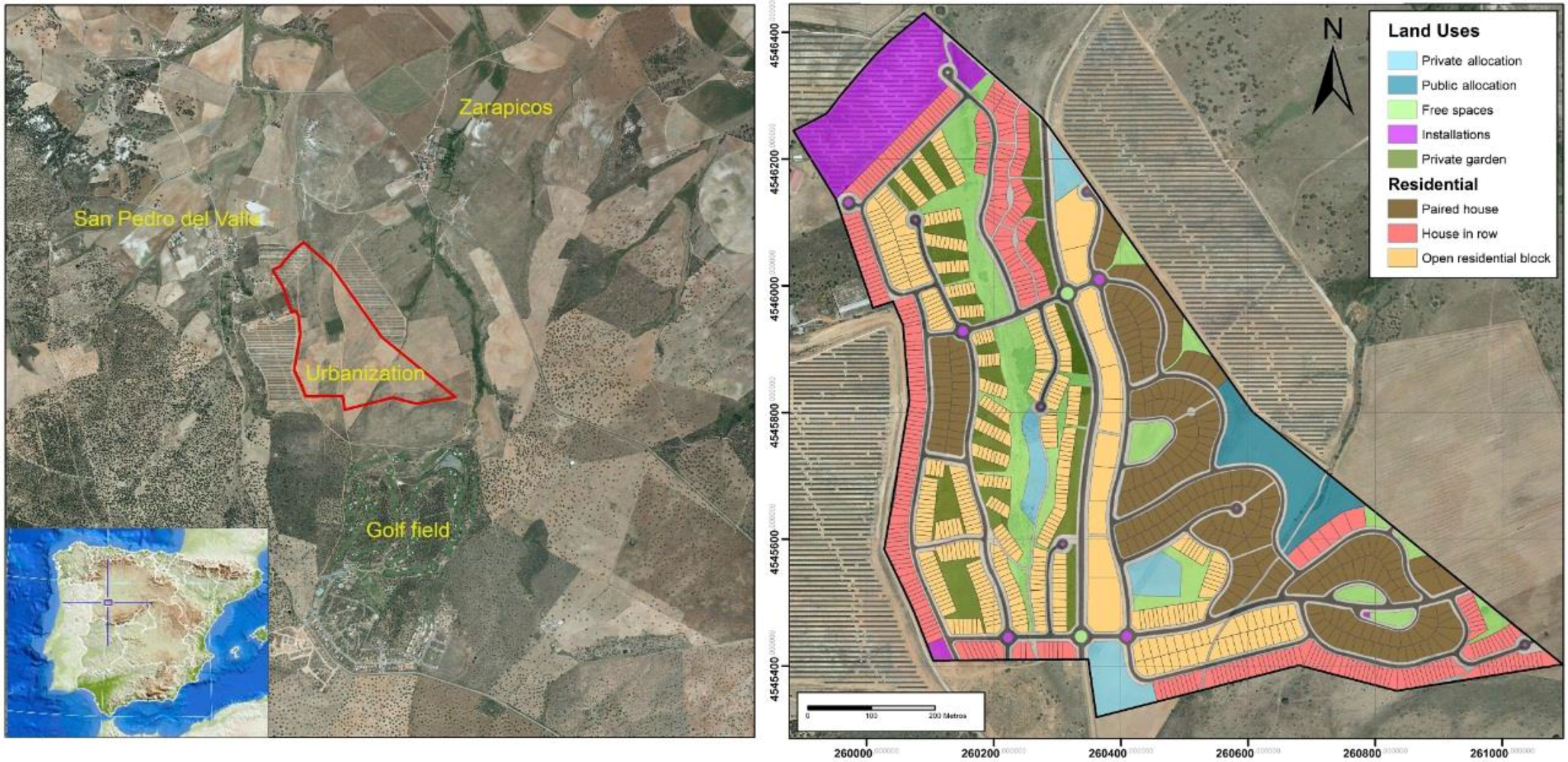
The key focus of this paper is to establish a procedure that combines the use of Geographical Information Systems (GIS) and remote sensing in order to achieve simulation and modeling of the landscape impact caused by construction. The procedure should be easily and inexpensively developed. With the aid of 3D virtual reconstruction and visualization, this paper proposes that the technologies of remote sensing and GIS can be applied to the landscape for post-urbanization environmental restoration. The goal is to create a rural zone in an urban development sector that integrates the residential areas and local infrastructure into the surrounding natural environment in order to measure the changes to the preliminary urban design. The units of the landscape are determined by means of two cartographic methods: (1) indirect, using the components of the landscape; and (2) direct methods, using the landscape’s elements. The visual basins are calculated for the most transited by the population points, while establishing the zones that present major impacts for the urbanization of their landscape. Based on this, the different construction types are distributed (one-family houses, blocks of houses, etc.), selecting the types of plant masses either with ornamentals or integration depending on the zone; integrating water channels, creating a water channel in recirculation and green spaces and leisure time facilities. The techniques of remote sensing and GIS allow for the visualization and modeling of the urbanization in 3D, simulating the virtual reality of the infrastructure as well as the actions that need to be taken for restoration, thereby providing at a low cost an understanding of landscape integration before it takes place. View Full-Text
Keywords: Landscape restoration; urban development restoration; environmental impact; virtual modeling 3D; urban development impacts; landscape integration
This is an open access article distributed under the Creative Commons Attribution License which permits unrestricted use, distribution, and reproduction in any medium, provided the original work is properly cited. (CC BY 4.0).
For further details log on website :
http://www.mdpi.com/2220-9964/5/1/2


No comments:
Post a Comment